


Nordhausen, Germany
Nordhausen is a town of 43,912 people in Thuringia, Germany, founded in 1220.
Why visit Nordhausen
Townapedia lists 112 museums and landmarks, 42 parks and trails, 134 places to eat, 29 places to stay and 113 attractions in and around town.
Highlights include Theater Nordhausen, Filmpalast Neue Zeit, Flohburg - Das Nordhausen Museum and Tabakspeicher.
Weather in Nordhausen
Forecast from MET Norway (CC BY 4.0). Full forecast
About Nordhausen
Nordhausen (German pronunciation: [ˈnɔʁtˌhaʊzn̩] ) is a city in Thuringia, Germany. It is the capital of the Nordhausen district and the urban centre of northern Thuringia and the southern Harz region; its population is 42,000. Nordhausen is located approximately 60 km (37 miles) north of Erfurt, 80 km (50 miles) west of Halle, 85 km (53 miles) south of Braunschweig and 60 km (37 miles) east of Göttingen.
From the Wikipedia article Nordhausen, Thuringia (this version), under CC BY-SA 4.0.
Travel tips from other travellers: Nordhausen on Wikivoyage (CC BY-SA 4.0).
Photos of Nordhausen


Things to do113

Theater Nordhausen
Cinema and theater
15 Käthe-Kollwitz-Straße, Nordhausen
Tu-Fr 10:00-18:30; Sa 16:00-18:30


Heimkehle
Monument and historic site · 11.0 km
Gypsum cave in Harz mountains, Germany

Poppenberg Observation Tower
Monument and historic site · 9.9 km
Observation tower on Poppenberg mountain near Ilfeld in Harz

Brückentorso Reichsautobahn Strecke 71, Göttingen-Dessau
Bridge · 2.7 km
Mittlerer Pfeiler der unvollendeten Eisenbahnbrücke der Helmetalbahn, die hier über die geplante Reichsautobahn führen sollte.

101 more on the map.
Museums and landmarks112


Wasserturm
Monument and historic site · 1.1 km
Wasserturm westlich des Bahnhofs an der Straße "Am Wasserturm" in Nordhausen
Am Wasserturm, Nordhausen
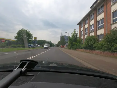


Preußischer Ganzmeilenobelisk Nordhausen
Monument and historic site · 1.2 km
Preußischer Ganzmeilenobelisk mit Sitzbank an der L 3080, Freiherr-vom-Stein Straße 20 in Nordhausen

Reformatoren-Bank
Monument and historic site · 1.8 km
Michael Meyenburg, Johann Spangenberg, Justus Jonas


Kunsthaus Meyenburg
Museum · 0.8 km
31 Alexander-Puschkin-Straße, Nordhausen


100 more on the map.
Parks, trails and playgrounds42




Freibad Niedersachswerfen
Sports field and stadium · 5.3 km
1 Am Kirchberg, Harztor
10:00-20:00


30 more on the map.
Restaurants and cafes134
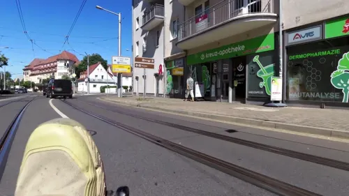
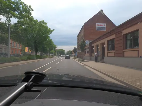
AKROPOLIS - Griechische Gastlichkeit
Restaurant · Greek · 0.7 km
45 Grimmelallee, Nordhausen
We-Mo 11:30-14:30,17:00-22:00
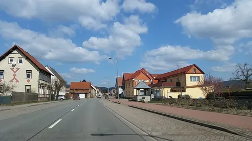
Eiscafe Baumann
Cafe · Regional, Ice Cream, Cafe · 6.4 km
55 Harzstraße, Harztor
Mo 14:00-18:00; Fr-Su,PH 12:00-18:00; Tu-Th off
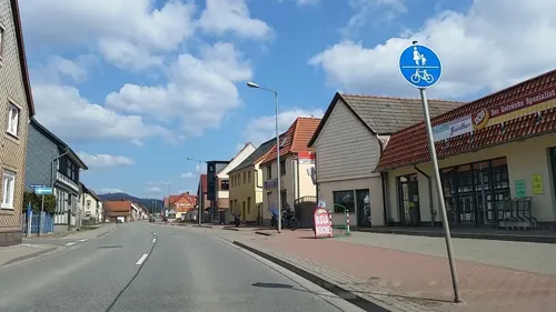
Harztor-Asiaküche
Restaurant · Asian · 6.3 km
62 Harzstraße, Harztor
Tu-Sa 10:30-14:30,16:30-20:30; Su,PH 16:30-20:30; Mo off
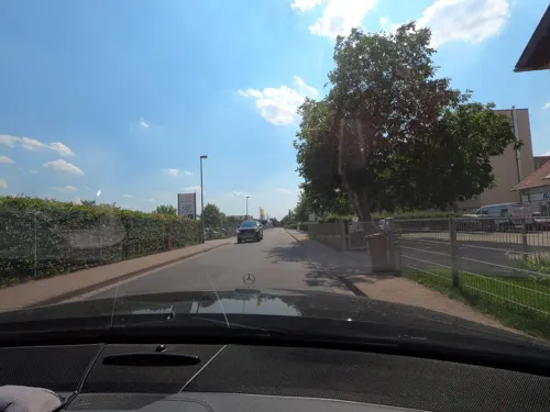
KOCHHAUS Nordhausen
Restaurant · German · 1.8 km
151 Straße der Genossenschaften, Nordhausen
Mo-Fr 07:30-14:00
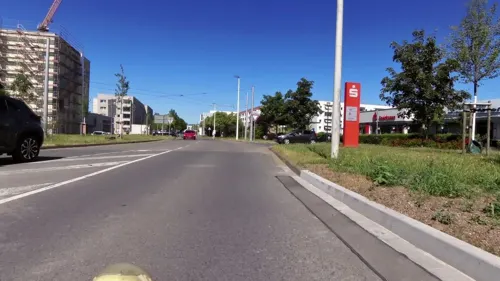
Rosengarten Villa Italia 2
Restaurant · Italian · 1.5 km
1 Dr.-Robert-Koch-Straße, Nordhausen
Tu-Sa 11:00-23:00; Su 11:00-22:00


Eiscafé Verona
Cafe · Ice Cream · 0.9 km
8a Bahnhofstraße, Nordhausen
Mo-Fr 08:30-17:00; Sa 09:30-17:00; Su 13:30-17:00
Gasthaus Sonneneck
Restaurant · Regional · 1.0 km
7 Gehege, Nordhausen
We,Th 11:00-22:00; Fr-Su 11:00-24:00
Hofbräu Zur Schönen Aussicht
Restaurant · 1.6 km
135 Stolberger Straße, Nordhausen
Mo-Fr 17:00-21:00; Sa,Su 11:30-14:00
Ristorante Pizzaria Rustica
Restaurant · Italian
36 Barfüßerstraße, Nordhausen
We-Mo 11:30-14:30, Mo,We-Sa 17:30-23:00, Su 17:30-22:00
122 more on the map.
History
The Franks colonized the area around Nordhausen about 800, many place names here have a Frankish origin, discernible by the suffix -hausen (like Nordhausen itself, Sundhausen, Windehausen and the later abandoned settlement Stockhausen as well as the neighbouring cities of Mühlhausen, Sondershausen, Frankenhausen and Sangerhausen). Nordhausen itself is first mentioned in a 13 May 927 document of King Henry the Fowler. He built a castle here, which is traceable between 910 and 1277 and became a centre of the empire during the 10th century. Gerberga of Saxony, Henry's daughter is supposed to have been born there, as was Henry I, Duke of Bavaria. The first market was established in the 10th century, as was a chapter of nuns (961). During the 12th century, the old town was semi-planned and established around the new market place and St. Nicholas' Church.
Read more of the history
Nordhausen was Reichsgut (estate of the German emperor) from the beginning, but in 1158, Frederick Barbarossa donated it to the local chapter of nuns, which was converted to a cathedral chapter by Frederick II in 1220, whereby the city came back to the empire and became an Imperial Free City. Nordhausen was granted the privileges of a town around 1200, in 1198 it was first mentioned as a villa and in 1206, there was a mayor, a Vogt and citizens. The municipal law of Nordhausen was similar to that of Mühlhausen, hence the Mühlhausen Book of Law was adopted in the mid-13th century. Today's city wall was established between 1290 and 1330 and cut the old town off from Altendorf in the north-west, the new town in the west and Altnordhausen in the south. Nevertheless, the new town was legally incorporated in 1365. Besides the parish churches, many monasteries were founded during the late Middle Ages in Nordhausen (Cistercians in Altnordhausen (Frauenberg, about 1200) and Altendorf (1294), Augustines where the Nordhäuser distillery is today (1312), Franciscans at Georgengasse (1230) and Dominicans at Predigerstraße (1287)). As distinct from Mühlhausen and many other free imperial cities, Nordhausen did not own any territories or villages in the surrounding area.
The city's independence was endangered by the ambitions of regional counts, especially by those of Hohnstein County (based in near Ilfeld), who extorted funds from Nordhausen during the 14th century. On the other hand, the debts of the Hohnstein Counts were gigantic: they owed 86 citizens of Nordhausen 5744 Mark silver in 1370. In 1306, Nordhausen allied with the two other major Thuringian cities Erfurt and Mühlhausen against the Wettins and the local counts (Hohnstein, Stolberg, Schwarzburg, Beichlingen etc.) and joined the Hanseatic League together with them in 1430. Further alliances were concluded with Goslar, Halberstadt, Quedlinburg and Aschersleben to represent urban interests against the landlords.
In 1349, during a plague epidemic, some number of Jewish residents were killed by the citizenry with support from Frederick II, Margrave of Meissen. According to legend, they danced on their way to the pyre.
In 1500 it became part of the Lower Saxon Circle, and from around the same year the city began producing fermented grain liquor, which became famous under the name Nordhäuser Doppelkorn. In 1523, a year in which Thomas Müntzer spent some time in the city, the Protestant Reformation came to Nordhausen, which was one of the first cities that adopted the new doctrine. The cathedral chapter stayed catholic, protected by the Habsburg emperors but the other monasteries got closed during the following decades and their heritage came to the city. During the 16th century, Nordhausen succeeded to push back the influence of the Wettins and the Hohnstein counts by buying back their privileges over the city. This marked the peak in pre-modern urban development, followed by some centuries of decline introduced by the Thirty Years' War. In 1551, the Jews were expelled from the city. They were not generally permitted to live there again until 1807.
After the war, the Electorate of Brandenburg tried to incorporate the free cities of Nordhausen, Mühlhausen and Goslar, because it already became large territories in the Harz region. The Electorate of Saxony, protecting power of Nordhausen gave hidden support to the Brandenburgs, so that Nordhausen tried to keep its independence through the protection by the Hanovers. After the Brandenburg-Prussians had occupied Nordhausen between 1703 and 1714, the city got protection of Hanover resp. England, which paid 50,000 Talers to the Prussians to leave Nordhausen, which was moreover destroyed by two town fires in 1710 and 1712. Under the protection of Hanover, the economy improved again and the production of tobacco since mid-18th century brought new wealth to Nordhausen.
During the Napoleonic Wars, Prussian troops occupied Nordhausen on 2 August 1802; the city lost its status as an Imperial Free City during the German Mediatisation. After Prussia's defeat against Napoleon, it became part of the Kingdom of Westphalia created in 1807.
Following the defeat of Napoleon Bonaparte, Nordhausen was included in the Kingdom of Prussia's Province of Saxony created in 1816. During the mid-19th century, industrialisation started in Nordhausen with production of chewing tobacco, alcoholic beverages, paper and textiles. The breakthrough was reached as Nordhausen got connected to main railways in four directions between 1866 and 1869. In 1882 it became an urban district (until 1950). In the late 19th century, narrow-gauge railways were constructed linking Nordhausen and other cities through the Harz mountains, operating by 1899.
As the engineering industry developed after 1900, the city saw an economic heyday. Industry developed and expanded during the following decades.
From the History section of Nordhausen, Thuringia on Wikipedia, under CC BY-SA 4.0.
More about Nordhausen
Geography
Nordhausen is situated at the border between the flat and fertile area of Goldene Aue in the south and the foothills of the Harz mountains in the north on a level of approx. 180 m of elevation. The Zorge river crosses the city from northwest to southeast and the bigger Helme river runs in west-eastern direction at the southern border of the municipality. Between them are some quarry ponds of former gravel mining near the Sundhausen and Bielen districts. To the north, the terrain is getting more hilly and part of a karst area south to the Harz mountains. The north-west of the territory is marked by the Kohnstein hill (335 m) and the north-east is the Rüdigsdorf Switzerland, a small area with a beautiful landscape up to 350 m of elevation around Rüdigsdorf district. South of Helme river, the terrain gets also hilly around the Windleite mountains between Nordhausen and Sondershausen. Most of the municipal territory is in agricultural use. The forests are located first between the city centre in the south and Rüdigsdorf in the north (with interruptions), second at Kohnstein hill and third in the east around Rodishain and Stempeda.
Economy
Agriculture plays an important role to the present day. Approximately 57% of the municipal territory is in agricultural use. Cereals from the region are used in the making of a famous local spirit, the Nordhäuser Korn. Historically, sulfuric acid produced by the distillation of green vitriol (iron(II) sulfate) was known as Nordhausen oil of vitriol.
The primary industry of Nordhausen is in the production of heavy machinery. The region had a factory for the production of rail engines until 1942. Later the region's plants produced truck motors, augers and excavators. Today, engineering is still the most important industrial branch of Nordhausen, although many factories have had to close following the reunification of Germany in 1990. In 2012 there were 35 companies of 20 workers or more were present in the industrial sector, all together employing 4,000 persons and generating an annual turnover of €800 mio, making Nordhausen the industrial core of Thuringia today.
Nordhausen is the biggest city in a circuit of 60 km (37 mi), making it an important regional service hub for retail, medicine, education, government and culture (theatre, cinema etc.). A major shopping centre is the Südharz Galerie at Bahnhofstraße, and the Südharz Klinikum is one of the biggest hospitals in Thuringia.
Arts and culture
The Flohburg/Nordhausen-Museum at Barfüßerstraße is the municipal museum of Nordhausen hosting an exhibition about the city's history.
The Museum Tabakspeicher at Bäckerstraße is a trade history museum, showing some items of the last centuries economic history.
The Kunsthaus Meyenburg at Alexander-Puschkin-Straße is Nordhausen's arthistorical museum and shows temporary exhibitions of art.
The Mittelbau-Dora memorial north-west of the city hosts an exhibition about the history of this Nazi concentration camp and a memorial for its 20,000 victims.
The IFA-Museum at Montaniastraße shows an exhibition of automotive engineering within an old Industrieverband Fahrzeugbau factory.
From the Wikipedia article Nordhausen, Thuringia, under CC BY-SA 4.0.
Notable people from Nordhausen
 Lothar de MaizièreGerman politician and the last Prime Minister of the GDR (born 1940)Photo: Henryk Plötz, CC BY-SA 3.0
 Ariane FriedrichGerman high jumperPhoto: Erik van Leeuwen, attribution: Erik..., GFDL
 Karl BötticherGerman archaeologist (1806-1889)Photo: Unknown author Unknown author, Public domain
 Maximilian BeyerGerman cyclistPhoto: Nicola, CC BY-SA 4.0
 Cyriacus SpangenbergGerman theologian and historian (1528-1604)Photo: Rijksmuseum, CC0
 Petra KöppingGerman politicianPhoto: Superbass, CC BY-SA 4.0
 Johannes GigasGerman theologian and writer (1514-1581)Photo: Unknown author Unknown author, Public domain
- Henry I921–955, Duke of Bavaria
- Gerberga of Saxonyoldest daughter of King Henry of Saxony, consort of Giselbert of Lorraine and Louis IV of France
- Wilhelm GeseniusGerman orientalist and theologian (1786–1842)
- Volker BeckEast German sprinter and hurdler
- Justus JonasGerman theologian and Lutheran reformer (1493-1555)
Born in Nordhausen, according to Wikidata (CC0). Each name links to its Wikipedia article.
Where to stay29
Churches and places of worship35
Sankt Martin und Johannes
Church · Protestant · 4.0 km
Lindenplatz, Nordhausen
Dorfkirche Hörningen
Church · Protestant · 7.0 km
Teichstraße, Nordhausen
Shopping42
Gas and EV charging23
Drachen Propangas GmbH/Gas-Schäfer
Gas station · 1.3 km
58 a Hesseröder Straße, Nordhausen
Diesel Tankstelle der Südharzer Landhandelsgesellschaft
Gas station · 1.9 km
Darrweg, Nordhausen
Schools, colleges and libraries20
Staatliches Regionales Förderzentrum "Johann Heinrich Pestalozzi"
School · 0.7 km
Geiersberg, Nordhausen
Evangelische Grundschule
School · Evangelical · 3.3 km
21 Freiheitsstraße, Nordhausen
Staatliche Grund- und Regelschule "Käthe Kollwitz"
School
44 Wilhelm-Nebelung-Straße, Nordhausen
Healthcare20
Map of Nordhausen
250 places. The map loads OpenStreetMap tiles when you open it.
Getting there and nearby towns
Magdeburg-Cochstedt Airport (CSO) is the nearest airport with scheduled flights listed in OpenStreetMap, 58 km away.
- Sondershausen 16 km south, about 16 min by car
- Bad Sachsa 20 km northwest, about 20 min by car
- Bad Lauterberg im Harz 27 km northwest, about 27 min by car
- Braunlage 28 km northwest, about 28 min by car
- Sankt Andreasberg 30 km northwest, about 30 min by car
- Thale 32 km northeast, about 32 min by car
- Blankenburg 34 km north, about 34 min by car
- Sangerhausen 35 km east, about 35 min by car
- Leinefelde-Worbis 35 km west, about 35 min by car
- Wernigerode 37 km north, about 37 min by car
Drive times are estimates from straight-line distance, not routes.
Towns near Nordhausen


Keep exploring
Local news
Headlines from INDB.
Reviews, tips and questions
Loading what members have shared...
Sources and licences
- GeoNames (CC BY 4.0): population, coordinates, regions and time zone
- Mapillary (see each image): photos
- OpenStreetMap contributors (ODbL 1.0): places, airports, map data
- Wikidata (CC0 1.0): elevation, founding date, time zone, website, landmarks and historic places
- Wikimedia Commons (see each image): photos
- Wikipedia (CC BY-SA 4.0): overview and history text
Photo credits
- Nordhausen - inner city by Vincent Eisfeld, Vincent Eisfeld, CC BY-SA 4.0
- Bürgerhaus und Stadtbibliothek Nordhausen by Vincent Eisfeld, Vincent Eisfeld, CC BY-SA 4.0
- Nordhausen, Thür. Töpferstraße, Filmpalast Neue Zeit, Eckie22 Eckbert John, CC0
- Straßenbahn Nordhausen zwischen Theaterplatz und Rathaus Kornmarkt, Mb2011, CC BY-SA 3.0
- Aarbrunnen am Markt in Nordhausen, Gerd Fahrenhorst, CC BY 4.0
- Thomas-Müntzer-Denkmal in Nordhausen, Vincent Eisfeld, CC BY-SA 4.0
- City view Nordhausen (1), MOs810, CC BY-SA 4.0
- Denkmal für die Opfer der Bombenangriffe Nordhausen, Gerd Fahrenhorst, CC BY 4.0
- Stadtinformation Nordhausen, Michael Sander, CC BY-SA 3.0
- Nordhausen , Thür. , Töpferstraße, Filmpalast Neue Zeit, Eckie22 Eckbert John, CC0
- Nordhausen, straatzicht Rautenstrasse IMG 5038 2018-07-04 20.53, Michielverbeek, CC BY-SA 4.0
- Denkmal Bombenangriffe Nordhausen - Mai 2015 - 2, Vincent Eisfeld, CC BY-SA 4.0
- Denkmal Bombenangriffe Nordhausen - Mai 2015 - 1, Vincent Eisfeld, CC BY-SA 4.0
- Rathaus Nordhausen, Michael Sander, CC BY-SA 3.0
- Am Theaterplatz Nordhausen, Michael Sander, CC BY-SA 3.0
- Rathaus Nordhausen Uhr - Mai 2015, Vincent Eisfeld, CC BY-SA 4.0
- Denkmal Bombenangriffe Nordhausen - Mai 2015, Vincent Eisfeld, CC BY-SA 4.0
- Haupteingang Altes Rathaus Nordhausen - 2015, Vincent Eisfeld, CC BY-SA 4.0
- Nordhausen - panoramio - ariannesmidt, ariannesmidt, CC BY-SA 3.0
- Nordhausen Stadtbibliothek, Vincent Eisfeld, CC BY-SA 3.0
- Eingang Altes Rathaus Nordhausen - Mai 2015 - 1, Vincent Eisfeld, CC BY-SA 4.0
- Nordhausen Wappen am Alten Rathaus, Vincent Eisfeld, CC BY-SA 4.0
- Nordhausen - panoramio - ariannesmidt (1), ariannesmidt, CC BY-SA 3.0
- Rauten Straße, Nordhausen - panoramio, Eduardo Manchon, CC BY-SA 3.0
- Bürgerhaus, Stadtbibliothek Nordhausen, Vincent Eisfeld, CC BY-SA 4.0
- Roland Nordhausen - Mai 2015, Vincent Eisfeld, CC BY-SA 4.0
- Tafel Altes Rathaus Nordhausen - 2015, Vincent Eisfeld, CC BY-SA 4.0
- Straßenbahnhaltestelle Theaterplatz, 1, Nordhausen, Landkreis Nordhausen, GeorgDerReisende, CC BY-SA 4.0
- Roland Nordhausen - Mai 2015 - 1, Vincent Eisfeld, CC BY-SA 4.0
- Rauten Straße, Nordhausen - panoramio - Eduardo Manchon, Eduardo Manchon, CC BY-SA 3.0
- Rathaus Nordhausen - panoramio, Eduardo Manchon, CC BY-SA 3.0
- 14 Heimkehle - Großer Dom, Raik Schröter, Berga, CC BY-SA 4.0
- Poppenbergturm, Benutzer:Hejkal, CC BY-SA 2.0 de
- Hochschule Nordhausen by Vincent Eisfeld, Vincent Eisfeld, CC BY-SA 4.0
- Helmarshausen panorama, Tremlin, CC BY-SA 3.0
- NDH Dom 01, ErwinMeier, CC BY-SA 4.0
- Theater Nordhausen, Michael Sander, CC BY-SA 3.0
- Blasiikirche (Nordhausen)2, Chris06, CC BY-SA 3.0
- Hohenrode-Wartt-a, HohenrodeWartt.jpg : Jwaller derivative work: dontworry ( talk ), CC BY-SA 3.0
- LeimbachNDH-Kirche2, Jwaller, CC BY-SA 3.0
- Hörningen Kirche, Wikswat, CC BY 3.0
- Bielen Kirche 2, Wikswat, CC BY 3.0
- Nordhausen Frauenbergkirche 2015, Wikswat, CC BY 3.0
- Nordhausen - Altendofer Kirche, Eckie22 Eckbert John, CC BY 3.0
- Kunsthaus Meyenburg, Christian Reinboth, CC BY-SA 2.0
- NordhausenTabakspeicher, Jwaller, CC BY-SA 3.0
- NDH-Flohburg, Jwaller, CC BY-SA 3.0
- Krankenhaus Nordhausen, Vincent Eisfeld, CC BY-SA 4.0
- Nordhausen, Stadtbad, Unknown artist Unknown artist ; Leipziger Kunstverlag, Leipzig, Public domain
- FH Nordhausen, Bibliothek, Haus 18, Oleksandr Telesniuk, CC BY-SA 3.0 de
- Buchholz (Thüringen) Kirche 1, Wikswat, CC BY 3.0
- Windehausen St. Ägidien Kirche von Südwesten, Sebastian Wallroth, CC BY-SA 3.0
- Osterode (Neustadt (Harz)) Kirche, Wikswat, CC BY 3.0
- Neustadt Harz Kirche, Wikswat, CC BY 3.0
- Nordhausen, Preußischer Ganzmeilenobelisk (1), Manfred Schröter, Berga, CC BY-SA 4.0
- Nordhausen - Altes Postamt, Königshof, Eckie22 Eckbert John, CC BY 3.0
- Nordhausen Wasserturm Bf-01, Radler59, CC BY-SA 4.0
- Reformatorenbank Nordhausen 2023 L1004344, Vincent Eisfeld, CC BY-SA 3.0
- Glockensteine-Steigerthal, Jwaller, CC BY-SA 3.0
- Nordhausen, Dr.-Wilhelm-Külz-Straße 8 20170510 001, Tilman2007, CC BY-SA 4.0
- Nordhäuser Fürstenhof (1), Reise Reise, CC BY-SA 4.0
- Dora-Mittelbau, JesterWr, CC BY-SA 3.0 de
- 09283-Nordhausen-1907-Lutherplatz mit Lutherdenkmal-Brück & Sohn Kunstverlag, Brück & Sohn Kunstverlag Meißen, CC0
- Street-level photo, RainerG, CC BY-SA 4.0
- Street-level photo, saschahaberkorn, CC BY-SA 4.0
- Street-level photo, RainerG, CC BY-SA 4.0
- Street-level photo, saschahaberkorn, CC BY-SA 4.0
- Street-level photo, thetornado76, CC BY-SA 4.0
- Street-level photo, tian, CC BY-SA 4.0
- Street-level photo, tian, CC BY-SA 4.0
- Street-level photo, surveyor99, CC BY-SA 4.0
- Street-level photo, saschahaberkorn, CC BY-SA 4.0
- Street-level photo, saschahaberkorn, CC BY-SA 4.0
- Street-level photo, saschahaberkorn, CC BY-SA 4.0
- Street-level photo, saschahaberkorn, CC BY-SA 4.0
- Street-level photo, saschahaberkorn, CC BY-SA 4.0
- Street-level photo, tian, CC BY-SA 4.0
- Street-level photo, surveyor99, CC BY-SA 4.0
- Street-level photo, hus13, CC BY-SA 4.0
- Street-level photo, hus13, CC BY-SA 4.0
- Street-level photo, hus13, CC BY-SA 4.0
- Street-level photo, tian, CC BY-SA 4.0
- Street-level photo, tian, CC BY-SA 4.0
- Street-level photo, saschahaberkorn, CC BY-SA 4.0


)_Kirche.JPG)


Page built November 9, 2026. Spotted a mistake? Tell us or suggest a place.