


Why visit Braunlage
Townapedia lists 31 museums and landmarks, 10 parks and trails, 68 places to eat, 66 places to stay and 30 attractions in and around town.
Highlights include Amkenberg, Bremkefall, Heimat- und FIS-Skimuseum Braunlage and Rehberger Graben.
Weather in Braunlage
Forecast from MET Norway (CC BY 4.0). Full forecast
About Braunlage
Braunlage (German pronunciation: [bʁaʊnˈlaːɡə] ) is a town and health resort in the Goslar district of Lower Saxony in Germany. Situated within the Harz mountain range, south of the Brocken massif, Braunlage's main business is tourism, particularly skiing. Nearby ski resorts include the Sonnenberg and the slopes on the Wurmberg.
From the Wikipedia article Braunlage (this version), under CC BY-SA 4.0.
Travel tips from other travellers: Braunlage on Wikivoyage (CC BY-SA 4.0).
Things to do30




18 more on the map.
Museums and landmarks31
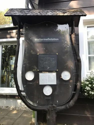
Heimat- und FIS-Skimuseum Braunlage
Museum
4 Dr.-Kurt-Schroeder-Promenade, Braunlage
Tu,Th 10:00-12:00





19 more on the map.
Parks, trails and playgrounds10



Hallen- und Freizeitbad Braunlage/Harz
Sports field and stadium
2 Ramsenweg, Braunlage
Mo off; Tu-We 10:00-19:00; Th 10:00-21:00; Fr 10:00-17:00; Sa...



Restaurants and cafes68

Waldgaststätte Rinderstall
Restaurant · Regional · 3.5 km
1 Rinderstall, Braunlage
Mo-Fr 11:00-17:00; Sa,Su,PH off


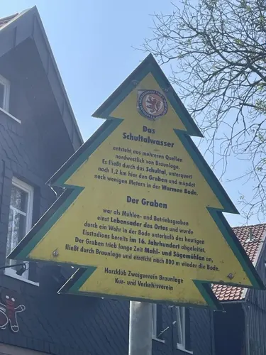
Moni´s Hexenhäuschen
Restaurant · Regional, Cake
5 Am Graben, Braunlage
Tu,We,Fr,Sa 12:00-21:00; Su 12:00-18:00; Mo,Th,PH off
Rodelhaus
Restaurant · German · 2.1 km
1, Braunlage
"Unregelmäßig. Bitte Anrufbeantworter oder Website befragen."
Waldcafé Forellenteich
Cafe · Cake, Fish, German, Ice Cream, Local · 2.2 km
1 Forellenteich, Braunlage
We-Su 11:00-17:00; PH closed "Ausgenommen Feiertage am Montag und Dienstag"
kleine Auszeit
Restaurant · International
5 Heinrich-Jasper-Platz, Braunlage
Mo-Su 11:30-14:00,18:00-23:00; We 18:00-23:00


56 more on the map.
History
First mentioned as Brunla in 1227, the town started out as a pit settlement in the Harz forests. It appeared as Brunenlo in a 1253 register of the Saxon counts of Regenstein and was revived when their successors, the Counts of Blankenburg, established an ironworks here in 1561. With the extinction of the Blankenburg dynasty in 1599 Braunlage fell to the Dukes of Brunswick-Wolfenbüttel.
In the 17th century it was a small Brunswick market town in the west corner of the former Blankenburg lands. Tourism developed from the late 19th century onwards and other branches of business were forestry and a large granite quarry on the Wurmberg. Around 1910 one of the first interurban bus lines ran from Bad Harzburg up to Braunlage, served by Büssing vehicles. The Wurmberg Ski Jumps were erected in 1922 (demolished in 2014). In 1934 Braunlage received town privileges and municipal status as a health resort.
After World War II Braunlage was close to the fortified inner German border through the Harz mountains. In 1963 it became the location of the Wurmberg Gondola Lift, today with a length of 2.8 kilometres (1.7 mi) and a height difference of 400 m (1,300 ft) to the summit station the longest in Northern Germany. On 7 May 1964 Gerhard Zucker demonstrated a flight of mail rockets on the Hasselkopf hill. One of them exploded, killing two spectators.
From the History section of Braunlage on Wikipedia, under CC BY-SA 4.0.
Where to stay66
Nationalpark-Jugendwaldheim Brunnenbachsmühle
Motel and hotel · 3.0 km
1 Brunnenbachsmühle, Braunlage
Churches and places of worship3
Pfarrkirche Hl. Familie
Church · Roman Catholic
von-Langen-Straße, Braunlage
Shopping14
Gas and EV charging2
Schools, colleges and libraries3
Healthcare2
Map of Braunlage
229 places. The map loads OpenStreetMap tiles when you open it.
Getting there and nearby towns
Magdeburg-Cochstedt Airport (CSO) is the nearest airport with scheduled flights listed in OpenStreetMap, 57 km away.
- Sankt Andreasberg 7 km west, about 7 min by car
- Bad Lauterberg im Harz 14 km southwest, about 14 min by car
- Wernigerode 17 km northeast, about 17 min by car
- Bad Harzburg 18 km north, about 18 min by car
- Herzberg am Harz 20 km southwest, about 20 min by car
- Clausthal-Zellerfeld 21 km northwest, about 21 min by car
- Goslar 23 km northwest, about 23 min by car
- Blankenburg 25 km east, about 25 min by car
- Vienenburg 25 km north, about 25 min by car
- Nordhausen 28 km southeast, about 28 min by car
Drive times are estimates from straight-line distance, not routes.
Local news
Headlines from INDB.
Reviews, tips and questions
Loading what members have shared...
Sources and licences
- GeoNames (CC BY 4.0): population, coordinates, regions and time zone
- Mapillary (see each image): photos
- OpenStreetMap contributors (ODbL 1.0): places, airports, map data
- Wikidata (CC0 1.0): elevation, founding date, time zone, website, landmarks and historic places
- Wikimedia Commons (see each image): photos
- Wikipedia (CC BY-SA 4.0): overview and history text
Photo credits
- Braunlage 04, Derzno, CC BY 3.0
- Trinitatiskirche in Braunlage, Olaf Meister, CC BY-SA 4.0
- Marktstrasse 19 in Braunlage (1), Krzysztof Golik, CC BY 4.0
- Kanzel Trinitatiskirche Braunlage 02, Olaf Meister, CC BY-SA 4.0
- Trinity church in Braunlage (7), Tournasol7, CC BY 4.0
- Trinity church in Braunlage (2), Tournasol7, CC BY 4.0
- Trinity church in Braunlage (1), Tournasol7, CC BY 4.0
- Trinity church in Braunlage (3), Tournasol7, CC BY 4.0
- Trinity church in Braunlage (6), Tournasol7, CC BY 4.0
- Trinity church in Braunlage (4), Tournasol7, CC BY 4.0
- Trinity church in Braunlage (5), Tournasol7, CC BY 4.0
- Höhenmarke Braunlage, Ulrich Kulle, CC BY-SA 4.0
- Höhenmarke Braunlage Kirche Nordseite, Ulrich Kulle, CC BY-SA 4.0
- Braunlage 01, Derzno, CC BY 3.0
- Braunlage 03, Derzno, CC BY 3.0
- Glocke im Altarraum Trinitatiskirche Braunlage 03, Olaf Meister, CC BY-SA 4.0
- Kirchenschiff Trinitatiskirche Braunlage 04, Olaf Meister, CC BY-SA 4.0
- Erwin Spindler Ansichtskarte Braunlage-Köhlerhütte, Erwin Spindler, Public domain
- Braunlage 02, Derzno, CC BY 3.0
- Trinitatiskirche in Braunlage Orgel 01, Olaf Meister, CC BY-SA 4.0
- Braunlage 19850501, Hardo Müller from Southampton, United Kingdom, CC BY-SA 2.0
- Braunlage 06, Derzno, CC BY 3.0
- Braunlage, die Trinitatis-Kirche IMG 5182 2018-07-06 10.51, Michielverbeek, CC BY-SA 4.0
- Heimatmuseum in Braunlage (1), Tournasol7, CC BY 4.0
- Warme Bode in Braunlage (1), Tournasol7, CC BY 4.0
- Braunlage 05, Derzno, CC BY 3.0
- 1953-02-01 WSV-Braunlage vs. WSV-Clausthal-Zellerfeld in Braunlage, Herbert Ahrens, CC BY-SA 4.0
- Braunlage, Germany - panoramio, ThorstenE, CC BY-SA 3.0
- Braunlage (DE), Oberharz-Gymnasium -- 2019 -- 0301, Anil Öztas, CC BY-SA 4.0
- Kamelfichte Braunlage 01, Llez, CC BY-SA 3.0
- Hapimag Braunlage, Januar 2018, Gerd Fahrenhorst, CC BY 4.0
- Braunlage - Wolken 01, Llez, CC BY-SA 3.0
- View of Braunlage 01, Llez, CC BY-SA 3.0
- 1974-08-31 Eisstadion-Braunlage Eroeffnung, Herbert Ahrens, CC BY-SA 4.0
- Kurpark in Braunlage (5), Tournasol7, CC BY 4.0
- Kurpark in Braunlage (4), Tournasol7, CC BY 4.0
- Kurpark in Braunlage (2), Tournasol7, CC BY 4.0
- Kurpark in Braunlage (1), Tournasol7, CC BY 4.0
- Kurpark in Braunlage (6), Tournasol7, CC BY 4.0
- Kurpark in Braunlage (3), Tournasol7, CC BY 4.0
- BT9-Sorge 1900px, ChrisO, CC BY-SA 3.0
- Ilsenburg, Ilsetal, Ilsefälle -- 2017 -- 0143, Dietmar Rabich, CC BY-SA 4.0
- BrunnenbachB27, Kassandro, CC BY-SA 3.0
- EG ehemaliger Bf Brunnenbachsmühle, de:Benutzer:ch ivk, CC BY 3.0
- NSG Kramershai 2022-04-07 15, Leonhard Lenz, CC0
- WurmbergsteinbruchB4, Kassandro, CC BY-SA 3.0
- Braunlage Kirche kath 2011, Kirchenfan, CC0
- Krankenhaus Dr. Barner Pano, Lehar Marie, CC BY-SA 4.0
- Gaststätte Rinderstall, Thomas Binder, CC BY-SA 4.0
- Weg zur Achtermannshöhe mit Schild zur Kamelfichte, Olaf Meister, CC BY-SA 4.0
- Wildererstein bei Elend 01, Olaf Meister, CC BY-SA 4.0
- VonLangenDenkmalBraunlage, Kassandro, CC BY-SA 3.0
- Wurmbergschanze Auslauf, Steffen Löwe, CC BY 3.0
- Kleiner Winterberg Harz 2022-04-07 01, Leonhard Lenz, CC0
- Skiklub Sankt Andreasberg at Rehberger Graben, Leonhard Lenz, CC BY-SA 4.0
- Street-level photo, surveyor99, CC BY-SA 4.0
- Street-level photo, fod, CC BY-SA 4.0
- Street-level photo, sunnyteater, CC BY-SA 4.0
- Street-level photo, surveyor99, CC BY-SA 4.0
- Street-level photo, fod, CC BY-SA 4.0
- Street-level photo, inextremo96, CC BY-SA 4.0
- Street-level photo, mezazis, CC BY-SA 4.0
- Street-level photo, thetornado76, CC BY-SA 4.0
- Street-level photo, Hightower-, CC BY-SA 4.0
- Street-level photo, fod, CC BY-SA 4.0
- Street-level photo, sunnyteater, CC BY-SA 4.0
- Street-level photo, atze02, CC BY-SA 4.0
- Street-level photo, fod, CC BY-SA 4.0
- Street-level photo, ReisenderKaufmann, CC BY-SA 4.0
- Street-level photo, thetornado76, CC BY-SA 4.0
- Street-level photo, ReisenderKaufmann, CC BY-SA 4.0
- Street-level photo, steelcroissant, CC BY-SA 4.0
- Street-level photo, Hightower-, CC BY-SA 4.0
- Street-level photo, ReisenderKaufmann, CC BY-SA 4.0
- Street-level photo, fod, CC BY-SA 4.0
- Street-level photo, ReisenderKaufmann, CC BY-SA 4.0
- Street-level photo, hotteliene, CC BY-SA 4.0
- Street-level photo, surveyor99, CC BY-SA 4.0


Page built November 9, 2026. Spotted a mistake? Tell us or suggest a place.