


Stockelsdorf, Germany
Stockelsdorf is a town of 16,562 people in Schleswig-Holstein, Germany.
Why visit Stockelsdorf
Townapedia lists 159 museums and landmarks, 55 parks and trails, 182 places to eat, 37 places to stay and 11 attractions in and around town.
Highlights include Kommunales Kino (KoKi), Holstentor, Hansemuseum Haupteingang and Brahms-Institut an der Musikhochschule Lübeck.
Weather in Stockelsdorf
Forecast from MET Norway (CC BY 4.0). Full forecast
About Stockelsdorf
Stockelsdorf is a municipality in the district of Ostholstein, in Schleswig-Holstein, Germany. It is situated directly northwest of Lübeck and forms an agglomeration with the easterly town of Bad Schwartau.
From the Wikipedia article Stockelsdorf (this version), under CC BY-SA 4.0.
Things to do11

Kommunales Kino (KoKi)
Cinema and theater · 3.4 km
Programmkino mit 2-3 Vorführungen am Tag, viele davon in Originalfassung. Betreiber ist ein gemeinnütziger Förderverein.
35 Mengstraße, Lübeck
Mo-Su 18:00+, 20:30+
Open in Google Maps · Wikipedia · +49 451 1221287;+49 176 70354704

Holstentor
Monument and historic site · 3.6 km
Two-towered city gate in Lübeck, Germany, used as a museum

Theater Lübeck
Cinema and theater · 3.6 km
Theatre and opera house in Lübeck, Germany

Eckhorster Hofladen
Farm and orchard · 2.8 km
We-Fr 14:00-19:00; Sa 09:00-13:00

Museums and landmarks159


Brahms-Institut an der Musikhochschule Lübeck
Museum · 3.4 km
4 Jerusalemsberg, Lübeck
We,Sa 14:00-18:00


Europäisches Hansemuseum
Museum · 3.4 km
Museum of the Hanseatic League in Lübeck
1 An der Untertrave, Lübeck


147 more on the map.
Parks, trails and playgrounds55




Neue Trave Werft
Marina and boat launch · 3.4 km
12A Zur Teerhofsinsel, Lübeck


43 more on the map.
Restaurants and cafes182

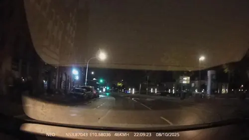
schickSAAL
Cafe · Brunch · 3.3 km
7 Clemensstraße, Lübeck
We 12:00-22:00; Th 12:00-01:00; Fr 12:00-01:00; Sa 09:00-01:00; Su...

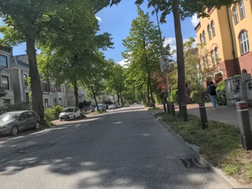
Alte Feuerwache Lübeck
Restaurant · Regional · 3.4 km
24 Hansestraße, Lübeck
Mo-Th 12:00-22:00; Fr-Sa 12:00-23:59

Cafe & Bar Celona
Restaurant · Burger, Coffee Shop, International · 3.4 km
1 Hafenstraße
Su-Th 09:00-24:00, Fr,Sa 09:00-01:00
Cafe Del Sol
Restaurant · International · 1.4 km
1 Stockelsdorfer Straße, Lübeck
Su-Th 09:00-23:00; Fr,Sa 09:00-24:00
Das kleine Restaurant
Restaurant · German, Fish, French, Wings, Chicken, Mediterranean, Seafood, Noodle, Regional, Steak House · 3.3 km
39 An der Untertrave, Lübeck
We-Sa 17:00-22:30; Su 17:00-21:00; 24/7 open "nach Vereinbarung"
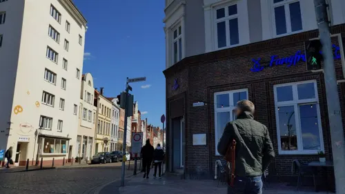
Fangfrisch
Restaurant · Seafood, Fish And Chips, Regional · 3.3 km
51 An der Untertrave, Lübeck
Mo-Su 12:00-22:00

Fräulein Brömse
Cafe · Coffee Shop, Breakfast · 3.5 km
2 Hinter der Burg
Mo-Th 10:00-18:00; Fr-Su 09:30-18:00


Kaizen
Restaurant · Asian, Sushi · 0.8 km
3-5 Segeberger Straße, Stockelsdorf
Mo-Fr 11:30-15:00,17:00-22:00; Sa-Su 12:00-15:00,17:00-22:00
Kantine am Jerusalemsberg
Restaurant · German · 3.5 km
3 Eschenburgstraße, Lübeck
Mo-Fr 08:30-09:30,11:30-13:30; Sa-Su off; Dec 24-31 off; PH off
LaBaracca
Restaurant · Italian · 3.4 km
1-5 Willy-Brandt-Allee, Lübeck
Fr,Sa 12:30-24:00, Su-Th 12:30-23:00
170 more on the map.
Where to stay37
Churches and places of worship22
Shopping50
Gas and EV charging22
Schools, colleges and libraries32
Healthcare12
Map of Stockelsdorf
250 places. The map loads OpenStreetMap tiles when you open it.
Getting there and nearby towns
Lübeck Airport (LBC) is the nearest airport with scheduled flights listed in OpenStreetMap, 11 km away.
- Musik und Kongresshalle (MUK) / Busparkplatz map
- Lübeck 4 km southeast, about 4 min by car
- Wentorf bei Hamburg 51 km southwest, about 51 min by car
- Hamburg 57 km southwest, about 57 min by car
- Kiel 58 km northwest, about 58 min by car
- Tornesch 65 km west, about 1 h by car
- Winsen 66 km southwest, about 1 h by car
- Uetersen 69 km west, about 1 h 15 min by car
- Seevetal 71 km southwest, about 1 h 15 min by car
- Wedel 71 km southwest, about 1 h 15 min by car
- Lüneburg 73 km south, about 1 h 15 min by car
Drive times are estimates from straight-line distance, not routes.
Local news
Headlines from INDB.
Reviews, tips and questions
Loading what members have shared...
Sources and licences
- GeoNames (CC BY 4.0): population, coordinates, regions and time zone
- Mapillary (see each image): photos
- OpenStreetMap contributors (ODbL 1.0): places, airports, map data
- Wikidata (CC0 1.0): elevation, founding date, time zone, website, landmarks and historic places
- Wikimedia Commons (see each image): photos
- Wikipedia (CC BY-SA 4.0): overview and history text
Photo credits
- Stockelsdorf - Kirche, Genet, CC BY-SA 3.0
- Stockelsdorf Villa Jebsen 02, J.-H. Janßen, CC BY-SA 4.0
- Stockelsdorf Villa Jebsen 01, J.-H. Janßen, CC BY-SA 4.0
- Stockelsdorf Villa Jebsen 04, J.-H. Janßen, CC BY-SA 4.0
- Stockelsdorf Villa Jebsen 03, Jan-Herm Janßen, CC BY-SA 4.0
- Stockelsdorf Evangelische Kirche 03, J.-H. Janßen, CC BY-SA 4.0
- Stockelsdorf – Kirche – Kriegerehrenmal – 5, 1970gemini, CC BY-SA 4.0
- Stockelsdorf – Kirche – Kriegerehrenmal – 4, 1970gemini, CC BY-SA 4.0
- Stockelsdorf – Kirche – Kriegerehrenmal – 3, 1970gemini, CC BY-SA 4.0
- HL Damals – Stockelsdorf – Ahrensböker Straße – 3 – 2021, 1970gemini, CC BY-SA 4.0
- HL Damals – Stockelsdorf – Ahrensböker Straße – 2 – 2021, 1970gemini, CC BY-SA 4.0
- HL Damals – Stockelsdorf – Ahrensböker Straße – 4 – 2021, 1970gemini, CC BY-SA 4.0
- Stockelsdorf Evangelische Kirche 02, J.-H. Janßen, CC BY-SA 4.0
- Stockelsdorf Evangelische Kirche 04, J.-H. Janßen, CC BY-SA 4.0
- Stockelsdorf Evangelische Kirche 01, J.-H. Janßen, CC BY-SA 4.0
- HL Damals – Stockelsdorf – Ahrensböker Straße – 1 – 2021, 1970gemini, CC BY-SA 4.0
- 00 3778 Lübeck - Holstentor, W. Bulach, CC BY-SA 4.0
- HL Damals – Dom – Baubehörde – Stadtarchiv – Museum für Natur und Umwelt – 2019, 1970gemini, CC BY-SA 4.0
- Herz Jesu Lübeck, außen, Klaus Kegebein, CC BY-SA 4.0
- Aerial image of St.-Aegidien-Kirche, Lübeck (view from the southwest), Carsten Steger, CC BY-SA 4.0
- Katharinenkirche Lübeck, Photo: Andreas Praefcke, CC BY 3.0
- Aerial image of St. James' Church, Lübeck (view from the west), Carsten Steger, CC BY-SA 4.0
- Aerial image of St. Mary's Church, Lübeck (view from the west), Carsten Steger, CC BY-SA 4.0
- Aerial image of St. Peter's Church, Lübeck (view from the southwest), Carsten Steger, CC BY-SA 4.0
- Musikhochschule Lübeck, Unknown author, Public domain
- TH Lübeck Seminargebäude, TH Lübeck, CC BY-SA 4.0
- HL Damals – Mühlenpfordt – UKSH – Psychiatrische Klinik – Heilanstalt Strecknitz – 1, Stephan Grimm, CC BY-SA 4.0
- Europäisches Hansemuseum 2015, BS Hochschulstadtteil ( Diskussion ) 20:27, 11. Jun. 2015 (CEST), CC BY 4.0
- HL – Jerusalemsberg 4, 1970gemini, CC BY-SA 4.0
- PortalAlfstr36, Kresspahl ( talk ) 20:24, 22 November 2009 (UTC), CC BY-SA 4.0
- Friedrich-von-Bodelschwingh-Kirche (Luebeck), Andreas Geick, CC BY-SA 3.0
- Ernestinenschule, No machine-readable author provided. Tic-hl~commonswiki assumed (based on copyright claims)., Public domain
- Fehmarnbelt, NvG, Public domain
- Luebeck Engelsgrube 66, Lemke, Martin, CC BY-SA 4.0
- Kinosaal, Turbanmann, CC BY-SA 4.0
- HL Damals - Jerusalemsberg, 1970gemini, CC BY-SA 3.0
- Museumshafen Lubeck Titan, jphintze sur flickr, CC BY-SA 2.0
- Lübeck-Lohmühle 1, Mghamburg, CC BY-SA 3.0
- Restaurant Wullenwever, Jan Peer Baumann, CC BY-SA 3.0
- HL-008 Heinrich Herbert Mecklenburg (1886), Ralf Küpper, CC BY-SA 3.0 de
- Straßenlampen 09.10.2021 & Glockenläuten Vorwerk 078, Nur Luis, CC BY-SA 4.0
- H+Hotel Lübeck, Gerd Fahrenhorst, CC BY 4.0
- Lübeck - Kaiser-Wilhelm-Denkmal (30999275182), Fred Romero from Paris, France, CC BY 2.0
- Luebeck - Bismarck-Denkmal, Genet, CC BY-SA 3.0
- Jerusalemsberg 2, Peter Oldekop, Public domain
- HL-008 Hermann Marcus Mecklenburg (1927), Ralf Küpper, CC BY-SA 3.0 de
- St. Matthäi-Kirche in Lübeck. - panoramio, Andreas Geick, CC BY-SA 3.0
- Lübeck St. Bonifatius 01, Re Mare at de.wikipedia, GFDL
- WP Carl-Jacob-Burckhardt-Gymnasium 2024-06-22, Der Bischof mit der E-Gitarre, CC BY-SA 4.0
- Fischergrube theater Lübeck 2021-08-21 2, Z thomas, CC BY-SA 4.0
- Lübeck Flächerblattbaum Eschenburgpark c, JanTappenbeck, CC BY-SA 3.0
- Luebeck Zerrahns Gang Engelsgrube 73, Arnoldius, CC BY-SA 3.0
- Street-level photo, TechniPorter, CC BY-SA 4.0
- Street-level photo, DruideBizeps, CC BY-SA 4.0
- Street-level photo, hotteliene, CC BY-SA 4.0
- Street-level photo, chuck, CC BY-SA 4.0
- Street-level photo, rasmustravemnde, CC BY-SA 4.0
- Street-level photo, rasmustravemnd, CC BY-SA 4.0
- Street-level photo, TechniPorter, CC BY-SA 4.0
- Street-level photo, juliansaa_, CC BY-SA 4.0
- Street-level photo, TechniPorter, CC BY-SA 4.0
- Street-level photo, rasmustravemnd, CC BY-SA 4.0
- Street-level photo, rasmustravemnd, CC BY-SA 4.0
- Street-level photo, larshelmin, CC BY-SA 4.0
- Street-level photo, tobiaso, CC BY-SA 4.0
- Street-level photo, rasmustravemnd, CC BY-SA 4.0
- Street-level photo, juliansaa_, CC BY-SA 4.0
- Street-level photo, DruideBizeps, CC BY-SA 4.0
- Street-level photo, juliansaa_, CC BY-SA 4.0
- Street-level photo, rasmustravemnd, CC BY-SA 4.0
- Street-level photo, rasmustravemnd, CC BY-SA 4.0
- Street-level photo, larshelmin, CC BY-SA 4.0
- Street-level photo, changchun1, CC BY-SA 4.0


Page built November 8, 2026. Spotted a mistake? Tell us or suggest a place.