


Why visit Ratekau
Townapedia lists 76 museums and landmarks, 62 parks and trails, 148 places to eat, 33 places to stay and 19 attractions in and around town.
Highlights include Bismarcksäule Bad Schwartau, Holstentor, Brahms-Institut and Europäisches Hansemuseum.
Weather in Ratekau
Forecast from MET Norway (CC BY 4.0). Full forecast
About Ratekau
Ratekau (German pronunciation: [ˈʁaːtəˌkaʊ]) is a municipality in the district of Ostholstein, in Schleswig-Holstein, Germany. It is situated approximately 10 km northeast of Lübeck.
From the Wikipedia article Ratekau (this version), under CC BY-SA 4.0.
Things to do19


Holstentor
Monument and historic site · 9.5 km
Two-towered city gate in Lübeck, Germany, used as a museum

Theater Lübeck
Cinema and theater · 9.0 km
Theatre and opera house in Lübeck, Germany


Lindenhof
Farm and orchard · 2.1 km
Fr 08:00-10:00,11:00-12:00; Tu,Th 09:00-18:00

MovieStar
Cinema and theater · 3.9 km
"täglich 30 Minuten vor der ersten Vorstellung"
Obsthof Knoop
Farm and orchard · 2.8 km
32 Seestraße, Timmendorfer Strand

7 more on the map.
Museums and landmarks76


Europäisches Hansemuseum
Museum · 8.5 km
Museum of the Hanseatic League in Lübeck

Liubice
Monument and historic site · 4.4 km
Slavic Gord. Archaeological site in Germany

Museum Behnhaus Drägerhaus
Museum · 8.9 km
Art museum in Lübeck, Germany


Bauhofstein
Monument and historic site · 4.9 km
Vermutlich Lübecker Bauhofsteine

Großsteingrab Ratekau
Monument and historic site
Teilrekonstruiertes Großsteingrab. Standort ursprünglich etwa 53.93226 N, 10.76340 E


64 more on the map.
Parks, trails and playgrounds62
Karls Erlebnis-Dorf Warnsdorf
Sports field and stadium · 6.2 km
Der Eintritt ist frei. Einige Attraktionen sind kostenpflichtig.
4 Fuchsbergstraße, Ratekau
Mo-Su 08:00-19:00



Sielbektal, Kreuzkamper Seenlandschaft und umliegende Wälder
Hiking and trails · 2.5 km

Segler-Verein Trave
Marina and boat launch · 5.8 km
Seglerverein Trave, mit Gastonomie sehr zu empfehlen Sanitäre Anlagen gut
50 more on the map.
Restaurants and cafes148

Athena
Restaurant · Greek · 6.6 km
90 Strandallee, Timmendorfer Strand
Mo-Su,PH 12:00-14:30,17:00-22:00
Ciao Ciao
Restaurant · Italian · 6.6 km
126 Strandallee, Timmendorfer Strand
Mo 17:00-21:30; We-Su 17:00-21:30
Gambero
Restaurant · Italian · 3.6 km
3 Geibelstraße, Bad Schwartau
We-Fr 12:00-15:00, 17:00-22:00; Sa 12:00-22:00; Su 12:00-21:00

Markt-Stuben
Restaurant · International
6 Poststraße, Ratekau
We 17:30-22:00; Th-Su 11:30-14:30,17:30-22:00; Mo,Tu off
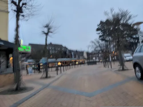
Peter Pane
Restaurant · Burger · 6.6 km
12 Timmendorfer Platz, Timmendorfer Strand
Mo-Th,Su 12:00-22:30; Fr-Sa 12:00-23:30
Taverne Hellas
Restaurant · Greek
2 Rosenstraße, Ratekau
Tu-Sa 11:30-14:00,17:00-22:00; Su 11:30-14:00,17:00-21:30


Trattoria del Campo
Restaurant · Italian · 6.3 km
12-14 Oeverdieker Weg, Timmendorfer Strand
Su-Th 17:00-22:00; Fr-Sa 17:00-23:00
136 more on the map.
Where to stay33
Grand Hotel Seeschlösschen Sea Retreat & SPA
Motel and hotel · 6.7 km
141 Strandallee, Timmendorfer Strand
Churches and places of worship28
Sankt Paulus
Church · Roman Catholic · 6.5 km
30 Poststraße, Timmendorfer Strand
Shopping45
Gas and EV charging16
Schools, colleges and libraries27
Healthcare18
Map of Ratekau
250 places. The map loads OpenStreetMap tiles when you open it.
Getting there and nearby towns
Lübeck Airport (LBC) is the nearest airport with scheduled flights listed in OpenStreetMap, 16 km away.
- Stockelsdorf 8 km southwest, about 8 min by car
- Scharbeutz 9 km north, about 9 min by car
- Lübeck 9 km south, about 9 min by car
- Ratzeburg 28 km south, about 28 min by car
- Schwarzenbek 52 km south, about 52 min by car
- Kiel 57 km northwest, about 57 min by car
- Reinbek 57 km southwest, about 57 min by car
- Wentorf bei Hamburg 59 km southwest, about 59 min by car
- Hamburg 66 km southwest, about 1 h by car
- Rellingen 68 km southwest, about 1 h 15 min by car
Drive times are estimates from straight-line distance, not routes.
Local news
Headlines from INDB.
Reviews, tips and questions
Loading what members have shared...
Sources and licences
- GeoNames (CC BY 4.0): population, coordinates, regions and time zone
- Mapillary (see each image): photos
- OpenStreetMap contributors (ODbL 1.0): places, airports, map data
- Wikidata (CC0 1.0): elevation, founding date, time zone, website, landmarks and historic places
- Wikimedia Commons (see each image): photos
- Wikipedia (CC BY-SA 4.0): overview and history text
Photo credits
- Vicelinkirche (Ratekau) 2012d 04, Holger.Ellgaard, CC BY-SA 3.0
- Eiche Ratekau c, JanTappenbeck, CC BY-SA 3.0
- Vicelinkirche Ratekau 04, Wikipeter-HH, CC BY-SA 4.0
- Ratekau - Vicelinkirche, Genet, CC BY-SA 3.0
- Feldsteinkirche Ratekau 003, SPD Schleswig-Holstein, CC BY 2.0
- Vicelinkirche (Ratekau) 2012d 03, Holger.Ellgaard, CC BY-SA 3.0
- Vicelinkirche in Ratekau, Rosa-Maria Rinkl, CC BY-SA 4.0
- Feldsteinkirche Ratekau 001, SPD Schleswig-Holstein, CC BY 2.0
- Vicelinkirche, Ratekau, Alte Schulstraße - panoramio, Andreas Geick, CC BY 3.0
- Ratekauer Feldsteinkirche mit Grabstein Hinrich Ehlers, Wilmsdorf, Wikieliuser, CC BY-SA 4.0
- Vicelinkirche (Ratekau) 2012e, Holger.Ellgaard, CC BY-SA 3.0
- Kirche Ratekau, Bera at German Wikipedia, CC BY-SA 3.0
- Ratekau - Ratekauer Kirche - NO, Genet, CC BY-SA 3.0 de
- Feldsteinkirche Ratekau, Sebastian Krüger, CC BY-SA 3.0
- 00 3778 Lübeck - Holstentor, W. Bulach, CC BY-SA 4.0
- HL – Jerusalemsberg 4, 1970gemini, CC BY-SA 4.0
- Europäisches Hansemuseum 2015, BS Hochschulstadtteil ( Diskussion ) 20:27, 11. Jun. 2015 (CEST), CC BY 4.0
- Lübeck, Deutschland, Behnhaus, 1970gemini, CC BY-SA 3.0
- Aerial image of St.-Aegidien-Kirche, Lübeck (view from the southwest), Carsten Steger, CC BY-SA 4.0
- Katharinenkirche Lübeck, Photo: Andreas Praefcke, CC BY 3.0
- Aerial image of St. James' Church, Lübeck (view from the west), Carsten Steger, CC BY-SA 4.0
- Aerial image of St. Mary's Church, Lübeck (view from the west), Carsten Steger, CC BY-SA 4.0
- Aerial image of St. Peter's Church, Lübeck (view from the southwest), Carsten Steger, CC BY-SA 4.0
- Musikhochschule Lübeck, Unknown author, Public domain
- Alt Lübeck Kirche, Peter Oldekop, CC BY-SA 3.0
- Bismarksaule-Pariner-Berg-2011, Dennis Siebert at de.wikipedia, CC BY-SA 3.0
- Bad-Schwartau Riesebusch Vorburgwall, Genet, CC BY-SA 3.0
- Bad Schwartau - Gross Parin - Ehrenmal, Genet at German Wikipedia, CC BY-SA 3.0
- Bad Schwartau Georgskapelle 01, J.-H. Janßen, CC BY-SA 4.0
- Ratekau Langbett-Langenrehm W, Genet at de.wikipedia, CC BY-SA 3.0
- Bad Schwartau - St.Fabian-Rensefeld, Genet at German Wikipedia, CC BY-SA 3.0
- Stolperstein Bad Schwartau Auguststraße 22 Familie Jaschek, Genet at German Wikipedia, CC BY-SA 3.0
- St. Stephanus Lübeck, Nur Luis, CC BY-SA 4.0
- Timmendorfer Strand 2010 PD 103, Bin im Garten, CC BY-SA 3.0
- St.-Paulus-Kirche-Timmendorfer-Strand-27.03.2022, Nur Luis, CC BY-SA 4.0
- St.-Joseph-Lübeck-Kücknitz, Nur Luis, CC BY-SA 4.0
- Bismarcksaeule Pariner Berg, Genet, CC BY-SA 3.0
- Ratekau - Steinkiste, Genet at de.wikipedia, CC BY-SA 3.0
- Bad-Schwartau Riesebusch Lange-Hörn, Genet, CC BY-SA 3.0
- Aalbeek-Niederung, Grabowski Karl-Heinz, CC BY-SA 4.0
- Go-Rup-3-2015, Esox117, CC BY-SA 3.0
- NSG Schellbruch, Lübeck-Gothmund (2), Tischbeinkatze, CC BY-SA 3.0
- Rensefeld St Fabian und Sebastian 01, J.-H. Janßen, CC BY-SA 4.0
- Bad Schwartau - Georgskapelle, Genet at German Wikipedia, CC BY-SA 3.0
- 2019 Bad Schwartau Christuskirche, Peter Oldekop, CC BY-SA 3.0 de
- Sielbektal, Kreuzkamper Seenlandschaft und umliegende Wälder See nördl Kiesgrube Kreuzkamp südl Wald Beutz, KerTe, CC BY-SA 4.0
- LüLandgraben012, Kresspahl, CC BY-SA 3.0
- Fischergrube theater Lübeck 2021-08-21 2, Z thomas, CC BY-SA 4.0
- Street-level photo, rasmustravemnd, CC BY-SA 4.0
- Street-level photo, rasmustravemnd, CC BY-SA 4.0
- Street-level photo, rasmustravemnd, CC BY-SA 4.0
- Street-level photo, rasmustravemnd, CC BY-SA 4.0
- Street-level photo, rasmustravemnd, CC BY-SA 4.0
- Street-level photo, rasmustravemnd, CC BY-SA 4.0
- Street-level photo, juliansaa_, CC BY-SA 4.0
- Street-level photo, rasmustrave1, CC BY-SA 4.0
- Street-level photo, rasmustravemnd, CC BY-SA 4.0
- Street-level photo, u14183, CC BY-SA 4.0
- Street-level photo, rasmustravemnd, CC BY-SA 4.0
- Street-level photo, changchun1, CC BY-SA 4.0
- Street-level photo, rasmustravemnd, CC BY-SA 4.0
- Street-level photo, rasmustravemnd, CC BY-SA 4.0
- Street-level photo, rasmustravemnd, CC BY-SA 4.0
- Street-level photo, rasmustravemnd, CC BY-SA 4.0
- Street-level photo, rasmustravemnd, CC BY-SA 4.0
- Street-level photo, rasmustravemnd, CC BY-SA 4.0
- Street-level photo, chuck, CC BY-SA 4.0
- Street-level photo, changchun1, CC BY-SA 4.0
- Street-level photo, rasmustravemnd, CC BY-SA 4.0
- Street-level photo, rasmustravemnd, CC BY-SA 4.0
- Street-level photo, u14183, CC BY-SA 4.0


Page built November 8, 2026. Spotted a mistake? Tell us or suggest a place.