


Bad Soden-Salmünster, Germany
Bad Soden-Salmünster is a town of 13,953 people in Hesse, Germany, founded in 1974.
Why visit Bad Soden-Salmünster
Townapedia lists 110 museums and landmarks, 28 parks and trails, 122 places to eat, 27 places to stay and 29 attractions in and around town.
Highlights include Teufelshöhle, Wartturm, Gradierwerk and Burgruine Stolzenberg.
Weather in Bad Soden-Salmünster
Forecast from MET Norway (CC BY 4.0). Full forecast
About Bad Soden-Salmünster
Bad Soden-Salmünster (German: [baːt ˈzoːdn̩ zaːlˈmʏnstɐ] ) is a town in the Main-Kinzig district, in Hesse, Germany. It is situated on the river Kinzig, between Fulda and Hanau. It has a population of around 13,000.
From the Wikipedia article Bad Soden-Salmünster (this version), under CC BY-SA 4.0.
Things to do29





17 more on the map.
Museums and landmarks110

Gradierwerk
Monument and historic site · 6.1 km
Technikdenkmal
12 Salinenstraße, Bad Orb
Mo-Su 08:00-20:00

Burgruine Stolzenberg
Monument and historic site · 1.7 km
Burgruine Stolzenberg, 1252 erstmals urkundlich erwähnt, Sitz der Hutten bis 1535 , danach nicht mehr bewohnt.

Huttenschloß
Monument and historic site · 1.5 km
6 Pacificusstraße, Bad Soden-Salmünster

Schleifrashof
Monument and historic site
56a Frankfurter Straße, Bad Soden-Salmünster


Kleinstes Haus
Monument and historic site · 5.6 km
Kleinstes Haus Hessens
23 Kirchgasse, Bad Orb



98 more on the map.
Parks, trails and playgrounds28
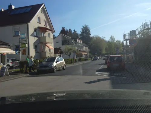
Spessart Therme
Sports field and stadium · 1.5 km
5 Frowin-von-Hutten-Straße, Bad Soden-Salmünster
Mo-Sa 09:00-22:00; PH,Su 09:00-20:00

Toskana Therme Bad Orb
Sports field and stadium · 6.3 km
1 Horststraße, Bad Orb
Mo-Fr 10:00-22:00; Sa 10:00-23:00; Su 10:00-22:00





16 more on the map.
Restaurants and cafes122

Jagdhaus Haselruhe
Restaurant · Regional, German · 6.3 km
Bei den Öffnungszeiten zu beachten: Mi-So geöffnet: Mittag 11:30-13:30; Kaffee 11:30-20:00; Abend 18:00-20:00 Mi-Fr Mittagspause 14:30-17:30
Haselstraße, Bad Orb
Apr-Oct: Mo,Tu off; Apr-Oct: We-Su 11:30-14:30,17:30-20:15;...
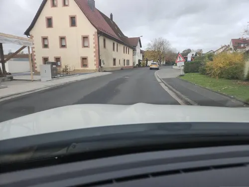
Zum Spessarttor
Restaurant · German, International · 1.1 km
44 Spessartstraße, Bad Soden-Salmünster
We-Su 11:30-14:00,17:00-22:30; PH 11:30-14:00,17:00-22:30
Da Enzo
Restaurant · Italian · 1.5 km
10 Badestraße, Bad Soden-Salmünster
Su-Tu 11:30-14:30,17:00-23:00; Th-Sa 11:30-14:30,17:00-23:30; We off

Eis Café Paradice
Ice cream · 1.0 km
Eis Café mit Innen- und Außenbereich, und Eis zum Mitnehmen
17 Parkstraße, Bad Soden-Salmünster
Sa,Su 12:00-20:00; Mo 13:00-19:00; Tu-Fr 12:00-20:00
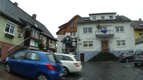
Gasthaus zur Quelle
Restaurant · German, Regional · 3.7 km
15 Leipziger Straße, Wächtersbach
Mo-Su 11:30-14:30,17:00-22:30; Th off
Knossos
Restaurant · Greek · 1.4 km
35 Sprudelallee, Bad Soden-Salmünster
Tu-Su 11:00-14:30,17:00-23:00; Mo off
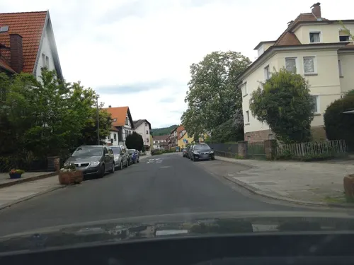
Kärrners Hausbrauerei
Restaurant · German, Regional · 5.9 km
7 Kurparkstraße, Bad Orb
Tu-Sa 17:30-24:00; Su 17:00-24:00
Landgasthaus Bayrischer Hof
Restaurant · 6.0 km
2 Am Bayrischen Hof, Steinau an der Straße
Tu,Th-Sa 17:00-20:00+; Mo,We off; Su 12:00-14:00,17:00-21:30
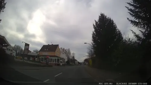


LeDang Restaurant
Restaurant · Vietnamese · 0.9 km
52 Bad Sodener Straße, Bad Soden-Salmünster
Mo,We-Fr 11:00-14:30,17:00-21:00; Sa 15:00-21:00; Su,PH...
Meridian Grill Restaurant
Restaurant · Grill, Turkish · 3.8 km
9 Neue Straße, Wächtersbach
Tu-Sa 17:30-22:00; Su 11:45-14:00,17:30-22:00
Rabenhorst
Restaurant · German · 3.0 km
32 Bornweg, Bad Soden-Salmünster
Fr,Sa 17:00-22:00; Su 11:30-16:00
110 more on the map.
History
Salmünster as a settlement likely dates to the 9th century, but is first mentioned in a document from around 1000, as Salchenmunster. Soden, probably created by Fulda Abbey ca. 909, appears in a document from ca. 1190, referred to as Sodin. Around 152, the abbot of Fulda Abbey had Burg Stolzenberg (see below) erected. Town rights were bestowed in 1296 (Soden, but called Stolzenthal) and 1320 (Salmünster), by King Adolf and Emperor Ludwig, respectively. In 1536, the Huttenschloss (see below) was built.
In medieval times, salt works were an important source of local income at Soden. Since the 12th century the water of the local wells, with a high salt and iron content, was used for salt production. The springs and the village were mortgaged by the abbot of Fulda to the lords of Hutten in 1330, who initially lived at Stolzenfels before moving to a new palace in the mid-16th century. When the Hutten family came into financial difficulties, they in turn mortgaged the area to the Archbishop of Mainz. However, the temporal organization of the Archbishopric, the Erzstift, was already running salt works at nearby (Bad) Orb. To avoid internal competition, salt production at Soden was ended in the later 16th century.
From the History section of Bad Soden-Salmünster on Wikipedia, under CC BY-SA 4.0.
Where to stay27
Churches and places of worship28
Johanneskirche
Church · Protestant, Catholic · 3.6 km
8 Birkenstraße, Wächtersbach
ev. Versöhnungskirche Salmünster
Church · Protestant
53 Frankfurter Straße, Bad Soden-Salmünster
Martin-Luther-Kirche
Church · Protestant · 3.8 km
13 Martin-Luther-Straße, Wächtersbach
Shopping32
Gas and EV charging11
Schools, colleges and libraries15
Healthcare16
Map of Bad Soden-Salmünster
250 places. The map loads OpenStreetMap tiles when you open it.
Getting there and nearby towns
Frankfurt Airport (FRA) is the nearest airport with scheduled flights listed in OpenStreetMap, 65 km away.
- Wächtersbach 6 km southwest, about 6 min by car
- Steinau an der Straße 8 km northeast, about 8 min by car
- Langenselbold 26 km southwest, about 26 min by car
- Neuhof 27 km northeast, about 27 min by car
- Mömbris 27 km southwest, about 27 min by car
- Rodenbach 28 km southwest, about 28 min by car
- Erlensee 30 km southwest, about 30 min by car
- Schotten 31 km northwest, about 31 min by car
- Hösbach 32 km south, about 32 min by car
- Goldbach 33 km southwest, about 33 min by car
Drive times are estimates from straight-line distance, not routes.
Local news
Headlines from INDB.
Reviews, tips and questions
Loading what members have shared...
Sources and licences
- GeoNames (CC BY 4.0): population, coordinates, regions and time zone
- Mapillary (see each image): photos
- OpenStreetMap contributors (ODbL 1.0): places, airports, map data
- Wikidata (CC0 1.0): elevation, founding date, time zone, website, landmarks and historic places
- Wikimedia Commons (see each image): photos
- Wikipedia (CC BY-SA 4.0): overview and history text
Photo credits
- Bad Soden-Salmünster - St. Peter und-Paul - Kloster 0490, Sven Teschke, CC BY-SA 3.0 de
- Bad Orb, Rathaus, Ulrich Stelzner, Public domain
- Molkenberg (Bad Orb), J. Braukmann Milseburg, CC BY-SA 3.0
- Schloss Wächtersbach, BXXXD at German Wikipedia, Public domain
- Sankt Martin (Bad Orb), Jörg Braukmann, CC BY-SA 4.0
- Schleifrashof salmünster 05, Commander-pirx, CC BY-SA 4.0
- Feuchtwiesen bei Aufenau 24, Ersin Caylak, CC BY-SA 4.0
- Feuchtwiesen bei Ahl 5, Ersin Caylak, CC BY-SA 4.0
- Waldweiher bei Bad Soden-Salmünster, SergejTruschkin, CC BY-SA 4.0
- Autal bei Bad Orb, Ersin Çaylak, CC BY-SA 4.0
- NSG Altholzinsel Gretenberg 2022-03-09 10, Leonhard Lenz, CC0
- Die Alte Weide bei Neudorf in Wächtersbach 1, Ersin Caylak, CC BY-SA 4.0
- Lange Wiese bei Weilers in Wächtersbach, Ersin Caylak, CC BY-SA 4.0
- Sterzwiese von Hesseldorf5, Ersin Caylak, CC BY-SA 4.0
- Zelleraue bei Salmünster 6, Ersin Caylak, CC BY-SA 4.0
- Wartturm (Bad Orb), Jörg Braukmann, CC BY-SA 4.0
- Wächtersbach Evangelische Kirche 2, Reinhardhauke, CC BY-SA 3.0
- Versöhnungskirche Bad Soden-Salmünster 20230304 0175, Tilman2007, CC BY-SA 4.0
- Bad Orb, Kirchgasse 23 20170126-003, Tilman2007, CC BY-SA 4.0
- Waechtersbach-Neudorf Johanneskirche, Dautrich, CC BY-SA 3.0
- Bad Orb, Kurpark, Salinenhaus 20170329 001, Tilman2007, CC BY-SA 4.0
- Bad Soden - Burg Stolzenberg 0482 3 4, Sven Teschke, CC BY-SA 3.0 de
- Bad Soden - Huttenschloss 0473, Sven Teschke, CC BY-SA 3.0 de
- Bad Soden, das Rathaus, Dguendel, CC BY 3.0
- Romsthal Kirche St. Franziskus 01, Surveyor54, CC BY-SA 4.0
- Kirche Unbefleckte Empfängnis Mariae Ahl 001, R.Raab, CC BY-SA 4.0
- Salmünster, die Kirche St. Peter und Paul, Dguendel, CC BY 3.0
- Salmünster, Frankfurter Straße 47, 49, Karsten Ratzke, CC0
- Salmünster, Frankfurter Straße 52-54, Karsten Ratzke, CC0
- Salmünster, Frankfurter Straße 37, Karsten Ratzke, CC0
- Salmünster, Frankfurter Straße 39, Karsten Ratzke, CC0
- Salmünster, Hirtengasse 1, Karsten Ratzke, CC0
- Salmünster, Hirtengasse 2, Karsten Ratzke, CC0
- Salmünster, Hirtengasse 4, Karsten Ratzke, CC0
- Salmünster, Kirche St. Peter und Paul, Innenansicht, Dguendel, CC BY 3.0
- Salmünster, Marienbild, Dguendel, CC BY 3.0
- Salmünster, die Franziskanergasse, Dguendel, CC BY 3.0
- Salmünster, der Schleifrashof, Dguendel, CC BY 3.0
- Salmünster, Klostergasse 5, Karsten Ratzke, CC0
- Salmünster, das Torhaus am Schleifrashof, Dguendel, CC BY 3.0
- Gretenberg Spessart 2022-03-09 15, Leonhard Lenz, CC0
- Bad Orb - Museum und Haus des Gastes, Jörg Braukmann, CC BY-SA 4.0
- Street-level photo, chuck, CC BY-SA 4.0
- Street-level photo, DerMaster0815, CC BY-SA 4.0
- Street-level photo, chuck, CC BY-SA 4.0
- Street-level photo, chuck, CC BY-SA 4.0
- Street-level photo, ramap, CC BY-SA 4.0
- Street-level photo, ramap, CC BY-SA 4.0
- Street-level photo, igdb, CC BY-SA 4.0
- Street-level photo, chuck, CC BY-SA 4.0
- Street-level photo, igdb, CC BY-SA 4.0
- Street-level photo, chuck, CC BY-SA 4.0
- Street-level photo, chuck, CC BY-SA 4.0
- Street-level photo, Planungsgesellschaft_RV-K_EN, CC BY-SA 4.0
- Street-level photo, chuck, CC BY-SA 4.0
- Street-level photo, igdb, CC BY-SA 4.0
- Street-level photo, ramap, CC BY-SA 4.0
- Street-level photo, ramap, CC BY-SA 4.0


Page built November 8, 2026. Spotted a mistake? Tell us or suggest a place.