


Barsinghausen, Germany
Barsinghausen is a town of 14,200 people in Lower Saxony, Germany.
Why visit Barsinghausen
Townapedia lists 171 museums and landmarks, 57 parks and trails, 157 places to eat, 15 places to stay and 31 attractions in and around town.
Highlights include Deister-Freilicht-Bühne, Rittergut Wichtringhausen, Agnes-Miegel-Haus and Kloster Barsinghausen.
Weather in Barsinghausen
Forecast from MET Norway (CC BY 4.0). Full forecast
About Barsinghausen
Barsinghausen (German pronunciation: [ˌbaʁzɪŋˈhaʊzn̩] ) is a town in the district of Hanover, in Lower Saxony, Germany. It is situated at the Deister chain of hills approx. 20 km west of Hanover. Barsinghausen belongs to the historic landscape Calenberg Land and was first mentioned in 1193.
From the Wikipedia article Barsinghausen (this version), under CC BY-SA 4.0.
Things to do31


Bad Münder am Deister
Monument and historic site · 11.3 km
Town in Hameln-Pyrmont District, in Lower Saxony, Germany

Belvedereturm
Scenic view · 4.4 km
Leider sind die Bäume d'rumherum mittlerweile höher als der Turm :-(





19 more on the map.
Museums and landmarks171


Kloster Barsinghausen
Monument and historic site · Lutheran · 0.7 km
8 Bergamtstraße, Barsinghausen





159 more on the map.
Parks, trails and playgrounds57




Grillhütte
Park · 5.2 km
Überdachte Grillstelle (Hütte) im Wald mit Bänken in der Hütte sowie Tischen und Bänken auf dem Außengelände; ca. 30-40 Personen....

Kneipp Wassertretstelle Wennigser Mark
Sports field and stadium · 6.4 km
Mo-Su,PH 00:00-24:00
45 more on the map.
Restaurants and cafes157
Waldgaststätte Nordmannsturm
Restaurant · Regional · 3.4 km
1, Bad Münder am Deister
Tu-Fr 11:00-17:00; Mo off; Sa,Su,PH 10:00-18:00


Landgasthaus Fischer
Restaurant · German · 6.7 km
11 Auf der Riehe, Suthfeld
Mo-Sa 17:30-22:00; Su 12:00-14:00,17:30-21:00
Mooshütte
Restaurant · German · 4.1 km
1, Bad Nenndorf
Tu-Sa 11:00-19:00; Su 10:00-19:00; Mo off; PH 10:00-19:00
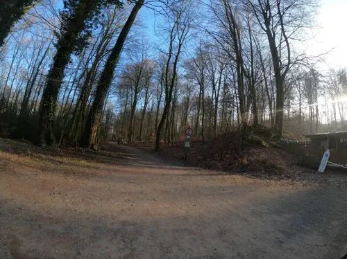
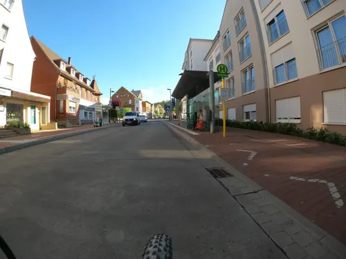
Akropolis
Restaurant · Greek, Mediterranean · 1.1 km
1 Bahnhofstraße, Barsinghausen
Mo off; Tu-Fr 17:00-22:00; Sa-Su 12:00-14:00,17:00-22:00
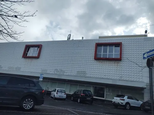
Asia Imbiss Paradies
Restaurant · Asian · 0.7 km
1 Altenhofstraße, Barsinghausen
Tu-Sa 11:30-15:30,17:00-21:30; Su 12:00-15:30,17:00-21:30
Bella Italia
Restaurant · Italian · 0.8 km
36 Marktstraße, Barsinghausen
Mo off; Tu-Sa 17:00-22:00; Su 12:00-21:00

Bäckerei Frenzel
Bakery · 6.0 km
Namensähnlich: Konditorei Frenkel in der Bahnhofstraße mit vormaligem Central-Cafe in Hauptstraße
1 Haster Straße, Bad Nenndorf
Mo-Fr 06:00-18:00; Sa 06:00-13:00
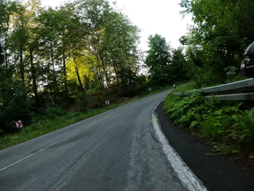
Bärenhöhle
Restaurant · Regional · 3.6 km
9 Waldstraße, Barsinghausen
Mo,Tu off; We-Fr 17:00-20:00; Sa,Su 12:00-20:00
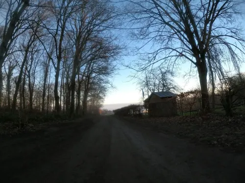


Deister Alm
Restaurant · German, Regional, Bavarian · 3.2 km
50 Luttringhäuser Weg, Barsinghausen
Mo off; Tu-Th 11:00-17:00; Fr-Su 11:00-20:00
145 more on the map.
History
Barsinghausen is the site of an old double monastery (“Kloster Barsinghausen”) that was established during the High Middle Ages. At that time, fertile loess soil and a number of influent streams to river Südaue constituted a central fundament for farming and numerous windmills in Calenberg Land. Barsinghausen became a coal mining town between 1871 and 1957. After World War II, other sectors of industry began to dominate Barsinghausen's economy.
From the History section of Barsinghausen on Wikipedia, under CC BY-SA 4.0.
Where to stay15
Churches and places of worship29
St. Marienkirche
Church · Lutheran · 0.8 km
Kirchstraße, Barsinghausen
Sankt Michaelis
Church · Lutheran · 7.4 km
2 Am Steinhof, Barsinghausen
Maria vom heiligen Rosenkranz
Church · Catholic · 6.7 km
11 Wilhelmstraße, Bad Nenndorf
Shopping41
Gas and EV charging24
Schools, colleges and libraries25
Gymnasium Bad Nenndorf
School · 7.0 km
42 Horster Straße, Bad Nenndorf
Healthcare14
Map of Barsinghausen
250 places. The map loads OpenStreetMap tiles when you open it.
Getting there and nearby towns
Hannover Airport (HAJ) is the nearest airport with scheduled flights listed in OpenStreetMap, 24 km away.
- Bad Nenndorf 6 km northwest, about 6 min by car
- Wennigsen 9 km east, about 9 min by car
- Gehrden 10 km east, about 10 min by car
- Springe 12 km southeast, about 12 min by car
- Wunstorf 14 km north, about 14 min by car
- Ronnenberg 14 km east, about 14 min by car
- Seelze 14 km northeast, about 14 min by car
- Garbsen 17 km northeast, about 17 min by car
- Stadthagen 17 km west, about 17 min by car
- Hannover 21 km east, about 21 min by car
Drive times are estimates from straight-line distance, not routes.
Local news
Headlines from INDB.
Reviews, tips and questions
Loading what members have shared...
Sources and licences
- GeoNames (CC BY 4.0): population, coordinates, regions and time zone
- Mapillary (see each image): photos
- OpenStreetMap contributors (ODbL 1.0): places, airports, map data
- Wikidata (CC0 1.0): elevation, founding date, time zone, website, landmarks and historic places
- Wikimedia Commons (see each image): photos
- Wikipedia (CC BY-SA 4.0): overview and history text
Photo credits
- Rathaus Barsinghausen IMG 2776, Losch at German Wikipedia, CC BY-SA 3.0
- Barsinghausen, Wilhelm-Heß-Straße 21, Den man tau, CC BY-SA 4.0
- NFV-Sportschule Barsinghausen-Einfahrt, Den man tau, CC BY-SA 4.0
- Barsinghausen-Altenhofstrasse 11, Den man tau, CC BY-SA 3.0
- Barsinghausen-Kaltenbornstraße 15 (2015), Den man tau, CC BY-SA 4.0
- Barsinghausen-Altenhofstrasse 15, Den man tau, CC BY-SA 3.0
- Barsinghausen-Altenhofstrasse 15a, Den man tau, CC BY-SA 3.0
- Barsinghausen-Altenhofstrasse 17, Den man tau, CC BY-SA 3.0
- Altenhofstraße 1B Barsinghausen, Clemensfranz, CC BY-SA 3.0
- Barsinghausen-Altenhofstrasse 13, Den man tau, CC BY-SA 3.0
- Altenhofstraße 23 in Barsinghausen Seifried Wappen, Bernd Schwabe in Hannover, CC BY-SA 4.0
- Barsinghausen-Altenhofstrasse 11a, Den man tau, CC BY-SA 3.0
- Altenhofstraße 23 in Barsinghausen Schild zum Maler Kurt Sohns, Bernd Schwabe in Hannover, CC BY-SA 4.0
- Altenhofstraße 23 in Barsinghausen Ansicht Straßenfront, Bernd Schwabe in Hannover, CC BY-SA 4.0
- Altenhofstraße 21 Barsinghausen, Clemensfranz, CC BY-SA 3.0
- Altenhofstraße 23 Barsinghausen, Clemensfranz, CC BY-SA 3.0
- Altenhofstraße 25 Barsinghausen, Clemensfranz, CC BY-SA 3.0
- Altenburgstraße in Barsinghausen Fachwerkhäuser, Bernd Schwabe in Hannover, CC BY-SA 4.0
- Altenhofstraße 27 Barsinghausen, Clemensfranz, CC BY-SA 3.0
- Stolperstein Barsinghausen Julie Levisohn, Den man tau, CC BY-SA 4.0
- Stolperstein Barsinghausen Johanna Hirschberg, Den man tau, CC BY-SA 4.0
- Stolperstein Barsinghausen Henny Schönfeld, Den man tau, CC BY-SA 4.0
- Barsinghausen-Kaltenbornstrasse 8, Den man tau, CC BY-SA 3.0 de
- Barsinghausen-Am Waldhof-Ehrenmal, Den man tau, CC BY-SA 3.0
- Altes Rathaus Bad Muender, Maren Kaltenbach at German Wikipedia Later version(s) were uploaded by BLueFiSH.as at de.wikipedia . ( Original text: M.Kaltenbach ), CC BY-SA 3.0
- Agnes-Miegel-Haus Bad Nenndorf IMG 6791 retouched, losch, Attribution
- Annaturm, Tortuosa im März 2005, CC BY-SA 3.0
- Bröhn, Den man tau, CC BY-SA 3.0
- St.Michaelis-Kirche in Groß Munzel (Barsinghausen) IMG 8777, losch, CC BY-SA 3.0
- Eimbeckhausen, Stuhlmuseum, Gerd Fahrenhorst, CC BY 3.0
- Nordmannsturm 02, Den man tau, CC BY-SA 4.0
- Elten-Denkmal im Deister, Fitsche, CC BY-SA 3.0
- Gymnasium Bad Nenndorf, Lutz Lange, CC BY-SA 4.0
- Kloster Barsinghausen IMG 2774, Losch at German Wikipedia, CC BY-SA 3.0
- Klosterkirche Barsinghausen IMG 2766, Losch at German Wikipedia, CC BY-SA 3.0
- Messenkamp - St. Georgkapelle - SO, Genet, CC BY-SA 3.0
- Walterbachtal-Rinderweide, Den man tau, CC BY-SA 3.0
- Bad Nenndorf St. Maria vom hl. Rosenkranz, Rabanus Flavus, CC0
- Rodenberg - St. Jacobi - Außenansicht, Misburg3014, CC BY-SA 3.0
- Egestorfer Stollen, Gerd Fahrenhorst, CC0
- Wasserräder Wennigsen IMG 2381, losch, Attribution
- Barsinghausen -Klosterstollen- 2015 by-RaBoe 012, © Ra Boe / Wikipedia, CC BY-SA 3.0 de
- Belvedereturm Deister, AxelHH, CC BY 3.0
- 2019-05-21 121316 Naturwald Steinbrink, Tim Rademacher, CC BY-SA 4.0
- Stolperstein Bad Nenndorf Hauptstraße 14 Ernst Blumenberg, Tomtom10, CC BY-SA 4.0
- Heilig-Kreuz-Kirche in Kirchdorf (Barsinghausen) IMG 4428, Losch, CC BY-SA 3.0
- Kapelle Langreder, Den man tau, CC BY-SA 4.0
- Naturwald Meinsberg 11, Den man tau, CC BY-SA 4.0
- Bad Nenndorf, view to the little palace, Dguendel, CC BY 4.0
- Kirche Egestorf (Deister) IMG 6026, Losch at German Wikipedia, Attribution
- Gefallenendenkmal Barsinghausen, Raugeier, CC BY-SA 4.0
- Bad Nenndorf Grandhotel Esplanade - ehemaliges Schwefelbadehaus, Rabanus Flavus, CC0
- Rodenberg Staendehaus, No machine-readable author provided. Warrior071~commonswiki assumed (based on copyright claims)., Public domain
- Severinskirche Landringhausen, Den man tau, CC BY-SA 4.0
- Wichtringhausen-Wichmarstrasse-Rittergut, Den man tau, CC BY-SA 4.0
- Kreuzsteine Großgoltern (8), Lutz Lange ( talk ), CC BY-SA 4.0
- Kloster Barsinghausen, Garten, Gerd Fahrenhorst, CC BY 4.0
- St. Godehardi-Kirche Bad Nenndorf, Lutzto, CC BY-SA 4.0
- Kirche Grossgoltern-Kirchturm, Den man tau, CC BY-SA 4.0
- Zugang Freilichtbühne Barsinghausen IMG 2180, Losch at German Wikipedia, CC BY-SA 3.0
- St.-Lukas-Kirche in Lauenau, losch , shifted & brightened by Rabanus Flavus, CC BY-SA 3.0
- Street-level photo, Langfahrer, CC BY-SA 4.0
- Street-level photo, thetornado76, CC BY-SA 4.0
- Street-level photo, Langfahrer, CC BY-SA 4.0
- Street-level photo, Langfahrer, CC BY-SA 4.0
- Street-level photo, Langfahrer, CC BY-SA 4.0
- Street-level photo, grobin, CC BY-SA 4.0
- Street-level photo, grobin, CC BY-SA 4.0
- Street-level photo, derlipper, CC BY-SA 4.0
- Street-level photo, hotteliene, CC BY-SA 4.0
- Street-level photo, Langfahrer, CC BY-SA 4.0
- Street-level photo, Langfahrer, CC BY-SA 4.0
- Street-level photo, Langfahrer, CC BY-SA 4.0
- Street-level photo, Langfahrer, CC BY-SA 4.0
- Street-level photo, klypern, CC BY-SA 4.0
- Street-level photo, Langfahrer, CC BY-SA 4.0
- Street-level photo, live, CC BY-SA 4.0


Page built November 8, 2026. Spotted a mistake? Tell us or suggest a place.