


Why visit Bensheim
Townapedia lists 141 museums and landmarks, 54 parks and trails, 196 places to eat, 17 places to stay and 21 attractions in and around town.
Highlights include Luxor Filmpalast, Bismarckturm Bensheim, Schloss Auerbach and Heimatmuseum Zwingenberg.
Weather in Bensheim
Forecast from MET Norway (CC BY 4.0). Full forecast
About Bensheim
Bensheim (German pronunciation: [ˈbɛnsˌhaɪm] ) is a town in the Bergstraße district in southern Hessen, Germany. Bensheim lies on the Bergstraße and at the edge of the Odenwald mountains while at the same time having an open view over the Rhine plain. With about 40,000 inhabitants (2016), it is the district's biggest town.
From the Wikipedia article Bensheim (this version), under CC BY-SA 4.0.
Travel tips from other travellers: Bensheim on Wikivoyage (CC BY-SA 4.0).
Photos of Bensheim


Things to do21
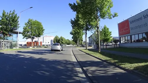





Fam. Friedrich & Maaß
Farm and orchard · 1.4 km
Th,Fr 09:00-18:00, Fr 09:00-12:30
9 more on the map.
Museums and landmarks141


Schlößchen Zwingenberg
Monument and historic site · 4.5 km
16 Untergasse, Zwingenberg

Abbey and Altenmünster of Lorsch
Museum · 4.9 km
UNESCO World Heritage Abbey of Lorsch in Germany

Ehem. Backhaus, 'Mägdleinschule'
Monument and historic site · 4.3 km
Von der westlichen Häuserzeile am Marktplatz zurückgesetzt liegendes Wohnhaus, als Nebengebäude des ehemaligen Wasserschlosses der...
6 Marktplatz, Zwingenberg

Gasthaus zum bunten Löwen
Monument and historic site · 4.5 km
Das Haus wird als Restaurant genutzt. Der Löwenkeller im Untergeschoss und der Diefenbachsaal im ersten Stock werden als...
6 Löwenplatz, Zwingenberg



Sanner Flight Champions
Museum · 2.5 km
Privatsammlung Russischer Flugzeug- und Raketentechnik
80 Schillerstraße, Bensheim
129 more on the map.
Parks, trails and playgrounds54


Tongrubengelände von Bensheim und Heppenheim
Hiking and trails · 2.6 km


Badesee
Sports field and stadium · 1.0 km
110 Berliner Ring, Bensheim
May 1-31: Mo-Su 08:00-20:00; Jun 1-Aug 31: Mo-Su 08:00-21:00; Sep...
Basinus Bad
Sports field and stadium
2 Spessartstraße, Bensheim
Mo,We,Fr 10:00-21:45; Tu,Th 06:30-21:45; Sa-Su,PH 08:00-21:45; Dec...

Golf-Club Bensheim
Golf course · 2.7 km
56 Außerhalb, Bensheim
Apr 01-Oct 31: Mo-Su 08:00-21:00; Nov 01-Mar 31: Mo-Su 08:00-20:00


42 more on the map.
Restaurants and cafes196
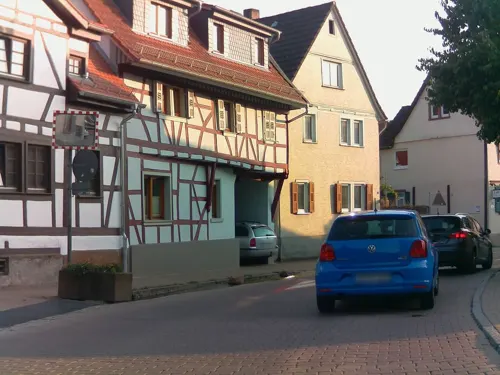
Alte Dorfmühle
Restaurant · Regional · 2.3 km
Öffnungszeiten Stand 05/24
71 Bachgasse, Bensheim
Mo-We 17:00-22:00; Th-Su,PH 12:00-22:00
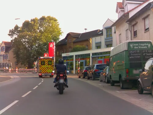
Altes Brauhaus
Restaurant · Regional · 4.3 km
19 Pass, Zwingenberg
We-Sa 17:00-22:00; Su 12:00-21:00; Mo,Tu off

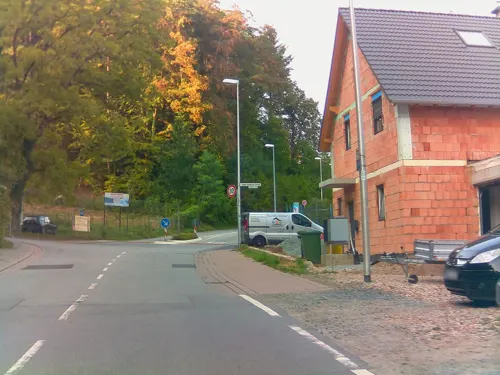
Dorfcafe
Cafe · 3.3 km
Samstag und Sonntag Frühstücksbüffet 09:00 - 13:00
1 Josef-Sartorius-Straße, Bensheim
Mo-We off; Th 12:00-21:00; Fr 12:00-17:30; Sa-Su 09:00-17:30
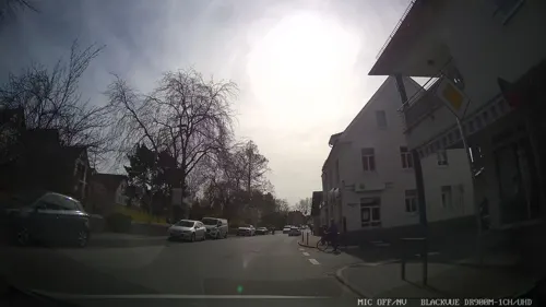
Bunter Löwe
Restaurant · Regional · 4.5 km
6 Löwenplatz, Zwingenberg
Mo-Tu off; We-Fr 11:30-14:00,17:30-22:00; Sa 17:30-22:00; Su...
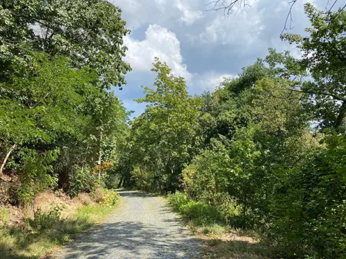
Burgschänke Starkenburg
Restaurant · 4.8 km
DEC to FEB closed. Nov and Mar only weekends and PH.
51 Starkenburgweg, Heppenheim
Mo-Tu off; We-Fr 14:00-20:00; Sa-Su 12:00-20:00
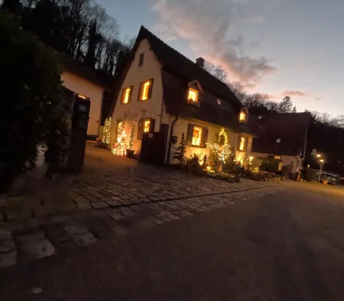

Kaltwasser´s Wohnzimmer
Restaurant · Regional · 4.5 km
Auswahl aus Menü mit drei, vier oder fünf Gängen.
15 Obergasse, Zwingenberg
Mo-Tu,Su off; We-Sa 18:00-23:00
Chinarestaurant Pavillon
Restaurant · Chinese · 2.3 km
163a Berliner Ring, Bensheim
Mo 11:30-15:00, 17:30-23:00; Tu off; We-Su 11:30-15:00, 17:30-23:00

Gaststätte Weiherhaus
Restaurant · German · 1.4 km
56 Saarstraße, Bensheim
Mo-Fr 11:30-14:00,18:00-23:00; Sa 17:30-23:00; Su 12:00-14:30, 17:30-21:00
184 more on the map.
History
Bensheim has grown out of a village that had its first documentary mention in the 8th century. In the 14th century, Bensheim was granted town rights. On 26 March 1945, shortly before American forces entered, much of the Old Town was destroyed by incendiary bombs.
The South Hesse area was settled quite early on. The many finds from archaeological digs stretch back to the time of the Linear Pottery and Corded Ware cultures (roughly 2500 to 1500 BC), peoples who raised crops and livestock.
In 765, Basinsheim had its first documentary mention in the Lorsch Abbey's Codex Laureshamensis. Its founding may go back to a knight named Basinus, who received the rights to found a settlement.
The name changed from Basinsheim to Basinusheim and then to Besensheim, finally becoming Bensheim. Noteworthy is that town rights were granted early on by Emperor Otto I on 5 March 956. It can be inferred from the document text that Otto I, on the occasion of his stay in Frankfurt am Main, with his wife Adelheid's intervention, awarded the Lorsch Abbey's oldest market privilege. The concept, called publicae mercationes in the original, indicates the community, where public buying and selling was allowed. It still cannot be assumed that this led to a regular yearly or weekly market. Great parts of the town were destroyed in the siege of 1301 by King Albrecht I.
Read more of the history
When Friedrich II enfeoffed the territory of the now derelict Lorsch Imperial Abbey to Archbishop Siegfried III of Eppstein, Bensheim became part of the Electorate of Mainz's domains and likely received town rights only a few decades later, which is, however, only proved by a certificate issued in 1320.
In today's outlying centres of Auerbach and Schönberg, Bensheim borders on what were the Upper County – "Upper" here refers to geography, not rank – of the Counts of Katzenelnbogen and domains of the Schenken of Erbach. When the Katzenelnbogens died out in 1479, the Landgraviate of Hesse became a neighbour to the north. In 1532, the Erbachs were raised to counts and the County of Erbach became a neighbour to the east.
In the time of the pledging to the counts palatine of the Rhine from 1461 to 1650, Bensheim experienced a boom, but as a Palatinate town, however, it was embroiled in the Bavarian-Palatine war of succession in 1504, and for eleven days was unsuccessfully besieged by the Landgrave of Hesse, who was charged with the execution of the ban of the Empire, and his confederates, the Dukes Henry of Brunswick and Henry of Mecklenburg. From this year, two yearly markets and one weekly can be established; a third yearly market came in 1619.
With the introduction of the Reformation in the Landgraviate of Hesse in 1526 and in the County of Erbach in 1544, Bensheim got not only a territorial border with these neighbours, but also a denominational one.
The Thirty Years' War put an end to all the positive developments mentioned above. On 20 November 1644, Bensheim was occupied by French and Swedish troops, who were driven out again on 2 December by Bavarian units. Later, the legend of the Fraa vun Bensem arose (the "woman from Bensheim" is said to have led the Bavarians into town through a secret route). In 1650, after just under 200 years of being pledged to the Electorate of the Palatinate, Bensheim was once again redeemed by the Archbishopric of Mainz.
By the Reichsdeputationshauptschluss in 1803, Bensheim passed to the Landgrave of Hesse-Darmstadt, who joined the Confederation of the Rhine in 1806 and was raised to Grand Duke. In 1822, there was a great fire in which 16 buildings were destroyed and 15 others were heavily damaged.
Bensheim became the seat of the Landratsbezirk (an administrative region) of Bensheim in the province of Starkenburg, which in 1832 was merged with the Landratsbezirk of Heppenheim to form the district of Bensheim (Kreis Bensheim) with Bensheim as its seat.
In 1918, the Grand Duke was removed and out of the Grand Duchy of Hesse the People's State of Hesse was formed. On 1 November 1938, the districts of Bensheim and Heppenheim were merged into one district, Kreis Bergstraße with Heppenheim as its seat. To offset Bensheim's loss of the status of district seat, the town got the district leadership of the Nazi Party.
During Kristallnacht on 9 November 1938, the synagogue was destroyed, while the one in Auerbach survived. In 1939, Auerbach, Schönberg and Zell were amalgamated, raising the population to just under 16,500. In Auerbach, a subcamp of Natzweiler-Struthof Concentration Camp was built.
On 24 March 1945, twelve people were taken to the Kirchberg (mountain) where they were murdered by the Gestapo. Two days later, on 26 March 1945, Saint George's Parish Church, the Town Hall and parts of the Old Town were destroyed by incendiary bombs. On 27 March, the town was occupied by United States troops. As the U.S. Army Counter Intelligence Corps agent, Henry Kissinger was the most important representative of the occupying power, after the official town commander.
After the Second World War ended in 1945, a displaced persons camp was established in Bensheim, first for Polish former forced labourers, later for Jewish displaced persons. The camp was dissolved in 1949.
In 1971, the population rose to some 34,000 with the amalgamation of Langwaden, Schwanheim, Fehlheim, Hochstädten, Gronau and Wilmshausen.
From 1859 to 1987 on the Nibelungenstraße towards Schönberg stood the Guntrum Bräu Bensheim brewery. In 1979, the brewery was taken over by Binding Bier Mainz, and then closed and torn down in 1987. Today, the former premises are home to a number of houses.
From the History section of Bensheim on Wikipedia, under CC BY-SA 4.0.
More about Bensheim
Geography
The town lies at the eastern edge of the Rhine rift on the slopes of the western Odenwald on the Bergstraße. The nearest major cities are Darmstadt (some 22 km (14 mi) to the north), Heidelberg (some 35 km (22 mi) to the south), Worms (some 18 km (11 mi) to the west) and Mannheim (some 32 km (20 mi) to the southwest). The district seat of Heppenheim lies roughly 5 km (3 mi) to the south.
The Lauter flows through Bensheim, coming from the Lauter valley from the east, which after it passes through Bensheim is known as the Winkelbach. In the south of town runs the Meerbach, also coming from the Odenwald (but from the Zell valley). Mostly channelled underground and only coming above ground at the western edge of town is the Neuer Graben, or “New Channel”, which branches off the Lauter.
Bensheim borders in the north on the town of Zwingenberg and the communities of Alsbach-Hähnlein und Seeheim-Jugenheim (both in Darmstadt-Dieburg), in the east on the community of Lautertal, in the south on the town of Heppenheim and in the west on the town of Lorsch and the community of Einhausen.
The main town east of the railway line (old town and outskirts) with many modern town expansion developments (for example the neighbourhoods of Brunnenweg, Metzendorf, Griesel, Meerbach and Hemsberg);
Economy
Bensheim is part of the economically strong Rhine Neckar Area and is together with various neighbouring towns and communities (among others, Heppenheim, Lorsch and Lautertal) identified as a middle centre in South Hesse regional planning.
The town has in its favour good economic data – even in relation to the Rhine Neckar Area's as a whole – above-average employment figures and an especially high proportion of graduates in the resident population's above-average buying power.
Arts and culture
The Parktheater was built in 1968 and offers cultural activities. Besides the municipal programme of plays, freelance producers, clubs and schools bring a multifaceted programme in the fields of spoken theatre, musical theatre and dance theatre. From October 1998 to December 1999, the Parktheater was optically, technologically and artistically made over from the ground up.
Furthermore, Bensheim also has the PiPaPo Theater (cabaret), the Vornerum Theater, the Varieté Pegasus and the Autorenkollektiv Laufkundschaft.
Besides the Museum der Stadt Bensheim (municipal museum), there is also the old synagogue in Auerbach which nowadays houses a museum.
The Bensheim Music School was founded in 1979. By taking part in various contests, the students at this municipal music school regularly find themselves among the prizewinners at both the state and national level. Many ensembles promote the music school's community spirit.
Bensheim, along with all its outlying centres has all together 557 cultural monuments. The following is a selection of the town's most important buildings:
Alte Faktorei, Mainz cathedral chapter's former factory (in the sense of "commercial outpost")
"Luginsland" (Blaues Türmchen or Eckturm [tower]) on the Höhenweg above Baßmannpark, built in 1910
Roter Turm, watchtower from the old town wall, from the 13th century
From the Wikipedia article Bensheim, under CC BY-SA 4.0.
Notable people from Bensheim
 Jannik KohlbacherGerman handball playerPhoto: Steffen Prößdorf, CC BY-SA 4.0
 Patrick FranziskaGerman table tennis playerPhoto: Stefan Brending ( 2eight ), CC BY-SA 3.0 de
 Alexander GehbauerAustrian cyclistPhoto: Tim Regan from Cambridge, UK, CC BY 2.0
 Heike B. GörtemakerGerman historian of modern age and authorPhoto: Remels, CC BY-SA 4.0
 Bernhard TraresGerman footballer and coachPhoto: Silesia711, CC BY-SA 4.0
 Jan DieterencyclistPhoto: Kuebi = Armin Kübelbeck, CC BY-SA 3.0
- Otto-Werner MuellerGerman conductor (1926-2016)
- Thomas Johannes MayerGerman opera singer (1969–2025)
- Natalie NesslerGerman female curler
- Karl Frank KleinCanadian politician
- Elsa FraenkelGerman–born British sculptor (1892–1975)
- Heinrich WerléGerman organist and choir director (1887–1955)
Born in Bensheim, according to Wikidata (CC0). Each name links to its Wikipedia article.
Where to stay17
Churches and places of worship39
Hospitalkirche St. Joseph
Church · Catholic · 0.6 km
83 Hauptstraße, Bensheim
Shopping52
Gas and EV charging21
Schools, colleges and libraries25
Healthcare15
Map of Bensheim
250 places. The map loads OpenStreetMap tiles when you open it.
Getting there and nearby towns
City-Airport Mannheim (MHG) is the nearest airport with scheduled flights listed in OpenStreetMap, 24 km away.
- Heppenheim an der Bergstrasse 5 km south, about 5 min by car
- Zwingenberg 5 km north, about 5 min by car
- Lorsch 5 km southwest, about 5 min by car
- Einhausen 5 km west, about 5 min by car
- Alsbach-Hähnlein 6 km north, about 6 min by car
- Laudenbach 8 km south, about 8 min by car
- Bickenbach 8 km north, about 8 min by car
- Seeheim-Jugenheim 9 km north, about 9 min by car
- Hemsbach 11 km south, about 11 min by car
- Biblis 12 km west, about 12 min by car
Drive times are estimates from straight-line distance, not routes.
Towns near Bensheim


Keep exploring
Local news
Headlines from INDB.
Reviews, tips and questions
Loading what members have shared...
Sources and licences
- GeoNames (CC BY 4.0): population, coordinates, regions and time zone
- Mapillary (see each image): photos
- OpenStreetMap contributors (ODbL 1.0): places, airports, map data
- Wikidata (CC0 1.0): elevation, founding date, time zone, website, landmarks and historic places
- Wikimedia Commons (see each image): photos
- Wikipedia (CC BY-SA 4.0): overview and history text
Photo credits
- Rathaus Bensheim 01, Kuebi = Armin Kübelbeck, CC BY-SA 3.0
- Bushaltestelle Rodensteinzentrum, 2, Bensheim, Landkreis Bergstraße, GeorgDerReisende, CC BY-SA 4.0
- Bushaltestelle Rodensteinzentrum, 1, Bensheim, Landkreis Bergstraße, GeorgDerReisende, CC BY-SA 4.0
- Bushaltestelle Bahnhof, 1, Bensheim, Landkreis Bergstraße, GeorgDerReisende, CC BY-SA 4.0
- 64625 Bensheim Wilhelmstraße 7, Tomgoebel, CC BY-SA 3.0
- 64625 Bensheim Wilhelmstraße 10, Tomgoebel, CC BY-SA 3.0
- Amstgericht Bensheim - panoramio, Stomatoloq Fərid Zey…, CC BY-SA 3.0
- Bensheim, Gartenstraße-Wegekreuz, Muck, CC BY-SA 4.0
- 64625 Bensheim Wilhelmstraße 22, Tomgoebel, CC BY-SA 3.0
- Bensheim, Wilhelmstraße 14, Muck, CC BY-SA 4.0
- Bensheim, Wilhelmstraße 19, Muck, CC BY-SA 4.0
- 64625 Bensheim Wilhelmstraße 24, Tomgoebel, CC BY-SA 3.0
- 64625 Bensheim Wilhelmstraße 25, Tomgoebel, CC BY-SA 3.0
- Bensheim, Gartenstraße 20, Muck, CC BY-SA 4.0
- Bensheim, Wilhelmstraße 21, Muck, CC BY-SA 4.0
- Bensheim, Friedrichstraße 7, Muck, CC BY-SA 4.0
- Bushaltestelle Bahnhof, 2, Bensheim, Landkreis Bergstraße, GeorgDerReisende, CC BY-SA 4.0
- Stolpersteinlage Bensheim Darmstädter Straße 5, Gmbo 2013, CC0
- Stolpersteine Bensheim Darmstädter Straße 5, Gmbo 2013, CC0
- Stolperstein Bensheim Darmstädter Straße 5 Julius Bauer, Gmbo 2013, CC0
- Stolperstein Bensheim Darmstädter Straße 5 Hedwig Bauer, Gmbo 2013, CC0
- Rodensteinstraße, 1, Bensheim, Landkreis Bergstraße, GeorgDerReisende, CC BY-SA 4.0
- 64625 Bensheim Wilhelmstraße 28, Tomgoebel, CC BY-SA 3.0
- Bensheim, Gartenstraße 26, Schützenstraße 2, Muck, CC BY-SA 4.0
- 64625 Bensheim Wilhelmstraße 30, Tomgoebel, CC BY-SA 3.0
- Bushaltestelle Geburtshaus, 1, Bensheim, Landkreis Bergstraße, GeorgDerReisende, CC BY-SA 4.0
- Bahnhofstraße 27, 1, Bensheim, Landkreis Bergstraße, GeorgDerReisende, CC BY-SA 4.0
- Naturdenkmal Rosskastanie Bensheim Stadtpark 431.2-28, René Schröder, CC BY-SA 4.0
- Naturdenkmal Rosskastanie Bensheimer Stadtpark 431.2-28, René Schröder, CC BY-SA 4.0
- Kirche, Bensheim - panoramio, Stomatoloq Fərid Zey…, CC BY-SA 3.0
- Lorsch, Elswhs at Dutch Wikipedia ( Original text: Els Slots ), CC BY-SA 3.0
- Auerbacher Schloss - Blick von unten, Philipp Hayer, CC BY-SA 4.0
- Melibokus von Schloss Auerbach, Jörg Braukmann, CC BY-SA 4.0
- Lutheran church in Zwingenberg (8), Krzysztof Golik, CC BY-SA 4.0
- Bismarckturm Hemsberg 01, Kuebi = Armin Kübelbeck, CC BY-SA 3.0
- Dalberger Hof 02, Kuebi = Armin Kübelbeck, CC BY-SA 3.0
- Synagoge Auerbach 03, Kpaugustin, CC0
- Zwingenberg Löwenplatz 6 c, Thomas Pusch, CC BY-SA 3.0
- Goethe Bensheim0703 1, Unknown author, Public domain
- Hemsberg 01, Kuebi = Armin Kübelbeck, CC BY-SA 3.0
- Bensheim Hospitalkirche 01, Kuebi = Armin Kübelbeck, CC BY-SA 3.0
- Bensheim Michaelskirche 01, Kuebi = Armin Kübelbeck, CC BY-SA 3.0
- St-Anna-Gronau 01, Kuebi = Armin Kübelbeck, CC BY-SA 3.0
- Schlösschen Zwingenberg 01, Commander-pirx, CC BY-SA 3.0
- Orbishöhe von Auerbach und Zwingenberg (4), Karsten Ratzke, CC0
- Wiki DSC00640 NSG Hemsberg Zell 1431010, René Schröder, CC BY-SA 4.0
- Wiki DSC00267 Tongrubengelände, René Schröder, CC BY-SA 4.0
- Wiki DSC00658 NSG Wasserschoepp 1431016, René Schröder, CC BY-SA 4.0
- Heimatmuseum (Zwingenberg)-01, Muck, CC BY-SA 4.0
- Aussichtsturm Melibokus-01, Muck, CC BY-SA 4.0
- Auerbach, Christuskirche, Karsten Ratzke, CC0
- St. Bartholomäus (Fehlheim), Muck, CC BY-SA 4.0
- St. Elisabeth (Schönberg)-01, Muck, CC BY-SA 4.0
- Marienkirche (Schönberg)-02, Muck, CC BY-SA 4.0
- Heppenheim, Hambacher Tal-Gedächtniskapelle, Muck, CC BY-SA 4.0
- Bensheim, Heidelberger Straße 35, Muck, CC BY-SA 4.0
- Zwingenberg, Marktplatz 6, Karsten Ratzke, CC0
- Bensheim, Nibelungenstraße 109, Muck, CC BY-SA 4.0
- Wingertsbergschule Lorsch, Immanuel Giel, CC BY 3.0
- Kloster Lorsch 07, Kuebi - Armin Kübelbeck, CC BY-SA 3.0
- Lorsch, Nibelungenstraße 23 20170609 002, Tilman2007, CC BY-SA 4.0
- Geschwister Scholl Schule Bensheim, Bernd Herd, CC BY-SA 4.0
- Bergkirche Bensheim-Auerbach von Süden 1, Reinhard Dietrich, CC BY-SA 4.0
- Street-level photo, ramap, CC BY-SA 4.0
- Street-level photo, ramap, CC BY-SA 4.0
- Street-level photo, ramap, CC BY-SA 4.0
- Street-level photo, ramap, CC BY-SA 4.0
- Street-level photo, wegavision, CC BY-SA 4.0
- Street-level photo, laci, CC BY-SA 4.0
- Street-level photo, ramap, CC BY-SA 4.0
- Street-level photo, changchun1, CC BY-SA 4.0
- Street-level photo, wegavision, CC BY-SA 4.0
- Street-level photo, wegavision, CC BY-SA 4.0
- Street-level photo, wegavision, CC BY-SA 4.0
- Street-level photo, changchun1, CC BY-SA 4.0
- Street-level photo, ramap, CC BY-SA 4.0
- Street-level photo, ottor, CC BY-SA 4.0
- Street-level photo, mfa, CC BY-SA 4.0
- Street-level photo, mfa, CC BY-SA 4.0
- Street-level photo, teddy73, CC BY-SA 4.0
- Street-level photo, chuck, CC BY-SA 4.0
- Street-level photo, chuck, CC BY-SA 4.0
- Street-level photo, ramap, CC BY-SA 4.0
- Street-level photo, chuck, CC BY-SA 4.0
- Street-level photo, chuck, CC BY-SA 4.0
- Street-level photo, chuck, CC BY-SA 4.0
- Street-level photo, chuck, CC BY-SA 4.0


Page built November 9, 2026. Spotted a mistake? Tell us or suggest a place.