


Heppenheim an der Bergstrasse, Germany
Heppenheim
Heppenheim an der Bergstrasse is a town of 25,442 people in Hesse, Germany.
Why visit Heppenheim an der Bergstrasse
Townapedia lists 118 museums and landmarks, 47 parks and trails, 214 places to eat, 22 places to stay and 26 attractions in and around town.
Highlights include Luxor Filmpalast, Saalbau Lichtspiele, Lorsch Abbey and Feuerwehr Museum Brandmeister Rudolf Kohl.
Weather in Heppenheim an der Bergstrasse
Forecast from MET Norway (CC BY 4.0). Full forecast
About Heppenheim an der Bergstrasse
Heppenheim (Bergstraße) (German pronunciation: [ˈhɛpn̩ˌhaɪm] ) is the seat of Bergstraße district in Hesse, Germany, lying on the Bergstraße on the edge of the Odenwald. It is best known for being the birthplace of Sebastian Vettel, a four-time Formula One World Champion and the place of founding of the Free Democratic Party (Germany).
From the Wikipedia article Heppenheim (this version), under CC BY-SA 4.0.
Travel tips from other travellers: Heppenheim an der Bergstrasse on Wikivoyage (CC BY-SA 4.0).
Things to do26
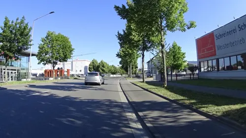
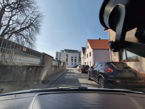





Fam. Friedrich & Maaß
Farm and orchard · 3.4 km
Th,Fr 09:00-18:00, Fr 09:00-12:30
14 more on the map.
Museums and landmarks118




Abbey and Altenmünster of Lorsch
Museum · 4.8 km
UNESCO World Heritage Abbey of Lorsch in Germany

Museum der Stadt Bensheim
Museum · 4.4 km
3 An der Stadtmühle, Bensheim
Th,Fr 15:00-18:00; Sa,Su 12:00-18:00


Rinnentor
Monument and historic site · 4.4 km
23 Am Rinnentor, Bensheim
106 more on the map.
Parks, trails and playgrounds47

Basinus Bad
Sports field and stadium · 4.9 km
2 Spessartstraße, Bensheim
Mo,We,Fr 10:00-21:45; Tu,Th 06:30-21:45; Sa-Su,PH 08:00-21:45; Dec...

Golf-Club Bensheim
Golf course · 3.9 km
56 Außerhalb, Bensheim
Apr 01-Oct 31: Mo-Su 08:00-21:00; Nov 01-Mar 31: Mo-Su 08:00-20:00



Outdoor Fitnessgeräte Sports & Country Club
Park · 1.1 km
62 Ludwigstraße, Heppenheim
24/7

Tongrubengelände von Bensheim und Heppenheim
Hiking and trails · 2.3 km


35 more on the map.
Restaurants and cafes214

Der Amerikanische Freund
Restaurant · 4.6 km
15 Dalbergergasse, Bensheim
We-Th 18:00-22:00;Fr-Sa 18:00-24:00

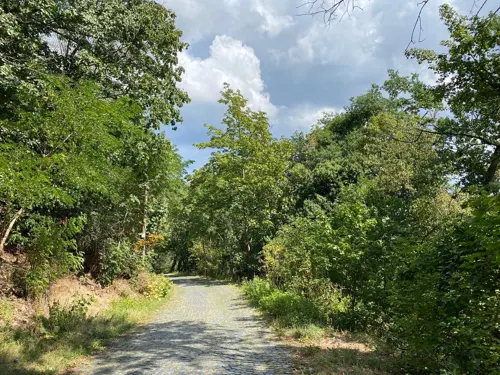
Burgschänke Starkenburg
Restaurant · 1.3 km
DEC to FEB closed. Nov and Mar only weekends and PH.
51 Starkenburgweg, Heppenheim
Mo-Tu off; We-Fr 14:00-20:00; Sa-Su 12:00-20:00


Cafe Bistro Filou
Restaurant · Regional · 0.9 km
4 Großer Markt, Heppenheim
Mo,We-Fr 16:00+; Tu off; Sa,Su 10:00+


Il Piccolo Mondo
Restaurant · Italian · 0.6 km
22 Werlestraße, Heppenheim
Tu-Sa 17:00-22:00; Su 11:30-14:00,17:00-21:00; Mo off


202 more on the map.
History
In 755, Heppenheim had its first documentary mention. At that time, the town was the hub of a Frankish domain. In 773, this area became one of Charlemagne’s donations to the Lorsch Abbey, and to protect it, the castle (Starkenburg) was built above it in 1065; in 1066 it successfully resisted a siege by Prince-Archbishop Adalbert of Hamburg-Bremen. The Imperial Abbey held the rank of principality, and Heppenheim developed over time into the territory's administrative and economic hub, although it lost its importance with the Abbey's downfall in the 11th and 12th centuries. In 1229, Emperor Friedrich II put the Starkenburg under the administration of the Archbishops of Electoral Mainz, doing likewise with the Lorsch Abbey along with Heppenheim in 1232. But for an interruption from 1461 to 1623 when the fief was pledged to the Electorate of the Palatinate, Heppenheim remained an Electoral Mainz holding right up until the Reichsdeputationshauptschluss in 1803. Then it became Hessian, first part of the Landgraviate of Hesse-Darmstadt, and since 1948 it has been part of the Bundesland of Hesse.
From the History section of Heppenheim on Wikipedia, under CC BY-SA 4.0.
Where to stay22
Churches and places of worship31
Pfarrkirche Sankt Peter - Dom der Bergstraße
Church · Catholic · 1.0 km
7 Kirchengasse, Heppenheim
Hospitalkirche St. Joseph
Church · Catholic · 4.2 km
83 Hauptstraße, Bensheim
St. Crescens (Bensheim)
Church · Catholic · 4.0 km
41 Friedhofstraße, Bensheim
Shopping49
Gas and EV charging22
Schools, colleges and libraries22
Healthcare22
Vitos - Kinder- und Jugendpsychiatrie Ambulanz
Clinic and pharmacy · 0.9 km
51 Ludwigstraße, Heppenheim
Map of Heppenheim an der Bergstrasse
250 places. The map loads OpenStreetMap tiles when you open it.
Getting there and nearby towns
City-Airport Mannheim (MHG) is the nearest airport with scheduled flights listed in OpenStreetMap, 20 km away.
- Lorsch 5 km west, about 5 min by car
- Hemsbach 6 km south, about 6 min by car
- Mörlenbach 9 km southeast, about 9 min by car
- Birkenau 10 km southeast, about 10 min by car
- Weinheim 11 km south, about 11 min by car
- Fürth 11 km east, about 11 min by car
- Viernheim 12 km south, about 12 min by car
- Lampertheim 12 km southwest, about 12 min by car
- Bürstadt 12 km west, about 12 min by car
- Heddesheim 15 km south, about 15 min by car
Drive times are estimates from straight-line distance, not routes.
Local news
Headlines from INDB.
Reviews, tips and questions
Loading what members have shared...
Sources and licences
- GeoNames (CC BY 4.0): population, coordinates, regions and time zone
- Mapillary (see each image): photos
- OpenStreetMap contributors (ODbL 1.0): places, airports, map data
- Wikidata (CC0 1.0): elevation, founding date, time zone, website, landmarks and historic places
- Wikimedia Commons (see each image): photos
- Wikipedia (CC BY-SA 4.0): overview and history text
Photo credits
- Heppenheim-luftbild, Christos Vittoratos, CC BY-SA 3.0
- Lorsch, Elswhs at Dutch Wikipedia ( Original text: Els Slots ), CC BY-SA 3.0
- Bismarckturm Hemsberg 01, Kuebi = Armin Kübelbeck, CC BY-SA 3.0
- 0260nb Sandsteinfassade Königshalle Kloster Lorsch, Heinz-Vale, CC BY-SA 4.0
- Dalberger Hof 02, Kuebi = Armin Kübelbeck, CC BY-SA 3.0
- Starkenburg Gymnasium, SirDschens, CC BY-SA 4.0
- Hemsberg 01, Kuebi = Armin Kübelbeck, CC BY-SA 3.0
- Bensheim Hospitalkirche 01, Kuebi = Armin Kübelbeck, CC BY-SA 3.0
- Heppenheim Amtsgasse 5 Kurmainzer Amtshof Total, Heidas, CC BY-SA 3.0
- Bensheim Michaelskirche 01, Kuebi = Armin Kübelbeck, CC BY-SA 3.0
- Rinnentorturm 04, Kuebi = Armin Kübelbeck, CC BY-SA 3.0
- St Crescens 02, Kuebi = Armin Kübelbeck, CC BY-SA 3.0
- StGeorg Bensheim Front 092011, Leithian, CC BY-SA 3.0
- Pfarrkirche St. Peter in Heppenheim, RudolfSimon, CC BY-SA 3.0
- Heppenheim, Halber Mond (1), Karsten Ratzke, CC0
- Wiki DSC00640 NSG Hemsberg Zell 1431010, René Schröder, CC BY-SA 4.0
- Wiki DSC00267 Tongrubengelände, René Schröder, CC BY-SA 4.0
- Wiki DSC00658 NSG Wasserschoepp 1431016, René Schröder, CC BY-SA 4.0
- Naturschutzgebiet in Hemsbach, Liebe Uwe, CC BY-SA 4.0
- Heppenheim mit Freilichtbühne, Jürgen Hamann, CC BY-SA 4.0
- Evangelische Kirche Lorsch 01, Immanuel Giel, CC BY-SA 3.0
- Heppenheim-Kirschhausen St. Bartholomäus 20100810, Rudolf Stricker, Attribution
- Lorsch, Schulstraße 12, St. Nazarius 20170609 003, Tilman2007, CC BY-SA 4.0
- Laudenbach Martin-Luther-Kirche 20110411, Rudolf Stricker, Attribution
- Heppenheim, Hambacher Tal-Gedächtniskapelle, Muck, CC BY-SA 4.0
- Bensheim, Heidelberger Straße 35, Muck, CC BY-SA 4.0
- Bensheim, Nibelungenstraße 109, Muck, CC BY-SA 4.0
- Heppenheim, Nibelungenschule, Muck, CC BY-SA 4.0
- Wingertsbergschule Lorsch, Immanuel Giel, CC BY 3.0
- Laudenbach-Bartholomaeus, Frank, CC BY-SA 2.5
- Torhalle Lorsch (4), Immanuel Giel, CC0
- Filou Heppenheim, Wegavision, CC BY-SA 4.0
- Empanada Heppenheim, Wegavision, CC BY-SA 4.0
- Zum Goldener Engel Heppenheim, Wegavision, CC BY-SA 4.0
- Lorsch, Nibelungenstraße 23 20170609 002, Tilman2007, CC BY-SA 4.0
- Rewe Heppenheim Tankstelle, Emilius123, CC BY-SA 4.0
- Kloster Lorsch 07, Kuebi - Armin Kübelbeck, CC BY-SA 3.0
- Kloster-lorsch-um-1615-matthaeus-merian 1-648x313, Matthäus Merian, Public domain
- KirchbergMitKirchberghäuschen(Bensheim), Karl Ulrich Würz, CC BY-SA 3.0 de
- Rinnentorturm 02, Kuebi = Armin Kübelbeck, CC BY-SA 3.0
- Kath. Pfarrkirche Erscheinung des Herrn, Muck, CC BY-SA 4.0
- Street-level photo, ramap, CC BY-SA 4.0
- Street-level photo, laci, CC BY-SA 4.0
- Street-level photo, wegavision, CC BY-SA 4.0
- Street-level photo, changchun1, CC BY-SA 4.0
- Street-level photo, changchun1, CC BY-SA 4.0
- Street-level photo, KevinHP, CC BY-SA 4.0
- Street-level photo, chuck, CC BY-SA 4.0
- Street-level photo, chuck, CC BY-SA 4.0
- Street-level photo, KevinHP, CC BY-SA 4.0
- Street-level photo, chuck, CC BY-SA 4.0
- Street-level photo, ramap, CC BY-SA 4.0
- Street-level photo, ottor, CC BY-SA 4.0
- Street-level photo, wegavision, CC BY-SA 4.0
- Street-level photo, wegavision, CC BY-SA 4.0
- Street-level photo, wegavision, CC BY-SA 4.0
- Street-level photo, teddy73, CC BY-SA 4.0
- Street-level photo, ramap, CC BY-SA 4.0
- Street-level photo, changchun1, CC BY-SA 4.0
- Street-level photo, ramap, CC BY-SA 4.0
- Street-level photo, chuck, CC BY-SA 4.0
- Street-level photo, chuck, CC BY-SA 4.0
- Street-level photo, wegavision, CC BY-SA 4.0
- Street-level photo, wegavision, CC BY-SA 4.0
- Street-level photo, chuck, CC BY-SA 4.0
- Street-level photo, wegavision, CC BY-SA 4.0


Page built November 8, 2026. Spotted a mistake? Tell us or suggest a place.