


Why visit Biblis
Townapedia lists 35 museums and landmarks, 15 parks and trails, 76 places to eat, 5 places to stay and 9 attractions in and around town.
Highlights include Rhine Bridge (Worms), Embachs Hofladen, Burg Stein and Ammenheisje.
Weather in Biblis
Forecast from MET Norway (CC BY 4.0). Full forecast
About Biblis
Biblis is a municipality in the Bergstraße district in southern Hesse, Germany.
From the Wikipedia article Biblis (this version), under CC BY-SA 4.0.
Things to do9




Museums and landmarks35




Stolperstein Heinz-Ludwig Brückmann
Monument and historic site · 5.6 km
23 more on the map.
Parks, trails and playgrounds15


Hammer Aue von Gernsheim und Groß-Rohrheim
Hiking and trails · 4.4 km




3 more on the map.
Restaurants and cafes76

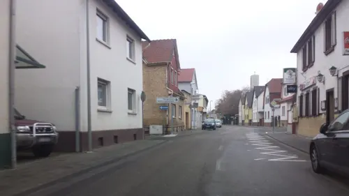
Zur Vorstadt
Restaurant · Regional · 4.9 km
38 Bahnhofstraße, Lampertheim
We-Fr 17:00-22:00; Sa 17:00-22:30; Su 11:45-14:00,17:00-22:00
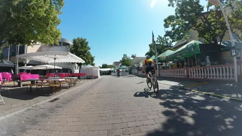
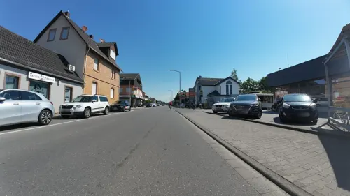

Bäcker Görtz
Bakery · 0.6 km
150 Darmstädter Straße, Biblis
Mo-Fr 06:30-20:30; Sa 07:00-20:30; Su,PH off
Bäcker Görtz
Bakery · 4.4 km
129 Mainstraße, Bürstadt
Mo-Fr 05:30-19:00; Sa 06:00-19:00; Su 07:30-17:00
Bäckerei Konditorei Scheubeck
Bakery · 5.2 km
1 Neugasse, Lampertheim
Mo-Sa 05:30-20:00; Su 08:00-11:00


64 more on the map.
History
In 836, Biblis had its first documentary mention in the Lorsch Abbey’s Codex Laureshamensis under the name Bibifloz (“settlement at the water”) when King Louis the German donated his holdings in Biblis, Wattenheim and Zullestein to his faithful vassal Wernher, who in turn bequeathed them to the Lorsch Abbey in 846. From 1461 to 1623, the area was pledged to the Palatinate, and in the Reformation’s wake it became Protestant, although after the retrocession, it became Catholic again. During the Thirty Years' War, the municipality was laid waste several times, and the populace was decimated by the Plague. With Secularization in 1803, the municipality passed to what later became the Grand Duchy of Hesse and was assigned to the district of Worms.
In 1936 the German Luftwaffe built an airfield in Biblis disguised as a typical Hessian farm. The airfield was used during World War II to intercept allied bombers and is an equestrian centre and restaurant today.
In 1945, Biblis was split off from Worms, which became part of the new federal state of Rhineland-Palatinate, and became part of the Bergstrasse district in the state of Hesse. The formerly self-governing municipalities of Biblis, Nordheim and Wattenheim merged in 1970 to form the greater municipality of Biblis.
From the History section of Biblis on Wikipedia, under CC BY-SA 4.0.
Where to stay5
Churches and places of worship20
Evangelische Kirche Bobstadt
Church · Protestant · 3.2 km
4 Holländerstraße, Bürstadt
Evangelische Kirche Groß-Rohrheim
Church · Protestant · 3.0 km
6 Kirchstraße, Groß-Rohrheim
Katholische Kirche Heilig Kreuz
Church · Catholic · 5.0 km
36 Hauptstraße, Hamm am Rhein
Katholische Kirche St. Theresia
Church · Roman Catholic · 2.9 km
25 Richard-Wagner-Straße, Groß-Rohrheim
St. Michael
Church · Roman Catholic · 5.6 km
10-14 Peterstraße, Bürstadt
Shopping19
Gas and EV charging8
Schools, colleges and libraries10
Healthcare5
Map of Biblis
202 places. The map loads OpenStreetMap tiles when you open it.
Getting there and nearby towns
City-Airport Mannheim (MHG) is the nearest airport with scheduled flights listed in OpenStreetMap, 24 km away.
- Bürstadt 5 km south, about 5 min by car
- Einhausen 7 km east, about 7 min by car
- Gernsheim 7 km north, about 7 min by car
- Worms 10 km southwest, about 10 min by car
- Lorsch 9 km southeast, about 9 min by car
- Lampertheim 10 km south, about 10 min by car
- Bensheim 12 km east, about 12 min by car
- Heppenheim an der Bergstrasse 14 km southeast, about 14 min by car
- Stockstadt am Rhein 13 km north, about 13 min by car
- Bobenheim-Roxheim 14 km southwest, about 14 min by car
Drive times are estimates from straight-line distance, not routes.
Local news
Headlines from INDB.
Reviews, tips and questions
Loading what members have shared...
Sources and licences
- GeoNames (CC BY 4.0): population, coordinates, regions and time zone
- Mapillary (see each image): photos
- OpenStreetMap contributors (ODbL 1.0): places, airports, map data
- Wikidata (CC0 1.0): elevation, founding date, time zone, website, landmarks and historic places
- Wikimedia Commons (see each image): photos
- Wikipedia (CC BY-SA 4.0): overview and history text
Photo credits
- Riedsee Biblis, Jens Stier, CC BY-SA 3.0
- 20241213 Bahnübergang Nordkopf Bahnhof Biblis, Bigbug21, CC BY-SA 4.0
- Evangelische Kirche Biblis-01, Muck, CC BY-SA 4.0
- Evangelische Kirche Biblis-02, Muck, CC BY-SA 4.0
- Biblis, Friedhofskapelle, Muck, CC BY-SA 4.0
- Biblis Wasserturm ehemalige Gurkenfabrik, Oberlausitzerin64, CC BY-SA 4.0
- Biblis, Hochstraße 16, Muck, CC BY-SA 4.0
- Biblis Bahnhofsgebäude, RSchreg, CC BY 4.0
- RE70 Twindexx im Bahnhof Biblis 2024, Tohma ( talk ), CC BY-SA 4.0
- Darmstädter Straße, 1, Biblis, Landkreis Bergstraße, GeorgDerReisende, CC BY-SA 4.0
- Biblis Bahnhof Güterschuppen, RSchreg, CC BY 4.0
- Biblis, Darmstädter Straße 34, Muck, CC BY-SA 4.0
- Biblis, Darmstädter Straße 39, Muck, CC BY-SA 4.0
- Biblis, Hintergasse 1, Muck, CC BY-SA 4.0
- Biblis, Darmstädter Straße 24, Muck, CC BY-SA 4.0
- Korngasse, 1, Biblis, Landkreis Bergstraße, GeorgDerReisende, CC BY-SA 4.0
- Biblis, Hintergasse 17, Muck, CC BY-SA 4.0
- Darmstädter Straße, 5, Biblis, Landkreis Bergstraße, GeorgDerReisende, CC BY-SA 4.0
- Domstadtl-Gedenkstein in Biblis, Tohma ( talk ), CC BY-SA 4.0
- Biblis, Ehemaliger Friedhof-02, Muck, CC BY-SA 4.0
- Biblis, Ehemaliger Friedhof-01, Muck, CC BY-SA 4.0
- Biblis, Ehemaliger Friedhof-03, Muck, CC BY-SA 4.0
- Biblis, Ehemaliger Friedhof-04, Muck, CC BY-SA 4.0
- Darmstädter Straße, 4, Biblis, Landkreis Bergstraße, GeorgDerReisende, CC BY-SA 4.0
- Biblis, Heinrichstraße 52, Muck, CC BY-SA 4.0
- Biblis, Bachgasse 1, Muck, CC BY-SA 4.0
- Bachgasse, 1, Biblis, Landkreis Bergstraße, GeorgDerReisende, CC BY-SA 4.0
- Biblis, Darmstädter Straße 31, Muck, CC BY-SA 4.0
- Biblis, Heinrichstraße 54, Muck, CC BY-SA 4.0
- Biblis, Heinrichstraße 3, Muck, CC BY-SA 4.0
- Biblis, Heinrichstraße 6, Muck, CC BY-SA 4.0
- Biblis, Heinrichstraße 10, Muck, CC BY-SA 4.0
- Bücherschrank, 1, Biblis, Landkreis Bergstraße, GeorgDerReisende, CC BY-SA 4.0
- Biblis, Heinrichstraße 5, Muck, CC BY-SA 4.0
- Biblis, Prozessionskreuz Bachgasse 17, Muck, CC BY-SA 4.0
- Biblis, Prozessionskreuz 2 Beim Kreuz, Muck, CC BY-SA 4.0
- Gedenkstein Synagoge Biblis, Muck, CC0
- Rathaus Biblis-02-Rückseite, Muck, CC0
- Biblis, Korngasse 2, Muck, CC BY-SA 4.0
- Worms Bruecke 02, Armin Kübelbeck -- Kuebi 16:55, 27 May 2007 (UTC), CC BY-SA 3.0
- NSG Steiner Wald Römische Anlage, Bernd Herd, CC BY-SA 4.0
- Mennonitenkirche Ibersheim 1, Sokkok, CC BY-SA 3.0
- Biblis katholische Kirche, Jürgen Lange, CC BY 3.0
- Buerstadt-St-Michael-04, Immanuel Giel, CC BY-SA 3.0
- Menhir of Bürstadt, Kurt Althoff, CC BY-SA 4.0
- Wiki DSC00762 HammerAue 1156, René Schröder, CC BY-SA 4.0
- Hamm am Rhein protestantische Kirche 10, Immanuel Giel, CC BY-SA 4.0
- Protestantische Kirche - panoramio (42), Immanuel Giel, CC BY 3.0
- Bobstadt, St. Josef (Außenansicht) (3), Cmcmcm1, CC BY-SA 4.0
- Groß-Rohrheim, Evangelische Kirche-01, Muck, CC BY-SA 4.0
- Groß-Rohrheim, St. Theresia, Muck, CC BY-SA 4.0
- Hamm am Rhein katholische Kirche 01, Immanuel Giel, CC BY-SA 4.0
- Simultankirche Nordheim-01, Muck, CC BY-SA 4.0
- St. Christophorus (Wattenheim)-01, Muck, CC BY-SA 4.0
- Stolperstein Bürstadt Luisen-7 Blondina Mann, Alfrejg, CC BY-SA 4.0
- Bft Groß-Rohrheim, Emilius123, CC BY-SA 4.0
- Street-level photo, wegavision, CC BY-SA 4.0
- Street-level photo, wegavision, CC BY-SA 4.0
- Street-level photo, ramap, CC BY-SA 4.0
- Street-level photo, teddy73, CC BY-SA 4.0
- Street-level photo, teddy73, CC BY-SA 4.0
- Street-level photo, changchun1, CC BY-SA 4.0
- Street-level photo, wegavision, CC BY-SA 4.0
- Street-level photo, bigbug21, CC BY-SA 4.0
- Street-level photo, changchun1, CC BY-SA 4.0
- Street-level photo, wegavision, CC BY-SA 4.0
- Street-level photo, teddy73, CC BY-SA 4.0
- Street-level photo, wegavision, CC BY-SA 4.0
- Street-level photo, schulf, CC BY-SA 4.0
- Street-level photo, schulf, CC BY-SA 4.0
- Street-level photo, wegavision, CC BY-SA 4.0
- Street-level photo, wegavision, CC BY-SA 4.0
- Street-level photo, changchun1, CC BY-SA 4.0
- Street-level photo, wegavision, CC BY-SA 4.0
- Street-level photo, wegavision, CC BY-SA 4.0
- Street-level photo, wegavision, CC BY-SA 4.0
- Street-level photo, mfa, CC BY-SA 4.0
- Street-level photo, changchun1, CC BY-SA 4.0
- Street-level photo, wegavision, CC BY-SA 4.0
- Street-level photo, wegavision, CC BY-SA 4.0
- Street-level photo, atze02, CC BY-SA 4.0
- Street-level photo, teddy73, CC BY-SA 4.0
- Street-level photo, wegavision, CC BY-SA 4.0


Page built November 9, 2026. Spotted a mistake? Tell us or suggest a place.