


Why visit Einhausen
Townapedia lists 28 museums and landmarks, 23 parks and trails, 70 places to eat, 9 places to stay and 6 attractions in and around town.
Highlights include Luxor Filmpalast, Vogelpark Birkengarten, Lorsch Abbey and Königshalle / Torhalle.
Weather in Einhausen
Forecast from MET Norway (CC BY 4.0). Full forecast
About Einhausen
Einhausen (German pronunciation: [aɪnˈhaʊzn̩]) is a municipality in the Bergstraße district in Hesse, Germany, some 15 km east of Worms.
From the Wikipedia article Einhausen, Hesse (this version), under CC BY-SA 4.0.
Things to do6
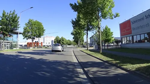

Vogelpark Birkengarten
Zoo and aquarium · 3.6 km
69 Mannheimer Straße, Lorsch
Apr-Oct: Tu-Su,PH 09:00-18:00; Apr-Oct: Mo off; Nov-Mar: Tu-Su,PH...


Renaturierung Weschnitz in Lorsch
Scenic view · 1.5 km
Informationen zur Weschnitzrenaturierung
Museums and landmarks28


Abbey and Altenmünster of Lorsch
Museum · 2.9 km
UNESCO World Heritage Abbey of Lorsch in Germany




Erinnerung an Schneewittchen -Schneeweißchen-
Monument and historic site · 4.0 km
16 more on the map.
Parks, trails and playgrounds23
Badesee
Sports field and stadium · 4.3 km
110 Berliner Ring, Bensheim
May 1-31: Mo-Su 08:00-20:00; Jun 1-Aug 31: Mo-Su 08:00-21:00; Sep...

Basinus Bad
Sports field and stadium · 4.7 km
2 Spessartstraße, Bensheim
Mo,We,Fr 10:00-21:45; Tu,Th 06:30-21:45; Sa-Su,PH 08:00-21:45; Dec...
Golf-Club Bensheim
Golf course · 3.5 km
56 Außerhalb, Bensheim
Apr 01-Oct 31: Mo-Su 08:00-21:00; Nov 01-Mar 31: Mo-Su 08:00-20:00
Hallenbad Einhausen
Sports field and stadium
7 Marktplatz, Einhausen
Tu,Th,Fr 15:00-21:00; We 15:00-18:30; Sa 15:00-19:00; Su 10:00-17:00


11 more on the map.
Restaurants and cafes70

Timberjacks
Restaurant · Steak House, Burger, Mexican, Tex-Mex · 3.4 km
2 Ampèrestraße, Bensheim
Mo-Th,Su 09:00-22:30; Fr-Sa 09:00-23:30
Vietnam
Restaurant · Asian, Vietnamese · 3.2 km
2-4 Zeppelinstraße, Bensheim
Sa-Su 11:30-22:00; Tu-Fr 11:30-14:30, 16:30-22:00
Zum Sportpark
Restaurant · Croatian · 4.5 km
114 Berliner Ring, Bensheim
Tu-Sa 17:00-22:30; Su 11:30-14:00, 17:00-21:30

Bäcker Görtz
Bakery · 4.1 km
81 Berliner Ring, Bensheim
Mo-Fr 06:00-20:00; Su,PH 07:30-12:00; Sa 06:30-20:00
Bäckerei Grimminger
Bakery · 1.7 km
2 Marie-Curie-Straße, Lorsch
Mo-Fr 06:00-18:00; Sa 06:00-17:00; Su off
Bäckerei Rauen
Bakery · 2.7 km
46 Rohrheimer Straße, Bensheim
Mo-Fr 05:30-12:30; Sa 05:30-12:00; Su 07:00-11:00
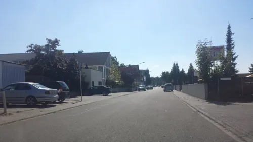


Restaurant Gud Stubb
Restaurant · Regional · 4.4 km
Tu-Fr 17:00-23:00;Apr-Aug: Sa 17:00-23:00;Sep-Mar: Sa...
58 more on the map.
History
The community was donated in 768 under the name Husun to the Lorsch Abbey. In the course of the Reformation and the Counterreformation there arose two politically and ecclesiastically divided communities: Groß-Hausen (Protestant), and Klein-Hausen (Catholic) which contradictorily became the larger of the two. On 1 April 1937, the two communities were merged into the community of Einhausen. (Older residents often tell the visitor that this merger was one of many mergers endorsed and signed into effect by Adolf Hitler.) As mentioned earlier, the historical distinction between Groß-Hausen and Klein-Hausen is still heard in speech today, even by younger residents.
From the History section of Einhausen, Hesse on Wikipedia, under CC BY-SA 4.0.
Where to stay9
Churches and places of worship16
Evangelische Kirchengemeinde Einhausen
Church · Evangelical
9 Friedhofstraße, Einhausen
Shopping27
Gas and EV charging16
Schools, colleges and libraries12
Healthcare7
Map of Einhausen
214 places. The map loads OpenStreetMap tiles when you open it.
Getting there and nearby towns
City-Airport Mannheim (MHG) is the nearest airport with scheduled flights listed in OpenStreetMap, 23 km away.
- Lorsch 3 km southeast, about 3 min by car
- Bensheim 5 km east, about 5 min by car
- Heppenheim an der Bergstrasse 7 km southeast, about 7 min by car
- Bürstadt 7 km southwest, about 7 min by car
- Gernsheim 10 km northwest, about 10 min by car
- Lampertheim 10 km southwest, about 10 min by car
- Laudenbach 10 km southeast, about 10 min by car
- Hemsbach 12 km southeast, about 12 min by car
- Seeheim-Jugenheim 12 km northeast, about 12 min by car
- Worms 14 km west, about 14 min by car
Drive times are estimates from straight-line distance, not routes.
Local news
Headlines from INDB.
Reviews, tips and questions
Loading what members have shared...
Sources and licences
- GeoNames (CC BY 4.0): population, coordinates, regions and time zone
- Mapillary (see each image): photos
- OpenStreetMap contributors (ODbL 1.0): places, airports, map data
- Wikidata (CC0 1.0): elevation, founding date, time zone, website, landmarks and historic places
- Wikimedia Commons (see each image): photos
- Wikipedia (CC BY-SA 4.0): overview and history text
Photo credits
- Weschnitz in Einhausen 01, Kuebi, CC BY-SA 3.0
- Einhausen, Gefallenen-Ehrenmal Nordfriedhof, Muck, CC BY-SA 4.0
- Einhausen, Evangelische Kirche, Muck, CC BY-SA 4.0
- Einhausen, Hauptstraße 34, Muck, CC BY-SA 4.0
- Einhausen, Hauptstraße 31, Muck, CC BY-SA 4.0
- Einhausen, Gefallenen-Ehrenmal Hauptstraße, Muck, CC BY-SA 4.0
- Einhausen, Hauptstraße 38, Muck, CC BY-SA 4.0
- Einhausen, Hauptstraße 20, Muck, CC BY-SA 4.0
- Einhausen, Hauptstraße 10-Pinienzapfen, Muck, CC BY-SA 4.0
- Einhausen, Schwanheimer Straße 1, Muck, CC BY-SA 4.0
- Einhausen, Hauptstraße 14-Ziehbrunnen, Muck, CC BY-SA 4.0
- Einhausen, Bensheimer Straße 2, Muck, CC BY-SA 4.0
- Einhausen, Hauptstraße 6-01, Muck, CC BY-SA 4.0
- Einhausen, Hauptstraße 6-03, Muck, CC BY-SA 4.0
- Einhausen, Hauptstraße 6-04, Muck, CC BY-SA 4.0
- Einhausen, Hauptstraße 6-02, Muck, CC BY-SA 4.0
- Einhausen, Hauptstraße 56, Muck, CC BY-SA 4.0
- Einhausen, Hauptstraße 51, Muck, CC BY-SA 4.0
- Einhausen (Hessen), Winterlinde, Muck, CC BY-SA 4.0
- Einhausen, Hauptstraße 65, Muck, CC BY-SA 4.0
- Einhausen, Hauptstraße 57, Muck, CC BY-SA 4.0
- Einhausen, Hauptstraße 70a, Muck, CC BY-SA 4.0
- Weschnitz Hochwasser Einhausen, Unknown author, CC BY-SA 3.0
- Einhausen, Ludwigstraße 18, Muck, CC BY-SA 4.0
- Einhausen, Ludwigstraße 17, Muck, CC BY-SA 4.0
- Einhausen, St. Michael-01, Muck, CC BY-SA 4.0
- Einhausen, Mariengärtchen, Muck, CC BY-SA 4.0
- Einhausen, St. Michael-04-innen, Muck, CC BY-SA 4.0
- Einhausen, Marktkreuz, Muck, CC BY-SA 4.0
- Einhausen, Schulstraße 2, Muck, CC BY-SA 4.0
- Einhausen, Marktplatz 1, Muck, CC BY-SA 4.0
- Einhausen, Ludwigstraße 2, Muck, CC BY-SA 4.0
- Einhausen, St. Michael-02, Muck, CC BY-SA 4.0
- Einhausen, Mathildenstraße 5, Muck, CC BY-SA 4.0
- Einhausen, Altes Rathaus, Muck, CC BY-SA 4.0
- Einhausen, St. Michael-03, Muck, CC BY-SA 4.0
- Einhausen, Mathildenstraße 43, Muck, CC BY-SA 4.0
- Einhausen, Mathildenstraße 37, Muck, CC BY-SA 4.0
- Lorsch, Elswhs at Dutch Wikipedia ( Original text: Els Slots ), CC BY-SA 3.0
- 0260nb Sandsteinfassade Königshalle Kloster Lorsch, Heinz-Vale, CC BY-SA 4.0
- St. Laurentius (Bensheim)-01, Muck, CC BY-SA 4.0
- Karl Kuebel Schule 06, Oxcguard, CC BY-SA 4.0
- St. Bartholomäus (Fehlheim), Muck, CC BY-SA 4.0
- Lorsch, Schulstraße 12, St. Nazarius 20170609 003, Tilman2007, CC BY-SA 4.0
- Wingertsbergschule Lorsch, Immanuel Giel, CC BY 3.0
- Torhalle Lorsch (4), Immanuel Giel, CC0
- Stolperstein Lorsch Nibelungenstraße 56 Berthold Kahn, Gmbo 2013, CC0
- Lorsch, Nibelungenstraße 23 20170609 002, Tilman2007, CC BY-SA 4.0
- Total Lorsch, Emilius123, CC BY-SA 4.0
- Kloster Lorsch 07, Kuebi - Armin Kübelbeck, CC BY-SA 3.0
- Geschwister Scholl Schule Bensheim, Bernd Herd, CC BY-SA 4.0
- Kirchenfragment, Kloster Lorsch, Cryptorebel, CC BY-SA 4.0
- Street-level photo, robffm, CC BY-SA 4.0
- Street-level photo, changchun1, CC BY-SA 4.0
- Street-level photo, ramap, CC BY-SA 4.0
- Street-level photo, mfa, CC BY-SA 4.0
- Street-level photo, teddy73, CC BY-SA 4.0
- Street-level photo, ottor, CC BY-SA 4.0
- Street-level photo, ramap, CC BY-SA 4.0
- Street-level photo, changchun1, CC BY-SA 4.0
- Street-level photo, wegavision, CC BY-SA 4.0
- Street-level photo, changchun1, CC BY-SA 4.0
- Street-level photo, rororo, CC BY-SA 4.0
- Street-level photo, ramap, CC BY-SA 4.0
- Street-level photo, wegavision, CC BY-SA 4.0
- Street-level photo, ramap, CC BY-SA 4.0
- Street-level photo, ramap, CC BY-SA 4.0
- Street-level photo, wegavision, CC BY-SA 4.0
- Street-level photo, wegavision, CC BY-SA 4.0
- Street-level photo, changchun1, CC BY-SA 4.0
- Street-level photo, changchun1, CC BY-SA 4.0
- Street-level photo, ramap, CC BY-SA 4.0
- Street-level photo, wegavision, CC BY-SA 4.0


Page built November 9, 2026. Spotted a mistake? Tell us or suggest a place.