


Why visit Birkenau
Townapedia lists 64 museums and landmarks, 26 parks and trails, 154 places to eat, 8 places to stay and 24 attractions in and around town.
Highlights include Modernes Theater, Quittenprojekt Bergstraße, Burgruine Windeck and Solardraisine Überwaldbahn.
Weather in Birkenau
Forecast from MET Norway (CC BY 4.0). Full forecast
About Birkenau
Birkenau (German pronunciation: [ˈbɪʁkənaʊ]) in the Odenwald is a municipality in the Bergstraße district in southern Hesse, Germany. Its nickname is Das Dorf der Sonnenuhren – “The Sundial Village”.
From the Wikipedia article Birkenau (Odenwald) (this version), under CC BY-SA 4.0.
Things to do24
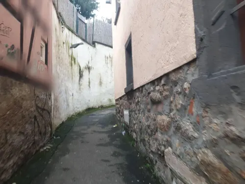


Waldnerturm
Scenic view · 3.7 km
Der Turm ist nicht der Rest einer Ritterburg, sondern das Produkt einer adeligen Laune. Der in Hemsbach begüterte Graf Waldner ließ den...



12 more on the map.
Museums and landmarks64

Burgruine Windeck
Monument and historic site · 2.8 km
2 Alter Burgweg, Weinheim
We-Fr 17:00-20:00; Sa-Su 11:00-20:00
Solardraisine Überwaldbahn
Monument and historic site · 4.3 km
Abfahrt Vormittag Mörlenbach nach Wald - Michelbach zwischen 8.30 Uhr und 9.30Uhr Abfahrt Nachmittag Mörlenbach nach Wald - Michelbach...
16 Weinheimer Straße, Mörlenbach
Mo-Su 08:30-14:30

Wachenburg
Monument and historic site · 2.1 km
We-Fr 16:00+; Sa 12:00+; Su 10:00+; PH 10:00+; Mo-Tu off


Krippen-Stübchen Mörlenbach
Monument and historic site · 4.3 km
Termine, das ganze Jahr über - auch für Gruppen - nach telefonischer Absprache!
14 Panoramastraße, Mörlenbach

Abgegangener Hof Rohr
Monument and historic site · 3.1 km
10 Abtsteinacher Straße, Birkenau

Eberhard Hosemann
Monument and historic site · 4.3 km
Zum Gedenken an Eberhard Hosemann 1. orsitzender des OWK Mörlenbach von 1975 bis 1994
52 more on the map.
Parks, trails and playgrounds26






14 more on the map.
Restaurants and cafes154

Galileo
Restaurant · Pizza · 2.6 km
108 Grundelbachstraße, Weinheim
Mo-Su 11:00-14:00,17:00-23:00; We off
Gasthaus Grüner Baum - Odenwälder Frühstückstreff
Restaurant · Breakfast · 2.4 km
27 Talstraße, Birkenau
Sa,Su 10:00-15:00
Gourmet Tempel
Restaurant · Asian · 3.9 km
7 Bergstraße, Weinheim
Mo-Fr 11:30-15:00,17:30-22:00; Sa-Su,PH 12:30-22:30
Hellas
Restaurant · Greek · 2.8 km
49 Hauptstraße, Weinheim
Tu-Fr 11:30-14:30,17:30-23:00; Sa 17:00-23:00; Su 12:00-15:00,17:00-23:00
Knuspergockel im Eulenspiegel
Restaurant · Chicken · 2.7 km
21 Lindenstraße, Weinheim
We,Th 17:00-22:30, Fr,Sa 17:00-00:00


Lotus Restaurant
Restaurant · Asian, Sushi, Vietnamese · 3.6 km
23 Mannheimer Straße, Weinheim
Tu-Sa 11:00-15:00,17:00-22:30; Su 12:00-15:00,17:00-22:30

142 more on the map.
History
Birkenau had its first documentary mention in 795 in the Lorsch Codex as a cell of the Lorsch Abbey. As one of the Abbey's holdings, it passed into the ownership of the Archbishopric of Mainz in 1232. The centres of Hornbach and Balzenbach, on the other hand, belonged to the Electorate of the Palatinate, meaning that after the Reformation, they belonged to different denominations. In 1532 the town hall was built, and in 1771 the palace, Schloss Birkenau, of the Lords of Wambolt von Umstadt. By 1964, the population had grown to more than 5,000. In 1967 the community was recognized as a recreational resort (Erholungsort) and in 1979 as an open-air resort (Luftkurort). Owing to the only slight tourism, however, it has not reapplied for this designation. In 1995, Birkenau celebrated its 1,200-year jubilee.
From the History section of Birkenau (Odenwald) on Wikipedia, under CC BY-SA 4.0.
Where to stay8
Churches and places of worship33
Kath. Kirchengemeinde Sta. Maria
Church · Catholic · 3.7 km
6 Gartenstraße, Weinheim
Peterskirche
Church · Protestant · 2.4 km
114 Grundelbachstraße, Weinheim
Shopping47
Gas and EV charging27
Schools, colleges and libraries21
Healthcare14
Map of Birkenau
250 places. The map loads OpenStreetMap tiles when you open it.
Getting there and nearby towns
City-Airport Mannheim (MHG) is the nearest airport with scheduled flights listed in OpenStreetMap, 17 km away.
- Weinheim 3 km southwest, about 3 min by car
- Mörlenbach 5 km northeast, about 5 min by car
- Hemsbach 5 km northwest, about 5 min by car
- Wald-Michelbach 9 km east, about 9 min by car
- Heddesheim 10 km southwest, about 10 min by car
- Schriesheim 10 km south, about 10 min by car
- Fürth 11 km northeast, about 11 min by car
- Ladenburg 12 km southwest, about 12 min by car
- Dossenheim 13 km south, about 13 min by car
- Edingen-Neckarhausen 14 km southwest, about 14 min by car
Drive times are estimates from straight-line distance, not routes.
Local news
Headlines from INDB.
Reviews, tips and questions
Loading what members have shared...
Sources and licences
- GeoNames (CC BY 4.0): population, coordinates, regions and time zone
- Mapillary (see each image): photos
- OpenStreetMap contributors (ODbL 1.0): places, airports, map data
- Wikidata (CC0 1.0): elevation, founding date, time zone, website
- Wikimedia Commons (see each image): photos
- Wikipedia (CC BY-SA 4.0): overview and history text
Photo credits
- Birkenau (Odenwald), Mariä Himmelfahrt-01, Muck, CC BY-SA 4.0
- Birkenau (Odenwald), Evangelische Kirche-02, Muck, CC BY-SA 4.0
- Birkenau (Odenwald), Hauptstraße 53, Muck, CC BY-SA 4.0
- Birkenau (Odenwald), Hauptstraße 88, Muck, CC BY-SA 4.0
- Birkenau (Odenwald), Kirchgasse 14a, Muck, CC BY-SA 4.0
- Birkenau (Odenwald), Grabsteine Alter Friedhof, Muck, CC BY-SA 4.0
- Birkenau (Odenwald), Friedhofskreuz, Muck, CC BY-SA 4.0
- Birkenau (Odenwald), Hauptstraße 83, Muck, CC BY-SA 4.0
- Birkenau (Odenwald), Mariä Himmelfahrt-02, Muck, CC BY-SA 4.0
- Birkenau (Odenwald), Hauptstraße 80, Muck, CC BY-SA 4.0
- Birkenau (Odenwald), Kirchgasse 6, Muck, CC BY-SA 4.0
- Birkenau (Odenwald), Am Großen Falltor 19, Muck, CC BY-SA 4.0
- Birkenau (Odenwald), Evangelische Kirche-03-Infotafel, Muck, CC BY-SA 4.0
- Birkenau (Odenwald), Evangelische Kirche-01, Muck, CC BY-SA 4.0
- Birkenau (Odenwald), Gedenkkreuz Alter Friedhof, Muck, CC BY-SA 4.0
- Birkenau (Odenwald), Gefallenen-Ehrenmal Alter Friedhof, Muck, CC BY-SA 4.0
- Birkenau (Odenwald), Weschnitzbrücke Brückenstraße, Muck, CC BY-SA 4.0
- Birkenau (Odenwald), Brückenstraße 2, Muck, CC BY-SA 4.0
- Birkenau (Odenwald), Kriegerdenkmal Brückenstraße, Muck, CC BY-SA 4.0
- Birkenau (Odenwald), Kreuzgasse 11, Muck, CC BY-SA 4.0
- Birkenau (Odenwald), Kreuzgasse 7, Muck, CC BY-SA 4.0
- Birkenau (Odenwald), Kreuzgasse 9, Muck, CC BY-SA 4.0
- Birkenau (Odenwald), Bahnhofstraße 3, Muck, CC BY-SA 4.0
- Birkenau (Odenwald), Bahnhofstraße 4, Muck, CC BY-SA 4.0
- Birkenau (Odenwald), Altes Rathaus-01, Muck, CC BY-SA 4.0
- Birkenau (Odenwald), Altes Rathaus-03-Infotafel, Muck, CC BY-SA 4.0
- Birkenau (Odenwald), Obergasse 5, Muck, CC BY-SA 4.0
- Birkenau (Odenwald), Altes Rathaus-02, Muck, CC BY-SA 4.0
- Birkenau (Odenwald), Altes Rathaus-04-Eingangstür, Muck, CC BY-SA 4.0
- Birkenau (Odenwald), Obergasse 6, Muck, CC0
- Birkenau (Odenwald), Hauptstraße 72, Muck, CC BY-SA 4.0
- Birkenau (Odenwald), Wilhelmstraße 9, Muck, CC BY-SA 4.0
- Birkenau (Odenwald), Wilhelmstraße 7, Muck, CC BY-SA 4.0
- Birkenau (Odenwald), Hauptstraße 63, Muck, CC BY-SA 4.0
- Birkenau (Odenwald), Jahnstraße 7, Muck, CC BY-SA 4.0
- Birkenau (Odenwald), Ehemaliges Gefallenen-Ehrenmal Hornbacher Straße, Muck, CC BY-SA 4.0
- Birkenau (Odenwald), Hauptstraße 55, Muck, CC BY-SA 4.0
- Birkenau (Odenwald), Am Schloßpark 14, Muck, CC BY-SA 4.0
- Birkenau (Odenwald), Zimmerstraße 15, Muck, CC BY-SA 4.0
- Birkenau Hauptstrasse 53, picture taken on 2021-10-22 10.53.36, Fraenkli Fraenkli, CC BY-SA 4.0
- Burg Windeck (Weinheim), Wollschaf, CC BY-SA 3.0
- Weinheim Peterskirche 20120918, Rudolf Stricker, Attribution
- Weinheim Dietrich-Bonhoeffer-Schule 20120909, Rudolf Stricker, Attribution
- Goldkopf, Ramessos, Public domain
- Wachenburg, de:Benutzer:Wollschaf, CC BY-SA 3.0
- Weinheim Schlossturm 20120918, Rudolf Stricker, Attribution
- Weinheim Werner-Heisenberg-Gymnasium 20120909, Rudolf Stricker, Attribution
- Waldnerturm 1, Muck, CC BY-SA 4.0
- Naturschutzgebiet Wüstnächstenbach und Haferbuckel Dickicht, Vollgenervt, CC BY-SA 4.0
- NSG Schafhof-Teufelsloch, Michael Linnenbach, CC BY-SA 4.0
- Hirschkopfturm-1, Muck, CC BY-SA 4.0
- Mörlenbach St. Bartholomäus 20100919, Rudolf Stricker, Attribution
- Weinheim - St.-Marien-Kirche, Radosław Drożdżewski (Zwiadowca21), CC BY-SA 3.0
- St. Michael (Buchklingen)-01, Muck, CC BY-SA 4.0
- Weinheim-Sulzbach, Paul-Gerhardt-Kirche (2), Cmcmcm1, CC BY-SA 4.0
- Weinheim-Sulzbach, Sta. Maria (2), Cmcmcm1, CC BY-SA 4.0
- Moerlenbach altes Rathaus, Christian Blaesing, CC BY-SA 3.0
- Panorama vom Hirschkopf, Jörg Braukmann, CC BY-SA 4.0
- Street-level photo, chuck, CC BY-SA 4.0
- Street-level photo, voschix, CC BY-SA 4.0
- Street-level photo, voschix, CC BY-SA 4.0
- Street-level photo, wegavision, CC BY-SA 4.0
- Street-level photo, robffm, CC BY-SA 4.0
- Street-level photo, voschix, CC BY-SA 4.0
- Street-level photo, voschix, CC BY-SA 4.0
- Street-level photo, ramap, CC BY-SA 4.0
- Street-level photo, robffm, CC BY-SA 4.0
- Street-level photo, robffm, CC BY-SA 4.0
- Street-level photo, NorMan61, CC BY-SA 4.0
- Street-level photo, nvbwseifert, CC BY-SA 4.0
- Street-level photo, ramap, CC BY-SA 4.0
- Street-level photo, Eraoniel, CC BY-SA 4.0
- Street-level photo, wegavision, CC BY-SA 4.0
- Street-level photo, Eraoniel, CC BY-SA 4.0
- Street-level photo, wegavision, CC BY-SA 4.0
- Street-level photo, ramap, CC BY-SA 4.0
- Street-level photo, waldemar, CC BY-SA 4.0
- Street-level photo, ramap, CC BY-SA 4.0
- Street-level photo, wegavision, CC BY-SA 4.0
- Street-level photo, wegavision, CC BY-SA 4.0
- Street-level photo, wegavision, CC BY-SA 4.0
- Street-level photo, ramap, CC BY-SA 4.0
- Street-level photo, voschix, CC BY-SA 4.0
- Street-level photo, changchun1, CC BY-SA 4.0
- Street-level photo, wegavision, CC BY-SA 4.0


Page built November 8, 2026. Spotted a mistake? Tell us or suggest a place.