


Birkenfeld, Germany
Birkenfeld is a town of 10,609 people in Baden-Wurttemberg, Germany.
Why visit Birkenfeld
Townapedia lists 48 museums and landmarks, 14 parks and trails, 101 places to eat, 6 places to stay and 12 attractions in and around town.
Highlights include Hofladen, Büchenbronn Observation Tower, Stadtmuseum Pforzheim and Schloss Neuenbürg.
Weather in Birkenfeld
Forecast from MET Norway (CC BY 4.0). Full forecast
About Birkenfeld
Birkenfeld (German pronunciation: [ˈbɪʁkn̩fɛlt] ) is a municipality in the Enz district, in Baden-Württemberg, Germany. It is situated in the Northern Black Forest, 6 km southwest of Pforzheim. The town is located on the top plain, the area extends down to the river Enz valley.
From the Wikipedia article Birkenfeld (Enz) (this version), under CC BY-SA 4.0.
Things to do12


Büchenbronn Observation Tower
Monument and historic site · 2.7 km
Observation tower near Büchenbronn in the Black Forest


Theater Pforzheim
Cinema and theater · 5.7 km
Theatre and opera house in Pforzheim, Germany



Museums and landmarks48

Stadtmuseum Pforzheim
Museum · 3.9 km
243 Westliche Karl-Friedrich-Straße, Pforzheim
We,Th 14:00-17:00; Su 10:00-17:00

Schloss Neuenbürg
Monument and historic site · 3.7 km
Zweigmuseum des Badischen Landesmuseums Karlsruhe
Tu-Sa 13:00-18:00; Su,PH 10:00-18:00; Mo off





36 more on the map.
Parks, trails and playgrounds14


Nagoldfreibad
Sports field and stadium · 3.5 km
Mo,We,Th,Fr 09:00-19:00; Tu 09:00-16:00; Sa-Su 11:00-19:00


2 more on the map.
Restaurants and cafes101
Bischoff's Landrestaurant
Restaurant · Regional · 3.7 km
Private events only; not open to public
1, Keltern
off
Schönblick
Restaurant · Regional · 1.5 km
5 Schönblickweg, Birkenfeld
Mo-Sa 16:30-21:30; Tu off; Su 11:30-20:00
Alter Adler
Restaurant · Regional, Greek · 2.6 km
8 Adlerstraße, Pforzheim
Tu-Su 10:00-13:00,16:00-24:00; Sa 10:00-24:00
Aurora PSG-Vereinsgaststätte
Restaurant · Italian · 3.1 km
107 Büchenbronner Straße, Pforzheim
Mo 17:00-23:00; Tu 17:00-22:00; We-Fr 12:00-14:00,17:00-22:00;...
Bella Napoli
Restaurant · Italian · 3.7 km
53 Wildbader Straße, Neuenbürg
Tu-Sa 12:00-14:30,17:00-23:00; Su 12:00-14:30,17:00-21:00, PH Mo off

Britschs Löwen
Restaurant · Regional · 4.0 km
17 Westliche Friedrichstraße, Keltern
Tu-Fr 08:00-13:00,15:00-18:00; Sa 07:30-12:30
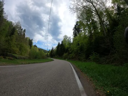
Gasthaus Grösseltal
Restaurant · Regional · 2.9 km
1 Grösseltal, Neuenbürg
Mo-Fr 14:30-22:00; Tu off; We off; Sa,Su 09:00-20:00
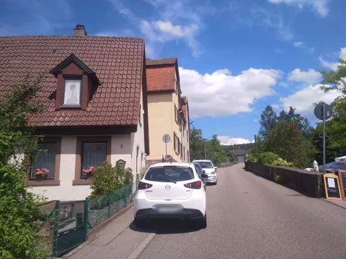


Mamma Leone
Restaurant · Italian · 3.8 km
251 Hirsauer Straße, Pforzheim
Tu-Sa 17:30-22:00; Su 12:00-14:00,17:30-21:00; Mo off
Restaurant Adler
Restaurant · German · 2.2 km
21 Lerchenstraße, Pforzheim
We-Fr 11:30-14:00,17:00-22:00; Sa 17:00-22:00; Su,PH...
89 more on the map.
History
The earliest known history in Birkenfeld is to be found in grave finds in a Celtic settlement in the municipality dated to 400 BC. Around 100 AD, the area came under the control of the Roman Empire and a Roman estate was built nearby. Birkenfeld was inhabited from 500 AD by the Alemanni and then the Franks.
From the History section of Birkenfeld (Enz) on Wikipedia, under CC BY-SA 4.0.
Where to stay6
Gaststätte Sonnenberg
Motel and hotel · Regional · 2.5 km
41 Julius-Naeher-Straße, Pforzheim
Churches and places of worship29
Evangelischer Gemeinschaftsverband AB, Bezirk Pforzheim
Church · Protestant · 3.7 km
9 Ankerstraße, Pforzheim
Heilig-Kreuz Kirche
Church · Catholic · 2.3 km
1 Obere Stöckstraße, Pforzheim
Heilig-Kreuz-Kirche
Church · Roman Catholic · 3.5 km
85 Turnstraße, Neuenbürg
Shopping27
Gas and EV charging12
SWE Südwestenergie GmbH - SB Tankstelle
Gas station · 2.0 km
6a Dennigstraße, Pforzheim
Schools, colleges and libraries20
Healthcare14
Apotheke am Markt
Clinic and pharmacy · 3.8 km
350 Westliche Karl-Friedrich-Straße, Pforzheim
Map of Birkenfeld
250 places. The map loads OpenStreetMap tiles when you open it.
Getting there and nearby towns
Airport Karlsruhe/Baden-Baden (FKB) is the nearest airport with scheduled flights listed in OpenStreetMap, 42 km away.
- Pforzheim 5 km east, about 5 min by car
- Mühlacker 17 km northeast, about 17 min by car
- Ettlingen 18 km northwest, about 18 min by car
- Calw 19 km southeast, about 19 min by car
- Bretten 20 km north, about 20 min by car
- Karlsruhe 23 km northwest, about 23 min by car
- Weil der Stadt 22 km southeast, about 22 min by car
- Malsch 22 km west, about 22 min by car
- Gaggenau 23 km west, about 23 min by car
- Gernsbach 24 km southwest, about 24 min by car
Drive times are estimates from straight-line distance, not routes.
Local news
Headlines from INDB.
Reviews, tips and questions
Loading what members have shared...
Sources and licences
- GeoNames (CC BY 4.0): population, coordinates, regions and time zone
- Mapillary (see each image): photos
- OpenStreetMap contributors (ODbL 1.0): places, airports, map data
- Wikidata (CC0 1.0): elevation, founding date, time zone, website, landmarks and historic places
- Wikimedia Commons (see each image): photos
- Wikipedia (CC BY-SA 4.0): overview and history text
Photo credits
- Kirche Birkenfeld 2013-05-27, GFHund, CC BY 3.0
- Church Of Birkenfeld - panoramio, Dg-505, CC BY 3.0
- Birkenfeld Enz 01, Hans-Peter Scholz Ulenspiegel, CC BY-SA 2.0 de
- Neuenbürg - Schloss (Ilgenberg) 01 ies, Frank Vincentz, CC BY-SA 3.0
- Christuskirche und St. Martinskirche (Pforzheim), Paralacre, CC0
- Neuenbürg - Marktstraße + Marktplatz - Stadtkirche 01 ies, Frank Vincentz, CC BY-SA 3.0
- Orchis purpurea im NSG Essigberg, Antje Schultner, CC BY-SA 4.0
- 16nov2018 Buechenbronn Bergkirche aussen 02, Klaus Martin Bardey, CC BY-SA 4.0
- Liebfrauenkirche Dillweißenstein - High Noon - panoramio, Dg-505, CC BY 3.0
- Michaelskirche (Gräfenhausen) Ansicht West, Moleskine, CC BY-SA 4.0
- Heilig Kreuz Kirche Neuenbürg, Schlafmuetze, CC BY-SA 3.0
- 17nov2018 Buechenbronn Heilig-Kreuz-Kirche 01, Klaus Martin Bardey, CC BY-SA 4.0
- Schiller-Gymnasium Pforzheim, Bernhard Layer, CC BY-SA 4.0
- Stadtmuseum, Pforzheim, Grossbildjaeger, CC BY-SA 3.0
- Kath. Kirche Hl. Familie - panoramio - Augenstein, Augenstein, CC BY-SA 3.0
- Stolperstein Pforzheim Sinowjew Alexander, Stolpersteineuploader, CC BY-SA 3.0
- Stolperstein Pforzheim Singaewska Julia, Stolpersteineuploader, CC BY-SA 3.0
- Stolperstein Pforzheim Meteschewski, Stolpersteineuploader, CC BY-SA 3.0
- Stolperstein Pforzheim Kossi, Stolpersteineuploader, CC BY-SA 3.0
- Stolperstein Pforzheim Iwanowa Tatjana, Stolpersteineuploader, CC BY-SA 3.0
- Stolperstein Pforzheim Bugajowa Jura, Stolpersteineuploader, CC BY-SA 3.0
- Stolperstein Pforzheim Mostizky Peter, Stolpersteineuploader, CC BY-SA 3.0
- Stolperstein Pforzheim Schejdin Wasilij, Stolpersteineuploader, CC BY-SA 3.0
- Gesamtansicht 1600x, Jocaranda, CC BY-SA 4.0
- 04dez2011 Buechenbronn Bergkirche aussen, Klaus Martin Bardey, CC BY-SA 4.0
- Minenräumkommando - panoramio, Dg-505, CC BY 3.0
- Sunset In April - panoramio, Dg-505, CC BY 3.0
- Colours Of Spring - panoramio, Dg-505, CC BY 3.0
- LANDLIEBE - panoramio, geo pixel, CC BY 3.0
- Bench In The Green - panoramio, Dg-505, CC BY 3.0
- Alphi On A Tree - panoramio, Dg-505, CC BY 3.0
- Early Spring - panoramio (2), Dg-505, CC BY 3.0
- Beech Trees - panoramio, Dg-505, CC BY 3.0
- Light And Shadow - panoramio (1), Dg-505, CC BY 3.0
- Trees At The Enz - panoramio, Dg-505, CC BY 3.0
- The Same Blue Like The Wall - panoramio, Dg-505, CC BY 3.0
- View From The Railway - panoramio, Dg-505, CC BY 3.0
- Bench In The Black Forest - panoramio, Dg-505, CC BY 3.0
- Enztal Querung Gegenlicht, Michael Kauffmann, CC BY 3.0
- Nice House - panoramio (1), Dg-505, CC BY 3.0
- Büchenbronner Aussichtsturm-01, Muck, CC BY-SA 4.0
- Ausblick vom Wallberg auf das Industriegebiet - panoramio, qwesy qwesy, CC BY 3.0
- Street-level photo, rausk, CC BY-SA 4.0
- Street-level photo, soulcover, CC BY-SA 4.0
- Street-level photo, mfa, CC BY-SA 4.0
- Street-level photo, soulcover, CC BY-SA 4.0
- Street-level photo, tasmaniadevil, CC BY-SA 4.0
- Street-level photo, eliasp, CC BY-SA 4.0
- Street-level photo, plexi32, CC BY-SA 4.0
- Street-level photo, pablopita, CC BY-SA 4.0
- Street-level photo, rausk, CC BY-SA 4.0
- Street-level photo, rausk, CC BY-SA 4.0
- Street-level photo, pablopita, CC BY-SA 4.0
- Street-level photo, rausk, CC BY-SA 4.0
- Street-level photo, tasmaniadevil, CC BY-SA 4.0
- Street-level photo, rausk, CC BY-SA 4.0
- Street-level photo, rausk, CC BY-SA 4.0
- Street-level photo, pablopita, CC BY-SA 4.0
- Street-level photo, pablopita, CC BY-SA 4.0
- Street-level photo, eliasp, CC BY-SA 4.0
- Street-level photo, eliasp, CC BY-SA 4.0
- Street-level photo, rausk, CC BY-SA 4.0
- Street-level photo, rausk, CC BY-SA 4.0
- Street-level photo, rausk, CC BY-SA 4.0
- Street-level photo, rausk, CC BY-SA 4.0
- Street-level photo, tasmaniadevil, CC BY-SA 4.0
- Street-level photo, mfa, CC BY-SA 4.0


Page built November 8, 2026. Spotted a mistake? Tell us or suggest a place.