


Why visit Mühlacker
Townapedia lists 181 museums and landmarks, 30 parks and trails, 130 places to eat, 8 places to stay and 13 attractions in and around town.
Highlights include Scala, Bauernhof Stahl, Kaffeemühlenmuseum and Waldensermuseum.
Weather in Mühlacker
Forecast from MET Norway (CC BY 4.0). Full forecast
About Mühlacker
Mühlacker (German pronunciation: [ˈmyːlˌʔakɐ] ) is a town in the eastern part of the Enz district of Baden-Württemberg, Germany. Mühlacker station has direct rail connections with Stuttgart, Karlsruhe, Heidelberg, and Pforzheim.
From the Wikipedia article Mühlacker (this version), under CC BY-SA 4.0.
Things to do13


Bauernhof Stahl
Farm and orchard · 2.6 km
2 Vordere Wanne, Mühlacker
Tu 09:00-18:30; Fr 09:00-18:30


1 more on the map.
Museums and landmarks181

Kaffeemühlenmuseum
Museum · 6.3 km
Eintritt 2.50€, Jahreskarte 4€
21 Marktplatz, Wiernsheim
Tu-Su 14:00-18:00; We off; Fr off; Sa off


Kloster Maulbronn
Monument and historic site · 6.2 km

Pfisterei, Klosterbäckerei
Monument and historic site · 6.2 km
28 Klosterhof, Maulbronn



Alte Kelter
Monument and historic site · 2.8 km
13 Schönenberger Straße, Ötisheim

169 more on the map.
Parks, trails and playgrounds30








Erhard Fahlbusch-Bad
Sports field and stadium · 4.9 km
Mo-Fr 09:00-20:00; Sa,Su 08:00-20:00; Nov-May off
18 more on the map.
Restaurants and cafes130

Goll
Restaurant · Regional · 5.1 km
6 Hebelstraße, Niefern-Öschelbronn
Tu-Fr 11:30-14:00,18:00-21:00; Sa 18:00-21:00
Zum Nachtwächter
Restaurant · Regional · 3.8 km
21 Knittlinger Straße, Mühlacker
Mo 17:00-22:00; Tu-Sa 11:30-14:00,17:00-22:00; Su,PH 11:00-22:00
Amigo Pizza Service
Restaurant · Italian, Pizza · 1.6 km
4 Dresdner Straße, Mühlacker
Mo-Fr 10:45-14:00,16:45-21:45; Sa-Su 11:45-21:45
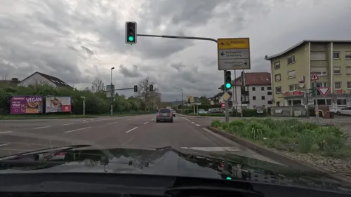
Amore
Restaurant · Italian · 1.0 km
102 Uhlandstraße, Mühlacker
Mo-Fr 11:00-14:00,16:30-22:45, Sa,Su,PH 11:00-22:45
Bonita's
Restaurant · Filipino · 2.1 km
78 Kanalstraße, Mühlacker
Mo 11:30-14:00, We-Fr 11:30-14:00, We-Fr 17:00-21:00,...
Da Joe
Restaurant · Italian, Pizza, Italian Pizza · 0.7 km
72 Hindenburgstraße, Mühlacker
Mo-Fr 11:30-14:00, 18:00-22:00; Sa 17:00-22:00; Su,PH 11:30-14:00,...
EssEnz
Restaurant · German
5 Philipp-Bauer-Weg, Mühlacker
Tu 11:30-14:00; We,Fr 11:30-22:00; Th 11:30-14:00,17:00-22:00; Sa...
Gasthaus Krone
Restaurant · Swabian, Hungarian · 6.0 km
1 Kronengässle, Vaihingen an der Enz
Th-Sa 17:00-21:00;Su 12:00-20:00
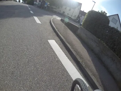
Gasthaus zur Rose
Restaurant · Greek · 4.4 km
16 Pforzheimer Straße, Ötisheim
We-Sa 11:00-14:00,17:00-24:00; Su 11:00-20:00
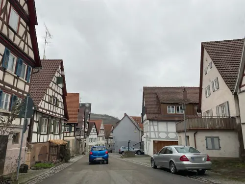
Hotel Restaurant Lamm
Restaurant · Regional · 6.0 km
4 Rathausstraße, Vaihingen an der Enz
Th 18:00-22:00; Fr,Sa 18:00-23:00
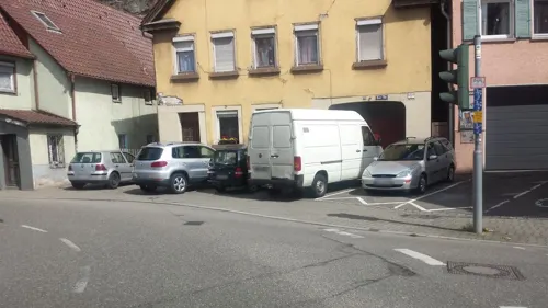


La Grotta Ristorante
Restaurant · Pizza, Italian · 0.9 km
2 Löffelstelzweg, Mühlacker
We-Su 18:00+; Mo,Tu off
118 more on the map.
History
The area of Mühlacker was inhabited by agricultural settlers since the Neolithic era. These included the Celts during the Bronze and Iron Age, as well as the Romans and Alemanni during ancient Rome.
The first named settlement in the area was Dürrmenz, spelled as Turmenz and dated to 779 in the Lorsch codex. Mühlacker was recorded as a hamlet in 1292.
By 1482, the ruling, impoverished Lords of Dürrmenz had sold all of their property to the Maulbronn Monastery. When the monastery went to Ulrich, Duke of Württemberg in 1504, Dürrmenz and its hamlets, including Mühlacker, were made part of the Duchy of Württemberg.
From the History section of Mühlacker on Wikipedia, under CC BY-SA 4.0.
Where to stay8
Best Western Queens Hotel Pforzheim-Niefern
Motel and hotel · 6.0 km
52 Pforzheimer Straße, Niefern-Öschelbronn
Churches and places of worship38
Wehrkirche Dürrn
Church · Protestant · 6.1 km
46 Hauptstraße, Ölbronn-Dürrn
Martinskirche
Church · Lutheran · 6.0 km
15 Sankt-Martin-Straße, Vaihingen an der Enz
Peterskirche
Church · Protestant · 2.7 km
4 Kirchbergstraße, Mühlacker
Peterskirche
Church · Protestant · 3.7 km
12 Kirchenburggasse, Mühlacker
Stephanuskirche
Church · Protestant · 6.3 km
6 Zwingerhof, Kieselbronn
Shopping34
Gas and EV charging11
Schools, colleges and libraries28
Healthcare16
Linden-Apotheke
Clinic and pharmacy · 4.9 km
323 Hauptstraße, Niefern-Öschelbronn
Map of Mühlacker
250 places. The map loads OpenStreetMap tiles when you open it.
Getting there and nearby towns
Manfred Rommel Airport Stuttgart (STR) is the nearest airport with scheduled flights listed in OpenStreetMap, 40 km away.
- Vaihingen an der Enz 9 km east, about 9 min by car
- Pforzheim 12 km southwest, about 12 min by car
- Oberderdingen 13 km north, about 13 min by car
- Rutesheim 17 km southeast, about 17 min by car
- Schwieberdingen 19 km southeast, about 19 min by car
- Tamm 21 km east, about 21 min by car
- Renningen 21 km south, about 21 min by car
- Weil der Stadt 22 km south, about 22 min by car
- Stuttgart 31 km southeast, about 31 min by car
- Karlsruhe 32 km west, about 32 min by car
Drive times are estimates from straight-line distance, not routes.
Local news
Headlines from INDB.
Reviews, tips and questions
Loading what members have shared...
Sources and licences
- GeoNames (CC BY 4.0): population, coordinates, regions and time zone
- Mapillary (see each image): photos
- OpenStreetMap contributors (ODbL 1.0): places, airports, map data
- Wikidata (CC0 1.0): elevation, founding date, time zone, website, landmarks and historic places
- Wikimedia Commons (see each image): photos
- Wikipedia (CC BY-SA 4.0): overview and history text
Photo credits
- Mühlacker - Pauluskirche - Westseite - 2005-07-22, SteveK, CC BY-SA 4.0
- Klosterstadt-Express (RB 72) auf Mühlacker Kurve, Luthermütze, CC BY-SA 4.0
- Mühlacker - Herz-Jesu-Kirche - Ostseite - 2005-07-22, SteveK, CC BY-SA 4.0
- Kloster Maulbronn 2009, Elke Wetzig ( Elya ), CC BY-SA 3.0
- Kirche Dürrn, Gunther Seibold, CC BY-SA 3.0 de
- Klosterfront maulbronn, Laurids at de.wikipedia, CC BY-SA 3.0
- Maulbronn KlosterBaeckerei, Joachim Köhler, CC BY-SA 3.0
- Burg Löffelstelz, Dr. Eugen Lehle, CC BY-SA 3.0
- Nijmegen-stauferstele, Geak, CC BY-SA 4.0
- 20140526 NSG-Nr 2-096 Enztal Niefern-Mühlackerl 016, Fröhlich!a, CC BY-SA 3.0
- P1090678 Roßweiher Bli-v-SW-Ufer-Ri-NO 03, ManyRocks, CC BY-SA 4.0
- NSG Enzaue bei Roßwag und Burghalde 2, Lhorn, CC BY-SA 4.0
- 2016-10-29 Roßwag 03, Yeerge, CC BY 4.0
- Tree in early spring, Moritz Speidel, CC BY-SA 4.0
- 2016-10-29 Roßwag 06, Yeerge, CC BY 4.0
- Michaelskirche Ötisheim, Gunther Seibold, CC BY-SA 3.0 de
- Kaffeemuehlenmuseum Wiernsheim26032020 1, Zonk43, CC BY-SA 3.0
- Mühlhausen (Enztal) - Albanikirche Süd West, Moleskine, CC BY-SA 4.0
- Rosswag Kirche 2, E-W, CC BY-SA 4.0
- Peterskirche (Lienzingen) Süd, Moleskine, CC BY-SA 4.0
- Kirche Lomersheim, Gunther Seibold, CC BY-SA 3.0 de
- Illingen - Cyriakuskirche - Ansicht vom Posthof - 2020-04-17, SteveK, CC BY-SA 4.0
- Kieselbronn-Ansicht von Norden mit Kirche über Kirchhofmauer und ehemaligem Zwingervorfeld-010309, Robert Pietschmann, CC BY-SA 4.0
- Grundschule Roßwag 03, PB3322, CC BY-SA 4.0
- Ötisheim Schönenberg - Waldensermuseum - panoramio, Augenstein, CC BY-SA 3.0
- Ötisheim - Schönenberger Straße 13 - Giebel - 2020-07-18, SteveK, CC BY-SA 4.0
- Ötisheim - Auferstehungskirche - 2020-07-26, SteveK, CC BY-SA 4.0
- Niederhaus-stauferstele-1048px, Geak ( Diskussion ), Public domain
- Stolperstein Toni Simon Muehlacker 2019-02-17, rolf_acker, CC BY-SA 4.0
- Stolperstein Mathilda Anna Hettler Muehlacker 2019-02-17, rolf_acker, CC BY-SA 4.0
- Stolperstein Margarete Rosemarie Hettler Muehlacker 2019-02-17, rolf_acker, CC BY-SA 4.0
- Stolperstein Ludwig Karl Hettler Muehlacker 2019-02-17, rolf_acker, CC BY-SA 4.0
- Stolperstein Theodor Louis Hettler Muehlacker 2019-02-17, rolf_acker, CC BY-SA 4.0
- Stolperstein Friedrich Theodor Hettler Muehlacker 2019-02-17, rolf_acker, CC BY-SA 4.0
- Stolperstein Anneliese Hettler Muehlacker 2019-02-17, rolf_acker, CC BY-SA 4.0
- Vacuum Cleaner - panoramio, Dg-505, CC BY 3.0
- Umtragen - panoramio, Dg-505, CC BY 3.0
- Keine ofas - panoramio, Dg-505, CC BY 3.0
- Weg entlang der Enz - panoramio, Augenstein, CC BY-SA 3.0
- Pauluskirche Muhlacker19032020, Zonk43, CC BY-SA 3.0
- Grenzstein Burgberg (Illingen, Schützingen) Nr 133 Nr 95 Seite 1, 2022-10-08, Fyrtaarn, CC BY-SA 3.0
- Street-level photo, changchun1, CC BY-SA 4.0
- Street-level photo, pic_nick, CC BY-SA 4.0
- Street-level photo, mfa, CC BY-SA 4.0
- Street-level photo, bct, CC BY-SA 4.0
- Street-level photo, wegavision, CC BY-SA 4.0
- Street-level photo, bct, CC BY-SA 4.0
- Street-level photo, rausk, CC BY-SA 4.0
- Street-level photo, gaw42, CC BY-SA 4.0
- Street-level photo, gaw42, CC BY-SA 4.0
- Street-level photo, mfa, CC BY-SA 4.0
- Street-level photo, schokiss, CC BY-SA 4.0
- Street-level photo, changchun1, CC BY-SA 4.0
- Street-level photo, mfa, CC BY-SA 4.0
- Street-level photo, mfa, CC BY-SA 4.0
- Street-level photo, mfa, CC BY-SA 4.0
- Street-level photo, changchun1, CC BY-SA 4.0
- Street-level photo, rausk, CC BY-SA 4.0
- Street-level photo, changchun1, CC BY-SA 4.0
- Street-level photo, changchun1, CC BY-SA 4.0
- Street-level photo, electria, CC BY-SA 4.0
- Street-level photo, electria, CC BY-SA 4.0
- Street-level photo, wegavision, CC BY-SA 4.0
- Street-level photo, clemdoc, CC BY-SA 4.0
- Street-level photo, meridianeum, CC BY-SA 4.0
- Street-level photo, rausk, CC BY-SA 4.0
- Street-level photo, electria, CC BY-SA 4.0
- Street-level photo, mfa, CC BY-SA 4.0
- Street-level photo, mfa, CC BY-SA 4.0
- Street-level photo, wegavision, CC BY-SA 4.0


Page built November 8, 2026. Spotted a mistake? Tell us or suggest a place.