


Why visit Brilon
Townapedia lists 140 museums and landmarks, 113 parks and trails, 88 places to eat, 31 places to stay and 87 attractions in and around town.
Highlights include Cineplex Brilon, Hochheideturm, Museum Haus Hövener and Phillipsstollen - Briloner Eisenberg.
Weather in Brilon
Forecast from MET Norway (CC BY 4.0). Full forecast
About Brilon
Brilon (German pronunciation: [ˈbʁiːlɔn] ; Westphalian: Brailen) is a town in North Rhine-Westphalia, Germany, which belongs to the Hochsauerlandkreis.
From the Wikipedia article Brilon (this version), under CC BY-SA 4.0.
Things to do87

Cineplex Brilon
Cinema and theater · 1.7 km
62 Keffelker Straße, Brilon
Mo-Fr 16:00-21:00; Sa-Su 14:00-21:00; Dec 24,31 off

Hochheideturm
Monument and historic site · 13.1 km
Observation tower on Ettelsberg mountain



75 more on the map.
Museums and landmarks140




128 more on the map.
Parks, trails and playgrounds113




101 more on the map.
Restaurants and cafes88


Hiebammen Hütte
Restaurant · Regional · 3.1 km
2 Hilbringse, Brilon
Th 17:00-18:00+; Fr 12:00-18:00+; Sa 12:00-18:00+; PH,Su...
zur Post
Restaurant · German · 7.3 km
1 Markt, Olsberg
Tu-Th 11:30-15:00,17:30-22:00; Fr 11:30-15:00,17:30-24:00; Sa...
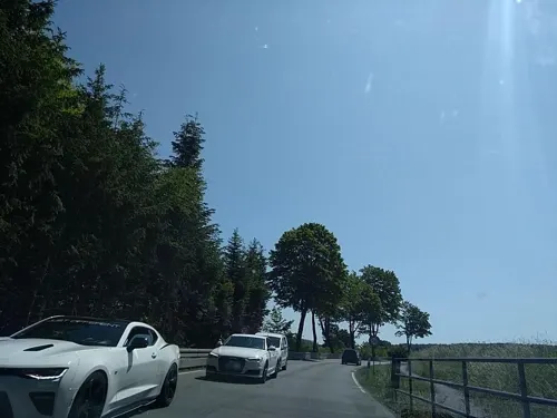
Forsthaus Waldsee
Restaurant · 2.9 km
2 Am Waldsee, Brilon
We-Th 15:00-23:00, Fr-Su 11:30-23:00, Mo-Tu off
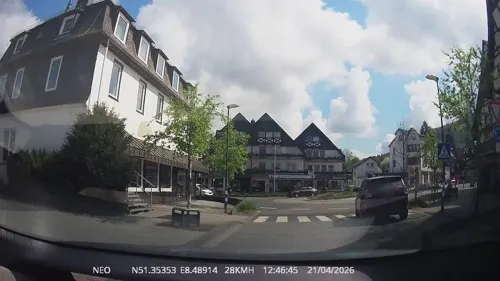
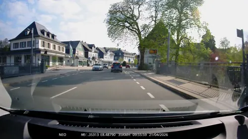
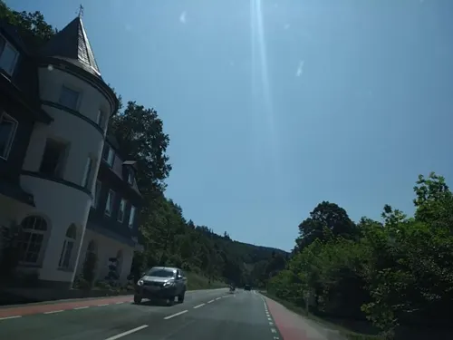
Herzstück
Restaurant · International · 6.5 km
76 Korbacher Straße, Brilon
Mo-Tu 07:00-10:30; PH Mo-Tu 08:00-10:30; We,Th...
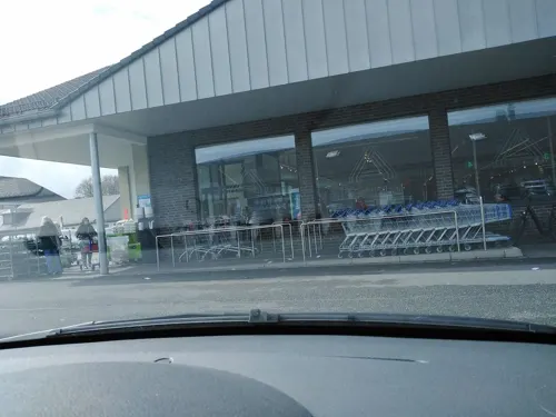
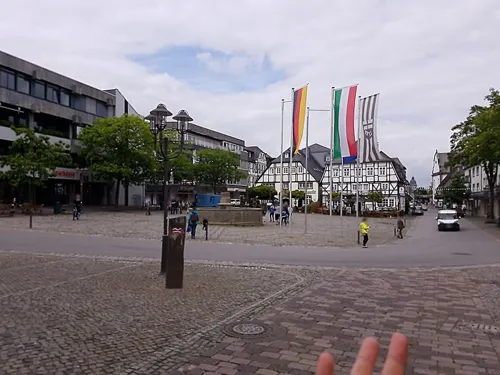
Pizzeria Nido
Restaurant · Italian, Pizza
Su-Tu,Th 11:30-14:00,17:30-23:00; Fr,Sa 11:30-14:00,17:30-24:00
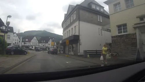


76 more on the map.
History
The first documentary reference occurs in a deed of the Emperor Otto II dated 973, confirming to the Cathedral of Magdeburg all those possessions in Westphalia given to it by his father, including the Villa Brilon. This reference must of course apply to a considerably older settlement than the present town, presumably what is now Altenbrilon. The Brilon estate passed later by exchange to the Archbishops of Paderborn, who endowed their steward ("Vogt") with it.
In about 1220 Engelbert I of Cologne, Archbishop of Cologne, acquired the Brilon lands of the brothers Hermann and Gernand of Brilon. The Archbishop laid out a fortified town and gave it municipal rights. Bloody conflicts followed between the Archbishops of Cologne and the Bishops of Paderborn over the rights of possession of the place. These ended when the Bishop of Paderborn, after being taken prisoner, waived his rights to Brilon (1256).
Thereafter Brilon developed under the rulership of the Prince-Bishops of Cologne into a thriving town of c 3,000 inhabitants with an active trading and mining life and far-reaching business connections. As a trading town Brilon was also a member of the Hansa. In 1350 Brilon had between 500 and 600 houses. At this time Brilon held the position of the second city of Westphalia behind Soest. After the secession of Soest in 1444 Brilon was elevated to being the capital of Westphalia.
From the History section of Brilon on Wikipedia, under CC BY-SA 4.0.
Where to stay31
Churches and places of worship39
Shopping34
Gas and EV charging10
Schools, colleges and libraries21
Berufskolleg für Wirtschaft und Verwaltung Brilon - Europaschule
School · 1.3 km
30 Zur Jakobuslinde, Brilon
Gemeinschaftsgrundschule "Am Hagen"
School · 5.4 km
23a Heinrich-Jansen-Straße, Brilon
Healthcare11
Map of Brilon
250 places. The map loads OpenStreetMap tiles when you open it.
Getting there and nearby towns
Airport Paderborn/Lippstadt (PAD) is the nearest airport with scheduled flights listed in OpenStreetMap, 25 km away.
- Olsberg 7 km southwest, about 7 min by car
- Rüthen 14 km northwest, about 14 min by car
- Warstein 16 km west, about 16 min by car
- Bad Wünnenberg 17 km northeast, about 17 min by car
- Büren 17 km north, about 17 min by car
- Meschede 21 km west, about 21 min by car
- Marsberg 21 km east, about 21 min by car
- Winterberg 23 km south, about 23 min by car
- Korbach 25 km southeast, about 25 min by car
- Geseke 28 km north, about 28 min by car
Drive times are estimates from straight-line distance, not routes.
Local news
Headlines from INDB.
Reviews, tips and questions
Loading what members have shared...
Sources and licences
- GeoNames (CC BY 4.0): population, coordinates, regions and time zone
- Mapillary (see each image): photos
- OpenStreetMap contributors (ODbL 1.0): places, airports, map data
- Wikidata (CC0 1.0): elevation, founding date, time zone, website, landmarks and historic places
- Wikimedia Commons (see each image): photos
- Wikipedia (CC BY-SA 4.0): overview and history text
Photo credits
- Brilon Sauerland-Ost 317, Michael Kramer, CC BY-SA 3.0
- Brilon-Königstraße 26-2011-08-07, SteveK, CC BY-SA 3.0
- Brilon-Niedere Straße 34-2010-01-17, SteveK, CC BY-SA 3.0
- Brilon - Niedere Straße 29-31 - Nordgiebel - 2011-08-07, SteveK, CC BY-SA 4.0
- Brilon-Niedere Straße 31-2012-10-20, Malchen53, CC BY-SA 3.0
- Brilon - Niedere Straße 29-31 - Nordseite - 2011-08-07, SteveK, CC BY-SA 4.0
- Königstraße 33, 1, Brilon, Hochsauerlandkreis, GeorgDerReisende, CC BY-SA 4.0
- Königstraße 30, 1, Brilon, Hochsauerlandkreis, GeorgDerReisende, CC BY-SA 4.0
- Stolpersteinlage, 2, Königstraße 33, Brilon, Hochsauerlandkreis, GeorgDerReisende, CC BY-SA 4.0
- Stolperstein Paula Lorig, 1, Königstraße 33, Brilon, Hochsauerlandkreis, GeorgDerReisende, CC BY-SA 4.0
- Stolperstein Sophia Willon, 1, Königstraße 33, Brilon, Hochsauerlandkreis, GeorgDerReisende, CC BY-SA 4.0
- Stolperstein Carl Lorig, 1, Königstraße 33, Brilon, Hochsauerlandkreis, GeorgDerReisende, CC BY-SA 4.0
- Stolpersteinlage, 1, Königstraße 33, Brilon, Hochsauerlandkreis, GeorgDerReisende, CC BY-SA 4.0
- Stolperstein Auguste Goldschmidt, 1, Königstraße 28-30, Brilon, Hochsauerlandkreis, GeorgDerReisende, CC BY-SA 4.0
- Stolperstein Berta Goldschmidt, 1, Königstraße 28-30, Brilon, Hochsauerlandkreis, GeorgDerReisende, CC BY-SA 4.0
- Stolperstein Israel Goldschmidt, 1, Königstraße 28-30, Brilon, Hochsauerlandkreis, GeorgDerReisende, CC BY-SA 4.0
- Stolperstein Albert Goldschmidt, 1, Königstraße 28-30, Brilon, Hochsauerlandkreis, GeorgDerReisende, CC BY-SA 4.0
- Stolperstein Siegfried Goldschmidt, 1, Königstraße 28-30, Brilon, Hochsauerlandkreis, GeorgDerReisende, CC BY-SA 4.0
- Stolperstein Johanna Eichenwald, 1, Königstraße 28-30, Brilon, Hochsauerlandkreis, GeorgDerReisende, CC BY-SA 4.0
- Stolpersteinlage, 1, Königstraße 28-30, Brilon, Hochsauerlandkreis, GeorgDerReisende, CC BY-SA 4.0
- Stolpersteinlage, 2, Königstraße 28-30, Brilon, Hochsauerlandkreis, GeorgDerReisende, CC BY-SA 4.0
- Königstraße 28, 1, Brilon, Hochsauerlandkreis, GeorgDerReisende, CC BY-SA 4.0
- Ein Esel in Brilon, © 1971markus (☠): ⇒ Laberkasten ..., CC BY-SA 3.0 de
- Brilon - Niedere Straße 17 - Nordtraufe - 2011-08-07, SteveK, CC BY-SA 4.0
- Brilon-Bahnhofstraße 26-2012-10-20, Malchen53, CC BY-SA 3.0
- Brilon - Königstraße 13 - 2011-08-07, SteveK, CC BY-SA 3.0
- 59929 Brilon, Germany - panoramio (3), Ben Bender, CC BY-SA 3.0
- Bahnhofstraße 15, 1, Brilon, Hochsauerlandkreis, GeorgDerReisende, CC BY-SA 4.0
- Brilon - Niedere Straße 16 - Südgiebel - 2011-08-07, SteveK, CC BY-SA 4.0
- Bahnhofstraße 15d, 2, Brilon, Hochsauerlandkreis, GeorgDerReisende, CC BY-SA 4.0
- Brilon Kreuziger Mauer, Gmbo 2013, CC0
- Brilon - Mädchen auf Stein, Dat doris, CC BY 4.0
- Brilon - Niedere Straße 14 - Südgiebel - 2011-08-07, SteveK, CC BY-SA 4.0
- Stolpersteine Brilon, Bahnhofstraße 19 - 2025-04-18, SteveK, CC BY-SA 4.0
- Stolperstein Walter Buchdahl, Bahnhofstraße 19, Brilon, Hochsauerlandkreis - 2025-04-18, SteveK, CC BY-SA 4.0
- Stolperstein Aron Buchdahl, Bahnhofstraße 19, Brilon, Hochsauerlandkreis - 2025-04-18, SteveK, CC BY-SA 4.0
- Stolperstein Sofia Buchdahl, Bahnhofstraße 19, Brilon, Hochsauerlandkreis - 2025-04-18, SteveK, CC BY-SA 4.0
- Stolperstein Dorothea Buchdahl, Bahnhofstraße 19, Brilon, Hochsauerlandkreis - 2025-04-18, SteveK, CC BY-SA 4.0
- Stolperstein Paula Buchdahl, Bahnhofstraße 19, Brilon, Hochsauerlandkreis - 2025-04-18, SteveK, CC BY-SA 4.0
- Stolperstein Luise Buchdahl, Bahnhofstraße 19, Brilon, Hochsauerlandkreis - 2025-04-18, SteveK, CC BY-SA 4.0
- Willingen 2011-07, Hochheideturm CN-04-1, Willingen_2011-07,_Hochheideturm_CN-04.jpg : [[User:Carschten| Carschten ]] Willingen_2011-07,_Hochheideturm_CN-04-2.jpg : * Willingen_2011-07,_Hochheideturm_CN-04.jpg : [[User:Carschten| Carschten..., CC BY-SA 3.0
- Sauerlandpano Olsberg-Bigge (Elop), Elop, CC BY-SA 3.0
- Brilon, Derker Tor, 2012-05 CN-01, kaʁstn Disk / Cat, CC BY-SA 3.0 de
- Brilon, Nehden, Kapelle St. Johannes, Eingangsansicht, Siegfried von Brilon, CC BY-SA 3.0
- Gudenhagen- Petersborn Ansicht von der Gemeindewiese 2, Malchen53, CC BY 3.0
- Brilon-Evangelische Stadtkirche 2007-04-29, SteveK, CC BY-SA 4.0
- Brilon-Haus Sauvigny-2006-06-25, SteveK, CC BY 2.5
- Altenbrilon-Hubertuskapelle, Altar 2-2011-07-11, AlterWolf49, CC BY-SA 3.0
- Brilon, Wülfte St. Anna Gesamtansicht 3, Malchen53, CC BY-SA 3.0
- Ginsterkopf, Dampftrain, CC BY-SA 4.0
- Alme-Haus Tinne-2009-04-26, SteveK, CC BY-SA 3.0
- Brilon, Haus Hövener for GLAM October 2014 in Germany, Michael Kramer, CC BY-SA 3.0
- Altenbüren Kirche, SteveK, CC BY 3.0
- Brilon, Propsteikirche von der Derkeren Straße aus 1, Malchen53, CC BY-SA 3.0
- Brilon-Petrusbrunnen, SteveK, CC BY-SA 3.0
- Schloss Antfeld Innenhof, Wolfgang Poguntke, CC BY 3.0
- Brilon-St.-Vitus-Kirche-2, Brilon-St.-Vitus-Kirche.jpg : SteveK derivative work: Rabanus Flavus ( talk ), CC BY-SA 3.0
- Schaaken-NRW-Stiftung-Briloner-Kalkkuppen-22.10.2004-2-WS, Werner Schubert, CC BY-SA 4.0
- Briloner Eisenberg - Philipp-Stollen - Mundloch, Simplicius, CC BY-SA 3.0
- Brilon - Aamühle 6 - Nepomukskulptur - 2020-08-08 1, SteveK, CC BY-SA 4.0
- NSG Feldberg (Brilon, HSK-512), Martin Lindner, CC BY 3.0
- Brilon, NSG Bilstein, HSK-237 (5), Malchen53, CC BY-SA 4.0
- Brilon - NSG Blumenstein - 2, Ath, CC0
- Brilon, NSG Drübel, HSK-003 (5), Malchen53, CC BY-SA 3.0
- Naturschutzgebiet Gretenberg 1, Martin Lindner, CC BY-SA 3.0
- Hansenberg, Martin Lindner, CC BY-SA 3.0
- Brilon-Propst-Meyer-Straße 3-2012-10-19, Malchen53, CC BY-SA 3.0
- Brilon gymnasium petrinum jetzt, Martin Herbst, CC BY-SA 3.0
- Aerial image of the Brilon-Hochsauerland airfield, Carsten Steger, CC BY-SA 4.0
- Pinge Eisenberg, Martin Lindner, CC BY-SA 3.0
- Kirche St. Martin Bigge, Wolfgang Poguntke, CC BY-SA 3.0
- Brilon-Scharfenberg Sonder Sauerland-Ost 315, Michael Kramer, CC BY-SA 3.0
- Brilon, Essigturm, 2012-05 CN-01, kaʁstn Disk / Cat, CC BY-SA 3.0 de
- Brilon, Bahnhof Brilon Stadt, Malchen53, CC BY-SA 3.0
- Bushaltestelle Aqua Olsberg, 1, Olsberg, Hochsauerlandkreis, GeorgDerReisende, CC BY-SA 4.0
- Street-level photo, ghyze, CC BY-SA 4.0
- Street-level photo, rolsch, CC BY-SA 4.0
- Street-level photo, poxonline, CC BY-SA 4.0
- Street-level photo, grauchen1964, CC BY-SA 4.0
- Street-level photo, thetornado76, CC BY-SA 4.0
- Street-level photo, thetornado76, CC BY-SA 4.0
- Street-level photo, TechniPorter, CC BY-SA 4.0
- Street-level photo, TechniPorter, CC BY-SA 4.0
- Street-level photo, Schmarvis, CC BY-SA 4.0
- Street-level photo, thetornado76, CC BY-SA 4.0
- Street-level photo, commodoortje, CC BY-SA 4.0


Page built November 8, 2026. Spotted a mistake? Tell us or suggest a place.