


Why visit Rüthen
Townapedia lists 231 museums and landmarks, 51 parks and trails, 80 places to eat, 17 places to stay and 63 attractions in and around town.
Highlights include Gut Körtlinghausen, Hof Jaeger - Hofladen am Pöppelschetal, Station Nr. 38 des Preußischen optischen Telegrafen and Station Nr. 39 des Preußischen optischen Telegrafen.
Weather in Rüthen
Forecast from MET Norway (CC BY 4.0). Full forecast
About Rüthen
Rüthen (German pronunciation: [ˈʁyːtn̩] ) is a town in the district of Soest, in North Rhine-Westphalia, Germany.
From the Wikipedia article Rüthen (this version), under CC BY-SA 4.0.
Things to do63

Hof Maas
Farm and orchard · 8.5 km
25 Hauptstraße, Rüthen
"nach telefonischer Vereinbarung"

51 more on the map.
Museums and landmarks231

Station Nr. 38 des Preußischen optischen Telegrafen
Monument and historic site · 3.5 km
Station Nr. 38 des preußischen optischen Telegrafen Berlin-Köln-Koblenz (1832 - 1849): „Am Telegrafen“ Rüthen-Kneblinghausen
Station Nr. 39 des Preußischen optischen Telegrafen
Monument and historic site · 8.1 km
Station Nr. 39 des preußischen optischen Telegrafen Berlin-Köln-Koblenz (1832 - 1849): „Lange Hecke“ Anröchte-Uelden




Gedenkstein
Monument and historic site · 9.4 km
Gelände der Warsteiner Brauerei Haus Cramer KG

Pfarrhaus
Monument and historic site · 2.0 km
9 Stefanusstraße, Rüthen

Schloß Körtlinghausen
Monument and historic site · 3.7 km
5 Körtlinghausen, Rüthen

Städt. Museum Haus Kupferhammer
Museum · 7.1 km
9 Belecker Landstraße, Warstein
219 more on the map.
Parks, trails and playgrounds51





39 more on the map.
Restaurants and cafes80

Haus Welschenbeck
Bar and pub · 7.8 km
30 Mülheimer Straße, Warstein
We,Th 11:00-18:00; Fr-Su 09:00-18:00
HenrichS
Restaurant · Regional, Coffee Shop, Ice Cream, German, Breakfast, Cake, Tea, Salad, Fries, Brunch, Waffeln, Windbeutel · 1.3 km
1 Bibertal, Rüthen
Fr,Sa 14:30-21:00; PH,Su 12:00-18:00
Romantik Landhotel Knippschild
Restaurant · German · 4.4 km
1 Theodor-Ernst-Straße, Rüthen
Mo-Su,PH 11:30-13:30,17:30-21:00
Hotel Gasthof Hoppe
Restaurant · German · 7.0 km
62 Lanfer, Warstein
Tu-Sa 16:00-24:00; Su 12:15-14:15,17:00-24:00
Pizzeria Mühlenstube
Restaurant · Italian · 6.9 km
10 Bahnhofstraße, Warstein
Mo,Tu,We,Fr,Sa,Su 10:00-14:00,17:00-23:00; Th off
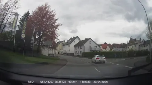
Pizzeria Trattoria Gargano
Restaurant · Italian · 8.0 km
7 Domring, Warstein
Tu-Sa 11:00-14:30,17:00-23:00; Su 11:00-22:00; Mo off
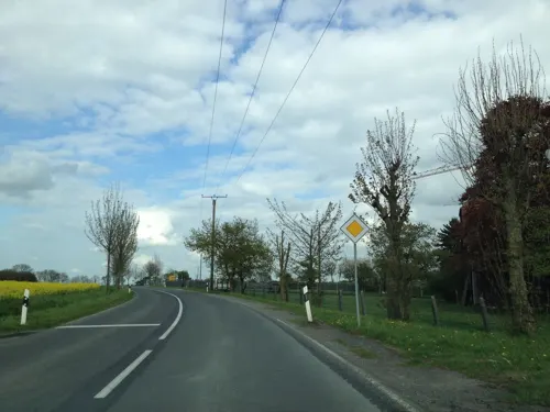
Uelder Bahnhof
Restaurant · German · 8.3 km
8 Effelner Straße, Anröchte
Tu-Fr 16:00-23:30, Sa 15:00-23:30, Su 11:30-22:00

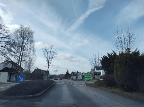
Bauernstübchen
Restaurant · 9.8 km
45 Erlenweg, Warstein
Tu-Fr 11:30-14:30, 17:00+; Sa 17:00+; Su 11:30+
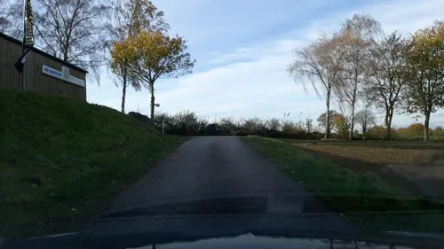


Café Buuck
Cafe
1 Niedere Straße, Rüthen
Th, Sa 14:00-18:00; Fr 09:00-11:30, 14:00-22:00; Su 13:00-18:00

Gasthof Knickenberg
Restaurant
14 Hachtorstraße, Rüthen
Mo-Tu, Fr 16:00-00:00; Sa-Su 10:00-13:00, 16:00-00:00
68 more on the map.
History
The city of Rüthen was first mentioned in a document of the Kloster Grafschaft (abbey earldom) in 1072. The area around Rüthen already belonged to the Erzbistum Köln (archbishopric Cologne) in the High Middle Ages. On 29 September 1200 Rüthen was given town law by the sovereign, the archbishop of Cologne Adolf I. von Altena. Starting in 1375 Rüthen belonged to the Hanse, an economic alliance of trading cities and their guilds that dominated trade along the coast of Northern Europe in the later Middle Ages. The merchants of the city had far reaching business connections and because of that were able to ensure wealth. In the following centuries, however, the importance of Rüthen decreased massively.
Like many other cities in the duchy of Westfalen, Rüthen held witch trials. From 1573 to 1660, 104 people were tried as witches and wizards, at least 79 being sentenced to death. Freund Happen, who had been accused of being a sorcerer, was discharged after two months of torture on 23 September 1660.
From the History section of Rüthen on Wikipedia, under CC BY-SA 4.0.
Where to stay17
Churches and places of worship51
Pfarrkirche St. Johannes Baptist
Church · Roman Catholic · 8.0 km
2 Am Schulplatz, Rüthen
St. Antonius Einsiedler
Church · Roman Catholic · 8.5 km
9 Antoniusstraße, Rüthen
Shopping22
Gas and EV charging13
Schools, colleges and libraries15
Healthcare8
LWL-Klinik Warstein für Psychiatrie, Psychotherapie und Psychosomatik
Clinic and pharmacy · 6.5 km
Map of Rüthen
250 places. The map loads OpenStreetMap tiles when you open it.
Getting there and nearby towns
Airport Paderborn/Lippstadt (PAD) is the nearest airport with scheduled flights listed in OpenStreetMap, 19 km away.
- Warstein 8 km southwest, about 8 min by car
- Bad Wünnenberg 19 km east, about 19 min by car
- Soest 25 km northwest, about 25 min by car
- Paderborn 34 km northeast, about 34 min by car
- Winterberg 34 km south, about 34 min by car
- Werl 37 km west, about 37 min by car
- Korbach 39 km southeast, about 39 min by car
- Schmallenberg 39 km south, about 39 min by car
- Wickede 39 km west, about 39 min by car
- Hamm 47 km northwest, about 47 min by car
Drive times are estimates from straight-line distance, not routes.
Local news
Headlines from INDB.
Reviews, tips and questions
Loading what members have shared...
Sources and licences
- GeoNames (CC BY 4.0): population, coordinates, regions and time zone
- Mapillary (see each image): photos
- OpenStreetMap contributors (ODbL 1.0): places, airports, map data
- Wikidata (CC0 1.0): elevation, founding date, time zone, website
- Wikimedia Commons (see each image): photos
- Wikipedia (CC BY-SA 4.0): overview and history text
Photo credits
- Rüthen mit Stadtmauer FFSN-1081, Michael Kramer, CC BY-SA 3.0
- Altes Rathaus in Rüthen 2012, Stefan Didam - Schmallenberg, CC BY-SA 3.0
- Preussischer optischer Telegraf, Lencer, CC BY-SA 2.5
- Ringelstein1, Marco Bollheimer (Marcobolli), CC BY-SA 3.0
- Hachtor in Rüthen, Stefan Didam - Schmallenberg, CC BY-SA 3.0
- St.-Johannes-Baptist-Kirche, Rüthen, Dominik Schäfer, CC BY-SA 3.0 de
- Haus Welschenbeck01, THWZ, CC BY-SA 3.0
- Aerial image of Schloss Körtlinghausen (view from the south), Carsten Steger, CC BY-SA 4.0
- St.-Georg-Kapelle, Westereiden, Dominik Schäfer, CC BY-SA 3.0 de
- Hexenturm Rüthen, Xqwtzs, CC BY 3.0
- Berge - St. Michael - 1, Ath, CC0
- Suttrop - LWL-Klinik Warstein - Haus 01, Ath, CC0
- St.-Johannes-Baptist-Kirche, Langenstraße, Dominik Schäfer, CC BY-SA 3.0 de
- Rüthen - St. Nikolaus - 1, Ath, CC0
- HeiligKreuzKirche, Arne Hückelheim, CC BY-SA 3.0
- Rüthen - NSG Hengelsbach - 1, Ath, CC0
- Rüthen - NSG Aschenhütte und Bachsystem der Romecke - 5, Ath, CC0
- Friedrich-Spee-Gymnasium Rüthen, Arcantor76, CC BY-SA 4.0
- Oestereiden - St. Antonius - 1, Ath, CC0
- Weiner Kirche, THWler 33142, CC BY-SA 3.0
- Naturschutzgebiet Piusberg 5, Falkmart, CC BY-SA 4.0
- Rüthen - NSG Aschenhütte und Bachsystem der Romecke - 6, Ath, CC0
- Naturschutzgebiet Brüche-1, Martin Lindner, CC BY-SA 4.0
- Brilon-Naturschutzgebiet-Brummerhagen-(Süd)-HSK-494, .gs8 ( talk ), CC BY-SA 3.0
- Warstein - NSG Drewer Steinbrüche - 01, Ath, CC0
- Brilon - NSG Eselsbruch, Harlebachsystem 09, Ath, CC0
- Hengelsbach, Ath, CC0
- StuetingsMuehle 1, THWZ, CC BY 3.0
- Haus Welschenbeck S, THWZ, CC BY-SA 3.0
- Stamps of Germany (Berlin) 1983, MiNr 693, Unknown author, Public domain
- Warstein LWL-Klinik FFSN-3599, Petra Klawikowski, CC BY-SA 3.0
- Haus Kupferhammer 2009, Stefan Didam - Schmallenberg, CC BY-SA 3.0
- Altenrüthen - Pfarrhaus - 2, Ath, CC0
- Naturschutzgebiet Brüche-3, Martin Lindner, CC BY 3.0
- Blick ins NSG, Nora Franz, CC BY-SA 4.0
- Warstein Steinbruch am Hillenberg FFSN-3638, Petra Klawikowski, CC BY-SA 3.0
- Street-level photo, baldur80, CC BY-SA 4.0
- Street-level photo, chuck, CC BY-SA 4.0
- Street-level photo, nicolaus1977, CC BY-SA 4.0
- Street-level photo, baldur80, CC BY-SA 4.0
- Street-level photo, TechniPorter, CC BY-SA 4.0
- Street-level photo, nicolaus1977, CC BY-SA 4.0
- Street-level photo, ghyze, CC BY-SA 4.0
- Street-level photo, thetornado76, CC BY-SA 4.0
- Street-level photo, nrailuj, CC BY-SA 4.0
- Street-level photo, Schmarvis, CC BY-SA 4.0
- Street-level photo, Lowiekse, CC BY-SA 4.0
- Street-level photo, Lowiekse, CC BY-SA 4.0
- Street-level photo, TechniPorter, CC BY-SA 4.0
- Street-level photo, thetornado76, CC BY-SA 4.0
- Street-level photo, Schmarvis, CC BY-SA 4.0
- Street-level photo, nrailuj, CC BY-SA 4.0
- Street-level photo, TechniPorter, CC BY-SA 4.0


Page built November 8, 2026. Spotted a mistake? Tell us or suggest a place.