


Winterberg, Germany
Winterberg is a town of 14,601 people in North Rhine-Westphalia, Germany.
Why visit Winterberg
Townapedia lists 130 museums and landmarks, 74 parks and trails, 116 places to eat, 89 places to stay and 109 attractions in and around town.
Highlights include Bollerbergturm, Hochheideturm, Kunstgalerie Stolte and LWL-Museum für Naturkunde Außenstelle Kahler Asten Winterberg.
Weather in Winterberg
Forecast from MET Norway (CC BY 4.0). Full forecast
About Winterberg
Winterberg (German pronunciation: [ˈvɪntɐˌbɛʁk] ; Westphalian: Winnenmerg) is a town in the Hochsauerland district of North Rhine-Westphalia, central Germany and a major winter sport resort of the Wintersport Arena Sauerland.
From the Wikipedia article Winterberg (this version), under CC BY-SA 4.0.
Travel tips from other travellers: Winterberg on Wikivoyage (CC BY-SA 4.0).
Things to do109

Bollerbergturm
Scenic view · 6.5 km
100 Bollerbergstraße, Hallenberg
24/7

Hochheideturm
Monument and historic site · 10.6 km
Observation tower on Ettelsberg mountain
Skiliftkarussell Winterberg
Ski area · 1.5 km
Ski resort in North Rhine-Westphalia, Germany




97 more on the map.
Museums and landmarks130

Kunstgalerie Stolte
Museum
Gezeigt und verkauft werden eigene Werke, sowie Werke aus Ausstellungen verbündeter Künstler/Innen. Termine auch nach Vereinbarung.
12 Hellenstraße, Winterberg
Th 14:00-18:00
LWL-Museum für Naturkunde Außenstelle Kahler Asten Winterberg
Museum · 3.5 km
1 Astenturm, Winterberg
PH,Mo-Su 10:30-19:00

LeBertIGo
Monument and historic site · 6.0 km
LEGO® Abenteuerland
Fr 13:00-19:00; Sa, Su, PH 10:00-19:00||school_holidays: Tu-Su 10:00-19:00

Pferdefuhrhalterei Tenne-Stall
Monument and historic site · 1.7 km
118 more on the map.
Parks, trails and playgrounds74



62 more on the map.
Restaurants and cafes116
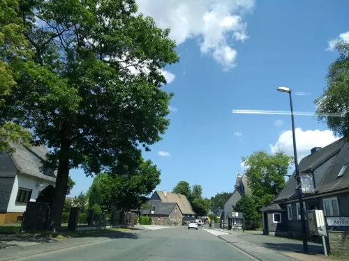
Astenblick
Cafe · Ice Cream, Coffee Shop, Cake · 5.8 km
11 Winterberger Straße, Medebach
Tu,Fr 10:00-18:00, Sa 06:45-13:00; Su,Mo,We,Th off

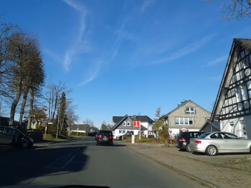
Landhotel-Gasthof Zur Post
Restaurant · Regional · 6.6 km
20 Bundesstraße, Winterberg
Mo-Su 12:00-14:00, 18:00-20:00; We closed
Benny's Kartoffelkiste
Restaurant · German · 0.6 km
45 Am Waltenberg, Winterberg
Tu-Su 11:30-14:00,17:30-22:00; Mo off
Bistorant Uppu
Restaurant · German, Burger, Steak, Baguette, Ice Cream
19 Am Waltenberg, Winterberg
Tu-Su 09:00-22:00; Mo off

Bobhaus
Restaurant · 2.2 km
Gemütliche Skihütte mit super Aussicht, direkt an der Piste
1 Kappe, Winterberg
Mo-Su 10:00-18:00
Bracks Nudelhaus
Restaurant · Italian
5 Hellenstraße, Winterberg
Mo,Th 17:00-21:30; Fr,Sa 17:00-22:30; Su 13:00-20:30; Tu,We off

Da Salvatore
Restaurant · Italian · 0.7 km
12 Bahnhofstraße, Winterberg
We-Su 11:30-14:00, Tu-Su 17:30-23:00
Die Schanze
Restaurant · Bowls, Streetfood, Burger, Regional, Homemade, Waffle, Coffee, Cake · 1.3 km
100 Herrlohweg, Winterberg
Su-Th 11:00-18:00; Fr-Sa 11:00-21:00


104 more on the map.
Where to stay89
Churches and places of worship26
Kath. Kirche St. Luzia und Willibrord
Church · Roman Catholic · 5.4 km
58 Bergfreiheit, Winterberg
St. Johannes Baptist
Church · Roman Catholic · 4.8 km
14 Mollseifener Straße, Winterberg
St.Lambertus-Kirche
Church · Catholic · 4.5 km
3 Lambertusplatz, Winterberg
Shopping18
Gas and EV charging8
Schools, colleges and libraries4
Sportschule der Bundesweht, Ausbildungsstützpunkt Winterberg - Olympiastützpunkt Westfalen - Außenstelle Hochsauerland
School · 2.1 km
2 Kapperundweg, Winterberg
Healthcare3
Map of Winterberg
250 places. The map loads OpenStreetMap tiles when you open it.
Getting there and nearby towns
Airport Paderborn/Lippstadt (PAD) is the nearest airport with scheduled flights listed in OpenStreetMap, 47 km away.
- Frankenberg 24 km southeast, about 24 min by car
- Korbach 25 km east, about 25 min by car
- Biedenkopf 31 km south, about 31 min by car
- Bad Wünnenberg 38 km north, about 38 min by car
- Bad Arolsen 39 km northeast, about 39 min by car
- Bad Wildungen 42 km east, about 42 min by car
- Marburg an der Lahn 46 km south, about 46 min by car
- Wolfhagen 47 km east, about 47 min by car
- Gladenbach 47 km south, about 47 min by car
- Siegen 50 km southwest, about 50 min by car
Drive times are estimates from straight-line distance, not routes.
Local news
Headlines from INDB.
Reviews, tips and questions
Loading what members have shared...
Sources and licences
- GeoNames (CC BY 4.0): population, coordinates, regions and time zone
- Mapillary (see each image): photos
- OpenStreetMap contributors (ODbL 1.0): places, airports, map data
- Wikidata (CC0 1.0): elevation, founding date, time zone, website, landmarks and historic places
- Wikimedia Commons (see each image): photos
- Wikipedia (CC BY-SA 4.0): overview and history text
Photo credits
- Winterberg d schmidt wv 01 05 09, Dirk Schmidt ( celsius ), CC BY-SA 3.0
- Willingen 2011-07, Hochheideturm CN-04-1, Willingen_2011-07,_Hochheideturm_CN-04.jpg : [[User:Carschten| Carschten ]] Willingen_2011-07,_Hochheideturm_CN-04-2.jpg : * Willingen_2011-07,_Hochheideturm_CN-04.jpg : [[User:Carschten| Carschten..., CC BY-SA 3.0
- Skiliftkarussell Winterberg, Nichter85, CC0
- St.LambertusKircheGrönebach, Rmbonn, CC BY 3.0
- Wallanlage auf dem Schlossberg bei Küstelberg, Wolfgang Poguntke, CC BY-SA 3.0
- Kreuzbergkapelle (Altastenberg), Jörg Braukmann, CC BY-SA 4.0
- Winterberg - St-Jakobus-Kirche 20190518, Otter, CC BY-SA 4.0
- Sankt Erasmus Altastenberg, Jörg Braukmann, CC BY-SA 4.0
- Züschen-St. Johannes Baptist, SteveK, CC BY-SA 3.0
- Winterberg-Neuastenberg St. Laurentius Sauerland-Ost 045, Michael Kramer, CC BY-SA 3.0
- NSG Bergwiesen bei Altastenberg, Martin Lindner, CC BY-SA 3.0
- Blick Richtung Neuastenberg - panoramio, qwesy qwesy, CC BY 3.0
- Aussichtsturm Bollerberg, Jörg Braukmann, CC BY-SA 4.0
- Land- und Kurhotel Tommes - panoramio, qwesy qwesy, CC BY 3.0
- NSG Hilmesberg, Martin Lindner, CC BY-SA 4.0
- NSG-Iberg2, Falkmart, CC BY-SA 4.0
- Naturschutzgebiet Molbecke, Martin Lindner, CC BY-SA 3.0
- Arnika bei Altastenberg, Dorin Henrichs, CC BY-SA 3.0
- Naturschutzgebiet Bergwiesen bei Neuastenberg 3, Martin Lindner, CC BY-SA 4.0
- Kahler Asten 2007 (1054349078), Axel Schwenke from Meschede, Deutschland, CC BY-SA 2.0
- Bollerberg von Süden, Jörg Braukmann, CC BY-SA 4.0
- Ausschnitt Karte Le Cog 1805, Le Cog, gezeichnet von Dohme,gestochen von K. Kolbers,, Public domain
- Winterberg-100911-17850-St-Jakobus, Mbdortmund, GFDL 1.2
- Hohe Seite, Alte Grimme und Reetsberg vom Bollerberg aus (Elop), Elop, CC BY-SA 3.0
- NSG Bergwiesen bei neuastenberg, Martin Lindner, CC BY-SA 4.0
- KahlerAstenView, Ingo2802 at de.wikipedia, CC BY-SA 3.0
- 2019-01-25 Fridays Victory Ceremonies at FIL World Luge Championships 2019 by Sandro Halank–002, Sandro Halank , Wikimedia Commons, CC BY-SA 4.0
- 2019-01-24 Opening Ceremony at FIL World Luge Championships 2019 by Sandro Halank–008, Sandro Halank , Wikimedia Commons, CC BY-SA 4.0
- 2019-01-25 Fridays Victory Ceremonies at FIL World Luge Championships 2019 by Sandro Halank–005, Sandro Halank , Wikimedia Commons, CC BY-SA 4.0
- 2019-01-25 Fridays Victory Ceremonies at FIL World Luge Championships 2019 by Sandro Halank–010, Sandro Halank , Wikimedia Commons, CC BY-SA 4.0
- 2019-01-25 Fridays Victory Ceremonies at FIL World Luge Championships 2019 by Sandro Halank–016, Sandro Halank , Wikimedia Commons, CC BY-SA 4.0
- 2019-01-25 Fridays Victory Ceremonies at FIL World Luge Championships 2019 by Sandro Halank–015, Sandro Halank , Wikimedia Commons, CC BY-SA 4.0
- 2019-01-25 Fridays Victory Ceremonies at FIL World Luge Championships 2019 by Sandro Halank–012, Sandro Halank , Wikimedia Commons, CC BY-SA 4.0
- 2019-01-25 Fridays Victory Ceremonies at FIL World Luge Championships 2019 by Sandro Halank–011, Sandro Halank , Wikimedia Commons, CC BY-SA 4.0
- 2019-01-25 Fridays Victory Ceremonies at FIL World Luge Championships 2019 by Sandro Halank–014, Sandro Halank , Wikimedia Commons, CC BY-SA 4.0
- 2019-01-25 Fridays Victory Ceremonies at FIL World Luge Championships 2019 by Sandro Halank–013, Sandro Halank , Wikimedia Commons, CC BY-SA 4.0
- 2019-01-24 Opening Ceremony at FIL World Luge Championships 2019 by Sandro Halank–082, Sandro Halank , Wikimedia Commons, CC BY-SA 4.0
- 2019-01-25 Fridays Victory Ceremonies at FIL World Luge Championships 2019 by Sandro Halank–004, Sandro Halank , Wikimedia Commons, CC BY-SA 4.0
- 2019-01-24 Opening Ceremony at FIL World Luge Championships 2019 by Sandro Halank–050, Sandro Halank , Wikimedia Commons, CC BY-SA 4.0
- 2019-01-24 Opening Ceremony at FIL World Luge Championships 2019 by Sandro Halank–051, Sandro Halank , Wikimedia Commons, CC BY-SA 4.0
- Street-level photo, thetornado76, CC BY-SA 4.0
- Street-level photo, thetornado76, CC BY-SA 4.0
- Street-level photo, chuck, CC BY-SA 4.0
- Street-level photo, chuck, CC BY-SA 4.0
- Street-level photo, nrailuj, CC BY-SA 4.0
- Street-level photo, chuck, CC BY-SA 4.0
- Street-level photo, Schmarvis, CC BY-SA 4.0
- Street-level photo, Lowiekse, CC BY-SA 4.0
- Street-level photo, thetornado76, CC BY-SA 4.0
- Street-level photo, thetornado76, CC BY-SA 4.0
- Street-level photo, heetENkoel, CC BY-SA 4.0
- Street-level photo, nrailuj, CC BY-SA 4.0
- Street-level photo, nrailuj, CC BY-SA 4.0
- Street-level photo, toho, CC BY-SA 4.0
- Street-level photo, chuck, CC BY-SA 4.0
- Street-level photo, chuck, CC BY-SA 4.0
- Street-level photo, chuck, CC BY-SA 4.0
- Street-level photo, toho, CC BY-SA 4.0
- Street-level photo, toho, CC BY-SA 4.0
- Street-level photo, xanu, CC BY-SA 4.0
- Street-level photo, Lowiekse, CC BY-SA 4.0


Page built November 8, 2026. Spotted a mistake? Tell us or suggest a place.