


Meschede, Germany
Meschede is a town of 32,224 people in North Rhine-Westphalia, Germany.
Why visit Meschede
Townapedia lists 175 museums and landmarks, 66 parks and trails, 90 places to eat, 20 places to stay and 74 attractions in and around town.
Highlights include Lörmecke-Turm, Goldener Strauch, Alte Sägemühle Remblinghausen and Haus Niederberge.
Weather in Meschede
Forecast from MET Norway (CC BY 4.0). Full forecast
About Meschede
Meschede (German: [ˈmɛʃədə] ) is a town in the Hochsauerland district, in North Rhine-Westphalia, Germany. It is the capital of the district Hochsauerlandkreis.
From the Wikipedia article Meschede (this version), under CC BY-SA 4.0.
Travel tips from other travellers: Meschede on Wikivoyage (CC BY-SA 4.0).
Photos of Meschede


Things to do74




62 more on the map.
Museums and landmarks175


Haus Niederberge
Monument and historic site · 8.1 km
67 Olper Straße, Meschede

Heimatmuseum
Museum · 4.0 km
12 Mittelstraße, Meschede
Mar-Nov: Tu,Th,Sa,Su 15:00-17:00; Dec-Feb: Tu, Th, Sa, Su 15:00-16:00


Wasserschloss Laer
Monument and historic site · 1.8 km
1 Laer, Meschede



163 more on the map.
Parks, trails and playgrounds66



54 more on the map.
Restaurants and cafes90
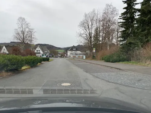
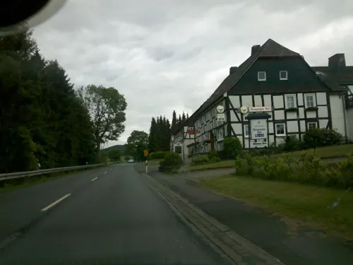
Hennetaler Hof
Restaurant · German · 7.6 km
Mo,Tu 17:30-20:30, Fr 17:30-20:30, Sa 16:00-20:30, Su,PH 12:00-20:00
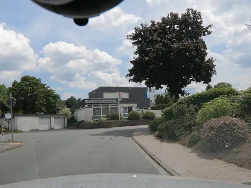
Dollenhof
Restaurant · 4.1 km
27a Mittelstraße, Meschede
Mo,We-Sa 12:00-14:00,17:00+; Su 10:30-14:00,17:00+; Tu off
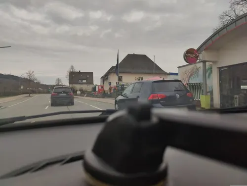
Eiscafé Schoko-Vanille
Cafe · Ice Cream · 7.3 km
104b Bundesstraße, Bestwig
Jun-Aug: Mo-Su 11:00-20:00
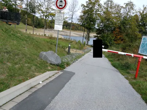
H1 am See
Restaurant · 2.7 km
1 Am Hentenberg, Meschede
Mo-Th 09:00-24:00; Fr,Sa 09:00+; Su 09:00-24:00+
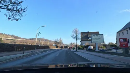
Knusperhäuschen
Bakery · 7.3 km
104a Bundesstraße, Bestwig
Mo-Fr 05:30-17:30; Sa 05:30-12:30; Su 07:00-11:00

Franzes
Bakery · 5.4 km
6 Jakobusstraße, Meschede
Mo-Fr 07:00-12:00,14:30-18:00, Sa 07:00-12:00, Su 08:00-10:30

Landhotel Donner
Restaurant · 5.3 km
4 Zur Alten Schmiede, Meschede
Mo,Tu,Th,Fr,Sa 17:30-21:00; Sa 12:00-14:00; PH 12:00-14:00,17:30-21:00
BABAs Burger & Grillhaus
Restaurant · Pizza, Burger, Breakfast
5 Ruhrplatz, Meschede
Mo-Su 16:00-21:00
78 more on the map.
History
Meschede was founded as a settlement around a convent, the Walpurgis-Stift, in the 10th century. In 1572, it became a member of the Hanseatic League.
In the 18th century, many inhabitants of Meschede died during at least two epidemics of dysentery.
Both in World War I and in World War II, Meschede was notorious as a location where the Germans exploited POWs in labour camps. In February 1945, the town was destroyed by Allied air raid bombings, because of its strategically important railway station, but rebuilt after the war.
In 1970, Meschede's St. Walburga Hospital was the site of a smallpox outbreak, as described in the book The Demon in the Freezer by Richard Preston.
From the History section of Meschede on Wikipedia, under CC BY-SA 4.0.
More about Meschede
Geography
Meschede is situated in the Ruhr valley, near to the Hennesee, south of the nature-park Arnsberger Wald. Major towns in the vicinity of Meschede are Paderborn (51 km), Kassel (85 km), Siegen (57 km), Hagen, Dortmund (60 km) and Hamm (49 km).
After the local government reforms of 1975 Meschede consists of these districts and villages:
Economy
the Honsel factory, founded in 1908, that produces car parts and other products from aluminium, owned by the Canadian company Martinrea.
An industrial zone is located near the crossing of the A 46 with the B 55 (see below).
Education
One of the five branches of South Westphalia University of Applied Sciences (also: Fachhochschule Südwestfalen (FH SWF)) is located here.
From the Wikipedia article Meschede, under CC BY-SA 4.0.
Notable people from Meschede
 August MackeGerman painter of the expressionist group Der Blaue Reiter (1887–1914)Photo: August Macke, Public domain
 Klaus-Jürgen WredeKlaus-Jürgen WredePhoto: Blois-Blois, CC BY-SA 4.0
 Teresa BückerGerman journalistPhoto: Superbass, CC BY-SA 4.0
 Norbert LossauGerman librarianPhoto: AxelHH, CC BY 3.0
 Matthias KerkhoffGerman politicianPhoto: Ailura, CC BY-SA 3.0 at
 Joseph Hippolyt PulteGerman-American physicianPhoto: Unknown author Unknown author, Public domain
- Josef StoerGerman mathematician
- Christian M. GoldbeckGerman production designer
- Astrid HengsbachGerman rower
Born in Meschede, according to Wikidata (CC0). Each name links to its Wikipedia article.
Where to stay20
Churches and places of worship58
Kapelle zu den 14 Nothelfern
Church · Catholic · 5.8 km
17 Sägemühle, Meschede
Pfarrkirche St. Jakobus
Church · Catholic · 5.3 km
8 Jakobusstraße, Meschede
Lucienkapelle
Church · Roman Catholic · 4.0 km
2 Marktstraße, Meschede
Sankt Johannes Evangelist
Church · Catholic · 3.8 km
15 Marktstraße, Meschede
Shopping26
Gas and EV charging15
Schools, colleges and libraries22
FH Südwestfalen;Fachhochschule Südwestfalen (Campus Meschede)
School · 1.5 km
53 Lindenstraße, Meschede
Healthcare10
Map of Meschede
250 places. The map loads OpenStreetMap tiles when you open it.
Getting there and nearby towns
Airport Paderborn/Lippstadt (PAD) is the nearest airport with scheduled flights listed in OpenStreetMap, 37 km away.
- Bestwig 8 km east, about 8 min by car
- Warstein 11 km northeast, about 11 min by car
- Arnsberg 14 km west, about 14 min by car
- Olsberg 14 km east, about 14 min by car
- Belecke 15 km north, about 15 min by car
- Bad Fredeburg 18 km south, about 18 min by car
- Rüthen 19 km northeast, about 19 min by car
- Möhnesee 20 km northwest, about 20 min by car
- Brilon 21 km east, about 21 min by car
- Schmallenberg 22 km south, about 22 min by car
Drive times are estimates from straight-line distance, not routes.
Towns near Meschede


Keep exploring
Local news
Headlines from INDB.
Reviews, tips and questions
Loading what members have shared...
Sources and licences
- GeoNames (CC BY 4.0): population, coordinates, regions and time zone
- Mapillary (see each image): photos
- OpenStreetMap contributors (ODbL 1.0): places, airports, map data
- Wikidata (CC0 1.0): elevation, founding date, time zone, website
- Wikimedia Commons (see each image): photos
- Wikipedia (CC BY-SA 4.0): overview and history text
Photo credits
- Meschede Innenstadt Sauerland-Ost 399, Michael Kramer, CC BY-SA 3.0
- Meschede Karolingerstr.1a fd, Friedhelm Dröge, CC BY-SA 4.0
- Bahnhof Meschede, 4, Meschede, Hochsauerlandkreis, GeorgDerReisende, CC BY-SA 4.0
- Vogel, 1, Meschede, Hochsauerlandkreis, GeorgDerReisende, CC BY-SA 4.0
- Bahnhof Meschede, 3, Meschede, Hochsauerlandkreis, GeorgDerReisende, CC BY-SA 4.0
- Ruhr, 1, Meschede, Hochsauerlandkreis, GeorgDerReisende, CC BY-SA 4.0
- Meschede Ruhr footbridge, Arnoldius, CC BY-SA 3.0
- Busbahnhof Meschede, 1, Meschede, Hochsauerlandkreis, GeorgDerReisende, CC BY-SA 4.0
- Ruhrplatz, 1, Meschede, Hochsauerlandkreis, GeorgDerReisende, CC BY-SA 4.0
- Alte Henne, 1, Meschede, Hochsauerlandkreis, GeorgDerReisende, CC BY-SA 4.0
- Nepomukdenkmal, 1, Meschede, Hochsauerlandkreis, GeorgDerReisende, CC BY-SA 4.0
- Henne, 3, Meschede, Hochsauerlandkreis, GeorgDerReisende, CC BY-SA 4.0
- Busbahnhof Meschede, 2, Meschede, Hochsauerlandkreis, GeorgDerReisende, CC BY-SA 4.0
- Meschede - Heiligenhäuschen St. Antonius Eremit 01, Dat doris, CC BY 4.0
- Meschede - Heiligenhäuschen St. Antonius Eremit 04, Dat doris, CC BY 4.0
- Meschede - Heiligenhäuschen St. Antonius Eremit 03, Dat doris, CC BY 4.0
- Meschede - Heiligenhäuschen St. Antonius Eremit 02, Dat doris, CC BY 4.0
- Bürgerbus, 1, Meschede, Hochsauerlandkreis, GeorgDerReisende, CC BY-SA 4.0
- Fachwerktraufenhaus Meschede Warsteiner Str.fd, Friedhelm Dröge, CC BY-SA 4.0
- Bahnhofsschild Meschede, Clic, CC BY-SA 4.0
- Meschede Ruhr bridge west side, Arnoldius, CC BY-SA 3.0
- DB928517-Meschede, Pimvantend, CC BY-SA 3.0
- Bahnhofsschild Meschede 120907, Clic, CC BY-SA 4.0
- Bahnhof Meschede, 2, Meschede, Hochsauerlandkreis, GeorgDerReisende, CC BY-SA 4.0
- Bahnhof Meschede, 1, Meschede, Hochsauerlandkreis, GeorgDerReisende, CC BY-SA 4.0
- Meschede new Johannesbrücke, Arnoldius, CC BY-SA 3.0
- Kampstraße, 1, Meschede, Hochsauerlandkreis, GeorgDerReisende, CC BY-SA 4.0
- Meschede Johannesbrücke Hochwasser, Arnoldius, CC BY-SA 4.0
- Meschede - Mariä Himmelfahrt, Dat doris, CC BY 4.0
- Meschede Alte Synagoge, Arnoldius, CC BY-SA 4.0
- Meschede Ruhr footbridge 2, Arnoldius, CC BY-SA 3.0
- Kampstraße 8, 1, Meschede, Hochsauerlandkreis, GeorgDerReisende, CC BY-SA 4.0
- St.Marien Kirche in Meschede fd., Friedhelm Dröge, CC BY-SA 4.0
- Meschede Mühlengraben, Arnoldius, CC BY-SA 3.0
- Meschede Coventry-Bridge, Arnoldius, CC BY-SA 3.0
- Meschede church St Walburga, Arnoldius, CC BY-SA 3.0
- Meschede - Abtei Königsmünster - Haus der Stille, Dat doris, CC BY 4.0
- Eversberg (Meschede - Germany) (7), Dickelbers, CC BY-SA 3.0
- Kirche Remblinghausen, -- Wolfgang Poguntke 13:27, 15. Okt. 2007 (CEST), CC BY-SA 2.0
- Haus Niederberge Meschede-Berge, Stefan Didam - Schmallenberg, CC BY-SA 3.0
- Meschede Schloss Laer Sauerland-Ost 414, Michael Kramer, CC BY-SA 3.0
- Kriegsgräberstätte Eversberg, Stefan Flöper, CC BY-SA 4.0
- Evangelische Christuskirche, Meschede, Rumburak3, CC0
- Lörmecke-Turm, Jörg Braukmann, CC BY-SA 4.0
- Moschede fd, Friedhelm Dröge, CC BY-SA 4.0
- Hünenburg in Meschede, Stefan Didam - Schmallenberg, CC BY-SA 3.0
- Goldener Strauch, J. Braukmann Milseburg, CC BY-SA 3.0
- Meschede-Klausenkapelle1-Bubo, Bubo, CC BY-SA 3.0
- Vierzehn-Nothelfer-Kapelle, Martin Lindner, CC BY-SA 3.0
- Schiedlike Borg fd (1), Friedhelm Dröge, CC BY-SA 4.0
- Meschede-Eversberg St. Johannes Evangelist Sauerland-Ost 391, Michael Kramer, CC BY-SA 3.0
- St.Lucia Erflinghausen, Friedhelm Dröge, CC BY-SA 3.0 de
- Kirche Calle, -- Wolfgang Poguntke 21:25, 18. Okt. 2007 (CEST), CC BY-SA 2.0 de
- Meschede - St. Walburga 02, Dat doris, CC BY 4.0
- Sägemühle Remblinghausen, Martin Lindner, CC BY 3.0
- Turmruine Laer 3, Stefan Didam - Schmallenberg, CC BY-SA 3.0
- Hoher Ransen 2024, Jörg Braukmann, CC BY-SA 4.0
- Reste des Burghauses Beringhausen (Meschede), Stefan Didam - Schmallenberg, CC BY-SA 4.0
- St.Andreas-Kirche in Bestwig-Velmede, Friedhelm Dröge, CC BY-SA 3.0 de
- St.Lucia Kapelle Eversberg, Friedhelm Dröge, CC BY 3.0
- NSG Hunstein fd (4), Friedhelm Dröge, CC BY-SA 4.0
- NSG Ransenberg, Martin Lindner, CC BY-SA 4.0
- NSG Remberg, Falkmart, CC BY-SA 4.0
- NSG Seltenberg, Martin Lindner, CC BY-SA 4.0
- NSG Wallenstein, Martin Lindner, CC BY-SA 3.0
- Eversberg Heimatmuseum front, Arnoldius, CC BY-SA 3.0
- Die Himmelstreppe am Hennedamm fd, Friedhelm Dröge, CC BY-SA 4.0
- Street-level photo, sunufatarungo, CC BY-SA 4.0
- Street-level photo, rab, CC BY-SA 4.0
- Street-level photo, chuck, CC BY-SA 4.0
- Street-level photo, sunufatarungo, CC BY-SA 4.0
- Street-level photo, xoxzoz, CC BY-SA 4.0
- Street-level photo, chuck, CC BY-SA 4.0
- Street-level photo, uwekoch, CC BY-SA 4.0
- Street-level photo, poxonline, CC BY-SA 4.0
- Street-level photo, baldur80, CC BY-SA 4.0
- Street-level photo, poxonline, CC BY-SA 4.0
- Street-level photo, chuck, CC BY-SA 4.0


Page built November 9, 2026. Spotted a mistake? Tell us or suggest a place.