


Bruchhausen-Vilsen, Germany
Samtgemeinde Bruchhausen-Vilsen
Bruchhausen-Vilsen is a town of 6,205 people in Lower Saxony, Germany.
Why visit Bruchhausen-Vilsen
Townapedia lists 31 museums and landmarks, 3 parks and trails, 22 places to eat and 2 places to stay in and around town.
Highlights include DEV Kleinbahnmuseum Fahrzeughalle and DEV Kleinbahnmuseum Lokschuppen.
Weather in Bruchhausen-Vilsen
Forecast from MET Norway (CC BY 4.0). Full forecast
About Bruchhausen-Vilsen
Bruchhausen-Vilsen is a Samtgemeinde ("collective municipality") in the district of Diepholz, in Lower Saxony, Germany. Its seat is in Bruchhausen-Vilsen.
From the Wikipedia article Bruchhausen-Vilsen (Samtgemeinde) (this version), under CC BY-SA 4.0.
Museums and landmarks31
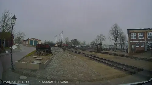
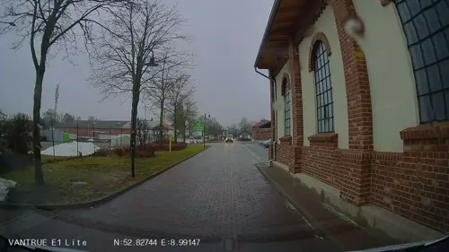

Denkmal
Monument and historic site · 0.9 km
Baudenkmal Kriegerdenkmal und Platzanlage

Denkmal
Monument and historic site · 2.1 km
Baudenkmal Kriegerdenkmal und Platzanlage
Mini-Bahn Bruchhausen-Vilsen
Monument and historic site
Personenbefördernde Gartenbahn mit Echtdampfbetrieb zwischen dem Gelände der Museums-Eisenbahn und dem Gartenbahncafe VOLLDAMPF


19 more on the map.
Parks, trails and playgrounds3

Restaurants and cafes22

Esszimmer
Bar and pub · 0.9 km
62 Bahnhofstraße, Bruchhausen-Vilsen
Tu,We 18:00-23:00; Fr,Sa 17:30-24:00; Su 17:30-22:30

Bäckerei und Café Orlamünde
Cafe · Regional · 0.8 km
49 Bahnhofstraße, Bruchhausen-Vilsen
Mo-Fr 06:00-18:00; Sa 06:00-13:00; Su 07:00-17:00
KRAFT HANDELSKONTOR
Brewery and winery
3, Bruchhausen-Vilsen
We-Fr 14:00-18:30;Sa 09:00-13:00

Zum Treppchen
Bar and pub · 0.9 km
6 Brautstraße, Bruchhausen-Vilsen
Mo, Th 18:00-22:00; Fr 17:00-24:00; Sa 00:00-01:00, 15:00-24:00;...
Akropolis
Restaurant · Greek, Italian · 0.8 km
Mo-Sa 17:30-22:30; Tu off; Su 12:00-14:00,17:30-22:30

Eiscafé da Angelo
Ice cream · 0.7 km
36 Bahnhofstraße, Bruchhausen-Vilsen
We off; Th-Tu 10:00-22:00
Italia
Restaurant · Italian · 0.9 km
Mo-Sa 11:30-14:30,17:30-22:30; Tu off; We off; Su 11:30-14:00,17:00-22:00
10 more on the map.
Where to stay2



Churches and places of worship4
St. Cyriakus
Church · Lutheran · 0.8 km
Kirchplatz, Bruchhausen-Vilsen
Shopping10
Gas and EV charging2
Schools, colleges and libraries6
Healthcare2
Map of Bruchhausen-Vilsen
82 places. The map loads OpenStreetMap tiles when you open it.
Getting there and nearby towns
Bremen Airport (BRE) is the nearest airport with scheduled flights listed in OpenStreetMap, 28 km away.
- Syke 15 km northwest, about 15 min by car
- Dörverden 17 km east, about 17 min by car
- Bassum 18 km west, about 18 min by car
- Verden 20 km northeast, about 20 min by car
- Achim 21 km north, about 21 min by car
- Sulingen 20 km southwest, about 20 min by car
- Langwedel 21 km northeast, about 21 min by car
- Twistringen 24 km west, about 24 min by car
- Nienburg 26 km southeast, about 26 min by car
- Bremen 30 km northwest, about 30 min by car
Drive times are estimates from straight-line distance, not routes.
Local news
Headlines from INDB.
Reviews, tips and questions
Loading what members have shared...
Sources and licences
- GeoNames (CC BY 4.0): population, coordinates, regions and time zone
- Mapillary (see each image): photos
- OpenStreetMap contributors (ODbL 1.0): places, airports, map data
- Wikidata (CC0 1.0): elevation, founding date, time zone, website
- Wikimedia Commons (see each image): photos
- Wikipedia (CC BY-SA 4.0): overview and history text
Photo credits
- Bruchhausen-Vilsen, Turm St. Cyriakus Kirche, Tobiasbruvi, Public domain
- GymBruviPan2, Tobiasbrvui, Public domain
- Kriegerdenkmal Bruchhöfen, Dibruvi, CC BY-SA 4.0
- BRUCHHAUSEN Bruchhausen-Vilsen 16.10.10 (w5), Wassen, CC BY-SA 3.0
- Stolperstein Bruchhausen-Vilsen Brautstraße 1 Edith Salomon, Gmbo 2013, CC0
- Stolperstein Bruchhausen-Vilsen Engelbergplatz 3 Emil Lindenberg, Gmbo 2013, CC0
- Stolperstein Bruchhausen-Vilsen Bahnhofstraße 36 Erich Hanau, Gmbo 2013, CC0
- Stolperstein Bruchhausen-Vilsen Bahnhofstraße 36 Franziska Mannheimer, Gmbo 2013, CC0
- Stolperstein Bruchhausen-Vilsen Bruchhöfener Straße 16 Friederike Meyer, Gmbo 2013, CC0
- Vilsen Cyriakus Turm altes Südquerschiff, Ulamm ( talk ), CC BY-SA 4.0
- Street-level photo, Hightower-, CC BY-SA 4.0
- Street-level photo, Hightower-, CC BY-SA 4.0
- Street-level photo, moenk, CC BY-SA 4.0
- Street-level photo, Hightower-, CC BY-SA 4.0
- Street-level photo, Hightower-, CC BY-SA 4.0
- Street-level photo, Hightower-, CC BY-SA 4.0
- Street-level photo, Hightower-, CC BY-SA 4.0
- Street-level photo, moenk, CC BY-SA 4.0
- Street-level photo, fischtown, CC BY-SA 4.0
- Street-level photo, geogast, CC BY-SA 4.0
- Street-level photo, moenk, CC BY-SA 4.0
- Street-level photo, geogast, CC BY-SA 4.0

Page built November 9, 2026. Spotted a mistake? Tell us or suggest a place.