


Nienburg, Germany
Nienburg/Weser
Nienburg is a town of 32,629 people in Lower Saxony, Germany.
Why visit Nienburg
Townapedia lists 70 museums and landmarks, 30 parks and trails, 117 places to eat, 19 places to stay and 9 attractions in and around town.
Highlights include FilmPalast am Hafen, Theater auf dem Hornwerk, Fresenhof and GalerieN.
Weather in Nienburg
Forecast from MET Norway (CC BY 4.0). Full forecast
About Nienburg
Nienburg (German: [ˈniːnˌbʊʁk] , official name: Nienburg/Weser; Low German: Nienborg, Neenborg or Negenborg), is a town and capital of the district of Nienburg in Lower Saxony, Germany.
From the Wikipedia article Nienburg, Lower Saxony (this version), under CC BY-SA 4.0.
Travel tips from other travellers: Nienburg on Wikivoyage (CC BY-SA 4.0).
Photos of Nienburg


Things to do9




Früchtehof Schindler
Farm and orchard · 4.5 km
Mo-Fr 09:00-18:00; Sa 09:00-14:00; Su,PH 10:00-13:00

Museums and landmarks70

Fresenhof
Museum · 0.7 km
48 Leinstraße, Nienburg/Weser
Tu-Th 10:00-17:00; Fr 10:00-13:00; Su 14:00-17:00; May-Aug Sa 14:00-17:00
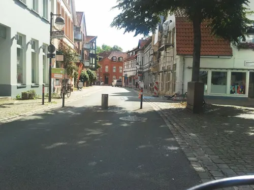

Giebichenstein
Monument and historic site · 6.7 km
Glacial erratic in Germany

Polizeimuseum Niedersachsen
Museum · 1.0 km
20-22 Lange Straße, Nienburg/Weser
We,Th 10:00-17:00; Su 14:00-17:00; May-Aug Fr 10:00-13:00; May-Aug...

Quaet-Faslem-Haus
Museum · 0.9 km
4 Leinstraße, Nienburg/Weser
Tu-Th 10:00-17:00; Fr 10:00-13:00; Su 14:00-17:00

Stockturm
Monument and historic site · 0.9 km
8 Schloßplatz, Nienburg/Weser




58 more on the map.
Parks, trails and playgrounds30



Freibad Marklohe
Sports field and stadium · 4.5 km
12 An der Beeke, Marklohe
Mo-Su 09:00-11:00, 15:00-18:00 "bei gutem Wetter"
Wesavi
Sports field and stadium · 1.2 km
22a Mindener Landstraße, Nienburg/Weser
Mo-Fr 07:00-20:00; Sa 11:00-19:00; Su,PH 08:00-18:00

18 more on the map.
Restaurants and cafes117
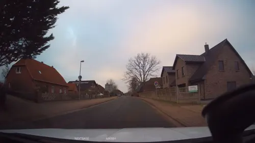
Asia World
Restaurant · Asian · 3.7 km
267 Verdener Landstraße, Nienburg/Weser
Mo-Sa 11:30-14:30, 17:30-22:30; Su 11:30-22:30
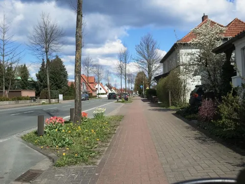
Deicke
Bakery · 1.6 km
80 Celler Straße, Nienburg/Weser
Mo-Fr 05:30-18:00; Sa 05:30-12:00; Su 07:30-10:30
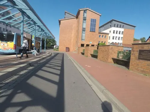
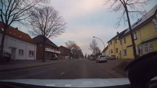
Jade Haus
Restaurant · Chinese · 1.8 km
114 Verdener Landstraße, Nienburg/Weser
Mo-Su 12:00-14:30,17:30-23:00; Tu off
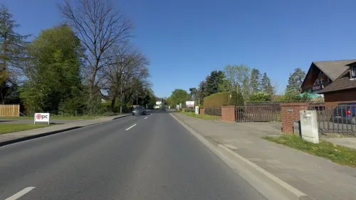
Osteria memo
Restaurant · Italian · 1.2 km
29 Kräher Weg, Nienburg/Weser
Tu-Fr 12:00-14:00,17:00-22:00; PH,Sa,Su 12:00-22:00; Mo off
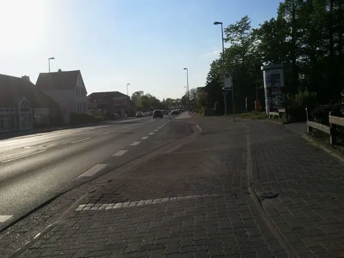
Restaurant am Bürgerpark
Restaurant · German · 1.7 km
73 Hannoversche Straße, Nienburg/Weser
Tu-Fr 15:00-23:00;Sa-Su 11:30-23:00


Hasbergscher Hof
Restaurant · German · 1.1 km
5 Wallstraße, Nienburg/Weser
Mo off; Tu-Fr 16:00-21:30; PH,Sa,Su 12:00-14:30,16:00-21:30
La Matta
Restaurant · Italian · 0.6 km
1 Hafenstraße, Nienburg/Weser
Tu-Fr 12:00-14:00,18:00+; Sa,Su 18:00+; Mo off
Vier Jahrezeiten
Restaurant · Italian · 5.1 km
70 Hoyaer Straße, Marklohe
Mo,We,Th 17:00-22:30; Fr,Sa 12:00-23:00; Su 09:30-23:00; Tu off
Waldgaststätte Oyler Berg
Restaurant · German · 5.5 km
21 Oyler Berg, Marklohe
Mar-Sep Mo 15:00-18:00, Tu-Sa 15:00+, Su 11:00+, Th off, Oct-Feb Mo off
casa mexicana
Restaurant · Mexican · 0.7 km
12 Friedrich-Ludwig-Jahn-Straße, Nienburg/Weser
Mo-Su,PH 08:00-10:00,12:00-23:00
105 more on the map.
History
The major reason for the emergence and development of Nienburg into the largest city in the Middle Weser region was its location at a convenient ford in the Weser River, leading to multiple trade routes radiating from the location. As early as 1025 the location was referred to as Negenborg, i.e. New Castle. In 1215 it began to be referred to as a city, a civitas, when Count Henry I of Hoya began the residence of his ruling line. From 1582 until 1866 the Guelph (Welf) Dukes of Brunswick-Lüneburg controlled the county, except for Napoleonic French rule from 1803 to 1813. In 1871, it became part of the German Empire.
During World War II, it was the location of German prisoner-of-war camps Oflag X-B and Stalag X-C, in which French, Polish, Belgian, Romanian, Serbian, Italian and Soviet POWs were held.
In the wake of the war, a large number of livestock was killed in the region by an unknown predator, called Lichtenmoor Strangler.
The former County of Wölpe was the seat of the Grafen (counts) von Wölpe with its associated castle. The castle (Burg Wölpe) was destroyed in the Hildesheim Diocesan Feud in 1522.
From the History section of Nienburg, Lower Saxony on Wikipedia, under CC BY-SA 4.0.
More about Nienburg
Geography
Situated on the scenic German Timber-Frame Road, Nienburg lies on the River Weser, approximately 55 km (34 mi) south-east of Bremen and 45 km (28 mi) north-west of Hanover. Nienburg is the largest town in the Middle Weser Region.
From the Wikipedia article Nienburg, Lower Saxony, under CC BY-SA 4.0.
Notable people from Nienburg
 Oskar Gröningaccountant in Auschwitz (1921–2018)Photo: Unknown author Unknown author, CC BY-SA 3.0
 Carsten SielingGerman politicianPhoto: Sandro Halank, Wikimedia Commons, CC BY-SA 4.0
 Levent AyçiçekTurkish-German association football player (born 1994)Photo: Werner100359, CC BY-SA 4.0
 Maja MaranowGerman actress (1961-2016)Photo: Mutter Erde, CC BY-SA 4.0
 Maik BeermannGerman politicianPhoto: Foto-AG Gymnasium Melle, CC BY 4.0
 Ernst ThomsGerman painter (1896-1983)Photo: Ernst Thoms (1896-1983), CC BY-SA 3.0 de
 Susanne SchröterGerman anthropologistPhoto: C.Stadler/Bwag, CC BY-SA 4.0
 Johann Georg SteigerthalGerman physician (1666-1740)Photo: Unknown author Unknown author, Public domain
 Nathalie VolkGerman modelPhoto: Urban Explorer Hamburg from..., CC BY 2.0
- Volker FinkeGerman association football player and manager
- Angelika NeuwirthGerman academic
- Christine TraurigOlympic medalist in equestrian
Born in Nienburg, according to Wikidata (CC0). Each name links to its Wikipedia article.
Where to stay19
Altstadt Pension Weserkate
Motel and hotel · 1.1 km
1 Lange Straße, Nienburg/Weser
Familie Schlagowsky
Motel and hotel · 0.9 km
6 An den Schrebergärten, Nienburg/Weser
Churches and places of worship18
Kirche Sankt Michael
Church · Lutheran · 1.2 km
6 Martinsheidestraße, Nienburg/Weser
Sankt-Martins-Kirche
Church · Lutheran · 3.6 km
Wassermühle, Nienburg/Weser
Shopping41
Gas and EV charging25
Schools, colleges and libraries21
Berufsbildende Schulen des Landkreises Nienburg
School · 0.8 km
45 Berliner Ring, Nienburg/Weser
Healthcare11
Map of Nienburg
250 places. The map loads OpenStreetMap tiles when you open it.
Getting there and nearby towns
Hannover Airport (HAJ) is the nearest airport with scheduled flights listed in OpenStreetMap, 37 km away.
- Steyerberg 16 km southwest, about 16 min by car
- Stolzenau 17 km southwest, about 17 min by car
- Rehburg-Loccum 19 km south, about 19 min by car
- Neustadt am Rübenberge 23 km southeast, about 23 min by car
- Dörverden 23 km north, about 23 min by car
- Bruchhausen-Vilsen 26 km northwest, about 26 min by car
- Sulingen 28 km west, about 28 min by car
- Schwarmstedt 27 km east, about 27 min by car
- Wunstorf 29 km southeast, about 29 min by car
- Verden 31 km north, about 31 min by car
Drive times are estimates from straight-line distance, not routes.
Towns near Nienburg


Keep exploring
Local news
Headlines from INDB.
Reviews, tips and questions
Loading what members have shared...
Sources and licences
- GeoNames (CC BY 4.0): population, coordinates, regions and time zone
- Mapillary (see each image): photos
- OpenStreetMap contributors (ODbL 1.0): places, airports, map data
- Wikidata (CC0 1.0): elevation, founding date, time zone, website, landmarks and historic places
- Wikimedia Commons (see each image): photos
- Wikipedia (CC BY-SA 4.0): overview and history text
Photo credits
- Weser Nienburg Martinskirche, Corradox, CC BY-SA 3.0
- Bahnhof Nienburg Unterführung 2111091609, Clic, CC BY-SA 4.0
- Bahnhof Nienburg Unterführung 2111091602, Clic, CC BY-SA 4.0
- Bahnhof Nienburg Unterführung 2111091601, Clic, CC BY-SA 4.0
- Bahnhof Nienburg Unterführung 2111091603, Clic, CC BY-SA 4.0
- Bahnhof Nienburg Unterführung 2111091604, Clic, CC BY-SA 4.0
- Bahnhof Nienburg Unterführung 2111091606, Clic, CC BY-SA 4.0
- Bahnhof Nienburg Unterführung 2111091608, Clic, CC BY-SA 4.0
- Bahnhof Nienburg Unterführung 2111091607, Clic, CC BY-SA 4.0
- Bahnhof Nienburg Unterführung 2111091605, Clic, CC BY-SA 4.0
- SBH 3427 036 Nienburg 2303150853, Clic, CC BY-SA 4.0
- Bahnhof Nienburg, Party2hearty at de.wikipedia, Public domain
- Bahnhof, 1, Nienburg, Landkreis Nienburg, GeorgDerReisende, CC BY-SA 4.0
- Eurobahn ET901 Nienburg 2307131253, Clic, CC BY-SA 4.0
- Eurobahn ET523 Nienburg 2606020904, Clic, CC BY 4.0
- DB 442 257 Nienburg 2606090500, Clic, CC BY 4.0
- Bahnhof Nienburg 2101101154, Clic, CC BY-SA 4.0
- DB 442 809 Nienburg 2606242308, Clic, CC BY 4.0
- DB 442 809 Nienburg 2606242307, Clic, CC BY 4.0
- SBH 3427 089 Nienburg 2311080847, Clic, CC BY 4.0
- Eurobahn ET902 Nienburg 2302160848, Clic, CC BY-SA 4.0
- Eurobahn ET901 Nienburg 2307131252, Clic, CC BY-SA 4.0
- DB 146 108 Nienburg 2405101903, Clic, CC BY 4.0
- Bahnhofsanzeige Nienburg 2403080900, Clic, CC BY 4.0
- DB IC2 Nienburg 2402011112, Clic, CC BY 4.0
- DB IC2 Nienburg 2402011113, Clic, CC BY 4.0
- SBH 3427 062 Nienburg 2307170950, Clic, CC BY-SA 4.0
- Bahnhof Nienburg 170420, Clic, CC BY-SA 4.0
- Bahnhof Nienburg 2301140849, Clic, CC BY-SA 4.0
- Eurobahn ET905 Nienburg 2504061058, Clic, CC BY 4.0
- DB 146 554 Nienburg 2401181450, Clic, CC BY 4.0
- DB 424 012 S-Bahn Hannover Nienburg 190910, Clic, CC BY-SA 4.0
- Bahnhof Nienburg 1807261034, Clic, CC BY-SA 4.0
- DB 425 282 S-Bahn Hannover Nienburg 2003011050, Clic, CC BY-SA 4.0
- SBH 3427 062 Nienburg 2308090831, Clic, CC BY-SA 4.0
- Bahnhof Nienburg 1703040950, Clic, CC BY-SA 4.0
- Eurobahn ET901 Nienburg 2506270651, Clic, CC BY 4.0
- SBH 3427 060 Nienburg 2403172257, Clic, CC BY 4.0
- Bahnhof Nienburg 2003220933, Clic, CC BY-SA 4.0
- Bahnhof Nienburg 0711061137, Clic, CC BY-SA 4.0
- Blick auf den Buchhorster Auwald, NSG HA 036-Landkreis Nienburg, Niedersachsen, DeltaNatur, CC BY-SA 3.0
- Bunkenmoor - 01, Muschelschubser, CC BY-SA 3.0
- Drakenburger Marsch, Kiwi05, CC BY-SA 4.0
- Lemker Marsch, Kiwi05, CC BY-SA 4.0
- Krähenmoor - 01, Muschelschubser, CC BY-SA 3.0
- Polizeimuseum Niedersachsen Nienburg Fassade, Axel Hindemith, CC BY 3.0
- Jüdischer Friedhof Nienburg grüne Steine, Axel Hindemith, CC BY-SA 3.0
- LiebenauerGruben, Kiwi05, CC BY-SA 4.0
- Nienburg Weser Stockturm2, PaulT (Gunther Tschuch), CC BY-SA 4.0
- ASS Nienburg, Niehold, CC BY-SA 4.0
- Alte Schanze Oyle Wall Durchbruch, Axel Hindemith, CC BY 3.0
- Teufelsbett Stöckse mit Infotafel, Axel Hindemith, CC BY 3.0
- Нинбургская городская библиотека, Anastasiya Lvova, CC BY-SA 4.0
- Film-Eck, Njenburg, Anastasiya Lvova, CC BY-SA 4.0
- St. Clemens Romanus Kirche in Marklohe IMG 9049, Losch, CC BY-SA 3.0
- St.Martin NienburgWeser rIMG 4961, losch, Attribution
- Theater auf dem Hornwerk, Nienburg, Anastasiya Lvova, CC BY-SA 4.0
- Drakenburg Schiff + Chor von SO769, Ulamm ( talk ), CC BY-SA 4.0
- Nienburg Bernward, Kirchenfan, CC0
- St.-Martin-Kirche in Holtorf (Nienburg) IMG 9990, Losch, CC BY-SA 3.0
- Corvinus-Kirche Erichshagen-Wölpe IMG 3426, Losch at German Wikipedia, Attribution
- Kleine Saalkirche in Binnen IMG 8783, Losch, CC BY-SA 4.0
- St.Johannis-Kirche Langendamm (Nienburg) IMG 4921, losch, Attribution
- Kirche St. Michael, Verdener Landstr. 69, Nienburg (Weser), Kiwi05, CC BY-SA 4.0
- Nienburg Fresenhof Museum, Axel Hindemith, CC BY 3.0
- Stolperstein Nienburg Ernstingstraße 20 Karl Bergen, Gmbo 2013, CC0
- Giebichenstein bei Stöckse IMG 5085, Losch, CC BY-SA 3.0
- Das Quaet-Faslem-Haus 09, Anastasiya Lvova, CC BY-SA 4.0
- Sanitary Dump Station Marina Mehlbergen, Gmbo 2013, CC0
- Street-level photo, derlipper, CC BY-SA 4.0
- Street-level photo, mapiman, CC BY-SA 4.0
- Street-level photo, mapiman, CC BY-SA 4.0
- Street-level photo, hubert87, CC BY-SA 4.0
- Street-level photo, mfa, CC BY-SA 4.0
- Street-level photo, moenk, CC BY-SA 4.0
- Street-level photo, hubert87, CC BY-SA 4.0
- Street-level photo, Schmarvis, CC BY-SA 4.0
- Street-level photo, Schmarvis, CC BY-SA 4.0
- Street-level photo, hubert87, CC BY-SA 4.0
- Street-level photo, hubert87, CC BY-SA 4.0
- Street-level photo, derlipper, CC BY-SA 4.0
- Street-level photo, hubert87, CC BY-SA 4.0
- Street-level photo, mapiman, CC BY-SA 4.0
- Street-level photo, mfa, CC BY-SA 4.0
- Street-level photo, mapiman, CC BY-SA 4.0
- Street-level photo, changchun1, CC BY-SA 4.0
- Street-level photo, hubert87, CC BY-SA 4.0
- Street-level photo, hubert87, CC BY-SA 4.0
- Street-level photo, Schmarvis, CC BY-SA 4.0
- Street-level photo, marczoutendijk, CC BY-SA 4.0
- Street-level photo, changchun1, CC BY-SA 4.0


Page built November 9, 2026. Spotted a mistake? Tell us or suggest a place.