


Why visit Achim
Townapedia lists 50 museums and landmarks, 63 parks and trails, 169 places to eat, 34 places to stay and 8 attractions in and around town.
Highlights include CineStar, Bioland-Hof Böse-Hartje, Achimer Mühle and Erbhof.
Weather in Achim
Forecast from MET Norway (CC BY 4.0). Full forecast
About Achim
Achim (German pronunciation: [ˈaxɪm] ; Northern Low Saxon: Achem), commonly Achim bei Bremen, is a municipality and the largest town (population 30,059 in December 2006) in the district of Verden, in Lower Saxony, Germany. It is situated on the right bank of the Weser, approx. 17 km northwest of Verden, and 16 km southeast of Bremen.
From the Wikipedia article Achim (this version), under CC BY-SA 4.0.
Photos of Achim


Things to do8
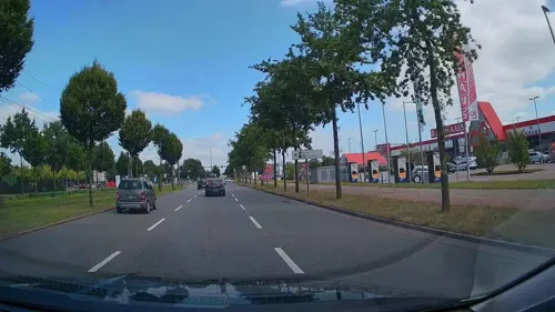
CineStar
Cinema and theater · 6.1 km
9 Hans-Bredow-Straße, Bremen
Mo-We 14:00-21:00; Th-Fr 14:00-23:30; Sa 11:00-23:30; Su 11:00-21:00

Bioland-Hof Böse-Hartje
Farm and orchard · 4.0 km
26 Groß Eißel, Thedinghausen
Fr 10:00-19:00; Sa 10:00-13:00
Lunser Land-Lädchen & Café
Farm and orchard · 5.3 km
Th,Fr 09:00-12:30,15:00-18:00; Sa 09:00-13:00; Su 13:00-18:00

Hof Meyer-Roselius Selbstbedienungshofladen
Farm and orchard · 6.6 km
1 Beppener Bruchweg, Thedinghausen
24/7

Museums and landmarks50


Gutshaus Clüverswerder
Monument and historic site · 3.5 km
2 Clüverswerder, Achim




Mahndorfer Gräberfeld
Monument and historic site · 5.7 km
Gräberfeld mit Bestattungen vom 3. bis 9. Jahrhundert; 1939 ausgegraben
38 more on the map.
Parks, trails and playgrounds63



Adventure Park
Playground · 5.8 km
8 An Krietes Park, Bremen
Mo-Th 15:00-19:00; Su 10:00-19:00; Fr 14:00-20:00; Sa 10:00-20:00


Boot-Sport-Verein Achim-Thedinghausen
Marina and boat launch · 2.7 km
51 more on the map.
Restaurants and cafes169
Café im Clüverhaus
Cafe
Fahrradladestation
1 Große Kirchenstraße, Achim
Mo off; Tu-Su 13:00-18:00; We,Sa 08:30-18:00
Daisy's Diner
Diner · American · 4.4 km
2 An der Autobahn, Oyten
Mo-Th 10:00-22:00; Fr 10:00-24:00; Sa 09:00-24:00; Su 09:00-22:00
Das Hirtenhaus
Restaurant · Regional · 2.1 km
1 Marsch-Anna-Weg, Achim
Mo-We,Fr 15:00-20:00; Sa,Su 11:00-20:00
El Serratto
Restaurant · Italian · 3.8 km
35 Uphuser Heerstraße, Achim
Mo,We-Sa 12:00-14:30,17:30-22:00; Su 12:00-14:30,17:30-21:00; Tu off
Gasthaus Gerken
Restaurant · German · 4.2 km
55 Uphuser Heerstraße, Achim
Mo-Su 12:00-14:00,18:00-22:00; Sa 18:00-22:00
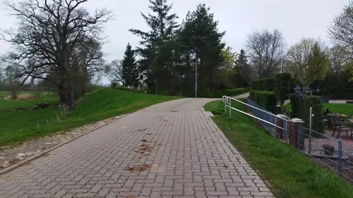
Gasthof "Zur Linde"
Restaurant · Regional · 1.1 km
3 Grüne Straße, Achim
We-Sa 17:00-24:00, Su 11:00-24:00
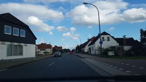

Bellini
Restaurant · Italian, Pizza · 4.1 km
2 Bahnhofstraße, Achim
Tu-Sa 11:30-14:30,17:00-22:00; Su 11:30-22:00
Bollener Dorfkrug
Restaurant · Regional · 5.4 km
38 Bollener Landstraße, Achim
Mo off; Tu-Fr 15:00-24:00; Sa,Su 10:00-24:00
157 more on the map.
History
The first recorded mention of Achim came in 1091 as Arahem. The controlling heights of the Linden Mountains, south of Bremen, on which the old Arahem leaned, was a cult- and court-location. Achim was a meeting place of old Saxon courts. The court met three times annually.
The Christian missionaries erected a baptismal church in Achim in the 12th century; it was the predecessor of St. Laurentius Church in Achim, built in 1257. It then belonged to the Prince-Archbishopric of Bremen.
During the course of the War of the Lunenburgian Succession (1370–1388), Achim was set on fire in 1381 because of the fights between Duke Albrecht of Saxe-Wittenberg, Duke-designate of Brunswick and Lunenburg, and the Prince-Archbishop of Bremen, Albert II, titular Duke of Brunswick and Lunenburg.
Read more of the history
From 1626 Achim was controlled alternately by Danes and Swedes. In 1648 the Prince-Archbishopric was transformed into the Duchy of Bremen, which was first ruled in personal union by the Swedish Crown and — interrupted by a Danish occupation (1712–1715) — from 1715 on by the House of Hanover. During the Third Silesian or Seven Years' War (precipitated by the Anglo-French and Indian War) it was controlled by France. In 1807 the ephemeric Kingdom of Westphalia annexed the Duchy of Bremen, including Achim, before France annexed it in 1810. Achim became the capital of a homonymous canton within the Département des Bouches-du-Weser. In 1813 the Duchy was restored to the Electorate of Hanover. In 1814 the Electorate was upgraded to the Kingdom of Hanover at the Congress of Vienna. In 1823 Hanover incorporated the Duchy in a real union and the ducal territory, including Achim, became part of the Stade Region, established in 1823.
A train station has existed in Achim since 1847. Achim lies along the track between Bremen and Hannover.
Achim is home to several international companies including Vitakraft and Desma shoe machines.
Mercedes-Benz, Coca-Cola and Amazon.com, Inc. also have branch offices in the city.
The Jewish Cemetery in Achim, located on the street "An der Bahn," contains 56 gravestones for Jews from Achim and the surrounding area who died between 1867 and 1935. The cemetery is a listed cultural monument.
From the History section of Achim on Wikipedia, under CC BY-SA 4.0.
More about Achim
Geography
Achim lies in the Weser Depression, an Urstromtal. The area surrounding Achim is primarily moorland in its natural state. It has an elevation between 12 and 40 metres above sea level, and an area of 65.1 km2.
For the Badener mountains and Oil Camp, see Baden, Lower Saxony.
From the Wikipedia article Achim, under CC BY-SA 4.0.
Notable people from Achim
 Ole RahmelGerman handball playerPhoto: Wenflou, CC0
 Marcel CostlyGerman association football playerPhoto: Silesia711, CC BY-SA 4.0
 Kai WargallaGerman politician and cashierPhoto: Leonie Rabea Große, CC BY 3.0 de
 Michel BrandtGerman actor and politician (The Left)Photo: Fraktion DIE LINKE. im Bundestag, CC BY 2.0
- Lucas HölerGerman association football player
- Karl RavensGerman politician (1927-2017)
- Heinz EmigholzGerman film producer, author, cinematographer and artist (born 1948)
- Martin SchmidtGerman handball player
- Heinrich FahrenholzGerman zoologist
Born in Achim, according to Wikidata (CC0). Each name links to its Wikipedia article.
Where to stay34
Churches and places of worship15
Shopping47
Gas and EV charging18
Schools, colleges and libraries25
Healthcare13
Map of Achim
250 places. The map loads OpenStreetMap tiles when you open it.
Getting there and nearby towns
Bremen Airport (BRE) is the nearest airport with scheduled flights listed in OpenStreetMap, 16 km away.
- Oyten 5 km north, about 5 min by car
- Langwedel 11 km east, about 11 min by car
- Ottersberg 13 km northeast, about 13 min by car
- Bremen 16 km northwest, about 16 min by car
- Lilienthal 16 km northwest, about 16 min by car
- Verden 17 km southeast, about 17 min by car
- Syke 18 km southwest, about 18 min by car
- Sottrum 18 km northeast, about 18 min by car
- Stuhr 19 km west, about 19 min by car
- Grasberg 19 km north, about 19 min by car
Drive times are estimates from straight-line distance, not routes.
Towns near Achim


Keep exploring
Local news
Headlines from INDB.
Reviews, tips and questions
Loading what members have shared...
Sources and licences
- GeoNames (CC BY 4.0): population, coordinates, regions and time zone
- Mapillary (see each image): photos
- OpenStreetMap contributors (ODbL 1.0): places, airports, map data
- Wikidata (CC0 1.0): elevation, founding date, time zone, website, landmarks and historic places
- Wikimedia Commons (see each image): photos
- Wikipedia (CC BY-SA 4.0): overview and history text
Photo credits
- Rathaus Stadt Achim, Pottz, Public domain
- Achim - Grundschule am Paulsberg - geo-en.hlipp.de - 11085, Peter von Rueden, CC BY-SA 2.0
- Abends am Bahnhof Achim (Krs. Verden), JoachimKohler-HB, CC BY-SA 4.0
- Bahnhof Achim 2108080715, Clic, CC BY-SA 4.0
- St. Laurentius Achim (NW), Dirk Godlinski, CC BY-SA 3.0
- Achim St. Laurentius (Turm v NW), Dirk Godlinski, CC BY-SA 3.0
- Bahnhof Achim 2108080718, Clic, CC BY-SA 4.0
- Bahnhof Achim 2108080717, Clic, CC BY-SA 4.0
- Bahnhof Achim 2108080719, Clic, CC BY-SA 4.0
- Bahnhofsschild Achim 090331, Clic, CC BY-SA 4.0
- Bahnhof Achim 2108080743, Clic, CC BY-SA 4.0
- Bahnhof Achim 2108080744, Clic, CC BY-SA 4.0
- Bahnhofsschild Achim 2009150430, Clic, CC BY-SA 4.0
- Mahnmal synagoge achim, Alephmembeth, CC BY-SA 4.0
- Bahnhof Achim 2108080727, Clic, CC BY-SA 4.0
- Bahnhof Achim 2108080742, Clic, CC BY-SA 4.0
- Bahnhof Achim 2108080730, Clic, CC BY-SA 4.0
- Bahnhof Achim 2108080732, Clic, CC BY-SA 4.0
- Bahnhof Achim 2108080736, Clic, CC BY-SA 4.0
- Bahnhof Achim 2108080741, Clic, CC BY-SA 4.0
- Bahnhof Achim 2108080735, Clic, CC BY-SA 4.0
- Bahnhof Achim 2108080725, Clic, CC BY-SA 4.0
- Bahnhof Achim 2108080731, Clic, CC BY-SA 4.0
- Bahnhof Achim 2108080738, Clic, CC BY-SA 4.0
- Bahnhof Achim 2108080728, Clic, CC BY-SA 4.0
- Bahnhof Achim 2108080733, Clic, CC BY-SA 4.0
- Bahnhof Achim 2108080724, Clic, CC BY-SA 4.0
- Bahnhof Achim 2108080740, Clic, CC BY-SA 4.0
- Bahnhof Achim 2108080722, Clic, CC BY-SA 4.0
- Bahnhof Achim 2108080737, Clic, CC BY-SA 4.0
- Bahnhof Achim 2108080739, Clic, CC BY-SA 4.0
- Bahnhof Achim 2108080723, Clic, CC BY-SA 4.0
- Bahnhof Achim 2108080734, Clic, CC BY-SA 4.0
- Bahnhof Achim 2108080729, Clic, CC BY-SA 4.0
- Bahnhof Achim 2108080726, Clic, CC BY-SA 4.0
- Achim- Wesermarsch - geo.hlipp.de - 11097, Peter von Rueden on geo.hlipp.de, CC BY-SA 2.0
- Fussgängerunterführung Gaswerkstrasse des Bahnhofs Achim, JoachimKohler-HB, CC BY-SA 4.0
- Eingang zum Haus Clüver in Achim (2024), JoachimKohler-HB, CC BY-SA 4.0
- Cato-Bontjes-van-Beek-Gymnasium (Achim), Pottz, Public domain
- Thedinghausen Erbhof Mai-2017 DSC 0628, C. Löser, CC BY 3.0 de
- Bremen Weserpark, Reise Reise, CC BY-SA 3.0
- Juedischer friedhof achim, Alephmembeth, CC BY-SA 4.0
- Naturschutzgebiet Sandtrockenrasen Achim 01, Florian Tenhaken, CC BY-SA 3.0
- Achim Matthias 3, Kirchenfan, CC0
- Schloss in Etelsen, WiesbAdler 23:03, 21. Aug. 2009 (CEST), Public domain
- Kirche-Achim-Weser, Jürgen Howaldt, CC BY-SA 2.0 de
- Gymnasium markt, Alephmembeth, CC BY-SA 4.0
- Lunsen Kirche, Uwe Barghaan, CC BY 3.0
- Kirche oyten, Hegis, Public domain
- Thedinghausen Maria-Magdalena-Kirche, Dirk Godlinski, CC BY-SA 3.0
- Bremen-Mahndorf St-Nikolai 01, Joern M, CC BY-SA 3.0
- Achimer Muehle, Bürgermeisterbüro, CC BY-SA 4.0
- Clüverswerder-Ansicht aus der Weite 1, Marcel Dominic Bandowski, CC BY-SA 4.0
- Kapelle im Schlosspark Etelsen, JoachimKohler-HB, CC BY-SA 4.0
- Rathauspark Achim, Dirk Godlinski, CC BY-SA 3.0
- Emma Baumgarten, Hinzke, CC BY-SA 4.0
- Krietes Wald Baum-Lehrpfad 4198, Günther Meyer, CC BY-SA 4.0
- Luftaufnahmen Luftbild vom Schloss Etelsen 2015, Luftaufnahmen Verden, CC BY-SA 4.0
- Thedinghausen Baumpark, Corradox, CC BY-SA 3.0
- Amtsgericht Achim an der Obernstrasse 40 (2025), JoachimKohler-HB, CC BY-SA 4.0
- Mausoleum im Schlosspark Etelsen (2014), JoachimKohler-HB, CC BY-SA 4.0
- Street-level photo, StefanS79, CC BY-SA 4.0
- Street-level photo, marczoutendijk, CC BY-SA 4.0
- Street-level photo, jiffyspace, CC BY-SA 4.0
- Street-level photo, hubert87, CC BY-SA 4.0
- Street-level photo, jiffyspace, CC BY-SA 4.0
- Street-level photo, angelwahn, CC BY-SA 4.0
- Street-level photo, angelwahn, CC BY-SA 4.0
- Street-level photo, changchun1, CC BY-SA 4.0
- Street-level photo, angelwahn, CC BY-SA 4.0
- Street-level photo, angelwahn, CC BY-SA 4.0
- Street-level photo, changchun1, CC BY-SA 4.0
- Street-level photo, changchun1, CC BY-SA 4.0
- Street-level photo, angelwahn, CC BY-SA 4.0
- Street-level photo, angelwahn, CC BY-SA 4.0
- Street-level photo, changchun1, CC BY-SA 4.0
- Street-level photo, xanu, CC BY-SA 4.0
- Street-level photo, jiffyspace, CC BY-SA 4.0
- Street-level photo, thetornado76, CC BY-SA 4.0
- Street-level photo, thetornado76, CC BY-SA 4.0
- Street-level photo, hubert87, CC BY-SA 4.0
- Street-level photo, hubert87, CC BY-SA 4.0
- Street-level photo, xanu, CC BY-SA 4.0
- Street-level photo, hotteliene, CC BY-SA 4.0
- Street-level photo, zoegglmeyr1, CC BY-SA 4.0
- Street-level photo, heetENkoel, CC BY-SA 4.0
- Street-level photo, StefanS79, CC BY-SA 4.0
- Street-level photo, mar_k83, CC BY-SA 4.0
- Street-level photo, hubert87, CC BY-SA 4.0
- Street-level photo, gmbremen, CC BY-SA 4.0
- Street-level photo, angelwahn, CC BY-SA 4.0
- Street-level photo, hubert87, CC BY-SA 4.0


Page built November 9, 2026. Spotted a mistake? Tell us or suggest a place.