


Why visit Bückeburg
Townapedia lists 151 museums and landmarks, 47 parks and trails, 116 places to eat, 15 places to stay and 23 attractions in and around town.
Highlights include Meyer's Hof Sb-Laden, Stadttheater Minden, Museum Bückeburg and Berg- und Stadtmuseum.
Weather in Bückeburg
Forecast from MET Norway (CC BY 4.0). Full forecast
About Bückeburg
Bückeburg (German pronunciation: [ˈbʏkəbʊʁk] ; Northern Low Saxon: Bückeborg) is a town in Lower Saxony, Germany, on the border with North Rhine Westphalia. It is located in the district of Schaumburg close to the northern slopes of the Weserbergland ridge. Bückeburg has a population of 21,030.
From the Wikipedia article Bückeburg (this version), under CC BY-SA 4.0.
Things to do23


Stadttheater Minden
Cinema and theater · 9.4 km
Theatre in Minden, Germany

Idaturm
Scenic view · 2.5 km
Oct-Mar: Sa,Su 11:00-17:00; Apr-Sep: Su 11:00-17:00; Apr-Sep: PH...
Tiedemanns Hofladen
Farm and orchard · 3.5 km
2 Warbersche Straße, Bückeburg
Fr 09:00-12:00,15:00-18:00

11 more on the map.
Museums and landmarks151




Neues Palais
Monument and historic site
23A Herminenstraße, Bückeburg

Emperor William Monument
Monument and historic site · 10.0 km
Colossal monument near Porta Westfalica in North Rhine-Westphalian, Germany


Niedersächsisches Landesarchiv - Standort Bückeburg
Monument and historic site
2 Schlossplatz, Bückeburg
139 more on the map.
Parks, trails and playgrounds47

Bergbad Bückeburg
Sports field and stadium · 1.0 km
3 Birkenallee, Bückeburg
Mo-Fr 06:00-12:00,14:00-18:00; Sa,Su 08:00-12:00,14:00-19:00





Jagdschloss Baum
Park · 7.7 km
Small hunting lodge near Bückeburg, Germany

35 more on the map.
Restaurants and cafes116
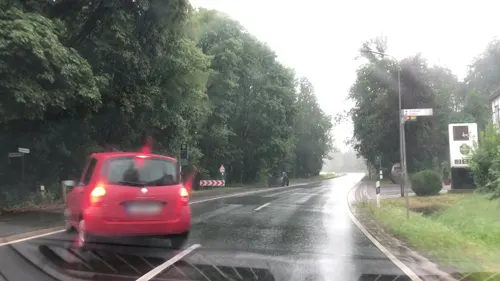
Hotel & Restaurant Große Klus
Restaurant · German · 4.8 km
19 Am Klusbrink, Bückeburg
Mo-Sa 17:00+; Su,PH 11:00+

FOODHAFEN
Restaurant · Burger, Indian, Pakistanisch, Fries · 4.5 km
2 Friedrichstraße, Bad Eilsen
Mo-Su 11:30-21:30, We off
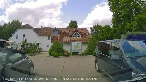
Golf-Restaurant
Restaurant · Pizza, Noodle, Soup, Fish, Pasta, Salad, Steak, Meat, Dessert, Juice, Beverages, Drinks, Coffee · 6.8 km
2 Röserheide, Obernkirchen
Mo off; Tu-Su 11:00-21:00
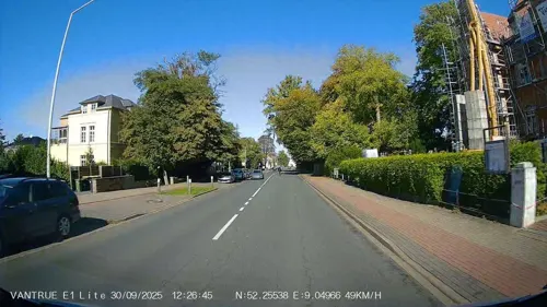
La Villa
Restaurant · Italian
23 Georgstraße, Bückeburg
Tu-Fr 16:30-22:00; Sa 15:00-23:00; Su 11:30-22:00; PH 11:30-22:00 open
Labyrinth
Restaurant · Greek, Italian · 5.2 km
12 Vehlener Straße, Obernkirchen
Mo-Th 17:30-23:00; Fr-Su 12:00-14:30,17:30-23:00
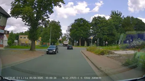
Rhodos im Lindenhof
Restaurant · Greek · 6.1 km
33 Sülbecker Weg, Obernkirchen
Tu-Sa 17:00+; Su,PH 12:00-14:00, 17:00+
Ristorante Pizzeria Da Calo
Restaurant · Italian
3 Wallstraße, Bückeburg
Mo,We-Fr,Su 12:30-14:30; Mo,We-Su 17:00-22:00
SchraubBar
Restaurant · Burger · 0.9 km
1 Lehnstraße, Bückeburg
Tu 18:00+; Fr 18:00+; Sa 18:00+; May-Aug Su 13:00-21:00


104 more on the map.
History
Until the German Revolution of 1918–1919, Bückeburg was the capital of the tiny principality of Schaumburg-Lippe. Schaumburg-Lippe continued to be an independent German state (Free state) until 1946.
Houses began to gather around the castle c. 1365 and were protected by a city wall in the 17th century. In the 19th century, it was connected to the Minden and Hanover Railway and housed a synagogue. The poet J. G. von Herder was court preacher here from 1771 to 1776.
Bückeburg is a former British garrison town and had a number of British residents until recently. Most of the British residents worked at the British Military Hospital (BMH) in Rinteln, or in the local English Prince Rupert School, also in Rinteln. The number of British military residents in Bückeburg decreased significantly in the late 1990s, when BMH Rinteln closed down, however the staff of Prince Rupert School were still based in Bückeburg until the closure of the school in July 2014.
From the History section of Bückeburg on Wikipedia, under CC BY-SA 4.0.
Where to stay15
Churches and places of worship35
St. Cosmas und St. Damian
Church · Lutheran · 3.4 km
Pastor-Mensching-Weg, Bückeburg
Shopping35
Gas and EV charging12
Schools, colleges and libraries23
Healthcare9
Agaplesion Evangelisches Klinikum Schaumburg gGmbH
Hospital · 3.8 km
1 Zum Schaumburger Klinikum, Obernkirchen
Map of Bückeburg
250 places. The map loads OpenStreetMap tiles when you open it.
Getting there and nearby towns
Flugplatz Bielefeld (BFE) is the nearest airport with scheduled flights listed in OpenStreetMap, 48 km away.
- Obernkirchen 6 km east, about 6 min by car
- Rinteln 9 km south, about 9 min by car
- Minden 10 km west, about 10 min by car
- Porta Westfalica 10 km west, about 10 min by car
- Stadthagen 13 km northeast, about 13 min by car
- Petershagen 14 km northwest, about 14 min by car
- Vlotho 17 km southwest, about 17 min by car
- Hessisch Oldendorf 17 km southeast, about 17 min by car
- Hille 22 km west, about 22 min by car
- Löhne 26 km west, about 26 min by car
Drive times are estimates from straight-line distance, not routes.
Local news
Headlines from INDB.
Reviews, tips and questions
Loading what members have shared...
Sources and licences
- GeoNames (CC BY 4.0): population, coordinates, regions and time zone
- Mapillary (see each image): photos
- OpenStreetMap contributors (ODbL 1.0): places, airports, map data
- Wikidata (CC0 1.0): elevation, founding date, time zone, website, landmarks and historic places
- Wikimedia Commons (see each image): photos
- Wikipedia (CC BY-SA 4.0): overview and history text
Photo credits
- Bückeburg Schloß, de:user:Ingo2802, CC BY-SA 3.0
- Erwin Spindler Ansichtskarte Bückeburg, Erwin Spindler, Public domain
- Stolpersteinlage Bückeburg Lange Straße 15, Gmbo 2013, CC0
- Stolperstein Bückeburg Lange Straße 15 Gertrud Wertheim, Gmbo 2013, CC0
- Stolperstein Bückeburg Lange Straße 15 Elise Wertheim, Gmbo 2013, CC0
- Stolperstein Bückeburg Lange Straße 15 Adolf Wertheim, Gmbo 2013, CC0
- Stolpersteine Bückeburg Lange Straße 15, Gmbo 2013, CC0
- Stolpersteine Bückeburg Lange Straße 66, Gmbo 2013, CC0
- Stolperstein Bückeburg Lange Straße 66 Grete Berl, Gmbo 2013, CC0
- Stolperstein Bückeburg Lange Straße 66 Horst Berl, Gmbo 2013, CC0
- Stolperstein Bückeburg Lange Straße 66 Helga Berl, Gmbo 2013, CC0
- Stolperstein Bückeburg Lange Straße 66 Emil Berl, Gmbo 2013, CC0
- Stolpersteinlage Bückeburg Lange Straße 66, Gmbo 2013, CC0
- 2022-08-07 Bückeburg Schulstraße 02, Bärbel Miemietz, CC BY-SA 4.0
- 2019-02-14 112355 Bückeburg Stadtkirche, Tim Rademacher, CC BY-SA 4.0
- Stolpersteinlage Bückeburg Schulstraße 1, Gmbo 2013, CC0
- Stolpersteine Bückeburg Schulstraße 21, Gmbo 2013, CC0
- Stolperstein Bückeburg Schulstraße 1 Otto Weihl, Gmbo 2013, CC0
- Stolperstein Bückeburg Schulstraße 1 Ilse Weihl, Gmbo 2013, CC0
- Stolperstein Bückeburg Schulstraße 1 Emil Weihl, Gmbo 2013, CC0
- Stolpersteine Bückeburg Schulstraße 1, Gmbo 2013, CC0
- Stolperstein Bückeburg Schulstraße 21 Erwin Rautenberg, Gmbo 2013, CC0
- Stolperstein Bückeburg Schulstraße 21 Leo Rautenberg, Gmbo 2013, CC0
- Stolperstein Bückeburg Schulstraße 21 Selma Rautenberg, Gmbo 2013, CC0
- Stolperstein Bückeburg Schulstraße 21 Ruth Rautenberg, Gmbo 2013, CC0
- Stolperstein Bückeburg Schulstraße 21 Manfred Rautenberg, Gmbo 2013, CC0
- Stolpersteinlage Bückeburg Schulstraße 21, Gmbo 2013, CC0
- 2022-08-07 Bückeburg Schulstraße 01, Bärbel Miemietz, CC BY-SA 4.0
- Braustraße 6, 1, Bückeburg, Landkreis Schaumburg, GeorgDerReisende, CC BY-SA 4.0
- Trompeterstraße, 1, Bückeburg, Landkreis Schaumburg, GeorgDerReisende, CC BY-SA 4.0
- Stolpersteine Bückeburg Braustraße 7, Gmbo 2013, CC0
- Stolpersteinlage Bückeburg Braustraße 7, Gmbo 2013, CC0
- Stolperstein Bückeburg Braustraße 7 Rosa Philippsohn, Gmbo 2013, CC0
- Stolperstein Bückeburg Braustraße 7 Willy Philippsohn, Gmbo 2013, CC0
- Stolperstein Bückeburg Braustraße 7 Hermann Philippsohn, Gmbo 2013, CC0
- Stolperstein Bückeburg Braustraße 7 Hilde Philippsohn, Gmbo 2013, CC0
- Neue Straße, 2, Bückeburg, Landkreis Schaumburg, GeorgDerReisende, CC BY-SA 4.0
- 2022-08-07 Bückeburg Alte Lateinschule 01, Bärbel Miemietz, CC BY-SA 4.0
- Minden Stadttheater, -- Ingo2802 22:47, 14. Apr 2006 (CEST), CC BY-SA 3.0
- Kaiser Wilhelm PW, Dschazz, CC BY-SA 2.0 de
- Minden6, Ingo2802 13:19, 18. Feb. 2007 (CET), CC BY-SA 3.0
- Schloss baum 1, Smirk9, CC0
- PW-Einsbergen - NSG Appenhäuser Bruch - 2, Ath, CC0
- Besucherbergwerk1, -- Ingo2802 08:20, 5. Jun 2006 (CEST), CC BY-SA 3.0
- Bückeburger Niederung 2022, Uwe Barghaan, CC BY-SA 3.0
- Aussenansicht des Hubschraubermuseums in Bückeburg, Nortix08, CC BY-SA 4.0
- 2022-08-07 Jetenburger Kirche 02, Bärbel Miemietz, CC BY-SA 4.0
- Stiftskirche Obernkirchen, Schaumbuerger, CC BY-SA 3.0
- Eisbergen3, Ingo2802 17:49, 2. Feb. 2008 (CET), CC BY-SA 3.0
- Kleinenbremen EvKirche, Grugerio, CC BY-SA 3.0
- Bueckeburg Schloss v O, Beckstet, CC BY-SA 3.0
- 2022-08-07 Mausoleum im Schlosspark Bückeburg, Bernd Schwabe in Hannover, CC BY-SA 4.0
- Bückeburg - NSG Hofwiesenteiche - 4, Ath, CC0
- Bückeburg Eingangstor jüdischen Friedhof, Gmbo 2013, CC0
- Nammen-Laurentiuskapelle-0132, Grugerio, CC BY-SA 3.0
- Bückeburg Palais 09, Axel Hindemith, Public domain
- Kapelle Schloss Bückeburg 01, Hajotthu, CC BY-SA 3.0
- Museum Bückeburg, HJunghans, CC BY-SA 4.0
- Bad Eilsen Christuskirche 2022, Kirchenfan, CC0
- Petzen Kirche Seitenansicht, Axel Hindemith, CC BY 3.0
- 20230108 Nammer-Klippen, Knase, CC BY-SA 4.0
- Bückeburg Marien 3, Kirchenfan, CC0
- Street-level photo, DHessel71, CC BY-SA 4.0
- Street-level photo, lvl5, CC BY-SA 4.0
- Street-level photo, klypern, CC BY-SA 4.0
- Street-level photo, stefanro74, CC BY-SA 4.0
- Street-level photo, Hightower-, CC BY-SA 4.0
- Street-level photo, aceini, CC BY-SA 4.0
- Street-level photo, Schmarvis, CC BY-SA 4.0
- Street-level photo, Schmarvis, CC BY-SA 4.0
- Street-level photo, Hightower-, CC BY-SA 4.0
- Street-level photo, Hightower-, CC BY-SA 4.0
- Street-level photo, aceini, CC BY-SA 4.0
- Street-level photo, knoefix, CC BY-SA 4.0
- Street-level photo, derlipper, CC BY-SA 4.0
- Street-level photo, stefanro74, CC BY-SA 4.0
- Street-level photo, MikePeters, CC BY-SA 4.0
- Street-level photo, klypern, CC BY-SA 4.0
- Street-level photo, lvl5, CC BY-SA 4.0
- Street-level photo, Hightower-, CC BY-SA 4.0
- Street-level photo, mtek, CC BY-SA 4.0
- Street-level photo, ubahnverleih, CC BY-SA 4.0


Page built November 8, 2026. Spotted a mistake? Tell us or suggest a place.