


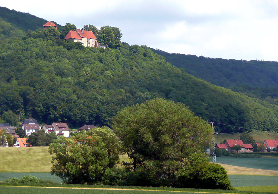

Hessisch Oldendorf, Germany
Hessisch Oldendorf is a town of 20,129 people in Lower Saxony, Germany.
Why visit Hessisch Oldendorf
Townapedia lists 29 museums and landmarks, 21 parks and trails, 49 places to eat, 12 places to stay and 48 attractions in and around town.
Highlights include Hof Bonorden, Großer Langenfelder Wasserfall, Schillat-Höhle and Heimatmuseum Auetal.
Weather in Hessisch Oldendorf
Forecast from MET Norway (CC BY 4.0). Full forecast
About Hessisch Oldendorf
Hessisch Oldendorf (German pronunciation: [ˈhɛsɪʃ ˈʔɔldn̩dɔʁf] ) is a town in the Hamelin-Pyrmont district, in Lower Saxony, Germany. It is situated on the river Weser, approximately 10 km (6 mi) northwest of Hamelin. The adjective "Hessisch" (lit. 'Hessian') has been used since 1905 to distinguish it from other towns named Oldendorf. Hessisch Oldendorf was part of Landgraviate of Hessen-Kassel from 1640 until 1932.
From the Wikipedia article Hessisch Oldendorf (this version), under CC BY-SA 4.0.
Things to do48



36 more on the map.
Museums and landmarks29

Schillat-Höhle
Monument and historic site · 4.4 km
2a Riesenbergstraße, Hessisch Oldendorf
Sa,Su,PH 10:00-18:00; We 14:00-18:00; Nov,Feb,Mar We off; Dec,Jan off
Heimatmuseum Auetal
Museum · 6.8 km
47 Langenfelder Straße, Auetal
"nach Vereinbarung"

Fischbeck Abbey
Museum · 4.7 km
Monastery in Fischbeck, Lower Saxony, Germany

Paschenburg
Monument and historic site · 4.6 km
1 Paschenburg, Rinteln



Gedenkstein für russische Zwangsarbeiter
Monument and historic site · 6.7 km
36 Zwangsarbeiter zwischen 1942 und 1943 wurden hier beigesetzt

17 more on the map.
Parks, trails and playgrounds21

Auenlandschaft Hohenrode
Hiking and trails · 7.0 km
Die Weser ist für den Vogelzug eine bedeutende Leitlinie. Zahlreiche Vogelarten ziehen entlang dieser Geländemarke nach Norden,...
24/7






9 more on the map.
Restaurants and cafes49

Parthenon
Restaurant · Greek · 3.6 km
21a Am Weserbogen, Hessisch Oldendorf
Tu-Sa 17:30-22:00; Su,PH 11:30-15:00,17:30-22:00
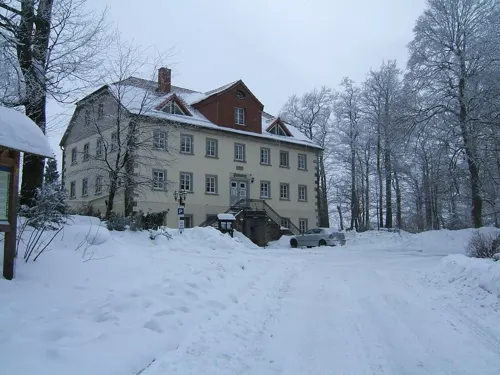
Restaurant Paschenburg
Restaurant · German, Regional · 4.6 km
1 Paschenburg, Rinteln
We-Fr 12:00-15:00, 18:00-21:30; Sa, Su 12:00-21:30; Th-Mo...
Schaumburger Ritter
Restaurant · German, Regional · 4.6 km
2-4 Burgstraße, Rinteln
We-Su 12:00+; Mo off; Tu 18:00+
Burg-Gaststätte
Restaurant · German, Regional · 4.5 km
Apr-Oct Fr-We,PH 11:00-18:00; Nov-Dec Sa-Su 12:00-17:00; Feb-Mar...

Dasos
Restaurant · Indian, Greek · 8.1 km
1 Zum Friedhof Wehl
Mo,Tu off; We-Su 17:00-22:00; Su 12:00-14:00
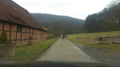
Hotel Papp-Mühle
Restaurant · 4.7 km
1 Pappmühle, Hessisch Oldendorf
Mo-We 17:00-20:00; Fr-Su 12:00-20:00; Th off
Landbäckerei Scholz
Bakery · 6.2 km
19 Alte Heerstraße, Rinteln
Tu-Fr 06:00-18:00; Sa 06:00-12:00; Su 08:00-11:00


Bei Toli
Restaurant · Greek · 8.3 km
3 Westerwalder Straße, Auetal
Mo-Tu off; We-Su 17:00-21:15
Café Am Wehl
Cafe · Cake · 8.0 km
6 Zum Friedhof Wehl, Hameln
Mo-Su, PH 13:00-16:30
Café Sorgenfrei
Cafe · 3.8 km
71 Am Weserbogen, Hessisch Oldendorf
Fr-Su 13:00-18:00; Mo-Th "je nach Wetter oder Anfrage"
37 more on the map.
Where to stay12
Pension Sonnenblick
Motel and hotel · 5.2 km
1 Pötzer Kirchweg, Hessisch Oldendorf
Churches and places of worship24
Stiftskirche Fischbeck
Church · Lutheran · 4.7 km
12 Im Stift, Hessisch Oldendorf
Pfarrkirche St. Eligius
Church · Lutheran · 7.4 km
26 Hattendorfer Straße, Auetal
Shopping12
Gas and EV charging16
Schools, colleges and libraries10
Healthcare7
Map of Hessisch Oldendorf
228 places. The map loads OpenStreetMap tiles when you open it.
Getting there and nearby towns
Hannover Airport (HAJ) is the nearest airport with scheduled flights listed in OpenStreetMap, 43 km away.
- Rinteln 12 km west, about 12 min by car
- Aerzen 14 km south, about 14 min by car
- Obernkirchen 14 km northwest, about 14 min by car
- Stadthagen 17 km north, about 17 min by car
- Springe 21 km east, about 21 min by car
- Bad Nenndorf 20 km northeast, about 20 min by car
- Porta Westfalica 24 km west, about 24 min by car
- Lügde 24 km south, about 24 min by car
- Wennigsen 25 km northeast, about 25 min by car
- Minden 26 km northwest, about 26 min by car
Drive times are estimates from straight-line distance, not routes.
Local news
Headlines from INDB.
Reviews, tips and questions
Loading what members have shared...
Sources and licences
- GeoNames (CC BY 4.0): population, coordinates, regions and time zone
- Mapillary (see each image): photos
- OpenStreetMap contributors (ODbL 1.0): places, airports, map data
- Wikidata (CC0 1.0): elevation, founding date, time zone, website, landmarks and historic places
- Wikimedia Commons (see each image): photos
- Wikipedia (CC BY-SA 4.0): overview and history text
Photo credits
- Marktplatz mit Rathaus, Fubb-a84, CC BY-SA 3.0
- Hessisch Oldendorf - Stift Fischbeck, Franzfoto, CC BY-SA 3.0
- Kulturlandschaft im Naturschutzgebiet Aher Kämpe mit Wiese, Hecken und Bäumen, Kathy2408, CC BY-SA 4.0
- Amelungsberg Sommer, Axel Hindemith, CC BY 3.0
- Schaumburg Kuppe Weser, Axel Hindemith, Public domain
- Heineburg Heineberg, Axel Hindemith, CC BY 3.0
- Burg Roden Burgplateau, AxelHH, CC BY 3.0
- NSG-Kamm-des-Wesergebirges, Grugerio, CC BY-SA 4.0
- Paschenburg Gebäude Eingang, Axel Hindemith, CC BY 3.0
- Naturschutzgebiet Hohenstein - Frühlingswald (5), Ragnar1904, CC BY-SA 3.0
- Langenfeld-Niedersachsen-Wasserfall, Misburg3014, CC BY-SA 3.0
- Der westliche Bereich der Auenlandschaft von oben, Kathy2408, CC BY-SA 4.0
- Fuhlen,Kirche, Fuhlen2010, CC0
- Kirche Hattendorf - Kirchhof, Raugeier, CC BY-SA 4.0
- Hess Oldendorf Bonifatius 6, Kirchenfan, CC0
- Sankt Matthaei Großenwieden fm811807, Ludwig Bickell, Public domain
- Rehren Katharina 3, Kirchenfan, CC0
- Hemeringen Maria 3, Kirchenfan, CC0
- Heineberg vom Wesertal, Axel Hindemith, CC BY-SA 3.0
- Schillathoehle, User:Gerhard Elsner, CC BY-SA 3.0
- Hessisch Oldendorf - Stift Fischbeck Kirche Innenhof, Franzfoto, CC BY-SA 3.0
- Der mittlere Teich bei Sonnenaufgang an einem Sommermorgen, Kathy2408, CC BY-SA 4.0
- Hamelquelle, Sönke Kraft aka Arnulf zu Linden, CC BY-SA 3.0
- Kriegerdenkmal, 1, Hess. Oldendorf, Landkreis Hameln-Pyrmont, GeorgDerReisende, CC BY-SA 4.0
- St. Bonifatius, 2, Schilfstraße 18, Hess. Oldendorf, Landkreis Hameln-Pyrmont, GeorgDerReisende, CC BY-SA 4.0
- St. Bonifatius, 1, Schilfstraße 18, Hess. Oldendorf, Landkreis Hameln-Pyrmont, GeorgDerReisende, CC BY-SA 4.0
- Gartenstraße, 1, Hess. Oldendorf, Landkreis Hameln-Pyrmont, GeorgDerReisende, CC BY-SA 4.0
- Hess Oldendorf Bonifatius 5, Kirchenfan, CC0
- Unter den Tannen 2, 1, Hess. Oldendorf, Landkreis Hameln-Pyrmont, GeorgDerReisende, CC BY-SA 4.0
- St. Bonifatius, 3, Schilfstraße 18, Hess. Oldendorf, Landkreis Hameln-Pyrmont, GeorgDerReisende, CC BY-SA 4.0
- Hess Oldendorf Bonifatius 4, Kirchenfan, CC0
- Rosenstraße, 1, Hess. Oldendorf, Landkreis Hameln-Pyrmont, GeorgDerReisende, CC BY-SA 4.0
- St. Bonifatius, 4, Schilfstraße 18, Hess. Oldendorf, Landkreis Hameln-Pyrmont, GeorgDerReisende, CC BY-SA 4.0
- Bushaltestelle Schilfstraße, 1, Hess. Oldendorf, Landkreis Hameln-Pyrmont, GeorgDerReisende, CC BY-SA 4.0
- Neue Straße, 1, Hess. Oldendorf, Landkreis Hameln-Pyrmont, GeorgDerReisende, CC BY-SA 4.0
- Unter den Tannen 2, 2, Hess. Oldendorf, Landkreis Hameln-Pyrmont, GeorgDerReisende, CC BY-SA 4.0
- Segelhorster Straße 20, 1, Hess. Oldendorf, Landkreis Hameln-Pyrmont, GeorgDerReisende, CC BY-SA 4.0
- Hess Oldendorf Bonifatius 3, Kirchenfan, CC0
- Hess Oldendorf Bonifatius 2, Kirchenfan, CC0
- Hess Oldendorf Bonifatius 1, Kirchenfan, CC0
- Dachtelfeld im Süntel mit Süntelbuche 01, Puusterke, CC BY-SA 4.0
- Street-level photo, klypern, CC BY-SA 4.0
- Street-level photo, Langfahrer, CC BY-SA 4.0
- Street-level photo, snowdiver, CC BY-SA 4.0
- Street-level photo, Langfahrer, CC BY-SA 4.0
- Street-level photo, Langfahrer, CC BY-SA 4.0
- Street-level photo, Langfahrer, CC BY-SA 4.0
- Street-level photo, derlipper, CC BY-SA 4.0
- Street-level photo, Langfahrer, CC BY-SA 4.0
- Street-level photo, Langfahrer, CC BY-SA 4.0
- Street-level photo, live, CC BY-SA 4.0
- Street-level photo, changchun1, CC BY-SA 4.0
- Street-level photo, derlipper, CC BY-SA 4.0
- Street-level photo, derlipper, CC BY-SA 4.0
- Street-level photo, Langfahrer, CC BY-SA 4.0
- Street-level photo, Hightower-, CC BY-SA 4.0
- Street-level photo, Langfahrer, CC BY-SA 4.0
- Street-level photo, Langfahrer, CC BY-SA 4.0


Page built November 8, 2026. Spotted a mistake? Tell us or suggest a place.