


Why visit Dannenberg
Townapedia lists 34 museums and landmarks, 9 parks and trails, 49 places to eat, 12 places to stay and 4 attractions in and around town.
Highlights include Café Grenzbereiche, Biohof Linde, Museum im Alten Zollhaus and Waldemarturm.
Weather in Dannenberg
Forecast from MET Norway (CC BY 4.0). Full forecast
About Dannenberg
Dannenberg (German pronunciation: [ˈdanənbɛʁk]; Polabian: Weidars) is a town in the district Lüchow-Dannenberg, in Lower Saxony, Germany. It is situated on the river Jeetzel, approx. 30 km north of Salzwedel, and 50 km south-east of Lüneburg. Dannenberg has a population of 8,147 inhabitants as of December 2010.
From the Wikipedia article Dannenberg (Elbe) (this version), under CC BY-SA 4.0.
Things to do4
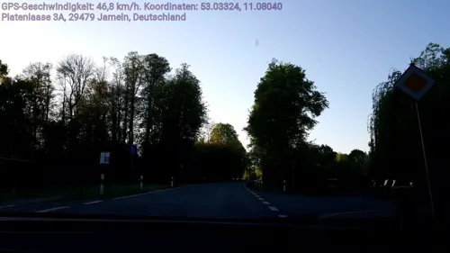
Café Grenzbereiche
Cinema and theater · 7.1 km
15 Platenlaase, Jameln
"immer, wenn Filme gut zeigt werden. Oft Donnerstag, Freitag,...

Biohof Linde
Farm and orchard · 7.2 km
Bioland zertifizierter Rindermast- und Legehennenbetrieb mit eigenem Biofutteranbau
27 Alte Dorfstraße, Gusborn
"nach Vereinbarung"


Museums and landmarks34


Waldemarturm
Museum · 0.6 km
Früherer Bergfried von Burg und Schloss Dannenberg in Dannenberg (Elbe)

Hitzacker Archaeological Centre
Monument and historic site · 6.3 km
Archaeological open-air museum

Historisches Feuerwehrmuseum
Museum · 5.4 km
Apr-Oct: Mo,Tu off; We-Fr 14:00-17:00; Sa,Su,PH 10:00-17:00

Mausoleum
Monument and historic site · 4.8 km
Erputzter Backsteinbau über quadratischem Grundriss unter flach geneigtem Satteldach in schwarz glasierter Hohlpfannendeckung. Im...
Markierung Flurstueckgrenzecke Eisenbahngrundstueck OstheideElbeBahn
Monument and historic site · 1.9 km

22 more on the map.
Parks, trails and playgrounds9

HIDDO-Freibad Hitzacker
Sports field and stadium · 6.4 km
3 Rieselweg, Hitzacker (Elbe)
May 15-Aug 31: Mo-Su 10:00-20:00


WSV Hitzacker
Marina and boat launch · 6.8 km
Die Einfahrt zum WSV ist schmal und nicht betonnt, sind bei normalem Wasserstand aufgelaufen. Grund steinig. Empfehle Weiterfahrt bis...



Restaurants and cafes49
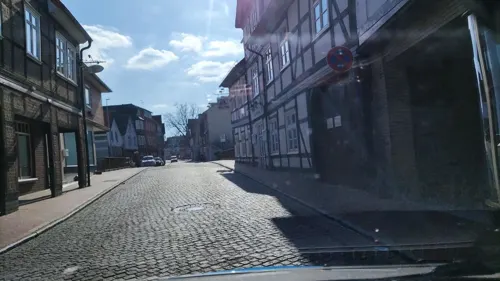
Restaurant Alte Post
Restaurant · German · 0.6 km
6 Marschtorstraße, Dannenberg (Elbe)
Tu-Su 11:00-21:00; Mo off

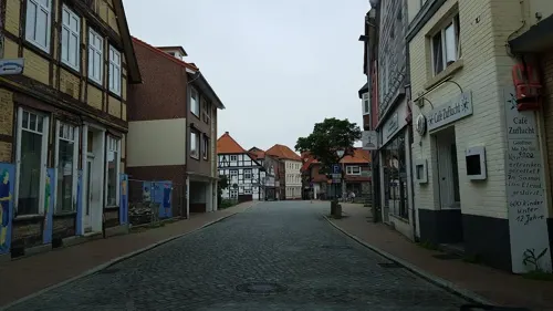
Einstein junior
Restaurant · 0.6 km
2a Kuhmarkt, Dannenberg (Elbe)
Mo-Sa 11:30-14:30,18:00-22:00; Su,PH 12:00-22:00
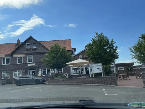
Bauer's am Markt
Restaurant
3 Am Markt, Dannenberg (Elbe)
Mo,Th 09:30-22:00; Fr-Su 11:30-22:00; Tu-We off


)_Carpe_Diem3.jpg)
)_Carpe_Diem2.jpg)
)_Carpe_Diem4.jpg)


37 more on the map.
History
The actual history of the town began with the construction of the castle (first mentioned in 1153) during the rule of Volrad I, Count of Dannenberg (1153–1169), who had been given the task of settling and securing the territory by Duke Henry the Lion. The Waldemarturm is a local historical landmark, a tower in which the Danish King Valdemar II was imprisoned from 1223 to 1224.
After World War II, Dannenberg was part of West Germany. However, it is situated very close to the Elbe river, which served as the border between East and West Germany until 1990.
Lüchow-Dannenberg is situated in a region known as the Wendland, a mostly rural and agricultural area on the eastern edge of Lower Saxony. Starting in the 1970s, Dannenberg was a center for anti-nuclear protests due to the government's plan to build a nuclear waste site in Gorleben, a municipality within the district. Much of the organizing against this facility was based in Dannenberg, notably a tractor drive from Dannenberg to Hannover culminating in a rally. Environmental activism persists as a major issue in the area.
From the History section of Dannenberg (Elbe) on Wikipedia, under CC BY-SA 4.0.
Where to stay12
Churches and places of worship9
Neuapostolische Kirche
Church · New Apostolic
1 Prochaskaplatz, Dannenberg (Elbe)
St. Peter und Paul
Church · Roman Catholic · 1.8 km
20 Feldstraße, Dannenberg (Elbe)
Shopping26
Gas and EV charging9
Hoyer Automatenstation Hitzacker
Gas station · 6.0 km
26 Dannenberger Straße, Hitzacker (Elbe)
Raiffeisen-Warengenossenschaft Jameln eG
Gas station · 6.4 km
12 Hauptstraße, Jameln
Schools, colleges and libraries13
Healthcare4
Map of Dannenberg
169 places. The map loads OpenStreetMap tiles when you open it.
Getting there and nearby towns
Lübeck Airport (LBC) is the nearest airport with scheduled flights listed in OpenStreetMap, 82 km away.
- Hitzacker 7 km northwest, about 7 min by car
- Lüchow 15 km south, about 15 min by car
- Hansestadt Salzwedel 27 km south, about 27 min by car
- Ludwigslust 37 km northeast, about 37 min by car
- Wieren 37 km southwest, about 37 min by car
- Uelzen 38 km southwest, about 38 min by car
- Hagenow 38 km north, about 38 min by car
- Boizenburg 39 km northwest, about 39 min by car
- Wittenberge 45 km east, about 45 min by car
- Lüneburg 48 km west, about 48 min by car
Drive times are estimates from straight-line distance, not routes.
Local news
Headlines from INDB.
Reviews, tips and questions
Loading what members have shared...
Sources and licences
- GeoNames (CC BY 4.0): population, coordinates, regions and time zone
- Mapillary (see each image): photos
- OpenStreetMap contributors (ODbL 1.0): places, airports, map data
- Wikidata (CC0 1.0): elevation, founding date, time zone, website, landmarks and historic places
- Wikimedia Commons (see each image): photos
- Wikipedia (CC BY-SA 4.0): overview and history text
Photo credits
- Dannenberg Blick zum Adolfsplatz, Der Kolonist, CC BY-SA 3.0
- Dannenberg vor der Demo - panoramio, Ralf Houven, CC BY 3.0
- Dannenberg Mühlentor 10, ClausNe, CC BY-SA 4.0
- Stele Mühlentor 5 (Dannenberg (Elbe)) Carpe Diem3, OTFW , Berlin, CC BY-SA 3.0
- Stele Mühlentor 5 (Dannenberg (Elbe)) Carpe Diem2, OTFW , Berlin, CC BY-SA 3.0
- Stele Mühlentor 5 (Dannenberg (Elbe)) Carpe Diem4, OTFW , Berlin, CC BY-SA 3.0
- Stele Mühlentor 5 (Dannenberg (Elbe)) Carpe Diem, OTFW , Berlin, CC BY-SA 3.0
- Brunnen Mühlentor 17 (Dannenberg (Elbe)) Brunnen2, OTFW , Berlin, CC BY-SA 3.0
- Brunnen Mühlentor 17 (Dannenberg (Elbe)) Brunnen3, OTFW , Berlin, CC BY-SA 3.0
- Brunnen Mühlentor 17 (Dannenberg (Elbe)) Brunnen, OTFW , Berlin, CC BY-SA 3.0
- Dannenberg (Elbe), sculpture on the street "An der Marsch", Dguendel, CC BY 3.0
- Dannenberg (Elbe), the Lange Straße, Dguendel, CC BY 3.0
- Dannenberg, die Lange Straße, Dguendel, CC BY 3.0
- Dannenberg Lange Straße 22, ClausNe, CC BY-SA 4.0
- Dannenberg Lange Straße 20, ClausNe, CC BY-SA 4.0
- Dannenberg Lange Straße 32, ClausNe, CC BY-SA 4.0
- Dannenberg Lange Straße 19, ClausNe, CC BY-SA 4.0
- Gedenktafel Lange Str 32 (Dannenberg (Elbe)) Eleonore Prochaska, OTFW , Berlin, CC BY-SA 3.0
- Dannenberg (Elbe), the Lange Straße number 34, Dguendel, CC BY 3.0
- Dannenberg, Haus Lange Straße 34, Dguendel, CC BY 3.0
- Dannenberg, Haus Lange Straße 18, Dguendel, CC BY 3.0
- Dannenberg Lange Straße 35, ClausNe, CC BY-SA 4.0
- Dannenberg, Fachwerkhaus - geo.hlipp.de - 43002, Oxfordian Kissuth on geo.hlipp.de, CC BY-SA 2.0
- Dannenberg Lange Straße 11+12, ClausNe, CC BY-SA 4.0
- Dannenberg Lange Straße 07, ClausNe, CC BY-SA 4.0
- Dannenberg (Elbe), the Lange Straße number 41, Dguendel, CC BY 3.0
- Dannenberg Lange Straße 41, ClausNe, CC BY-SA 4.0
- Dannenberg Lange Straße 42, ClausNe, CC BY-SA 4.0
- Gedenktafel Adolfsplatz 3 (Dannenberg (Elbe)) Widerstandsgruppe Adolfsplatz, OTFW , Berlin, CC BY-SA 3.0
- Dannenberg, die Fischerstraße, Dguendel, CC BY 3.0
- Dannenberg Fischerstraße 3, ClausNe, CC BY-SA 4.0
- Dannenberg Adolfsplatz 2, ClausNe, CC BY-SA 4.0
- Dannenberg Adolfsplatz 1, ClausNe, CC BY-SA 4.0
- Gedenktafel Lange Str 4 (Dannenberg (Elbe)) Wasserläufe und Brunnen, OTFW , Berlin, CC BY-SA 3.0
- Dannenberg Fischerstraße 6, ClausNe, CC BY-SA 4.0
- Dannenberg, Gasse zwischen Lange Straße und Adolfsplatz, Dguendel, CC BY 3.0
- Dannenberg Lange Straße 04, ClausNe, CC BY-SA 4.0
- Dannenberg Fischerstraße 7, ClausNe, CC BY-SA 4.0
- Dannenberg Lange Straße 02, ClausNe, CC BY-SA 4.0
- Brunnen Adolfsplatz (Dannenberg (Elbe)) Brunnen, OTFW , Berlin, CC BY-SA 3.0
- Maujahn1, Christian Fischer, CC BY-SA 3.0
- WaldemarturmDannenberg2, Christian Fischer, CC BY-SA 3.0
- GutskapelleBreese5, Christian Fischer, CC BY-SA 3.0
- Church(newapost) Dannenberg, Christian Fischer, CC BY-SA 3.0
- St Annen Friedhof Dannenberg6, Christian Fischer, CC BY-SA 3.0
- DamnatzChurch3, Christian Fischer, CC BY-SA 3.0
- Church of Hitzacker4, Christian Fischer, CC BY-SA 3.0
- Church of Quickborn Gusborn, Christian Fischer, CC BY-SA 3.0
- Church of Breselenz, Christian Fischer, CC BY-SA 3.0
- Church(cath) Dannenberg, Christian Fischer, CC BY-SA 3.0
- Church of Dannenberg1, Christian Fischer, CC BY-SA 3.0
- Langhaus 1 Hitzacker, Hermann Junghans, CC BY-SA 3.0
- AltesZollhausHitzacker, C.Felder, CC BY-SA 3.0
- Blick vom Weinberg bei Hitzacker auf das Biosphärenreservat 1, Andreas Huth, CC BY-SA 4.0
- Street-level photo, hotteliene, CC BY-SA 4.0
- Street-level photo, hotteliene, CC BY-SA 4.0
- Street-level photo, hotteliene, CC BY-SA 4.0
- Street-level photo, hotteliene, CC BY-SA 4.0
- Street-level photo, hotteliene, CC BY-SA 4.0
- Street-level photo, hotteliene, CC BY-SA 4.0
- Street-level photo, hotteliene, CC BY-SA 4.0
- Street-level photo, hotteliene, CC BY-SA 4.0
- Street-level photo, hotteliene, CC BY-SA 4.0
- Street-level photo, hotteliene, CC BY-SA 4.0
- Street-level photo, hotteliene, CC BY-SA 4.0
- Street-level photo, hotteliene, CC BY-SA 4.0
- Street-level photo, hotteliene, CC BY-SA 4.0
- Street-level photo, hotteliene, CC BY-SA 4.0
- Street-level photo, Jaschu31311, CC BY-SA 4.0
- Street-level photo, hotteliene, CC BY-SA 4.0
- Street-level photo, hotteliene, CC BY-SA 4.0
- Street-level photo, deleted_user, CC BY-SA 4.0
- Street-level photo, hotteliene, CC BY-SA 4.0
- Street-level photo, hotteliene, CC BY-SA 4.0
- Street-level photo, hotteliene, CC BY-SA 4.0
- Street-level photo, hotteliene, CC BY-SA 4.0
- Street-level photo, hotteliene, CC BY-SA 4.0
- Street-level photo, hotteliene, CC BY-SA 4.0
- Street-level photo, hotteliene, CC BY-SA 4.0
)_Carpe_Diem.jpg)
)_Brunnen2.jpg)
)_Brunnen3.jpg)
)_Brunnen.jpg)


)_Eleonore_Prochaska.jpg)


)_Widerstandsgruppe_Adolfsplatz.jpg)


)_Wasserl%C3%A4ufe_und_Brunnen.jpg)


)_Brunnen.jpg)


Page built November 9, 2026. Spotted a mistake? Tell us or suggest a place.