


Why visit Emstek
Townapedia lists 79 museums and landmarks, 42 parks and trails, 157 places to eat, 15 places to stay and 9 attractions in and around town.
Highlights include Hofladen im Ferienhof Repke, Jahn Hofladen, Kulturbahnhof Cloppenburg and KunstHalle im Kulturbahnhof.
Weather in Emstek
Forecast from MET Norway (CC BY 4.0). Full forecast
About Emstek
Emstek (German pronunciation: [ˈɛmʃtɛk]; Low German: Emstäk) is a municipality in the district of Cloppenburg, in Lower Saxony, Germany. It is situated approximately 8 km east of Cloppenburg.
From the Wikipedia article Emstek (this version), under CC BY-SA 4.0.
Things to do9

Hofladen im Ferienhof Repke
Farm and orchard · 4.8 km
4 Zum Moorfeld, Emstek
Sa-Su 14:00-18:00, Mo 15:00-18:00

Obsthof Bergmann
Farm and orchard · 7.1 km
Nur zur Erntezeit im herbst geöffnet
Mo-Fr 09:00-12:00,14:00-17:00; Sa 09:00-12:00
Wild- und Tannenhof Giese
Farm and orchard · 6.3 km
77 Ahlhorner Straße, Cloppenburg
Museums and landmarks79

Kulturbahnhof Cloppenburg
Museum · 6.9 km
82 Bahnhofstraße, Cloppenburg
We 15:00-18:00; Su 11:00-18:00
KunstHalle im Kulturbahnhof
Museum · 6.9 km
82 Bahnhofstraße, Cloppenburg
We 15:00-18:00; Su 11:00-18:00


Cloppenburg Museum Village
Museum · 7.3 km
Open-air-museum in Cloppenburg, Lower Saxony, Germany (1934-)


67 more on the map.
Parks, trails and playgrounds42
Museumsdorf Cloppenburg
Sports field and stadium · 7.1 km
6 Bether Straße, Cloppenburg
Mar-Oct Mo-Su,PH 10:00-18:00; Nov-Feb Mo-Su,PH 10:00-16:30; Dec...

Soestebad Cloppenburg
Sports field and stadium · 7.5 km
28 Hagenstraße, Cloppenburg
Mo 15:00-20:00; Tu 06:30-08:00,15:00-21:00; We 15:00-21:00; Th...



30 more on the map.
Restaurants and cafes157
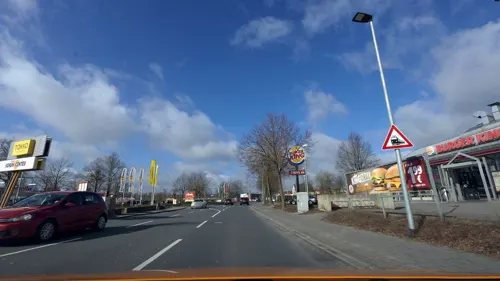
GS Café
Cafe · 6.9 km
43 Emsteker Straße, Cloppenburg
Mo-Sa 06:00-22:00; Su 07:00-22:00; Dec 24 07:00-16:00; Dec...
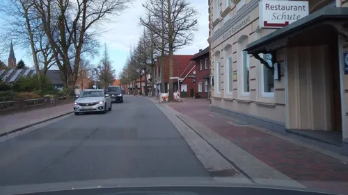
Hotel Schute
Restaurant
Famielienfeiern, Gesellschaftsfeiern, Tagungen - Räume 10 - 120 Personen
15 Lange Straße, Emstek
Mo-Fr 06:00-09:30,17:00-23:00, Sa,Su 07:30-10:00, Sa 18:00-23:00
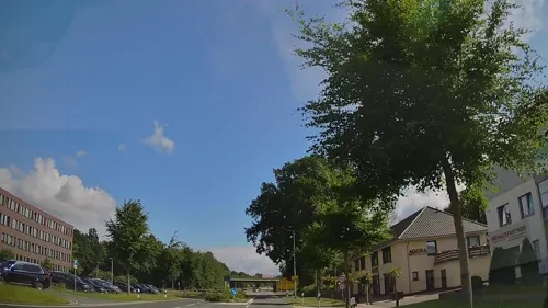
Agora
Restaurant · Greek, Italian, Mediterranean, Pasta, Pizza · 7.1 km
66 Bether Straße, Cloppenburg
Mo-Sa 17:30-24:00; Su,PH 12:00-15:00,17:30-23:00
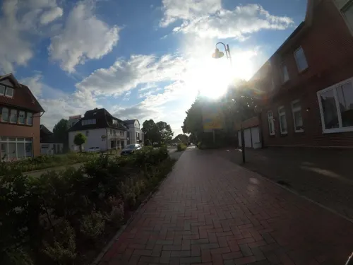
Ahlhorner Krug
Restaurant · Mediterranean · 8.3 km
6 Wildeshauser Straße, Großenkneten
Mo,We-Sa 17:00-23:00; Su,PH 12:00-14:30,17:00-22:00; Tu off
Aladin
Restaurant · Turkish · 7.7 km
8-12 Bahnhofstraße, Cloppenburg
Mo-Tu,Th-Sa 11:00-22:00; We off; Su 12:00-22:00


Bernay's
Bar and pub · 7.8 km
Café; bar; pub; liveclub
20 - 22 Mühlenstraße, Cloppenburg
Mo-Fr 11:00-18:00+; Sa 10:00-18:00+; Su 14:00-18:00+


Franzmann
Restaurant · Sandwich · 7.7 km
8-12 Bahnhofstraße, Cloppenburg
Tu-Sa 10:00-22:00; Su 12:00-21:00; Mo off
Imbiss Meyer
Restaurant · German · 8.2 km
26 Löninger Straße, Cloppenburg
Tu-Sa 11:00-21:00; Su,PH 16:00-21:00; Mo off
Pizzeria Da Capo
Restaurant · Pizza · 7.8 km
20-22 Mühlenstraße, Cloppenburg
Mo,We-Sa 12:00-22:00; Su 15:00-22:00; Tu off
145 more on the map.
Where to stay15
Churches and places of worship31
St. Peter und Paul
Church · Catholic · 3.8 km
28 Große Straße, Cappeln (Oldenburg)
Evangelisch-lutherische Kirche
Church · Protestant · 8.0 km
11 Ritterstraße, Cloppenburg
Shopping53
Gas and EV charging22
Schools, colleges and libraries27
Healthcare16
Map of Emstek
250 places. The map loads OpenStreetMap tiles when you open it.
Getting there and nearby towns
Flugplatz Varrelbusch (VAC) is the nearest airport with scheduled flights listed in OpenStreetMap, 11 km away.
- Oldenburg 34 km north, about 34 min by car
- Ostrhauderfehn 49 km northwest, about 49 min by car
- Bremen 51 km northeast, about 51 min by car
- Osnabrück 63 km south, about 1 h by car
- Hasbergen 68 km south, about 1 h 15 min by car
- Friedeburg 72 km north, about 1 h 15 min by car
- Wietmarschen 77 km southwest, about 1 h 15 min by car
- Hilter 78 km south, about 1 h 15 min by car
- Kirchlinteln 79 km east, about 1 h 15 min by car
- Bremerhaven 85 km north, about 1 h 30 min by car
Drive times are estimates from straight-line distance, not routes.
Local news
Headlines from INDB.
Reviews, tips and questions
Loading what members have shared...
Sources and licences
- GeoNames (CC BY 4.0): population, coordinates, regions and time zone
- Mapillary (see each image): photos
- OpenStreetMap contributors (ODbL 1.0): places, airports, map data
- Wikidata (CC0 1.0): elevation, founding date, time zone, website, landmarks and historic places
- Wikimedia Commons (see each image): photos
- Wikipedia (CC BY-SA 4.0): overview and history text
Photo credits
- Rathaus von Emstek, Dirk urbansky, CC BY-SA 3.0
- Herz-Jesu-Altar Emstek, Cosmo3null, CC BY-SA 4.0
- Orgel St. Margaretha Emstek, Benutzername246, CC BY-SA 4.0
- Ortseinfahrt Emstek, Ringtonatus, CC BY-SA 4.0
- Cloppenburg Museumsdorf Arkenstede, Corradox, CC BY-SA 3.0
- Emstek Baumweg Urwald, Corradox, CC BY-SA 3.0
- Cloppenburg castle, Carsten Niehaus ( Lumbar ), CC BY-SA 1.0
- Cloppenburg cag oldbuilding, Carsten Niehaus ( Lumbar ), Public domain
- Langförden St. Laurentius 2, Langförden_St._Laurentius.JPG : Corradox derivative work: Rabanus Flavus ( talk ), CC BY-SA 3.0
- Innenansicht der Kirche St. Aloysius in der Weihnachtszeit, Volker.Ramsloh, CC BY-SA 4.0
- Bethen Wallfahrtsbasilika, Rabanus Flavus, Public domain
- St. Peter und Paul, Cappeln, Sichi77, CC BY-SA 4.0
- Cloppenburg Museumsdorf Wehlburg, Corradox, CC BY-SA 3.0
- Vechta landkreis Elsten Quatmann Hof 1885 mainhouse IMG 7676 cloppenburg museumsdorf, Bjoertvedt, CC BY-SA 4.0
- Schwichteler Christinenhof 1, Corradox, CC BY-SA 4.0
- Stolperstein Cloppenburg Garreler Weg 12 Günther Frank, Gmbo 2013, CC0
- Sevelter-Kirche-2, Christian Eckhardt, Public domain
- Ea h4 5 wehlburg, Museumsdorf, CC BY-SA 4.0
- Kath. Kirche St. Aloysius Höltinghausen 2017, P A, CC BY-SA 4.0
- Vechta landkreis Elsten Quatmann Hof 1885 mainhouse IMG 7660 cloppenburg museumsdorf, Bjoertvedt, CC BY-SA 4.0
- Desum Gogerichtsstaette, Corradox, CC BY-SA 3.0
- Schute Hotel view1, Figure19, CC BY-SA 3.0
- Schute Hotel view2, Figure19, CC BY-SA 3.0
- Street-level photo, lumbar, CC BY-SA 4.0
- Street-level photo, moenk, CC BY-SA 4.0
- Street-level photo, moenk, CC BY-SA 4.0
- Street-level photo, lumbar, CC BY-SA 4.0
- Street-level photo, lumbar, CC BY-SA 4.0
- Street-level photo, lumbar, CC BY-SA 4.0
- Street-level photo, Schmarvis, CC BY-SA 4.0
- Street-level photo, VIA_KK, CC BY-SA 4.0
- Street-level photo, lumbar, CC BY-SA 4.0
- Street-level photo, camdrive2000, CC BY-SA 4.0
- Street-level photo, hendel, CC BY-SA 4.0
- Street-level photo, jmsbert, CC BY-SA 4.0
- Street-level photo, jmsbert, CC BY-SA 4.0
- Street-level photo, jmsbert, CC BY-SA 4.0
- Street-level photo, jmsbert, CC BY-SA 4.0
- Street-level photo, moenk, CC BY-SA 4.0
- Street-level photo, jmsbert, CC BY-SA 4.0
- Street-level photo, lumbar, CC BY-SA 4.0
- Street-level photo, VIA_KK, CC BY-SA 4.0
- Street-level photo, jmsbert, CC BY-SA 4.0
- Street-level photo, moenk, CC BY-SA 4.0


Page built November 8, 2026. Spotted a mistake? Tell us or suggest a place.