


Why visit Enger
Townapedia lists 33 museums and landmarks, 30 parks and trails, 75 places to eat, 6 places to stay and 8 attractions in and around town.
Highlights include Bio-Markt Meyer-Arend, Aquarienschau im Biologiezentrum Bustedt, Gerberei Museum Enger and Holzhandwerksmuseum I.
Weather in Enger
Forecast from MET Norway (CC BY 4.0). Full forecast
About Enger
Enger (German pronunciation: [ˈɛŋɐ] ) is a town in the Herford district, in North Rhine-Westphalia, Germany.
From the Wikipedia article Enger (this version), under CC BY-SA 4.0.
Things to do8
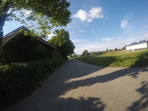
Bio-Markt Meyer-Arend
Farm and orchard · 5.4 km
60 Im Barrenholze, Herford
Mo-Fr 09:00-18:30; Sa 08:00-14:00
Aquarienschau im Biologiezentrum Bustedt
Zoo and aquarium · 4.5 km
Öffentliche Dauerausstellung des Aquarienvereins, ca. 20 Aquarien und Terrarien
Su 11:00-13:00, Tu 19:00-21:00, "oder jederzeit während der...

Stadttheater Herford
Cinema and theater · 8.5 km
Theatre in Herford, Germany, used by touring companies

Quest
Farm and orchard · 2.8 km
50 Lohkampweg, Enger
Mo-Sa 08:00-18:00; Su,PH 09:00-12:00
Höner zu Siederdissen
Farm and orchard · 2.2 km
80 Zur Hegge, Enger


Museums and landmarks33






21 more on the map.
Parks, trails and playgrounds30

Waldfreibad Hiddenhausen
Sports field and stadium · 5.4 km
13 Badstraße, Hiddenhausen
Mo-Fr 07:00-20:00; Sa,Su,PH 07:00-19:00
Werburger Waldbad
Sports field and stadium · 5.6 km
24 Bussche-Münch-Straße, Spenge
Oct-Apr off; Mo 06:30-08:00,12:00-20:00; Tu-Fr 06:30-20:00; PH...






Freibad Lenzinghausen
Sports field and stadium · 4.7 km
Mo-Fr 06:30-08:00,13:00-19:00, Sa-Su 13:00-19:00; Aug 22-May 20 off
18 more on the map.
Restaurants and cafes75
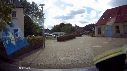

Bäckerei Hensel
Bakery · 1.8 km
Bäckerei im Gebäude des Supermarktes, aber mit eigenem Eingang
44 Minden-Weseler Weg, Enger
Mo-Fr 06:30-18:00, Sa 06:30-14:00, Su 08:00-11:00

Pizzeria Punkt
Restaurant · Pizza · 5.6 km
13 Am Rathausplatz, Hiddenhausen
Mo,We,Th 11:30-14:00,16:30-22:00; Fr 11:30-14:00,16:30-23:00; Sa...

Restaurant Alte Mühle
Restaurant · Greek, German · 5.6 km
17 Bussche-Münch-Straße, Spenge
Mo off; Tu-Sa 17:00-22:30; Su 12:00-14:30,17:00-22:30
Zum Weißen Stein
Restaurant · Italian, Pizza · 3.1 km
144 Markstraße, Enger
Th-Mo 17:30-23:30; Su 12:00-14:30,17:30-23:30
Bäckerei Hensel
Bakery · 5.2 km
2 Bussche-Münch-Straße, Spenge
Mo-Fr 06:00-18:00; Sa 06:00-17:00; Su 08:00-17:00
Bäckerei Karlchen's Backstube
Bakery · 3.3 km
346 Spenger Straße, Enger
Mo-Sa 07:00-20:00; Su 07:00-11:00


Bäckerei Karlchen's Backstube
Bakery · 5.1 km
58 Lange Straße, Spenge
Mo-Fr 07:00-18:00; Sa 07:00-17:00; Su 08:00-17:00
63 more on the map.
History
The town, first mentioned in 948, calls itself "Widukind's town." The Saxon leader Widukind died about 808. However, there is no evidence that Enger existed in his lifetime.
A legend tells that Widukind founded a church in Enger after his baptism, and that he lived at the place until his death. He was buried in the church of Enger, and his monumental tomb is still there.
Despite this, it remains doubtful that the remains of Widukind are actually in the tomb. Analysis shows that the memorial slab dates to the time around the year 1100.
The main current attractions of Enger are Widukind's tomb, the Widukind museum, the Widukind festival ("Timpkenfest"), held annually on January 6 and the "Kirschblütenfest" in April.
From the History section of Enger on Wikipedia, under CC BY-SA 4.0.
Where to stay6
Churches and places of worship30
Shopping23
Gas and EV charging8
Schools, colleges and libraries24
Healthcare14
Map of Enger
250 places. The map loads OpenStreetMap tiles when you open it.
Getting there and nearby towns
Flugplatz Bielefeld (BFE) is the nearest airport with scheduled flights listed in OpenStreetMap, 20 km away.
- Hiddenhausen 5 km northeast, about 5 min by car
- Spenge 5 km west, about 5 min by car
- Herford 8 km east, about 8 min by car
- Kirchlengern 8 km northeast, about 8 min by car
- Löhne 11 km northeast, about 11 min by car
- Bielefeld 12 km south, about 12 min by car
- Werther 12 km southwest, about 12 min by car
- Rödinghausen 13 km northwest, about 13 min by car
- Halle 16 km southwest, about 16 min by car
- Hüllhorst 17 km northeast, about 17 min by car
Drive times are estimates from straight-line distance, not routes.
Local news
Headlines from INDB.
Reviews, tips and questions
Loading what members have shared...
Sources and licences
- GeoNames (CC BY 4.0): population, coordinates, regions and time zone
- Mapillary (see each image): photos
- OpenStreetMap contributors (ODbL 1.0): places, airports, map data
- Wikidata (CC0 1.0): elevation, founding date, time zone, website, landmarks and historic places
- Wikimedia Commons (see each image): photos
- Wikipedia (CC BY-SA 4.0): overview and history text
Photo credits
- Enger mit Stiftskirche, Marc-André Aßbrock, CC BY-SA 4.0
- Tympanon Enger, Chris06, Public domain
- Enger Stiftskirche Innenraum, Chris06, Public domain
- Enger Stiftskirche Grundriss, A. Ludorff (d. 1915), Public domain
- Enger Stiftskirche Dionysius, Chris06, Public domain
- 33 Enger Tafel 5, Albert Ludorff . Hermann Jellinghaus. Uploaded by TUBS . Digitalised by Google Book Search . Alternative Source: OpenSourceBooks, Public domain
- Enger Stiftskirche Chorraum, Chris06, Public domain
- Enger, Kriegsgefangenendenkmal, BangertNo, CC BY-SA 3.0
- 34 Enger Tafel 6, Albert Ludorff . Hermann Jellinghaus. Uploaded by TUBS . Digitalised by Google Book Search . Alternative Source: OpenSourceBooks, Public domain
- 40 Enger Tafel 12, Albert Ludorff . Hermann Jellinghaus. Uploaded by TUBS . Digitalised by Google Book Search . Alternative Source: OpenSourceBooks, Public domain
- 39 Enger Tafel 11, Albert Ludorff . Hermann Jellinghaus. Uploaded by TUBS . Digitalised by Google Book Search . Alternative Source: OpenSourceBooks, Public domain
- 42 Enger Tafel 14, Albert Ludorff . Hermann Jellinghaus. Uploaded by TUBS . Digitalised by Google Book Search . Alternative Source: OpenSourceBooks, Public domain
- 35 Enger Tafel 7, Albert Ludorff . Hermann Jellinghaus. Uploaded by TUBS . Digitalised by Google Book Search . Alternative Source: OpenSourceBooks, Public domain
- 44 Enger Tafel 16, Albert Ludorff . Hermann Jellinghaus. Uploaded by TUBS . Digitalised by Google Book Search . Alternative Source: OpenSourceBooks, Public domain
- 37 Enger Tafel 9, Albert Ludorff . Hermann Jellinghaus. Uploaded by TUBS . Digitalised by Google Book Search . Alternative Source: OpenSourceBooks, Public domain
- 41 Enger Tafel 13, Albert Ludorff . Hermann Jellinghaus. Uploaded by TUBS . Digitalised by Google Book Search . Alternative Source: OpenSourceBooks, Public domain
- 36 Enger Tafel 8, Albert Ludorff . Hermann Jellinghaus. Uploaded by TUBS . Digitalised by Google Book Search . Alternative Source: OpenSourceBooks, Public domain
- 38 Enger Tafel 10, Albert Ludorff . Hermann Jellinghaus. Uploaded by TUBS . Digitalised by Google Book Search . Alternative Source: OpenSourceBooks, Public domain
- Herford, Baudenkmal 469, Portal, Drahreg01, CC BY-SA 3.0
- Evangelische Kirche Oetinghausen (1), Chris06, CC BY-SA 4.0
- 2007 Spenge St. Martin1, Chris06, Public domain
- Spenge-Werburg-Torhaus-20050114 1519 1969-1200px, 1-1111, Public domain
- Panorama Gut Bustedt clouds, TUBS, Public domain
- Stiftskirche Enger, Chris06, Public domain
- Kirche-joellenbeck-2014, Petit8, CC BY-SA 3.0
- Widukind Gymnasium Enger 4379, Benutzer:Fewskulchor, CC BY-SA 3.0 de
- EngBdNr45 (2), Hiddenhauser, CC0
- Steinbeck1, Chris06, Public domain
- Ev.-luth. Kirche Westerenger1, Chris06, Public domain
- Herforder kleinbahn Museum - in the former Enger Bahnhof (33525271608), Kevin Prince, CC BY-SA 2.0
- Ev-Luth Kirche Herringhausen1, Chris06, CC0
- Ev-Luth Kirche Lippinghausen2, Chris06, CC0
- Johanneskirche (Bünde) (4), Chris06, CC BY-SA 4.0
- Spenge - Lenzinghausen-Pauluskirche, Hagar66, CC BY-SA 3.0
- Meylip Glockenturm, Hiddenhauser, CC0
- NSG Asbeke-Kinzbachtal 01, Ingo Kirschnereit, CC BY 3.0
- Naturschutzgebiet Bustedt 5, Hiddenhauser, CC BY-SA 3.0
- Naturschutzgebiet Bustedt 6, Hiddenhauser, CC BY-SA 3.0
- Enger Bruch 15, Hiddenhauser, CC0
- Sundern Füllenbruch, Hiddenhauser, CC0
- Nordhof, BangertNo, CC BY-SA 3.0
- Street-level photo, derlipper, CC BY-SA 4.0
- Street-level photo, mapiman, CC BY-SA 4.0
- Street-level photo, crash69, CC BY-SA 4.0
- Street-level photo, mapiman, CC BY-SA 4.0
- Street-level photo, derlipper, CC BY-SA 4.0
- Street-level photo, resmai, CC BY-SA 4.0
- Street-level photo, derlipper, CC BY-SA 4.0
- Street-level photo, derlipper, CC BY-SA 4.0
- Street-level photo, mapiman, CC BY-SA 4.0
- Street-level photo, mapiman, CC BY-SA 4.0
- Street-level photo, mapiman, CC BY-SA 4.0
- Street-level photo, derlipper, CC BY-SA 4.0
- Street-level photo, crash69, CC BY-SA 4.0
- Street-level photo, Schmarvis, CC BY-SA 4.0
- Street-level photo, mapiman, CC BY-SA 4.0
- Street-level photo, crash69, CC BY-SA 4.0
- Street-level photo, mapiman, CC BY-SA 4.0
- Street-level photo, mapiman, CC BY-SA 4.0
- Street-level photo, mapiman, CC BY-SA 4.0
- Street-level photo, Schmarvis, CC BY-SA 4.0
- Street-level photo, mapillary_service, CC BY-SA 4.0


Page built November 8, 2026. Spotted a mistake? Tell us or suggest a place.