


Eningen unter Achalm, Germany
Eningen unter Achalm is a town of 10,715 people in Baden-Wurttemberg, Germany.
Why visit Eningen unter Achalm
Townapedia lists 39 museums and landmarks, 29 parks and trails, 291 places to eat, 16 places to stay and 25 attractions in and around town.
Highlights include Kamino, Theater Reutlingen Die Tonne, Heimatmuseum and Kunstmuseum Reutlingen | konkret.
Weather in Eningen unter Achalm
Forecast from MET Norway (CC BY 4.0). Full forecast
About Eningen unter Achalm
Eningen (full name Eningen unter Achalm [ˈeːnɪŋən ʔʊntɐ ˈʔaxalm], lit. 'Eningen under Achalm'; Swabian: Ẽnenga ondr dr Achl) is a municipality in the district of Reutlingen, Baden-Württemberg, Germany. It is situated at the foot of the Swabian Alps and near the big cities of Reutlingen and Stuttgart. Although it has a considerable population, its structure is more that of a village. The most important annual events include the Dorffest (the village festival) and the Weihnachtsmarkt (the Christmas market).
From the Wikipedia article Eningen (this version), under CC BY-SA 4.0.
Things to do25


Hohe Warte
Monument and historic site · 5.3 km
Mountain in Baden-Württemberg, Germany



13 more on the map.
Museums and landmarks39


Kunstmuseum Reutlingen | konkret
Museum · 3.9 km
14 Eberhardstraße, Reutlingen
Tu-Su,PH 11:00-17:00; Th 11:00-20:00; Mo off; easter -2 days,Dec...

Naturkundemuseum
Museum · 3.4 km
4 Weibermarkt, Reutlingen
Mo-We,Fr,Sa 11:00-17:00; Th 11:00-19:00; Su,PH 11:00-18:00

Baumannsche Mühle / Trachtenmuseum
Museum · 3.5 km
Trachten- und Mühlenmuseum
5/2 Josefstraße, Pfullingen
May-Oct Su,PH 14:00-17:00

Glashaus
Monument and historic site · 3.6 km
Ausstellungshaus und Veranstaltungsort
34 Oberamteistraße, Reutlingen
"Nur zu offiziellen Veranstaltungsterminen"
Baumannsche Mühle
Museum · 3.5 km
Trachten- und Mühlenmuseum
May-Oct Su,PH 14:00-17:00


Kunstverein Reutlingen e.V.
Museum · 3.9 km
14 Eberhardstraße, Reutlingen
We-Fr 14:00-18:00, Sa,Su 11:00-17:00


27 more on the map.
Parks, trails and playgrounds29

Waldfreibad Eningen
Sports field and stadium · 1.8 km
May-Sep Mo,We 07:00-19:00; Tu,Th-Sa 09:00-19:00; Su 09:00-18:00





Spielplatz Rubensstraße
Playground
Rutsche und Klettergerüst, sowie Sandkasten und Wippelement

17 more on the map.
Restaurants and cafes291

Hofgut Übersberg
Restaurant · 3.6 km
Biergarten mit Lademöglichkeiten (230V Steckdosen) für E-Bikes
1, Pfullingen
We-Su 11:00-21:00; Mo-Tu off

Stausee-Hotel
Restaurant · German · 3.1 km
Room from 88 €, free Wifi
3 Unterer Hof, Metzingen
Mo-Sa 07:00-23:00; Su,PH 07:00-21:00
Bangalore Bistro
Restaurant · Indian, South Indian · 3.6 km
Authentische Küche aus den fünf südindischen Staaten, jetzt endlich auch im Schwabenländle.
20 Mauerstraße, Reutlingen
Tu-Th 11:30-22:00, Fr 11:30 -23:00, Sa 09:30-23:00, Su 11:30-15:30
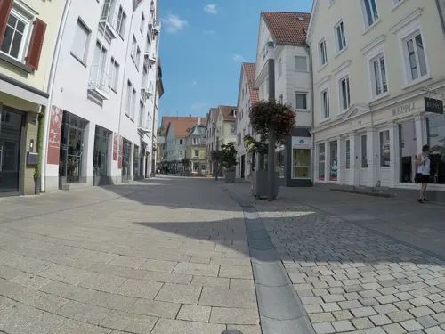
Bio-Bäckerei Berger
Bakery · 3.3 km
Bio Bäckerei Berger
127 Wilhelmstraße, Reutlingen
Mo-Fr 06:00-18:30; Sa 06:00-17:00; Su off; PH off
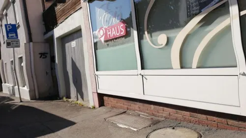
Eishaus
Ice cream · Ice Cream
23 Sorten feinstes Speiseeis, auch Sorten ohne Milchprodukte
1 Schwanenstraße, Eningen unter Achalm
week 11-42 Mo,Tu,Th,Fr,Sa 12:00-19:00; week 11-42 Su 13:00-19:00; We off
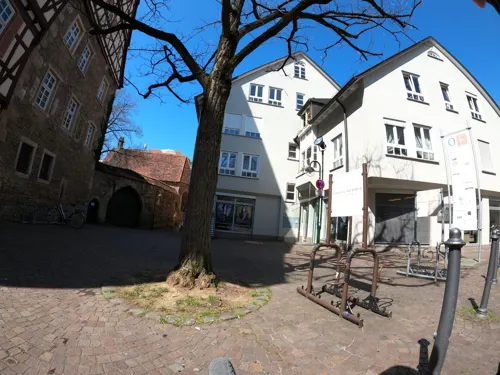
En Ville
Restaurant · Italian · 3.5 km
Trattoria Winebar Gelsomino
Oberamteistraße
Mo-We 11:00-17:30; Th,Fr 11:00-14:30,17:30-23:00; Sa 11:30-23:00; Su,PH off

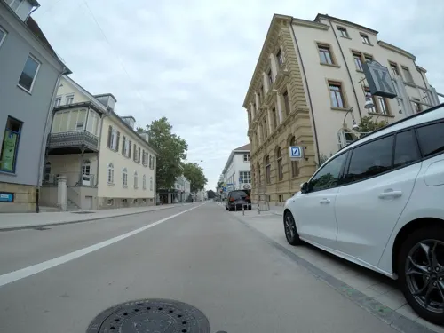
Ließchen
Restaurant · Regional · 3.4 km
Kneipe, Bar, Vesperstube
3 Kaiserpassage, Reutlingen
Tu-Th 16:00-24:00; Fr 16:00-01:00; Sa 15:00-01:00; Su,Mo off
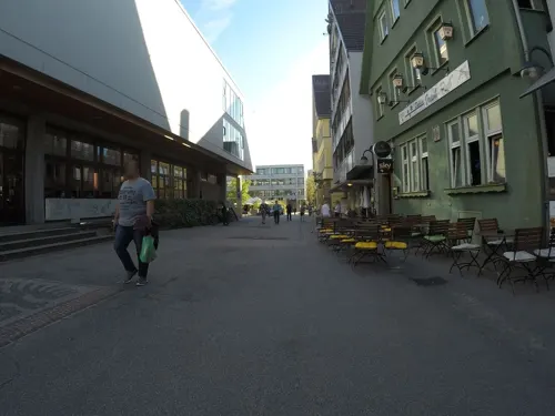
MaMa
Restaurant · Afghan · 3.6 km
Restaurant | Bar | Lounge
16 Marktplatz, Reutlingen
Mo-Th 11:00-23:00; Fr,Sa,Su 09:30-01:00
Suppengrün
Restaurant · Regional · 3.6 km
Mittagstisch und Catering Kalte und warme Buffets Essen im Glas Vegetarische und vegane Küche Fleischgerichte Regionale Frischezutaten...
31/2 Karlstraße, Reutlingen
Tu-Th 11:30-14:00; PH,Sa,Su off; Mo 11:30-14:00
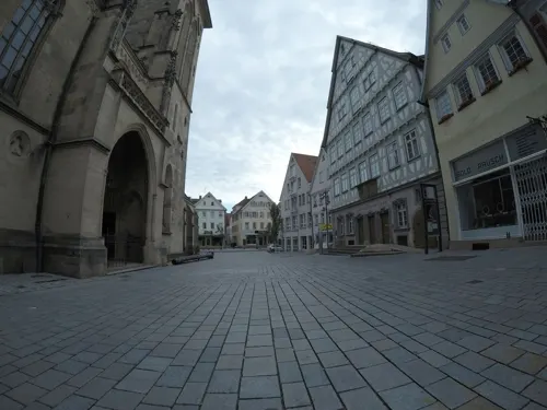


Vis a Vis
Bar and pub · Regional, Sandwich, Sausage, Tarte Flambee, Snacks · 3.4 km
Ihre gemütliche Café-Kneipe im Herzen Reutlingens
105 Wilhelmstraße, Reutlingen
Tu-Th 09:30-23:30; Fr-Sa 09:30-01:00
279 more on the map.
History
Eningen is considered to have been founded in 1090, through the contract of Bempflingen. At that time, Eningen was a small village and its destiny was connected with the interests of the church and nobility. Although the village had grown steadily, until the Thirty Years' War, to a stately municipality inhabited by at least 1,300 inhabitants, Eningen was almost completely destroyed as a result of the war. After the war, the municipality started to recover slowly. Over the years, Eningen developed into a major community. In 1843, Eningen had more than 5000 inhabitants and was considered to be "most beautiful and most populous village in the Kingdom of Württemberg". After the Second World War, Eningen was considered a village and belonged to the city of Reutlingen but it would recover its traditional independence. New roads, and industries were established. Its water supply came from Lake Constance. In 1970, Eningen was awarded with a “recreation and health locality recognition”. Today, Eningen has an area of approximately 2316 ha; 848 ha of those are forest or green area. Administratively, Eningen is a municipality of the county of Reutlingen which is assigned to the district of Tübingen in Baden Württemberg.
From the History section of Eningen on Wikipedia, under CC BY-SA 4.0.
Where to stay16
Churches and places of worship27
Kirche der Entschlafung der Gottesmutter und des Hl. Johannes des Vorläufers zu Reutlingen
Church · Greek Orthodox · 3.5 km
148 Am Heilbrunnen, Reutlingen
Nikolaikirche / Citykirche
Church · Protestant · 3.7 km
1 Nikolaiplatz, Reutlingen
Zu Unserer Lieben Frau
Church · Catholic · 0.7 km
7 Hegelweg, Eningen unter Achalm
Shopping61
Gas and EV charging21
Schools, colleges and libraries26
Healthcare20
Map of Eningen unter Achalm
250 places. The map loads OpenStreetMap tiles when you open it.
Getting there and nearby towns
Manfred Rommel Airport Stuttgart (STR) is the nearest airport with scheduled flights listed in OpenStreetMap, 23 km away.
- Pfullingen 3 km southwest, about 3 min by car
- Reutlingen 4 km west, about 4 min by car
- Metzingen 6 km north, about 6 min by car
- Bad Urach 10 km east, about 10 min by car
- Tübingen 16 km west, about 16 min by car
- Nürtingen 17 km north, about 17 min by car
- Mössingen 18 km southwest, about 18 min by car
- Münsingen 19 km southeast, about 19 min by car
- Weil im Schönbuch 21 km northwest, about 21 min by car
- Kirchheim unter Teck 23 km northeast, about 23 min by car
Drive times are estimates from straight-line distance, not routes.
Local news
Headlines from INDB.
Reviews, tips and questions
Loading what members have shared...
Sources and licences
- GeoNames (CC BY 4.0): population, coordinates, regions and time zone
- Mapillary (see each image): photos
- OpenStreetMap contributors (ODbL 1.0): places, airports, map data
- Wikidata (CC0 1.0): elevation, founding date, time zone, website, landmarks and historic places
- Wikimedia Commons (see each image): photos
- Wikipedia (CC BY-SA 4.0): overview and history text
Photo credits
- Eningen unter Achalm, Rathaus, Rolo-l, CC BY-SA 3.0
- HoheWarteAussichtsturm, Ssch, CC BY-SA 3.0
- Reutlingen Hochschule Fahnen, Windharp, CC BY-SA 4.0
- Reutlingen Marienkirche 2012-04, Helmlechner, CC BY-SA 3.0
- RT Friedrich-List-Gymnasium 001, Greencherry, CC BY-SA 4.0
- FSG Pfullingen D-Bau, WikiHilpi, CC0
- Reutlingen Gartentor, dierk schaefer, CC BY 2.0
- 1dfh-georgenberg-2, Dieter F. Heinlin, CC BY-SA 3.0
- Nikolaikirche Reutlingen Westansicht, Vux, CC BY-SA 3.0
- Rangenberg 2010 04 29 00, Moritz Wickendorf, CC BY-SA 3.0
- Reutlingen Marienkirche Heimatmuseum, Fundador at German Wikipedia, Public domain
- THR Eingang, Smrathr, CC BY-SA 4.0
- NSG Wendelstein IMG 4597 by Vux, Vux, CC BY-SA 3.0
- Achalm, NSG Wagenhals, Eningen unter Achalm, Vux ( Diskussion ), CC BY-SA 3.0 de
- Stadtbibliothek Reutlingen 30, Giftzwerg 88, CC BY-SA 3.0
- Reutlingen die Tonne Front, Windharp, CC BY-SA 4.0
- Pfullingen Martinskirche-1, Vux, CC BY-SA 3.0
- Reutlingen Kamino Eingang, Windharp, CC BY-SA 4.0
- Cineplex Planie Reutlingen 02, Giftzwerg 88, CC BY-SA 3.0
- NSG Kugelberg, Traubensaft2, CC BY-SA 4.0
- Mädlesfels, Dariusbenfoto, CC BY-SA 4.0
- Reutlingen Naturkundemuseum, Laserlicht, CC BY-SA 4.0
- Spendhaus Reutlingen, Autor, CC BY-SA 3.0
- Spitalhof, Theater - Die Tonne, Reutlingen - panoramio, qwesy qwesy, CC BY 3.0
- Pfullingen Baumannsche Mühle-5, Vux, CC BY-SA 3.0
- Eisturm Reutlingen southside, Wirtu, CC0
- Stadtgarten Reutlingen 01, Giftzwerg 88, CC BY-SA 3.0
- Griechisch-Orthodoxe Kirche der Entschlafung der Gottesmutter und des Hl. Johannes des Vorläufers zu Reutlingen 03, Vux, CC BY-SA 4.0
- Leonhardskirche Reutlingen 05, Giftzwerg 88, CC BY-SA 3.0
- St. Wolfgang Reutlingen 02, Giftzwerg 88, CC BY-SA 3.0
- Pfullingen St. Wolfgang-Kirche, Vux, CC BY-SA 3.0
- Pfullingen Magdalenenkirche Turm 1, Windharp, CC BY-SA 4.0
- Pfullingen-Blick-vom-Restaurant-Fritz 2021-08-08 MTh, ( MTheiler ), CC BY-SA 4.0
- Isolde-Kurz-Gymnasium Reutlingen 01, Giftzwerg 88, CC BY-SA 3.0
- Pfullingen-Uebersberg-Restaurant02 2022-08-21 MTh, MTheiler ( talk ), CC BY-SA 4.0
- Pfarrkirche Zu Unserer lieben Frau (Eningen unter Achalm), Vux, CC BY-SA 3.0
- Pfullingen Wilhelm-Hauff-Realschule (3), Windharp, CC BY-SA 4.0
- Eningen Versöhnungskirche (2), Windharp, CC BY-SA 4.0
- Pfullingen Friedenskirche (2), Windharp, CC BY-SA 4.0
- Spitalhof und Spitalkirche Reutlingen, Dem Zwickelbert sei Frau 15:58, 21. Mai 2009 (CEST), Public domain
- Pfullingen Schloss-Schule (4), Windharp, CC BY-SA 4.0
- Glashaus 1, Dulliman, CC BY 4.0
- Reutlingen Industriemagazin Eingang, Windharp, CC BY-SA 4.0
- Kinderhaus Planie 32 Reutlingen 01, Giftzwerg 88, CC BY-SA 3.0
- Wohngebäude im Museumsgarten in Reutlingen, Roland Puskaric, CC BY-SA 4.0
- Street-level photo, photastic2, CC BY-SA 4.0
- Street-level photo, snaysard, CC BY-SA 4.0
- Street-level photo, snaysard, CC BY-SA 4.0
- Street-level photo, snaysard, CC BY-SA 4.0
- Street-level photo, snaysard, CC BY-SA 4.0
- Street-level photo, snaysard, CC BY-SA 4.0
- Street-level photo, snaysard, CC BY-SA 4.0
- Street-level photo, snaysard, CC BY-SA 4.0
- Street-level photo, snaysard, CC BY-SA 4.0
- Street-level photo, snaysard, CC BY-SA 4.0
- Street-level photo, snaysard, CC BY-SA 4.0
- Street-level photo, snaysard, CC BY-SA 4.0
- Street-level photo, mfa, CC BY-SA 4.0
- Street-level photo, snaysard, CC BY-SA 4.0
- Street-level photo, snaysard, CC BY-SA 4.0
- Street-level photo, snaysard, CC BY-SA 4.0
- Street-level photo, snaysard, CC BY-SA 4.0
- Street-level photo, snaysard, CC BY-SA 4.0
- Street-level photo, fcignat, CC BY-SA 4.0
- Street-level photo, snaysard, CC BY-SA 4.0


Page built November 8, 2026. Spotted a mistake? Tell us or suggest a place.