


Geesthacht, Germany
Geesthacht is a town of 29,487 people in Schleswig-Holstein, Germany.
Why visit Geesthacht
Townapedia lists 35 museums and landmarks, 33 parks and trails, 97 places to eat, 10 places to stay and 20 attractions in and around town.
Highlights include Hofladen Schultz, Kleines Theater Schillerstraße, Dänenbrücke and Forsthaus Grüner Jäger.
Weather in Geesthacht
Forecast from MET Norway (CC BY 4.0). Full forecast
About Geesthacht
Geesthacht (German: [ɡeːstˈhaxt] ) is the largest city in the District of the Duchy of Lauenburg (Herzogtum Lauenburg) in Schleswig-Holstein in Northern Germany, 34 kilometres (21 mi) south-east of Hamburg on the right bank of the River Elbe. Dassendorf lies to the north.
From the Wikipedia article Geesthacht (this version), under CC BY-SA 4.0.
Things to do20
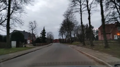
Hofladen Schultz
Farm and orchard · 4.2 km
Spargel, Kartoffeln, Eier, Honig, Milch, Gemüse
13 Dorfstraße, Worth
Mo-Tu,Th-Fr 10:00-17:00; Sa 10:00-13:00; PH off



Landhof Buhk
Farm and orchard · 2.8 km
34 Besenhorst, Geesthacht
Mo-Fr 10:00-18:00; Sa 09:00-13:00
Feldherrenhügel
Scenic view · 2.7 km
Hügel aufgeschüttet mit dem Aushub des Kernkraftwerks Krümmel.
8 more on the map.
Museums and landmarks35


Backboard Geesthacht (vorm. Hotel Zur Post)
Monument and historic site · 0.8 km
7 Elbstraße, Geesthacht
Ehrenmal für Russen
Monument and historic site
Position unbekannt, Info allein von der Webseite! 10/2023 gefunden und ergänzt.
Kriegsdenkmal 1870-71
Monument and historic site
Position unbekannt, Info allein von der Webseite! 10/2023 gefunden und ergänzt.
Kriegsdenkmal WKI
Monument and historic site
Position unbekannt, Info allein von der Webseite! 10/2023 gefunden und ergänzt.


GeesthachtMuseum! im Krügerschen Haus
Museum
Mo-Su 10:00-12:30, Mo-Fr 13:30-18:00, Sa,Su 13:00-16:00
Pfad der Menschenrechte
Monument and historic site · 0.9 km
Rundweg am Geesthachter Elbufer mit 16 Informationstafeln zur 'Allgemeinen Erklärung der Menschenrechte ' der Vereinten Nationen.
Werftstraße
23 more on the map.
Parks, trails and playgrounds33

Besenhorster Sandberge und Elbsandwiesen
Hiking and trails · 3.2 km
Verlassen der Wege verboten. Lebensgefahr durch ungesicherte Gefahrenstellen. Das Reiten ist nur auf den gekennzeichneten Reitwegen gestattet.






21 more on the map.
Restaurants and cafes97
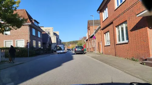
Asia Han
Restaurant · Asian, Chinese, Thai, Vietnamese
8 Buntenskamp
Mo-Fr 11:30-15:15,16:15-21:00; PH, Su 12:30-15:15,16:15-20:30; Sa off
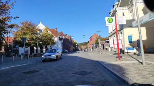
Feuervogel
Restaurant · Pizza
34 Bergedorfer Straße, Geesthacht
Mo-Fr 11:30-14:30,17:30-22:30; Sa-Su 11:30-22:30
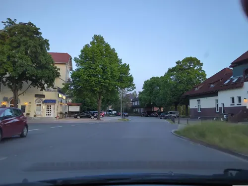
Holsteiner Hof
Restaurant · German · 0.6 km
36 Hechtholz, Geesthacht
Mo,Tu 17:00-21:00; We-Sa 12:00-14:30,17:00-20:30; Su 12:00-15:00
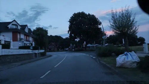
Landhaus Tesperhude
Restaurant · Regional · 5.2 km
100 Elbuferstraße, Geesthacht
Mo-Fr 11:30-15:00, 17:00-21:30;Sa-Su 11:00-21:30

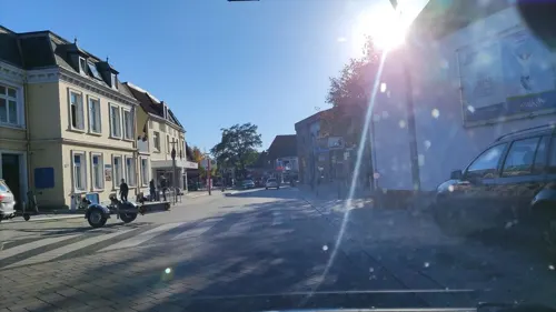
Showcool!
Restaurant · Asian, Vietnamese · 1.0 km
18 Fährstieg, Geesthacht
Tu-Fr 12:00-22:00, Sa-Su 13:00-22:00
Yama Restaurant
Restaurant · Asian, Sushi
49 Bergedorfer Straße, Geesthacht
Mo 10:00-22:00; We-Sa 10:00-22:00; Su 10:00-21:30
Zur Rennbahn
Restaurant · 4.7 km
4 Stover Strand, Drage (Elbe)
12:00-21:00; Mo,Th off; Nov-Feb Tu,We,Fr 17:00-21:00
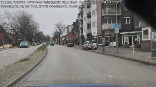
BE Geesthacht
Restaurant · Asian
58 Bergedorfer Straße, Geesthacht
Mo-Th 12:00-22:00, Fr 12:00-24:00, Sa 10:00-24:00, Su 13:00-21:00


85 more on the map.
History
A church was built in what is today Geesthacht around the year 800. The town was first mentioned in 1216 as Hachede, then a part of the Duchy of Saxony. A change in the course of the Elbe cut the settlement into two: Geesthacht and Marschacht (in today's Lower Saxony). In 1296, Geesthacht became part of the Duchy of Saxe-Lauenburg, partitioned from Saxony. Duke Eric III pawned Geesthacht - as part of the Herrschaft of Bergedorf - to the Free City of Lübeck in 1370. In 1401, Duke Eric IV retook the pawned area by force. Geesthacht was ceded as part of a condominium to the Hanseatic cities Hamburg and Lübeck by the Peace of Perleberg in 1420.
In 1811, Geesthacht was annexed to the First French Empire as part of the Bouches de l'Elbe département, but the condominium was restored two years later. In the 1860s, Swedish chemist Alfred Nobel established a glycerin factory in Geesthacht (on Krümmel hill) and invented dynamite, with Krümmel becoming the first dynamite factory in the world. Lübeck sold its share in the condominium to Hamburg in 1868, and Geesthacht became a part Hamburg's state territory. The Bergedorf-Geesthachter Railway (BGE) opened in 1906.
From the History section of Geesthacht on Wikipedia, under CC BY-SA 4.0.
Where to stay10
Churches and places of worship14
Shopping27
Gas and EV charging9
Schools, colleges and libraries17
Healthcare11
Johanniter-Klinik für Geriatrie Geesthacht
Clinic and pharmacy · 1.7 km
100 Johannes-Ritter-Straße, Geesthacht
Map of Geesthacht
250 places. The map loads OpenStreetMap tiles when you open it.
Getting there and nearby towns
Hamburg Airport (HAM) is the nearest airport with scheduled flights listed in OpenStreetMap, 34 km away.
- Wentorf bei Hamburg 10 km northwest, about 10 min by car
- Schwarzenbek 10 km northeast, about 10 min by car
- Reinbek 12 km northwest, about 12 min by car
- Winsen 14 km southwest, about 14 min by car
- Glinde 16 km northwest, about 16 min by car
- Stelle 18 km west, about 18 min by car
- Lüneburg 21 km south, about 21 min by car
- Seevetal 27 km west, about 27 min by car
- Hamburg 28 km northwest, about 28 min by car
- Mölln 29 km northeast, about 29 min by car
Drive times are estimates from straight-line distance, not routes.
Local news
Headlines from INDB.
Reviews, tips and questions
Loading what members have shared...
Sources and licences
- GeoNames (CC BY 4.0): population, coordinates, regions and time zone
- Mapillary (see each image): photos
- OpenStreetMap contributors (ODbL 1.0): places, airports, map data
- Wikidata (CC0 1.0): elevation, founding date, time zone, website
- Wikimedia Commons (see each image): photos
- Wikipedia (CC BY-SA 4.0): overview and history text
Photo credits
- Museum Geesthacht, flamenc, CC BY-SA 3.0
- Geesthacht Theater, flamenc, CC BY-SA 3.0
- Berliner Straße 43-45, Geesthacht, hh oldman, CC BY 3.0
- Moschee, Berliner Straße 48, Geesthacht, hh oldman, CC BY 3.0
- Alter Friedhof Geesthacht - panoramio, hh oldman, CC BY 3.0
- 21502 Geesthacht, Germany - panoramio (2), hh oldman, CC BY 3.0
- Rathausstraße 32 Geesthacht, Elbe-Hunte, CC BY-SA 4.0
- Alfred-Nobel-Schule, Neuer Krug 37-39, Geesthacht (1), hh oldman, CC BY 3.0
- Fassadenobjekt Sparkassencenter Geesthacht, Gerd Fahrenhorst, CC BY 4.0
- Kundenzentrum Stadtwerke Geesthacht - panoramio, hh oldman, CC BY 3.0
- Vfl Geesthacht - panoramio, hh oldman, CC BY 3.0
- Jugendzentrum Alter Bahnhof, Bahnstraße 45, Geesthacht, hh oldman, CC BY 3.0
- Der Alte Bahnhof von Geesthacht - panoramio, hh oldman, CC BY 3.0
- Rathaus Geesthacht - panoramio, hh oldman, CC BY 3.0
- 21502 Geesthacht, Germany - panoramio (24), hh oldman, CC BY 3.0
- Geesthacht Rathaus, Quartl, CC BY-SA 3.0
- Katholische Kirche St. Barbara in Geesthacht, Eingang zur Kirche, hh oldman, CC BY 3.0
- Geesthacht St. Barbara (2), hh oldman, CC BY 3.0
- Karoline vor dem Lokschuppen Geesthacht, Carol.Christiansen, CC BY-SA 4.0
- 21502 Geesthacht, Germany - panoramio (19), hh oldman, CC BY 3.0
- Zum Stübchen, Geesthachter Straße 31, Geesthacht, hh oldman, CC BY 3.0
- 21502 Geesthacht, Germany - panoramio (20), hh oldman, CC BY 3.0
- 21502 Geesthacht, Germany - panoramio (18), hh oldman, CC BY 3.0
- 21502 Geesthacht, Germany - panoramio (29), hh oldman, CC BY 3.0
- 21502 Geesthacht, Germany - panoramio (8), hh oldman, CC BY 3.0
- Geesthacht Polizeizentralstation, Quartl, CC BY-SA 3.0
- 21502 Geesthacht, Germany - panoramio (7), hh oldman, CC BY 3.0
- Elv Slenz, flamenc, CC BY-SA 3.0
- St Salvatoris Geesthacht Chor 1, Dirtsc, CC BY-SA 3.0
- Geesthacht Am Spakenberg 52, Matzematik, CC BY-SA 3.0
- Worth Kirche, Matzematik, CC BY-SA 3.0
- Die Elbe bei Geesthacht- Tesperhude - panoramio, chasasroc, CC BY-SA 3.0
- Escheburg Brücke, Dr. Regine Bachmann at de.wikipedia, CC BY-SA 3.0
- AmFriedhof1, Malte Jörn Krafft, CC BY-SA 3.0
- Ruinen im Naturschutzgebiet "Besenhorster Sandberge und Elbsandwiesen" (3), Tetra09, CC BY-SA 4.0
- AmFriedhof2, Malte Jörn Krafft, CC BY-SA 3.0
- Sedum Reflexum, Peter Leitheiser, Public domain
- Borghorster Brack, Hämbörger (Olaf Studt), CC BY-SA 3.0
- Johanniter Krankenhaus - panoramio, hh oldman, CC BY 3.0
- Hohenhorn Kirche 2010-03-21 003, Niteshift ( talk ), CC BY-SA 3.0
- Street-level photo, hotteliene, CC BY-SA 4.0
- Street-level photo, hotteliene, CC BY-SA 4.0
- Street-level photo, hotteliene, CC BY-SA 4.0
- Street-level photo, hotteliene, CC BY-SA 4.0
- Street-level photo, hotteliene, CC BY-SA 4.0
- Street-level photo, hotteliene, CC BY-SA 4.0
- Street-level photo, hotteliene, CC BY-SA 4.0
- Street-level photo, hotteliene, CC BY-SA 4.0
- Street-level photo, hotteliene, CC BY-SA 4.0
- Street-level photo, tian, CC BY-SA 4.0
- Street-level photo, seb1982, CC BY-SA 4.0
- Street-level photo, hotteliene, CC BY-SA 4.0
- Street-level photo, hotteliene, CC BY-SA 4.0
- Street-level photo, hotteliene, CC BY-SA 4.0
- Street-level photo, hotteliene, CC BY-SA 4.0
- Street-level photo, hotteliene, CC BY-SA 4.0
- Street-level photo, hotteliene, CC BY-SA 4.0
- Street-level photo, veloroute_hamburg, CC BY-SA 4.0
- Street-level photo, hotteliene, CC BY-SA 4.0
- Street-level photo, hotteliene, CC BY-SA 4.0
- Street-level photo, hotteliene, CC BY-SA 4.0
- Street-level photo, hotteliene, CC BY-SA 4.0


Page built November 8, 2026. Spotted a mistake? Tell us or suggest a place.