


Schwarzenbek, Germany
Schwarzenbek is a town of 14,832 people in Schleswig-Holstein, Germany.
Why visit Schwarzenbek
Townapedia lists 8 museums and landmarks, 8 parks and trails, 34 places to eat, 3 places to stay and 2 attractions in and around town.
Highlights include Altes Amtsgericht, ehem. „Alte Post“, Golf und Country Club Brunstorf e.V. and Sierre-Park.
Weather in Schwarzenbek
Forecast from MET Norway (CC BY 4.0). Full forecast
About Schwarzenbek
Schwarzenbek (German pronunciation: [ˈʃvaʁtsn̩beːk] ; Low German: Swattenbeek) is a town in the district of Lauenburg, in Schleswig-Holstein, Germany. It is situated east of Dassendorf and approximately 10 km northeast of Geesthacht, and 35 km east of Hamburg. Schwarzenbeks' coat of arms shows a black wolf on a yellow field, beneath the wolf, the water symbolizes the river Schwarze Beke (meaning Black Creek).
From the Wikipedia article Schwarzenbek (this version), under CC BY-SA 4.0.
Things to do2


Museums and landmarks8


ehem. „Alte Post“
Monument and historic site
Das um 1750 erbaute Gebäude war anfangs der Wohn- und Dienstsitz des Oberförsters vom Sachsenwald. Zwischen 1882 und 1905 befand sich...
5 Körnerplatz

ehem. Amtsschreiberhaus
Monument and historic site
Das Fachwerkhaus wurde von 1765 bis 1767 erbaut und war anfangs das Wohnhaus des Amtsschreibers. Zwischen 1870 und 1968 wohnten...



Parks, trails and playgrounds8



Restaurants and cafes34
Show Cool
Restaurant · Vietnamese, Sushi
21 Lauenburger Straße, Schwarzenbek
Tu-Fr 11:30-22:30; Mo off; Sa,Su 12:30-22:30


Bella Vita Schwarzenbek
Ice cream
9 Schmiedestraße, Schwarzenbek
Mo-Su 12:00-22:00
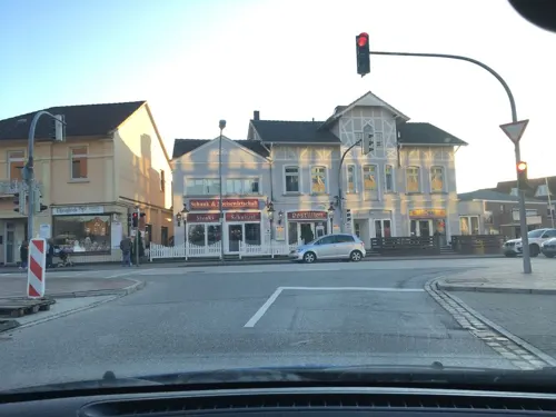
Postillion
Restaurant · International, German
1 Hamburger Straße, Schwarzenbek
Su-Th 17:00-24:00+, Fr,Sa 17:00-02:00, PH 17:00-24:00+
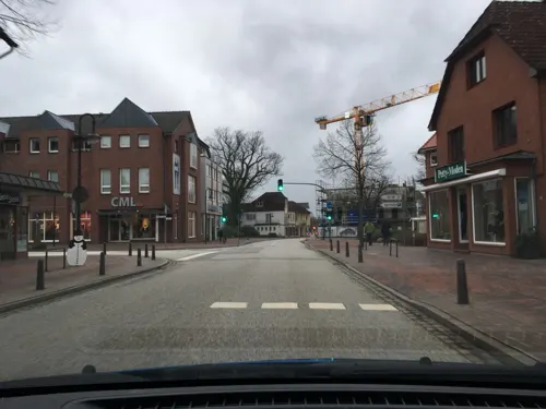
Dat Backhus
Bakery
5 Lauenburger Straße, Schwarzenbek
Mo-Fr 06:30-18:00; Sa 07:00-14:00; Su 07:30-14:00

Dat Backhus
Bakery · 1.3 km
8 Hans-Koch-Ring, Schwarzenbek
Mo-Fr 07:30-18:00; Sa 07:00-17:00
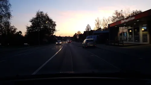
Eggers Cafe
Bakery
25 Möllner Straße, Schwarzenbek
Mo-Fr 05:30-18:00; Sa 05:30-13:00; Su 07:00-16:00
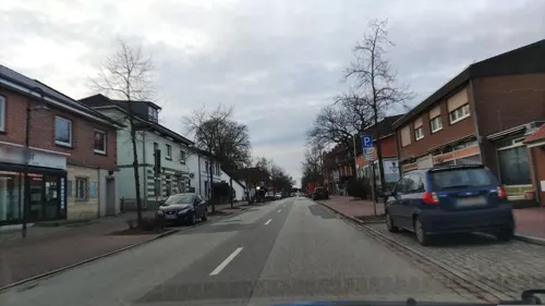


22 more on the map.
History
The first known reference to a population around the "Schwarze Beke" was in the year 1291. The municipal law followed in 1953 given by the government of the state Schleswig-Holstein. The location made Schwarzenbek attractive for many people after that not only that but also the transport connection the Hamburg with the "Deutsche Bahn" the most successful public transportation company in Germany. Connection to Lübeck and Hamburg, main cities in the north of Germany, have been there early in Schwarzenbek's history.
Schwarzenbek fraternized with cities all over Europe what gave it its name as "Europastadt" (European city). Aubenas in France, Sierre in Switzerland and Zelzate in Belgium fraternized with Schwarzenbek in the year of 1955. Two more cities in Europe followed in 1960 including Cesenatico in Italy and Delfzijl in the Netherlands. To show the inhabitants their fraternization to those cities the city named a district of Schwarzenbek Verbrüderungsring (Connection ring) and named streets in that quarter after those cities in Europe.
Schwarzenbek was the second city in Germany which was awarded the Europapreis (European prize).
Schwarzenbek's size grew tremendously the past years and didn't stop growing ever since.
From the History section of Schwarzenbek on Wikipedia, under CC BY-SA 4.0.
Where to stay3
Churches and places of worship6
Ev. Familienzentrum St. Elisabeth
Church · Lutheran · 1.0 km
41a Verbrüderungsring, Schwarzenbek
Hz. Ömer Camii-Moschee Schwarzenbek e.V.
Place of worship · 0.8 km
8 Kollower Straße, Schwarzenbek
Shopping15
Gas and EV charging3
Schools, colleges and libraries7
Healthcare4
Johanniter Krankenhaus Psychiatrische Tagesklinik Schwarzenbek
Clinic and pharmacy
6 Körnerplatz, Schwarzenbek
Map of Schwarzenbek
90 places. The map loads OpenStreetMap tiles when you open it.
Getting there and nearby towns
Hamburg Airport (HAM) is the nearest airport with scheduled flights listed in OpenStreetMap, 36 km away.
- Wentorf bei Hamburg 15 km west, about 15 min by car
- Winsen 24 km southwest, about 24 min by car
- Stelle 28 km southwest, about 28 min by car
- Lüneburg 29 km south, about 29 min by car
- Hamburg 33 km west, about 33 min by car
- Seevetal 36 km west, about 36 min by car
- Lübeck 43 km north, about 43 min by car
- Buchholz in der Nordheide 45 km southwest, about 45 min by car
- Stockelsdorf 44 km north, about 44 min by car
- Neu Wulmstorf 46 km west, about 46 min by car
Drive times are estimates from straight-line distance, not routes.
Local news
Headlines from INDB.
Reviews, tips and questions
Loading what members have shared...
Sources and licences
- GeoNames (CC BY 4.0): population, coordinates, regions and time zone
- Mapillary (see each image): photos
- OpenStreetMap contributors (ODbL 1.0): places, airports, map data
- Wikidata (CC0 1.0): elevation, founding date, time zone, website
- Wikimedia Commons (see each image): photos
- Wikipedia (CC BY-SA 4.0): overview and history text
Photo credits
- Rathaus Schwarzenbek 11, Peng 15:25, 5 September 2006 (UTC), CC BY-SA 3.0
- 21493 Schwarzenbek, Germany - panoramio (15), hh oldman, CC BY 3.0
- 21493 Schwarzenbek, Germany - panoramio (17), hh oldman, CC BY 3.0
- 21493 Schwarzenbek, Germany - panoramio (16), hh oldman, CC BY 3.0
- 21493 Schwarzenbek, Germany - panoramio (8), hh oldman, CC BY 3.0
- 21493 Schwarzenbek, Germany - panoramio (10), hh oldman, CC BY 3.0
- 21493 Schwarzenbek, Germany - panoramio (7), hh oldman, CC BY 3.0
- 21493 Schwarzenbek, Germany - panoramio (11), hh oldman, CC BY 3.0
- Schwarzenbek Franziskuskirche Orgel (02), Hans-Jörg Gemeinholzer, CC BY-SA 4.0
- Schwarzenbek Franziskuskirche Orgel (05), Hans-Jörg Gemeinholzer, CC BY-SA 4.0
- 21493 Schwarzenbek, Germany - panoramio (9), hh oldman, CC BY 3.0
- Schwarzenbek Franziskuskirche Orgel (03), Hans-Jörg Gemeinholzer, CC BY-SA 4.0
- 21493 Schwarzenbek, Germany - panoramio, hh oldman, CC BY 3.0
- Schwarzenbek Franziskuskirche Orgel (01), Hans-Jörg Gemeinholzer, CC BY-SA 4.0
- Schwarzenbek Franziskuskirche Orgel (04), Hans-Jörg Gemeinholzer, CC BY-SA 4.0
- 21493 Schwarzenbek, Germany - panoramio (14), hh oldman, CC BY 3.0
- 21493 Schwarzenbek, Germany - panoramio (12), hh oldman, CC BY 3.0
- 21493 Schwarzenbek, Germany - panoramio (6), hh oldman, CC BY 3.0
- 21493 Schwarzenbek, Germany - panoramio (5), hh oldman, CC BY 3.0
- Rathaus Schwarzenbek - panoramio, hh oldman, CC BY 3.0
- 21493 Schwarzenbek, Germany - panoramio (4), hh oldman, CC BY 3.0
- 21493 Schwarzenbek, Germany - panoramio (13), hh oldman, CC BY 3.0
- Grund- und Gemeinschaftsschule Schwarzenbek, Berliner Straße 12, Schwarzenbek (2), hh oldman, CC BY 3.0
- Grund- und Gemeinschaftsschule Schwarzenbek, Berliner Straße 12, Schwarzenbek (1), hh oldman, CC BY 3.0
- 21493 Schwarzenbek, Germany - panoramio (3), hh oldman, CC BY 3.0
- 21493 Schwarzenbek, Germany - panoramio (2), hh oldman, CC BY 3.0
- 21493 Schwarzenbek, Germany - panoramio (1), hh oldman, CC BY 3.0
- Schwarzenbek Amtsgericht, Matzematik at German Wikipedia, Public domain
- Schwarzenbek Alte Oberförsterei, Matzematik at German Wikipedia, Public domain
- Amtsrichterhaus Schwarzenbek, Innomann at German Wikipedia, CC BY-SA 3.0
- Jt ddr grenzsäule schwarzenbek park, JanTappenbeck, CC BY-SA 3.0
- Schwarzenbek Franziskuskirche 2010-03-21 002, Niteshift ( talk ), CC BY-SA 3.0
- Memorial Schefe, Gerd-HH, CC0
- Jugendtreff - panoramio, hh oldman, CC BY 3.0
- Giro - panoramio (1), hh oldman, CC BY 3.0
- Kirche - panoramio (23), hh oldman, CC BY 3.0
- Unter der Brücke - panoramio (8), hh oldman, CC BY 3.0
- Flötenspieler - panoramio, hh oldman, CC BY 3.0
- Der Grieche - panoramio, hh oldman, CC BY 3.0
- Fire-fighting-facility node-4692584338, AMWebteam, CC BY 2.0
- Street-level photo, hotteliene, CC BY-SA 4.0
- Street-level photo, hotteliene, CC BY-SA 4.0
- Street-level photo, hotteliene, CC BY-SA 4.0
- Street-level photo, hotteliene, CC BY-SA 4.0
- Street-level photo, hotteliene, CC BY-SA 4.0
- Street-level photo, hotteliene, CC BY-SA 4.0
- Street-level photo, hotteliene, CC BY-SA 4.0
- Street-level photo, hotteliene, CC BY-SA 4.0
- Street-level photo, hotteliene, CC BY-SA 4.0
- Street-level photo, quest444, CC BY-SA 4.0
- Street-level photo, hotteliene, CC BY-SA 4.0
- Street-level photo, hotteliene, CC BY-SA 4.0
- Street-level photo, bigbug21, CC BY-SA 4.0
- Street-level photo, hotteliene, CC BY-SA 4.0
- Street-level photo, hotteliene, CC BY-SA 4.0
- Street-level photo, hotteliene, CC BY-SA 4.0
- Street-level photo, hotteliene, CC BY-SA 4.0
- Street-level photo, hotteliene, CC BY-SA 4.0
- Street-level photo, hotteliene, CC BY-SA 4.0
- Street-level photo, hotteliene, CC BY-SA 4.0
- Street-level photo, hotteliene, CC BY-SA 4.0


Page built November 8, 2026. Spotted a mistake? Tell us or suggest a place.