


Gottmadingen, Germany
Gottmadingen is a town of 10,452 people in Baden-Wurttemberg, Germany.
Why visit Gottmadingen
Townapedia lists 243 museums and landmarks, 19 parks and trails, 66 places to eat, 6 places to stay and 13 attractions in and around town.
Highlights include Rosenegg, Buchhaldehof, Museum im Schlosspark and Burgruine Gebsenstein.
Weather in Gottmadingen
Forecast from MET Norway (CC BY 4.0). Full forecast
About Gottmadingen
Gottmadingen is a municipality in the district of Konstanz, in Baden-Württemberg, Germany, situated on the Swiss border, 5 km southwest of Singen, and 12 km east of Schaffhausen.
From the Wikipedia article Gottmadingen (this version), under CC BY-SA 4.0.
Things to do13


Buchhaldehof
Farm and orchard · 4.0 km
1 Vordere Buchhalde, Rielasingen-Worblingen
Mo, We, Fr 09:00-17:00; Sa 08:00-14:00
Hofladen Schoch
Farm and orchard · 3.7 km
1 Hintere Winkelstauden, Rielasingen-Worblingen
Th, Fr 09:00-12:00, 16:00-19:00; Sa 09:00-12:00

1 more on the map.
Museums and landmarks243

Museum im Schlosspark
Museum · 3.4 km
Bürger- und Bauernmuseum Schwerpunkt Bauernkrieg
36 Hauptstraße, Hilzingen
Apr-Oct Su[1] 14:00-17:00 || "für Gruppen jederzeit nach...


Kesslerloch
Monument and historic site · 6.3 km
Cave in Thayngen in the canton of Schaffhausen, Switzerland


231 more on the map.
Parks, trails and playgrounds19

Freibad Hilzingen
Sports field and stadium · 3.3 km
May-Sep: Mo-Tu,Th-Fr 09:00-20:00; May-Sep: We,Sa,Su,PH 08:00-20:00




7 more on the map.
Restaurants and cafes66
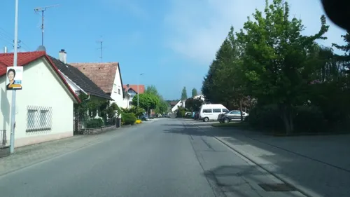
Café Künz
Cafe · Coffee Shop · 3.5 km
2 Trottengasse
Mo-Fr 05:30-17:30; Sa 05:30-17:00; PH,Su 08:00-17:00
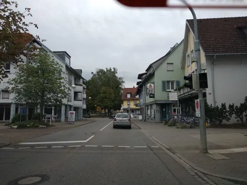
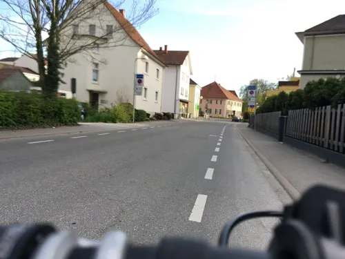
Pizzeria Salerno
Restaurant · Italian, Pizza, Pasta, Salad, Dessert
8 Hilzinger Straße, Gottmadingen
Tu-Fr 11:30-14:00,17:00-22:00; Sa-Su 17:00-22:00; Mo off
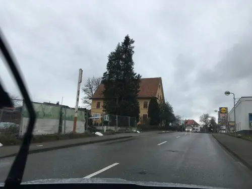
Better Days Coffee Company
Cafe · Coffee Shop
1/1 Johann-Georg-Fahr-Straße, Gottmadingen
Sa 10:00 - 13:00

Schlupfwinkel
Restaurant · 3.1 km
17 Roseneggstraße, Hilzingen
We-Fr 11:30-14:00,17:00-23:00; Sa 17:00-23:00; Su 11:30-14:00

Weingut Vollmayer
Brewery and winery · 3.7 km
1 Weingut Elisabethenberg, Hilzingen
Mo-Fr 09:00-12:30,14:00-18:00; Sa 09:00-13:00


Bäckerei Grecht
Bakery
19 Bahnhofstraße, Gottmadingen
Mo-Fr 06:00-18:00; Su 07:30-17:00; Sa 06:00-13:30

Café am Schlosspark
Cafe · Ice Cream · 3.4 km
1 Meckergasse, Hilzingen
Tu-Fr 10:00-22:00; Su 10:00-20:00
54 more on the map.
Where to stay6
Churches and places of worship27
Königreichsaal der Zeugen Jehovas
Church · Jehovahs Witness · 3.7 km
165e Schaffhauser Straße, Singen (Hohentwiel)
St. Johannes Kirche
Church · Roman Catholic · 2.2 km
12 Thaynger Straße, Gottmadingen
St.-Dionysius-Kirche
Church · Catholic · 4.4 km
1 Kirchstraße, Gailingen am Hochrhein
St. Bartholomäus
Church · Roman Catholic · 4.5 km
7 Hauptstraße, Rielasingen-Worblingen
Shopping22
Gas and EV charging6
Schools, colleges and libraries10
Grundschule Bietingen (Hebelschule Gottmadingen)
School · 3.1 km
1 Schulstraße, Gottmadingen
Healthcare5
Hegau-Bodensee-Klinikum Singen
Hospital · 4.3 km
10 Virchowstraße, Singen (Hohentwiel)
Map of Gottmadingen
250 places. The map loads OpenStreetMap tiles when you open it.
Getting there and nearby towns
Friedrichshafen Airport (FDH) is the nearest airport with scheduled flights listed in OpenStreetMap, 55 km away.
- Rielasingen-Worblingen 5 km east, about 5 min by car
- Singen 5 km northeast, about 5 min by car
- Stockach 22 km northeast, about 22 min by car
- Tuttlingen 28 km north, about 28 min by car
- Überlingen 30 km east, about 30 min by car
- Konstanz 31 km east, about 31 min by car
- Spaichingen 38 km north, about 38 min by car
- Trossingen 39 km north, about 39 min by car
- Villingen-Schwenningen 42 km northwest, about 42 min by car
- Pfullendorf 42 km northeast, about 42 min by car
Drive times are estimates from straight-line distance, not routes.
Local news
Headlines from INDB.
Reviews, tips and questions
Loading what members have shared...
Sources and licences
- GeoNames (CC BY 4.0): population, coordinates, regions and time zone
- Mapillary (see each image): photos
- OpenStreetMap contributors (ODbL 1.0): places, airports, map data
- Wikidata (CC0 1.0): elevation, founding date, time zone, website, landmarks and historic places
- Wikimedia Commons (see each image): photos
- Wikipedia (CC BY-SA 4.0): overview and history text
Photo credits
- Fahr D270 28PS 1958, Späth Chr. (user ChiemseeMan ), Public domain
- Hebelschule Gottmadingen, JoeHard, CC BY-SA 4.0
- Wegkreuz im Buck in Gottmadingen bessere Bildqualitaet, EinEngener, CC0
- Denkmal an die alte Kirche von Gottmadingen beim Kreuzweg, EinEngener, CC0
- 12. Station des Kreuzweges in der Nähe der kath. Kirche von Gottmadingen Jesus stirbt am Kreuze, EinEngener, CC0
- 2. Station des Kreuzweges in der Nähe der kath. Kirche von Gottmadingen Jesus nimmt das Kreuz auf seine Schultern, EinEngener, CC0
- 1. Station des Kreuzweges in der Nähe der kath. Kirche von Gottmadingen Jesus wird zum Tode verurteilt, EinEngener, CC0
- 9. Station des Kreuzweges in der Nähe der kath. Kirche von Gottmadingen Jesus fällt zum drittenmal unter dem Kreuze, EinEngener, CC0
- 13. Station des Kreuzweges in der Nähe der kath. Kirche von Gottmadingen Jesus wird vom Kreuze abgenommen, EinEngener, CC0
- 14. Station des Kreuzweges in der Nähe der kath. Kirche von Gottmadingen Jesus wird ins Grab gelegt, EinEngener, CC0
- 7. Station des Kreuzweges in der Nähe der kath. Kirche von Gottmadingen Jesus fällt zum zweitenmal unter dem Kreuze, EinEngener, CC0
- 11. Station des Kreuzweges in der Nähe der kath. Kirche von Gottmadingen Jesus wird ans Kreuz genagelt, EinEngener, CC0
- 6. Station des Kreuzweges in der Nähe der kath. Kirche von Gottmadingen, EinEngener, CC0
- 10. Station des Kreuzweges in der Nähe der kath. Kirche von Gottmadingen Jesus wird seiner Kleider beraubt, EinEngener, CC0
- 5. Station des Kreuzweges in der Nähe der kath. Kirche von Gottmadingen Simon von Cyrene wird gezwungen Christus das Kreuz tragen zu helfen, EinEngener, CC0
- 3. Station des Kreuzweges in der Nähe der kath. Kirche von Gottmadingen Jesus fällt zum erstenmal unter dem Kreuze, EinEngener, CC0
- 8. Station des Kreuzweges in der Nähe der kath. Kirche von Gottmadingen Jesus redet zu den weinenden Frauen, EinEngener, CC0
- 4. Station des Kreuzweges in der Nähe der kath. Kirche von Gottmadingen Jesus begegnet seiner Mutter, EinEngener, CC0
- Kreuz am kath. Gemeindehaus von Gottmadingen bei der kath. Kirche, EinEngener, CC0
- Bahnhof Gottmadingen, JoeHard, CC BY-SA 4.0
- Aerial View of Gottmadingen 15.07.2008 17-01-52, Hansueli Krapf, CC BY-SA 3.0
- Aerial View of Gottmadingen 15.07.2008 17-01-44, Hansueli Krapf, CC BY-SA 3.0
- Rosenegg 01, Hubenschmid, CC BY 3.0
- Riedheim1, Hubenschmid, CC BY 3.0
- Burg Rosenegg 05, Hubenschmid, CC BY 3.0
- Bürglischloss Gailingen 01, Podvalov, CC BY-SA 3.0
- Aerial image of the Hohentwiel Castle (view from the south), Carsten Steger, CC BY-SA 4.0
- Schloss Randegg 002 montage, BoogyBoogy 08:17, 21. Mär. 2010 (CET), CC BY-SA 3.0
- HilzingenKirche, Matthias Stahlmann, CC BY-SA 3.0 de
- Hilzingen, katholische Kirche St Peter und Paul, Rauenstein, Public domain
- Ebringen, Kirche St. Johannes der Täufer, Rauenstein, CC BY-SA 3.0
- Staufen 02, Hubenschmid, CC BY-SA 3.0
- Kirche St. Peter und Paul, Hilzingen 01, Waldteufel78, CC BY-SA 4.0
- Hilzingen, evangelische Paul-Gerhardt-Kirche, Rauenstein, Public domain
- Chäppeli "von Buttelen" zw. der Schweizer Grenze und Rielasingen, EinEngener, CC BY-SA 4.0
- Bürglischloss Gailingen 003, Commander-pirx, CC BY-SA 4.0
- Gottmadingen Hardtsee, Andreas Weygandt, CC BY-SA 4.0
- Street-level photo, canadarunner, CC BY-SA 4.0
- Street-level photo, talkrabb, CC BY-SA 4.0
- Street-level photo, mr4703, CC BY-SA 4.0
- Street-level photo, mr4703, CC BY-SA 4.0
- Street-level photo, talkrabb, CC BY-SA 4.0
- Street-level photo, talkrabb, CC BY-SA 4.0
- Street-level photo, canadarunner, CC BY-SA 4.0
- Street-level photo, talkrabb, CC BY-SA 4.0
- Street-level photo, canadarunner, CC BY-SA 4.0
- Street-level photo, talkrabb, CC BY-SA 4.0
- Street-level photo, canadarunner, CC BY-SA 4.0
- Street-level photo, talkrabb, CC BY-SA 4.0
- Street-level photo, mr4703, CC BY-SA 4.0
- Street-level photo, talkrabb, CC BY-SA 4.0
- Street-level photo, canadarunner, CC BY-SA 4.0
- Street-level photo, mr4703, CC BY-SA 4.0
- Street-level photo, canadarunner, CC BY-SA 4.0
- Street-level photo, canadarunner, CC BY-SA 4.0
- Street-level photo, mr4703, CC BY-SA 4.0
- Street-level photo, talkrabb, CC BY-SA 4.0
- Street-level photo, mr4703, CC BY-SA 4.0
- Street-level photo, talkrabb, CC BY-SA 4.0
- Street-level photo, fcignat, CC BY-SA 4.0
- Street-level photo, talkrabb, CC BY-SA 4.0


Page built November 8, 2026. Spotted a mistake? Tell us or suggest a place.