


Grefrath, Germany
Grefrath is a town of 16,016 people in North Rhine-Westphalia, Germany.
Why visit Grefrath
Townapedia lists 102 museums and landmarks, 38 parks and trails, 51 places to eat, 12 places to stay and 16 attractions in and around town.
Highlights include Hofkäserei Konnen, Hofladen Helfeshof, Stammenmühle and Haus Steinfunder.
Weather in Grefrath
Forecast from MET Norway (CC BY 4.0). Full forecast
About Grefrath
Grefrath (German pronunciation: [ˈɡʁeːfʁaːt]) is a municipality in the district of Viersen, in the western part of North Rhine-Westphalia, Germany.
From the Wikipedia article Grefrath (this version), under CC BY-SA 4.0.
Things to do16
Hofkäserei Konnen
Farm and orchard · 1.9 km
Ziegenkäse, Ziegenmilcheis, Ziegenlammfleisch, Wurstwaren
211 Mörtelsstraße, Grefrath
Mo-Fr 09:00-18:00; Sa 10:00-17:00

Hofladen Helfeshof
Farm and orchard · 5.1 km
Eier,Kartoffeln,Gemüse,Hähnchen,Kürbisse
15 Wevelinghoven, Nettetal
Mo-Fr 09:00-18:30; Tu off; We off; Sa 09:00-13:00

Burg Uda
Scenic view · 3.0 km
Burgruine der ehem. Burg Uda aus dem 14. Jh; Turm begehbar
Kürbishof Draack
Farm and orchard · 3.5 km
8 Grefrather Landstraße, Wachtendonk
von September bis Anfang November ganztägig

Werner-Jaeger-Forum
Cinema and theater · 5.5 km
Theater hall in North Rhine-Westphalia, Germany
Gemüsehof Nienhaus
Farm and orchard · 4.2 km
Potatoes, eggs, flowers, asperagus
Mo-Su 08:30-13:00; Tu-Fr 08:30-18:00




4 more on the map.
Museums and landmarks102

Stammenmühle
Monument and historic site · 3.6 km
Turmwindmühle, Backstein geschlämmt mit Haubendach und Holzflügeln. Flügel 2007 rekonstruiert.

Haus Steinfunder
Monument and historic site · 3.2 km
Backsteinanlage, zweigeschossig mit Sandsetingewaenden. links quadratisch mit Haubenwalmdach; rechts Staffelgiebel

Pilgerkreuz
Monument and historic site · Roman Catholic · 5.0 km
Erinnerung an tödlichen Pilgerunfall; 1983 erneuer

Aussiedlerhof
Monument and historic site · 4.0 km
Eingeschossiges Backsteinwohnhaus mit anschl. Stallgebäuden

Flootsmühle
Monument and historic site · 5.0 km
Ehemalige Wassermühle mit unterschlächtigen Wasserrad.
Hagelkreuz
Monument and historic site · Roman Catholic · 3.8 km
Sandstein verputzt, Sockel mit Inschrift, Holzkorpus

Kovermühle
Monument and historic site · 4.3 km
Die Kovermühle war eine an der Nette gelegene Wassermühle in der Gemeinde Wachtendonk mit einem unterschlächtigen Wasserrad.

Willmen-Kreuz
Monument and historic site · Roman Catholic · 4.9 km
Unter einer Esche Holzkreuz auf Steinfundament. Pfeildach (schwarzer Kunststoff) schützt braunen Korpus. Mit ausgebreiteten Armen und...
Wohnhaus
Monument and historic site · 3.0 km
Ein unverändertes,repräsentatives Bürgerhaus von anspruchsvoller Architektur des ausgeh. 19. Jh
'Nordkanal' am Schwiershof
Monument and historic site · 3.2 km
Geplanter schiffbarer Wasserweg zwischen Rhein und Maas

90 more on the map.
Parks, trails and playgrounds38

Niederrheinisches Freilichtmuseum
Sports field and stadium · 1.1 km
1 Am Freilichtmuseum, Grefrath
Apr-Oct: Tu-Su 10:00-18:00; Nov-Mar: Tu-Su 10:00-16:00


Krickenbecker Seen und Kleiner De Wittsee
Hiking and trails · 4.5 km


26 more on the map.
Restaurants and cafes51

Kleine Pause Café
Cafe · Cake, Kaffee, Eis · 2.4 km
Deine Kaffee-Pause mit leckerem Kuchen. Der umgebaute Bauwagen steht auf der Weide der Holthöfe und lädt Fahrradfahrer auf ihrer Tour zu...
Wefersweg, Mülhausen
Sa-Su 11:00-17:00
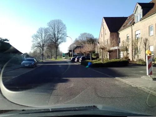


Museumsgaststätte "Pannekookehuus"
Restaurant · Regional · 1.2 km
Tu-Su 11:00+; PH 11:00+ || Mo off; Dec 24, Dec 25, Dec 31, Jan 01 off
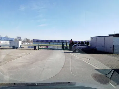
Restaurant Niershorst
Restaurant · German, Croatian · 1.3 km
Mo, Tu off; We-Fr 11:00-22:00; Sa, Su 09:00-22:00


39 more on the map.
History
The town of Grefrath was first mentioned in 1177, at that time bearing the name of Greverode. This stands for "The Earls' Clearing" (German: Rodung der Grafen).
In 1243 Grefrath was acquired by the county of Geldern (since 1339: duchy of Geldern) to which it belonged for the next centuries. In 1543 the duchy of Geldern was given to the Burgundian Netherlands, also called the Spanish Netherlands after the division of the House of Habsburg.
During the Eighty Years' War, in which the Seventeen Provinces (predecessor of today's Netherlands) fought for their independence from Spain, Grefrath continued to belong to Spain along with the southerly part of the duchy of Geldern.
Following the conclusion of the Treaty of Utrecht in 1713, the Spanish part of the duchy of Geldern was added to Prussia.
In the course of the French Revolutionary Wars, Grefrath was occupied by the French in 1794. It became an official part of the French territory in 1801, belonging to the department Roer.
After the defeat of Napoleonic France, the left Lower Rhineland region was returned to Prussia as a result of the Congress of Vienna in 1815, and Grefrath was assigned to what later became the Kempen District (Kreis Kempen).
Over a century later, when the country of Prussia was finally dissolved, Grefrath became a part of the newly created German federal state of North Rhine-Westphalia.
From the History section of Grefrath on Wikipedia, under CC BY-SA 4.0.
Where to stay12
DJH Jugendherberge Nettetal-Hinsbeck - Zirkus-Jugendherberge
Motel and hotel · 4.3 km
1 Heide, Nettetal
Churches and places of worship32
Shopping16
Gas and EV charging4
Schools, colleges and libraries12
Healthcare7
Map of Grefrath
250 places. The map loads OpenStreetMap tiles when you open it.
Getting there and nearby towns
Düsseldorf-Mönchengladbach Airport (MGL) is the nearest airport with scheduled flights listed in OpenStreetMap, 16 km away.
- Nettetal 5 km southwest, about 5 min by car
- Kempen 6 km northeast, about 6 min by car
- Viersen 10 km south, about 10 min by car
- Kaldenkirchen 10 km west, about 10 min by car
- Tönisvorst 11 km east, about 11 min by car
- Straelen 13 km northwest, about 13 min by car
- Krefeld 15 km east, about 15 min by car
- Schwalmtal 14 km south, about 14 min by car
- Willich 16 km southeast, about 16 min by car
- Mönchengladbach 18 km southeast, about 18 min by car
Drive times are estimates from straight-line distance, not routes.
Local news
Headlines from INDB.
Reviews, tips and questions
Loading what members have shared...
Sources and licences
- GeoNames (CC BY 4.0): population, coordinates, regions and time zone
- Mapillary (see each image): photos
- OpenStreetMap contributors (ODbL 1.0): places, airports, map data
- Wikidata (CC0 1.0): elevation, founding date, time zone, website, landmarks and historic places
- Wikimedia Commons (see each image): photos
- Wikipedia (CC BY-SA 4.0): overview and history text
Photo credits
- Grefrath, Markt, O.Falkner, CC BY-SA 3.0
- Grefrath Wasserturm 2026, Oberlausitzerin64, CC BY-SA 4.0
- Waldliege im Schwingbodenpark Grefrath, Clisch, CC BY-SA 4.0
- Bildstock Grefrath Oedt Floethütte 1, Kurwal, CC BY-SA 4.0
- Am Eisstadion in Grefrath (Niederrhein) - geo.hlipp.de - 20555, Udo und Joan Fugel on geo.hlipp.de, CC BY-SA 2.0
- Tussen Mülhausen en Grefrath, de Niers IMG 3119 2018-05-06 13.45, Michielverbeek, CC BY-SA 4.0
- Sankt Heinrich in Grefrath-Mülhausen - panoramio, Edgar El, CC BY 3.0
- Bronzeskulptur Müller mit seinem Esel in Grefrath-Mülhausen - panoramio, giggel, CC BY 3.0
- Grefrath Denkmal A 00009-001 01, Kurwal, CC BY-SA 4.0
- Werner-Jaeger-Halle, Filo64, Public domain
- Aussichtsturm auf dem Taubenberg, Beisenkrieger, CC BY-SA 4.0
- Burg uda, Thomas Inderdohnen/ Tiger28, CC BY-SA 2.0 de
- Innenhof Dorenburg, Mino1997, CC BY-SA 3.0
- Kovermühle 1, Käthe u. Bernd Limburg, www.limburg-bernd.de, CC BY-SA 3.0 de
- Neersdommer Mühle 3, Käthe u. Bernd Limburg, www.limburg-bernd.de, CC BY-SA 3.0 de
- Grefrath StLaurentius, Stefan Probst, Stp78 at de.wikipedia, CC BY-SA 3.0
- 2019 02 13 NSG Grasheide und Mühlhausener Benden (VIE-007) 7, Rudolfo42, CC BY-SA 4.0
- 2019 02 17 NSG Burgbruch (VIE-032) 3, Rudolfo42, CC BY-SA 4.0
- 2019 02 17 NSG Bremmersbruch (VIE-026) 5, Rudolfo42, CC BY-SA 4.0
- Nettetal-Hinsbeck Johanniskapelle, Graph Pixel, CC0
- Schmalbroich, Kriegergedächtniskapelle, O.Falkner, CC BY-SA 3.0
- Wasser.Blick 06 - Schürkesbach 01, Clisch, CC BY-SA 4.0
- Kempen, Haus Steinfunder, O.Falkner, CC BY-SA 3.0
- Flootsmühle 1, Käthe u. Bernd Limburg, www.limburg-bernd.de, CC BY-SA 3.0 de
- Kempen Ziegelheider Straße Wegkreuz 01, Kurwal, CC BY-SA 4.0
- 2024 Stolpersteine Grefrath Levy Alfred, Rudolfo42, CC BY-SA 4.0
- 2019 05 22 NSG Altbuchen an Harbes Hof (VIE-026) (2), Rudolfo42, CC BY-SA 4.0
- 2019 02 17 NSG Bremmersbruch (VIE-026) 4, Rudolfo42, CC BY-SA 4.0
- 2019 01 09 Fritzbruch (NSG VIE-031), Rudolfo42, CC BY-SA 4.0
- Niers Viersen 2017 017, Klaus Graf, CC BY-SA 3.0
- Glabbacher Bruch 2015, Tuxyso, CC BY-SA 3.0
- Kempen Denkmal A 00140-001 01, Kurwal, CC BY-SA 4.0
- 2021 08 01 Burg Uda (4), Rudolfo42, CC BY-SA 4.0
- Hinsbeck kirche, Ichmichi at German Wikipedia, CC BY-SA 3.0
- 2019 02 17 NSG Burgbruch (VIE-032) 5, Rudolfo42, CC BY-SA 4.0
- 2019 02 17 NSG Bremmersbruch (VIE-026) 6, Rudolfo42, CC BY-SA 4.0
- Stolperstein Viersen Moselstraße 10 Hermann Dortans, Gmbo 2013, CC0
- Stolperstein Viersen Moselstraße 10 Ernst Dortans, Gmbo 2013, CC0
- Stolperstein Viersen Moselstraße 10 Maria Dortans, Gmbo 2013, CC0
- Dorenburg Panorama, Mino1997, CC BY-SA 3.0
- Wasser.Blick 07 - Gewässer an der Flootsmühle 02, Clisch, CC BY-SA 4.0
- Wasser.Blick 04 - Niersauenprojekt Burgbenden 02, Clisch, CC BY-SA 4.0
- 2015-02 Stammenmühle Nettetal-Schild, Yvonne Bentele, CC BY-SA 4.0
- Street-level photo, poxonline, CC BY-SA 4.0
- Street-level photo, rausk, CC BY-SA 4.0
- Street-level photo, hektor1989, CC BY-SA 4.0
- Street-level photo, joopjrvdl, CC BY-SA 4.0
- Street-level photo, joopjrvdl, CC BY-SA 4.0
- Street-level photo, saschahaberkorn, CC BY-SA 4.0
- Street-level photo, saschahaberkorn, CC BY-SA 4.0
- Street-level photo, zuse, CC BY-SA 4.0
- Street-level photo, joopjrvdl, CC BY-SA 4.0
- Street-level photo, saschahaberkorn, CC BY-SA 4.0
- Street-level photo, zoegglmeyr, CC BY-SA 4.0
- Street-level photo, saschahaberkorn, CC BY-SA 4.0
- Street-level photo, saschahaberkorn, CC BY-SA 4.0
- Street-level photo, saschahaberkorn, CC BY-SA 4.0
- Street-level photo, joopjrvdl, CC BY-SA 4.0
- Street-level photo, joopjrvdl, CC BY-SA 4.0
- Street-level photo, zuse, CC BY-SA 4.0
- Street-level photo, joopjrvdl, CC BY-SA 4.0
- Street-level photo, poxonline, CC BY-SA 4.0
- Street-level photo, mfa, CC BY-SA 4.0
- Street-level photo, poxonline, CC BY-SA 4.0
- Street-level photo, rausk, CC BY-SA 4.0


Page built November 8, 2026. Spotted a mistake? Tell us or suggest a place.