


Why visit Kempen
Townapedia lists 196 museums and landmarks, 67 parks and trails, 124 places to eat, 9 places to stay and 17 attractions in and around town.
Highlights include Gut Heimendahl, Spargelhof Küthen, Haus Neersdonk and Burg Kempen.
Weather in Kempen
Forecast from MET Norway (CC BY 4.0). Full forecast
About Kempen
Kempen (German: [ˈkɛmpn̩] ) is a town in the district of Viersen, in North Rhine-Westphalia, Germany. It is situated approximately 30 kilometres (19 mi) northwest of Düsseldorf, and 20 kilometres (12 mi) east of Venlo.
From the Wikipedia article Kempen, Germany (this version), under CC BY-SA 4.0.
Photos of Kempen


Things to do17

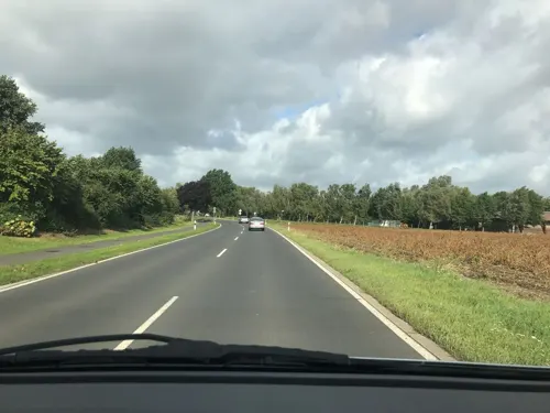
Spargelhof Küthen
Farm and orchard · 3.9 km
Spargel, Erdbeeren
100 Krefelder Weg, Kempen
Mo-Fr 09:00-18:30; Sa 09:00-14:00; Su 10:00-13:00

Burg Uda
Scenic view · 5.5 km
Burgruine der ehem. Burg Uda aus dem 14. Jh; Turm begehbar

Dirk Schumacher
Farm and orchard · 5.4 km
Appels, other fruits
20 Huverheide, Tönisvorst
We-Fr 09:00-18:00; Sa 09:00-14:00
Spargelhof Nytus
Farm and orchard · 2.2 km
25 Schauteshütte, Kempen
May-Jul Mo-Fr 09:00-18:30, May-Jul Sa 09:00-16:00, May-Jul Su,PH...
St. Töniser Obsthof
Farm and orchard · 5.9 km
4 Düsseldorfer Straße, Tönisvorst
Mo-Fr 08:30-18:30; Sa 08:30-18:00; Su 10:00-18:00
Hofladen Wingertsches Erb
Farm and orchard · 5.8 km
Senf, Brotaufstrich, Gelee, Sirup, Essig, Öl, Pestos, Früchte in Rotwein oder Likör
161 Unterweiden, Tönisvorst
We-Fr 14:00-18:00; Sa 10:00-13:00

Obsthof Fruhen
Farm and orchard · 5.3 km
Appels, other fruits
15 Huverheide, Tönisvorst
Mo-Fr 09:00-17:30; Sa 09:00-14:00
5 more on the map.
Museums and landmarks196

Haus Neersdonk
Monument and historic site · 5.8 km
Ehemaliger, wasserumwehrter spätgotischer Herrensitz. 2- geschossig mit hohem Sockel, Backstein verputzt, mit barocken Hauben,...

Burg Kempen
Monument and historic site
Rechtwinklige, zweiflügelige ehemalige Wasserburganlage aus Backstein; zweigeschossig mit Spitzbogenfriesen und drei runden Ecktürmen...

Haus Raedt
Monument and historic site · 6.0 km
17. Jh. und später ehemaliger spätgotischer Herrensitz, Herrenhaus 2-geschossig in 3 Achsen mit Rundbogenfenster und Treppengiebel an...

Haus Steinfunder
Monument and historic site · 3.6 km
Backsteinanlage, zweigeschossig mit Sandsetingewaenden. links quadratisch mit Haubenwalmdach; rechts Staffelgiebel

Hessenmühle
Monument and historic site
Https://commons.wikimedia.org/wiki/File:Kempen_Denkmal-Nr._3c,_Hessenwall_1_(2067).jpg

Kuhtor
Monument and historic site
Rekonstruktion bzw. teilweiser Wiederaufbau der im 18. Jahrhundert geschleiften Befestigungsanlagen mit funktional dazugehörigen Resten...

Villa Horten
Monument and historic site
2-geschossiges Wohnhaus in 3:6 Achsen, entstanden 1870, auf der Seitenfassade 2-achsiger Mittelrisalit, spätklassizistische Putzfassade,...

Berfes
Monument and historic site · 4.7 km
2-geschossiger Fachwerkturm mit wehrgangähnlich vorkragenden Obergeschoss, restauriert 1951,1981,1999.2003


Haefs-Kreuz
Monument and historic site · Roman Catholic · 2.8 km
Unter Ahorn imposantes Kreuz, Korpus weiß gestrichenen mit dunkelbraunen Dornenkrone, ausdrucksstarkes Gesicht nach rechts geneigt. Der...

Alter jüdischer Friedhof
Cemetery · 1.6 km
94 Grabsteine aus der Zeit zwischen 1845 und 1944. Herausragend die 5 Grabsteine der Familie Kounen; 1968 19 Gebeintruhen sowie die...

Voßen-Kreuz
Monument and historic site · 4.0 km
Erwähnt im C17 in der Nähe vom Voßenhof; ursprünglich unter großen Eichenbaum, bedingt durch neue Straßenführung 1984 versetzt; die...
184 more on the map.
Parks, trails and playgrounds67

Niederrheinisches Freilichtmuseum
Sports field and stadium · 5.9 km
1 Am Freilichtmuseum, Grefrath
Apr-Oct: Tu-Su 10:00-18:00; Nov-Mar: Tu-Su 10:00-16:00



Gartenpark Borghof
Park · 3.8 km
24 absolut unterschiedliche Gärten geplant und fertig gestaltet
Mo-Fr 09:00-18:00; Th off; Sa,Su 10:00-18:00


55 more on the map.
Restaurants and cafes124
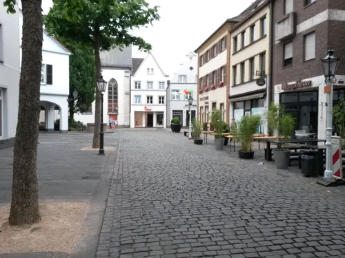
DuQu Lounge
Restaurant · Sushi, Asian, Chinese, Japanese, Vietnamese, Thai
Sushi, Grill & more
Mo-Th 12:00-15:00,17:00-22:00; Fr,Sa 12:00-22:30; Su,PH 12:00-21:30
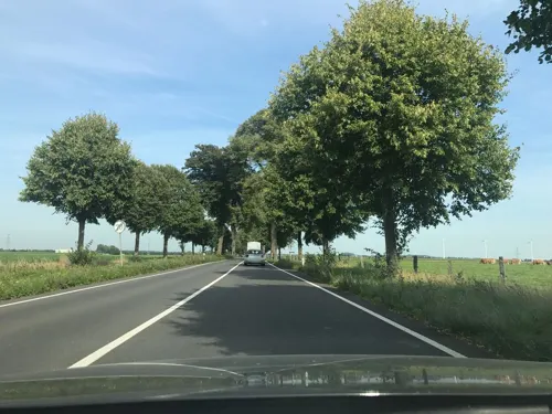
Gaststätte Restaurant Haus Bellen
Restaurant · Regional · 3.6 km
252 Hülser Straße, Kempen
Mo,Tu off; We-Fr 17:00-23:00; Sa 16:00-24:00; Su 12:00-15:00,16:30-21:30
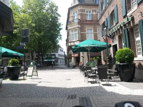
Weinhaus Straeten
Brewery and winery
Weinhaus Straeten Geschäft
Mo off; Tu-Fr 10:30-18:00; Sa 10:00-14:00

Fitscheshof Café & Restaurant UG
Restaurant · German, Regional, Burger, Cafe, Waffle · 6.1 km
3 Lounweg, Wachtendonk
Tu-Th 12:00-20:00; Fr,Sa 12:00-22:00; Su 09:30-22:00; Mo off

Hof-Café Wingertsches Erb
Cafe · Coffee Shop · 5.8 km
161 Unterweiden, Tönisvorst
Mo,Tu off; We 12:00-18:00, Th,Fr 14:00-18:00, Sa,Su,PH 09:30-18:00
Kleine Pause Café
Cafe · Cake, Kaffee, Eis · 4.0 km
Deine Kaffee-Pause mit leckerem Kuchen. Der umgebaute Bauwagen steht auf der Weide der Holthöfe und lädt Fahrradfahrer auf ihrer Tour zu...
Wefersweg, Mülhausen
Sa-Su 11:00-17:00
La Piazza
Restaurant · Italian
11 Buttermarkt
Mo off; Tu-Fr 12:00-14:00,18:00-22:30; Sa 18:00-22:30; Su...

112 more on the map.
History
1186: First mention in official documentation of Kempen as a place – the sovereign until 1794 is the Archbishop (electoral prince) of Cologne
11 March 1294: First confirmation of Kempen as a town in official documentation
15th century: town blooms economically and culturally (population of approx. 4,200)
1542–1543: Kempen is the centre of the Reformation for the Lower Rhine
1579: The plague costs the town almost half of its inhabitants
1642: Kempen is conquered and destroyed by the allied French, Hessian and Weimar troops during the "Hessen War" (Thirty Years' War)
1794–1814: Kempen is under French rule. In the département of Roer established in 1797, Kempen becomes a canton seat in 1798 and a French town in 1801.
1815: After the Congress of Vienna, Kempen becomes Prussian and is the county seat
1929: Due to local reforms, Kempen becomes the administrative seat of the county of Kempen-Krefeld
1970: Communal restructuring: The communities of Hüls, St. Hubert, Tönisberg and Schmalbroich join Kempen along with the localities of St. Peter and Unterweiden to form a single town
1975: In further local reforms, Hüls is assigned to the city of Krefeld. The county of Viersen is formed and Kempen becomes part of "Kreis Viersen"
1987: A cultural forum is opened in the Franciscan monastery after comprehensive restoration and renovation work.
Read more of the history
11 March 1994: Date of the 700-year jubilee of the confirmation of Kempen as a town
From the History section of Kempen, Germany on Wikipedia, under CC BY-SA 4.0.
Notable people from Kempen
 Thomas à KempisGerman canon regularPhoto: zeitgenössischer Maler, Public domain
 Jordan BeyerGerman footballerPhoto: Sven Mandel, CC BY-SA 4.0
 Daniel AltmaierGerman tennis player (born 1998)Photo: si.robi, CC BY-SA 2.0
 Anna LoerperGerman handball playerPhoto: Kuebi = Armin Kübelbeck, CC BY-SA 3.0
 Linus ButtGerman field hockey player (1987-)Photo: Sander van Ginkel, CC BY-SA 2.0
 Marith PrießenGerman association football playerPhoto: Michael Frey ( Michael Frey ), CC BY-SA 3.0
 Wilhelm HünermannGerman writer (1900–1975)Photo: Joachim Specht, Public domain
 Isabel VarellGerman singer and actressPhoto: Superbass, CC BY-SA 4.0
 Udo SchiefnerGerman politicianPhoto: Foto-AG Gymnasium Melle, CC BY 3.0
 Annkathrin HovenGerman athletics competitorPhoto: Steffen Prößdorf, CC BY-SA 4.0
- Aegidius GeleniusGerman historian (1595-1656)
- Tobias KochGerman musician
Born in Kempen, according to Wikidata (CC0). Each name links to its Wikipedia article.
Where to stay9
Churches and places of worship55
Shopping45
Gas and EV charging12
Schools, colleges and libraries27
Astrid-Lindgren-Grundschule (incl. Friedrich-Fröbel-Schule in Abwicklung)
School · 0.8 km
2 Straelener Straße, Kempen
Förderzentrum Ost - Teilstandort St. Hubert (früher: Johannes-Hubertus-Schule)
School · 3.5 km
19 Hohenzollernplatz, Kempen
Healthcare9
Map of Kempen
250 places. The map loads OpenStreetMap tiles when you open it.
Getting there and nearby towns
Düsseldorf-Mönchengladbach Airport (MGL) is the nearest airport with scheduled flights listed in OpenStreetMap, 16 km away.
- Grefrath 6 km southwest, about 6 min by car
- Tönisvorst 7 km southeast, about 7 min by car
- Wachtendonk 7 km northwest, about 7 min by car
- Krefeld 10 km east, about 10 min by car
- Nettetal 11 km southwest, about 11 min by car
- Rheurdt 12 km north, about 12 min by car
- Viersen 12 km south, about 12 min by car
- Neukirchen-Vluyn 13 km northeast, about 13 min by car
- Straelen 14 km northwest, about 14 min by car
- Willich 14 km southeast, about 14 min by car
Drive times are estimates from straight-line distance, not routes.
Towns near Kempen


Keep exploring
Local news
Headlines from INDB.
Reviews, tips and questions
Loading what members have shared...
Sources and licences
- GeoNames (CC BY 4.0): population, coordinates, regions and time zone
- Mapillary (see each image): photos
- OpenStreetMap contributors (ODbL 1.0): places, airports, map data
- Wikidata (CC0 1.0): elevation, founding date, time zone, website
- Wikimedia Commons (see each image): photos
- Wikipedia (CC BY-SA 4.0): overview and history text
Photo credits
- Kempen, Alte Schulstr, O.Falkner, CC BY-SA 3.0
- Kempen Heilig Geist Kapelle, Chris06, Public domain
- Charging station Kempen Hessenring, Kurwal, CC BY-SA 4.0
- Kempen 2010-04-18 – Probsteikirche St. Marien - panoramio - Edgar El, Edgar El, CC BY 3.0
- Kempen 2010-04-18 – Probsteikirche St. Marien - panoramio, giggel, CC BY 3.0
- Kempen 2010-04-18 – „St. Martin in Kempen“ am Buttermarkt - panoramio, giggel, CC BY 3.0
- Kempen 2010-04-18 – am Buttermarkt - panoramio, giggel, CC BY 3.0
- Kempen 2010-04-18 – Brunnen am Buttermarkt - panoramio, giggel, CC BY 3.0
- Kempen Propsteikirche, NiederRainer, CC BY-SA 3.0
- Kempen 2010-04-18 – Kuhtor - panoramio, giggel, CC BY 3.0
- Kempen 2010-04-18 – Alte Schulstraße - panoramio, Edgar El, CC BY 3.0
- Kempen 2010-04-18 – „et kemp’che huus“ - panoramio, giggel, CC BY 3.0
- Kempen 2010-04-18 – Alte Schulstraße-Ecke Orsaystraße - panoramio, giggel, CC BY 3.0
- Kempen 2010-04-18 – Paterskirche am Franziskanerkloster - panoramio - Edgar El, Edgar El, CC BY 3.0
- Kempen 2010-04-18 – Paterskirche am Franziskanerkloster - panoramio, giggel, CC BY 3.0
- Kempen Paterskirche, NiederRainer, CC BY-SA 3.0
- Kempen Denkmal A 00139-001 01, Kurwal, CC BY-SA 4.0
- Kempen, Kurkölnische Landesburg (8753082731), Heribert Pohl --- Thanks for half a million clicks! from Germering bei München, Bayern, CC BY-SA 2.0
- Turmwindmühle-Kempen, NiederRainer, Public domain
- Kempener Grenzsteinweg - Station 01 Kramermuseum Infotafel, Clisch, CC BY-SA 4.0
- Franziskanerkloster in Kempen, Krefeldphoto, CC BY-SA 4.0
- Kempener Grenzsteinweg - Station 01 Kramermuseum Stein Kempen, Clisch, CC BY-SA 4.0
- Infotafel Kuhtor Kempen, Clisch, CC BY-SA 4.0
- Kempener Grenzsteinweg - Station 01 Kramermuseum, Clisch, CC BY-SA 4.0
- Kempen Tor, Hwyrd, CC BY-SA 4.0
- Kempen, die Kempener Turmmühle (zonder wieken) op de voormalige stadsmuur IMG 3111 2018-05-06 13.16, Michielverbeek, CC BY-SA 4.0
- Kempen 2010-04-18 – Turmmühle am Hessenring - panoramio, giggel, CC BY 3.0
- Kempen 2010-04-18 – Amtsgericht Kempen - panoramio, giggel, CC BY 3.0
- Kempen Peterturm, NiederRainer, CC BY-SA 3.0
- Thomaeum-Kempen 2021-08-31 MTh0, MTheiler, CC BY-SA 3.0
- Kempen Denkmal-Nr. 252, Burganlage (2320), Käthe und Bernd Limburg, www.limburg-bernd.de, CC BY-SA 3.0 de
- Kempen Denkmal-Nr. 252, Burganlage (2320) Inschrift Rückseite, Clisch, CC BY-SA 4.0
- Kempen Denkmal-Nr. 252, Burganlage (2320) 18.07.2021, Clisch, CC BY-SA 4.0
- Thomaeum-Kempen 2021-08-31 MTh1, MTheiler, CC BY-SA 3.0
- Kempen 2010-04-18 – Ev. Thomaskirche - panoramio, giggel, CC BY 3.0
- Kempen 2010-04-18 – Ev. Thomaskirche - panoramio - Edgar El, Edgar El, CC BY 3.0
- Stellwerk Kempen, Tohma ( talk ), CC BY-SA 4.0
- Kempen, Mühle, O.Falkner, CC BY-SA 3.0
- Burg Kempen Suedansicht 01, Sir Gawain, CC BY-SA 3.0
- Burg uda, Thomas Inderdohnen/ Tiger28, CC BY-SA 2.0 de
- Kempen, Gymnasium Thomaeum, O.Falkner, CC BY-SA 3.0
- Innenhof Dorenburg, Mino1997, CC BY-SA 3.0
- Luise-von-Duesberg-Gymnasium Kempen, Rudolfo42, CC BY-SA 4.0
- Neersdommer Mühle 3, Käthe u. Bernd Limburg, www.limburg-bernd.de, CC BY-SA 3.0 de
- Grefrath StLaurentius, Stefan Probst, Stp78 at de.wikipedia, CC BY-SA 3.0
- 2019 02 17 NSG Burgbruch (VIE-032) 3, Rudolfo42, CC BY-SA 4.0
- 2020 03 17 Thomaskirche (Kempen) (1), Rudolfo42, CC BY-SA 4.0
- Kempen, Kuhtor (1), Palickap, CC BY-SA 4.0
- 2020 03 28 St. Josef (Kempen) (4), Rudolfo42, CC BY-SA 4.0
- Schmalbroich, Kriegergedächtniskapelle, O.Falkner, CC BY-SA 3.0
- 2020 04 01 Gustav-Adolf-Kirche (Kempen-St. Hubert) (2), Rudolfo42, CC BY-SA 4.0
- Haus Neersdonk 1, Df3vi, CC BY-SA 3.0
- Burg Kempen Westfluegel 01, Sir Gawain, CC BY-SA 3.0
- Haus Raedt, Df3vi, CC BY-SA 3.0
- Kempen, Haus Steinfunder, O.Falkner, CC BY-SA 3.0
- Kempen, Villa Horten, O.Falkner, CC BY-SA 3.0
- Kempen Maasheide Haefs-Kreuz, Kurwal, CC BY-SA 4.0
- 2019 01 24 NSG Tote Rahm (VIE 002) 1, Rudolfo42, CC BY-SA 4.0
- 2019 05 22 NSG Altbuchen an Harbes Hof (VIE-026) (2), Rudolfo42, CC BY-SA 4.0
- 2019 02 17 NSG Bremmersbruch (VIE-026) 4, Rudolfo42, CC BY-SA 4.0
- 2019 03 17 NSG Der breite Eschel (VIE-027) 1, Rudolfo42, CC BY-SA 4.0
- Niers Viersen 2017 017, Klaus Graf, CC BY-SA 3.0
- 5723234.Erwin Quedenfeldt, Erwin Quedenfeldt, Public domain
- Reisemobilpark Kempen am Aquasol, Gmbo 2013, CC0
- Kempen, kerk foto1 2009-08-16 13.35, Michielverbeek, CC BY-SA 3.0
- 15 Kapelle, St. Peter (Kempen), Käthe u. Bernd Limburg ( http://www.limburg-bernd.de ), CC BY-SA 3.0 de
- Franziskanerkloster Kempen, Master Mike, CC BY-SA 3.0
- Kempen - Gut Heimendahl, juli 2014 - panoramio (5), Gimo61, CC BY 3.0
- Kempen Berfes, NiederRainer, CC BY-SA 3.0
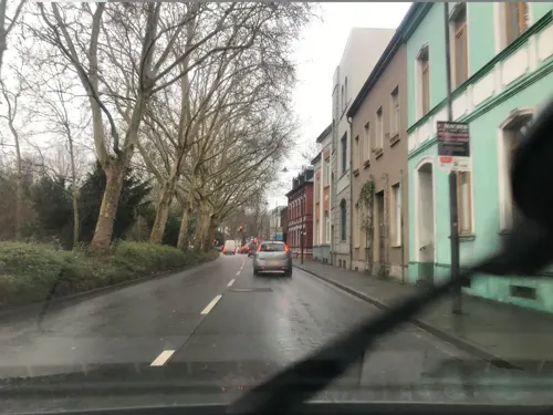
- Street-level photo, saschahaberkorn, CC BY-SA 4.0
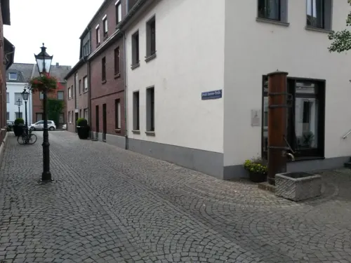
- Street-level photo, rausk, CC BY-SA 4.0
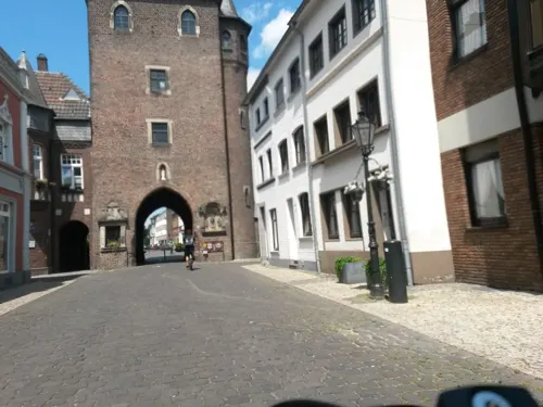
- Street-level photo, rausk, CC BY-SA 4.0
- Street-level photo, saschahaberkorn, CC BY-SA 4.0
- Street-level photo, saschahaberkorn, CC BY-SA 4.0
- Street-level photo, saschahaberkorn, CC BY-SA 4.0
- Street-level photo, rausk, CC BY-SA 4.0
- Street-level photo, rausk, CC BY-SA 4.0
- Street-level photo, rausk, CC BY-SA 4.0
- Street-level photo, rausk, CC BY-SA 4.0
- Street-level photo, rausk, CC BY-SA 4.0
- Street-level photo, zoegglmeyr, CC BY-SA 4.0
- Street-level photo, zoegglmeyr, CC BY-SA 4.0
- Street-level photo, saschahaberkorn, CC BY-SA 4.0
- Street-level photo, saschahaberkorn, CC BY-SA 4.0
- Street-level photo, saschahaberkorn, CC BY-SA 4.0
- Street-level photo, saschahaberkorn, CC BY-SA 4.0
- Street-level photo, DerMaster0815, CC BY-SA 4.0
- Street-level photo, saschahaberkorn, CC BY-SA 4.0
- Street-level photo, joopjrvdl, CC BY-SA 4.0
- Street-level photo, joopjrvdl, CC BY-SA 4.0
- Street-level photo, rausk, CC BY-SA 4.0
- Street-level photo, rausk, CC BY-SA 4.0
- Street-level photo, rausk, CC BY-SA 4.0
- Street-level photo, rausk, CC BY-SA 4.0
- Street-level photo, rausk, CC BY-SA 4.0


Page built November 9, 2026. Spotted a mistake? Tell us or suggest a place.