


Why visit Haan
Townapedia lists 110 museums and landmarks, 101 parks and trails, 193 places to eat, 11 places to stay and 8 attractions in and around town.
Highlights include Kohlfurther Bridge, Hofladen Biohof Nau, Haus Am Quall and Schloss Caspersbroich.
Weather in Haan
Forecast from MET Norway (CC BY 4.0). Full forecast
About Haan
Haan (German pronunciation: [haːn] ) is a town in the district of Mettmann, in North Rhine-Westphalia, Germany. It is situated at the western edge of the Bergisches Land, 12 km southwest of Wuppertal and 17 km east of Düsseldorf. In 1975, Gruiten was incorporated into Haan.
From the Wikipedia article Haan (this version), under CC BY-SA 4.0.
Things to do8

Kohlfurther Bridge
Bridge · 6.8 km
Bridge in Wuppertal – Kohlfurth / , Solingen – Kohlfurth



Hofladen Ellscheid
Farm and orchard · 1.4 km
Mo, We 16:00-18:30; Fr 10:00-12:00,16:00-18:30; Sa 10:00-12:00; Tu, Su off

Museums and landmarks110


Schloss Caspersbroich
Monument and historic site · 1.8 km
Schloss Caspersbroich ist ein im Ittertal gelegenes Schloss im Solinger Stadtteil Ohligs.
1 Caspersbroich, Solingen

Gesenkschmiede Hendrichs
Museum · 3.1 km
Tu-Fr 10:00-17:00; Sa-Su, PH 11:00-18:00; easter -1 day off,...

Alter Kirchturm
Monument and historic site · 3.8 km
Mettmanner Straße, Haan

Broßhauser Mühle
Monument and historic site · 3.1 km
61 Kottendorfer Straße, Solingen

Haus Bolthausen
Monument and historic site · 3.4 km
4 Bolthausen, Wuppertal
Hendrich's Drop Forge
Museum · 3.1 km
A museum in Solingen, a city in North Rhine-Westphalia, Germany

Kleine Feldhofer Grotte
Monument and historic site · 6.0 km
Former cave and archaeological site in Neandertal, Germany



Schornsteinsockel
Monument and historic site · 0.8 km
Sockel des Fabrikschornsteins der ehemaligen Weberei Schniewind
Schärerweg, Haan

Wasserkarussell
Monument and historic site · 1.8 km
Karussell ist durch Brand im Juli 2025 vollständig zerstört
Ittertalstraße, Solingen
98 more on the map.
Parks, trails and playgrounds101



Botanischer Garten Solingen
Park · 3.8 km
2A Vogelsang, Solingen
Mo-Su 08:00-22:00


Hildener Stadtwald, Bereich Sandbach-Krebsbach
Hiking and trails · 3.7 km



89 more on the map.
Restaurants and cafes193

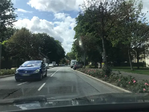
Hotel im Park
Restaurant · International · 0.6 km
28 Nordstraße, Haan
Mo-Sa 17:30-21:30; Th off; Su 11:30-14:30,17:30-20:30
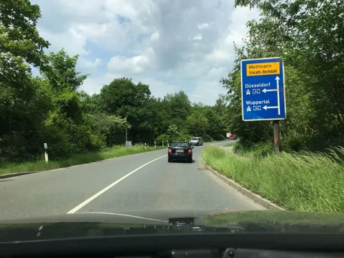
Korfu im Kellertor
Restaurant · Greek · 2.9 km
Anbindebalken vorhanden
271 Flurstraße, Haan
Mo-Su 12:00-23:00

Restaurant "Villa Zefyros"
Restaurant · 3.0 km
289 Merscheider Straße, Solingen
Tu-Sa 12:00-15:00,17:30-22:00; Su,PH 12:00-22:00; Mo off
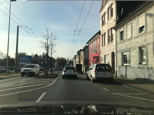
Aahar - the food legacy
Restaurant · Indian · 2.1 km
284a Weyerstraße, Solingen
Mo 13:30-21:30, We-Th 13:30-21:30, Fr-Su 13:30-22:00
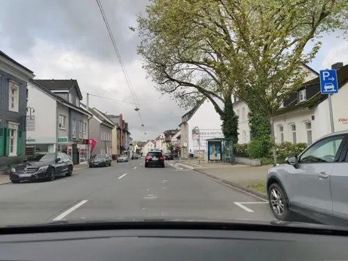


C. Pio
Restaurant · Italian · 0.8 km
52 Bahnhofstraße, Haan
Tu-Sa 18:00-23:00; Su 12:00-14:30, 18:00-23:00
Gut Hahn
Restaurant · International · 1.7 km
13-15 Rheinische Straße, Haan
We-Fr 17:00-23:00; Sa 12:00-23:00; Su 12:00-21:00
Maharaja
Restaurant · Indian
20 Friedrichstraße, Haan
Mo-Fr 11:30-15:00,16:30-21:45; We off; Sa,Su 12:00-21:30
181 more on the map.
History
Haan's origins date back to around 2200 BC. At that time, a hail-shaped settlement was founded in today's city center, which is equipped with a rampart, palisade fence and hedging strips. Accordingly, the name "Haan" should be derived from Hagen, with a reorganization analogous to grove.
From 718 AD Haan was close to the Saxon-Franconian border running between Sonnborn and Elberfeld (both today in Wuppertal). Since today's Kaiserstrasse was a route for the Franconian troops to the east, a marketing system (sutlers) was created in Haan to supply the soldiers.
Even before the early High Middle Ages, Haan belonged to the Archdiocese of Cologne together with Hilden and, even after the formation of the county and later the Duchy of Berg, was initially one of the enclaves within this territorial area. Already around 850, a pre-Romanesque chapel or church was built on the old church square, which Archbishop Wichfried von Köln consecrated in 935. At that time this church was subordinate to the main church in Hilden.
In 1386 the road from Hilden via Haan to Elberfeld, today's federal road 228, was first mentioned in a document. The first evidence of the grinding and weaving trade, which was widespread in Haan until the 20th century, can be dated back to 1589 and 1724 respectively.
In the second half of the 16th century the church of Haan was reformed by the Evangelicals.
From the History section of Haan on Wikipedia, under CC BY-SA 4.0.
Where to stay11
Churches and places of worship26
St. Katharina
Church · Roman Catholic · 2.2 km
316 Weyerstraße, Solingen
Neuapostolische Kirche Erkrath-Hochdahl
Church · New Apostolic · 3.3 km
45 Willbecker Straße, Erkrath
Shopping52
Gas and EV charging26
Schools, colleges and libraries29
Healthcare19
Map of Haan
250 places. The map loads OpenStreetMap tiles when you open it.
Getting there and nearby towns
Düsseldorf Airport (DUS) is the nearest airport with scheduled flights listed in OpenStreetMap, 20 km away.
- Solingen 5 km southeast, about 5 min by car
- Hilden 6 km southwest, about 6 min by car
- Mettmann 7 km northwest, about 7 min by car
- Leichlingen 10 km south, about 10 min by car
- Wülfrath 10 km north, about 10 min by car
- Langenfeld 11 km southwest, about 11 min by car
- Wuppertal 12 km northeast, about 12 min by car
- Remscheid 13 km east, about 13 min by car
- Monheim am Rhein 14 km southwest, about 14 min by car
- Düsseldorf 17 km west, about 17 min by car
Drive times are estimates from straight-line distance, not routes.
Local news
Headlines from INDB.
Reviews, tips and questions
Loading what members have shared...
Sources and licences
- GeoNames (CC BY 4.0): population, coordinates, regions and time zone
- Mapillary (see each image): photos
- OpenStreetMap contributors (ODbL 1.0): places, airports, map data
- Wikidata (CC0 1.0): elevation, founding date, time zone, website, landmarks and historic places
- Wikimedia Commons (see each image): photos
- Wikipedia (CC BY-SA 4.0): overview and history text
Photo credits
- Haan Markt, noebse, CC BY-SA 3.0
- Buecherschrank Haan 2, Kasimix, CC BY-SA 4.0
- Haan markt - panoramio, nexttime, CC BY 3.0
- Sonnenuhr Rathaus Haan, Kasimix, CC BY-SA 3.0
- A part of Haan - Friedrichstraße - panoramio (1), King Otto, CC BY-SA 3.0
- Town hall Haan - panoramio, King Otto, CC BY-SA 3.0
- Adler Rathaus Haan, Kasimix, CC BY-SA 3.0
- Rathaus Haan, Kasimix, CC BY-SA 3.0
- Haan markt - panoramio - nexttime (4), nexttime, CC BY 3.0
- Haan markt - panoramio - nexttime (2), nexttime, CC BY 3.0
- Haan markt - panoramio - nexttime (3), nexttime, CC BY 3.0
- Haan police department - panoramio, nexttime, CC BY 3.0
- Haan, straatzicht Kaiserstrasse-Frierichstrasse foto6 2014-03-30 14.51, Michielverbeek, CC BY-SA 4.0
- A part of Haan - Friedrichstraße - panoramio, King Otto, CC BY-SA 3.0
- Evangelische Kirche Kaiserstr Haan, noebse, Public domain
- Haan markt - panoramio - nexttime, nexttime, CC BY 3.0
- Haan - panoramio - nexttime, nexttime, CC BY 3.0
- Haan markt - panoramio - nexttime (1), nexttime, CC BY 3.0
- A part of Haan - panoramio (11), King Otto, CC BY-SA 3.0
- Am Ideck (Haan)-3, Velopilger, CC0
- Am Ideck (Haan)-4, Velopilger, CC0
- Am Ideck (Haan)-5, Velopilger, CC0
- A part of Haan - first day in 2015 - panoramio, King Otto, CC BY-SA 3.0
- Am Ideck (Haan)-6, Velopilger, CC0
- Am Ideck (Haan)-1, Velopilger, CC0
- Am Ideck (Haan)-2, Velopilger, CC0
- A part of Haan - panoramio (37), King Otto, CC BY-SA 3.0
- Buecherschrank Haan 1, Kasimix, CC BY-SA 4.0
- Haaner Marktplatz - panoramio, Come back, CC BY-SA 3.0
- Am Ideck (Haan)-7, Velopilger, CC0
- Am Ideck (Haan)-9, Velopilger, CC0
- Am Ideck (Haan)-8, Velopilger, CC0
- Haan WalderStr12, Kasimix, CC BY-SA 3.0
- Haan baudenkmale 2017 003, Klaus Graf, CC BY-SA 3.0
- A part of Haan - Schillerpark - panoramio, King Otto, CC BY-SA 3.0
- Haan baudenkmale 2017 001, Historiograf, CC BY-SA 3.0 de
- Haan baudenkmale 2017 002, Klaus Graf, CC BY-SA 3.0
- A part of Haan - panoramio (10), King Otto, CC BY-SA 3.0
- Kohlfurther Brücke 04 ies, Frank Vincentz, CC BY-SA 3.0
- Kleine Feldhofer Grotte, Unknown author Unknown author, Public domain
- Museum1, Heiko Tomaszewski -- Darkstar1970 20:01, 19 August 2007 (UTC), CC BY-SA 3.0
- Solingen - Gesenkschmiede Hendrichs 03 ies, Frank Vincentz, CC BY-SA 3.0
- Gruiten AlterKirchturm, Rabanus Flavus, Public domain
- Walder Kirche 1, Klaus Bailly, CC BY-SA 4.0
- Solingen, Friedrich-Albert-Lange-Schule, Eckgebäude Altenhofer Straße, Friedrich-Ebert-Straße, von Osten, SolingenFan95, CC BY-SA 4.0
- Bauernhaus Bolthausen 4 Wuppertal, Norbert Sdunzik, CC BY-SA 3.0
- Heilig-Geist-Kirche-Erkrath-Hochdahl-Sandheide-3702, HOWI - Horsch, Willy, CC BY 3.0
- Humboldtgymn-sg, A.Savin, CC BY-SA 3.0
- Schloss Caspersbroich, Savino110, CC BY-SA 3.0
- Haan StChrysanthus und Daria, Rabanus Flavus, Public domain
- Gymnasium Haan vom Schulhof, 3nt3nt31ch31nw0hn3r, CC BY-SA 4.0
- Haan - Neuer Markt - Stadtbücherei 01 ies, Frank Vincentz, CC BY-SA 3.0
- Hilden - Hildener Heide - Jaberg - Aussichtsturm 06 ies, Frank Vincentz, CC BY-SA 3.0
- Hilden - Hildener Heide - Sandberg 02 ies, Frank Vincentz, CC BY-SA 3.0
- NSG Sandbach Hildener Heide 02.04.14, Ökologix, CC BY-SA 3.0
- NSG Schönholz 02.04.14, Ökologix, CC BY-SA 3.0
- Hildener Heide 2016 100, Atamari, CC BY-SA 4.0
- NSG Baverter Bachtal - Weg zw. Caspersbroich und Garzenhaus (2), DiAuras, CC BY-SA 4.0
- NSG ME-013 Spörkelnbruch (Haan) (13), DiAuras, CC BY-SA 4.0
- NSG ME-042 Hühnerbachtal (12), DiAuras, CC BY-SA 4.0
- Naturschutzgebiet Ittertal (11), DiAuras, CC BY-SA 4.0
- Haan Gruiten - Am Quall - 12Haus am Quall 09 ies, Frank Vincentz, CC BY-SA 3.0
- Broßhauser Mühle 1, Kasimix, CC BY-SA 4.0
- Mahnmal Walder Stadtpark Solingen, SolingenFan95, CC BY-SA 4.0
- St. Katharina Solingen, Mabit1, CC BY-SA 4.0
- Geschwister-Scholl-Schule Solingen, SolingenFan95, CC BY-SA 4.0
- Haan, Schärerweg, Schornsteinsockel zw. Nrn. 3 und 5, von SO, Im Fokus, CC BY-SA 4.0
- Solingen Dahler Park, Reise Reise, CC BY-SA 4.0
- Becherhus in Haan, noebse, CC BY-SA 3.0
- Gruiten EvKirche, Rabanus Flavus, Public domain
- Church - panoramio - nexttime, nexttime, CC BY 3.0
- Street-level photo, saschahaberkorn, CC BY-SA 4.0
- Street-level photo, saschahaberkorn, CC BY-SA 4.0
- Street-level photo, littlefool, CC BY-SA 4.0
- Street-level photo, wladimir, CC BY-SA 4.0
- Street-level photo, littlefool, CC BY-SA 4.0
- Street-level photo, wladimir, CC BY-SA 4.0
- Street-level photo, saschahaberkorn, CC BY-SA 4.0
- Street-level photo, mfa, CC BY-SA 4.0
- Street-level photo, saschahaberkorn, CC BY-SA 4.0
- Street-level photo, saschahaberkorn, CC BY-SA 4.0
- Street-level photo, saschahaberkorn, CC BY-SA 4.0
- Street-level photo, saschahaberkorn, CC BY-SA 4.0
- Street-level photo, moogulator, CC BY-SA 4.0
- Street-level photo, moogulator, CC BY-SA 4.0
- Street-level photo, littlefool, CC BY-SA 4.0
- Street-level photo, mfa, CC BY-SA 4.0
- Street-level photo, saschahaberkorn, CC BY-SA 4.0
- Street-level photo, saschahaberkorn, CC BY-SA 4.0
- Street-level photo, littlefool, CC BY-SA 4.0
- Street-level photo, moogulator, CC BY-SA 4.0
- Street-level photo, moogulator, CC BY-SA 4.0


Page built November 8, 2026. Spotted a mistake? Tell us or suggest a place.