


Hagen im Bremischen, Germany
Hagen im Bremischen is a town of 3,928 people in Lower Saxony, Germany.
Why visit Hagen im Bremischen
Townapedia lists 28 museums and landmarks, 19 parks and trails, 65 places to eat, 24 places to stay and 19 attractions in and around town.
Highlights include Centraltheater Brake, Großer Rutenberg, Hermann-Allmers-Haus and Burg zu Hagen.
Weather in Hagen im Bremischen
Forecast from MET Norway (CC BY 4.0). Full forecast
About Hagen im Bremischen
Hagen im Bremischen (German pronunciation: [ˈhaːɡn̩ ʔɪm ˈbʁeːmɪʃn̩]) is a municipality in the district of Cuxhaven, in Lower Saxony, Germany. It is situated approximately 20 km south of Bremerhaven, and 35 km northwest of Bremen. Hagen was the seat of the former Samtgemeinde ("collective municipality") Hagen.
From the Wikipedia article Hagen im Bremischen (this version), under CC BY-SA 4.0.
Things to do19








7 more on the map.
Museums and landmarks28

Hermann-Allmers-Haus
Museum · 9.4 km
1 Mittelstraße, Hagen im Bremischen
Su 13:00-17:00

Burg zu Hagen
Monument and historic site · 0.6 km
1 Burgallee, Hagen im Bremischen
May-Sep Tu-Fr 09:00-12:00,15:00-18:00; Sa-Su 10:00-18:00; PH...
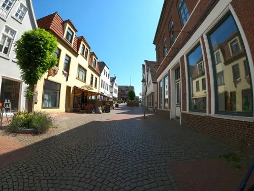
Schiffahrtsmuseum der Oldenburgischen Unterweser Borgstede & Becker (Haus2)
Museum · 11.1 km
9 Breite Straße, Brake (Unterweser)
Apr-Oct: Tu-Su 10:00-17:00; Nov-Mar Tu-Sa 11:00-17:00, Su...





16 more on the map.
Parks, trails and playgrounds19






7 more on the map.
Restaurants and cafes65

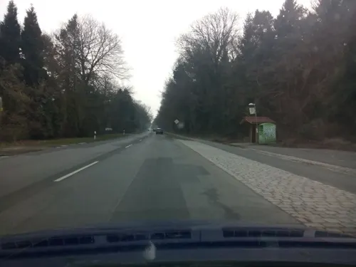
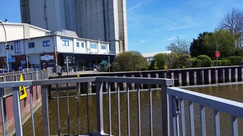
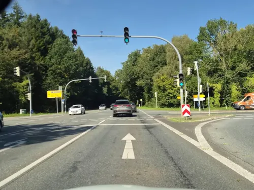
Sentosa
Restaurant · Chinese · 2.1 km
8 Börsten, Hagen im Bremischen
Mo-Th 12:00-15:00, 17:30-22:00; Fr-Sa 12:00-15:00, 17:30-23:00
aipi.cafe
Cafe · Coffee Shop · 11.2 km
Firmeninternes Mini-Internet-Café für Kunden und Mitarbeiter.
38 Bahnhofstraße, Brake (Unterweser)
"nach Vereinbarung"


#datenschutz.bar
Bar and pub · 11.2 km
Nicht öffentliche Bar von aipi - nur für Geschäftskunden
38 Bahnhofstraße, Brake (Unterweser)
"nach Vereinbarung"


Akropolis
Restaurant · Greek
45 Amtsdamm, Hagen im Bremischen
Mo,We-Sa 18:00-22:00; Su 18:00-21:30
53 more on the map.
History
Hagen im Bremischen belonged to the Prince-Archbishopric of Bremen, established as a territory of imperial immediacy in 1180. The prince-archiepiscopal fortress (Latin: Castrum Hagen, German: Burghagen) dates back to the 12th century, probably Prince-Archbishop Hartwig II initiated its construction. Since the 14th century the fortress has also been used as a residential castle by the Bremian prince-archbishops. The present structure was formed between 1502 and 1507 by Prince-Archbishop Johann Rode. In the mid-16th century the inhabitants adopted Lutheranism. During the Leaguist occupation under Tilly (1628–1630), they suffered from attempts of reCatholicisation.
In 1648 the Prince-Archbishopric was transformed into the Duchy of Bremen, which was first ruled in personal union by the Swedish crown – interrupted by a Danish occupation (1712–1715) – and from 1715 on by the House of Hanover. In 1807 the ephemeric Kingdom of Westphalia annexed the Duchy, before France annexed it in 1810. In 1813 the duchy was restored to the Electorate of Hanover, which – after its upgrade to the Kingdom of Hanover in 1814 – incorporated the duchy in a real union and the ducal territory, including Hagen, became part of the new Stade Region, established in 1823.
From the History section of Hagen im Bremischen on Wikipedia, under CC BY-SA 4.0.
Where to stay24
Churches and places of worship15
St. Johanniskirche Sandstedt
Church · Evangelisch · 7.9 km
Marktstraße, Hagen im Bremischen
Shopping17
Naturkostfachhandel Lebenswert
Grocery · 0.8 km
4 Am Gewerbepark, Hagen im Bremischen
Gas and EV charging7
Schools, colleges and libraries13
Healthcare5
Map of Hagen im Bremischen
212 places. The map loads OpenStreetMap tiles when you open it.
Getting there and nearby towns
Bremen Airport (BRE) is the nearest airport with scheduled flights listed in OpenStreetMap, 36 km away.
- Brake (Unterweser) 11 km west, about 11 min by car
- Lunestedt 11 km northeast, about 11 min by car
- Loxstedt 13 km north, about 13 min by car
- Hambergen 13 km southeast, about 13 min by car
- Schwanewede 15 km south, about 15 min by car
- Ovelgönne 15 km west, about 15 min by car
- Neuenkirchen 16 km southwest, about 16 min by car
- Osterholz-Scharmbeck 18 km southeast, about 18 min by car
- Nordenham 19 km northwest, about 19 min by car
- Schiffdorf 19 km north, about 19 min by car
Drive times are estimates from straight-line distance, not routes.
Local news
Headlines from INDB.
Reviews, tips and questions
Loading what members have shared...
Sources and licences
- GeoNames (CC BY 4.0): population, coordinates, regions and time zone
- Mapillary (see each image): photos
- OpenStreetMap contributors (ODbL 1.0): places, airports, map data
- Wikidata (CC0 1.0): elevation, founding date, time zone, website
- Wikimedia Commons (see each image): photos
- Wikipedia (CC BY-SA 4.0): overview and history text
Photo credits
- Burg zu Hagen 01-06-05, Ansgar Walk, CC BY-SA 3.0
- Burg zu Hagen im Bremischen, Hans-Jürgen Hübner, CC BY-SA 3.0
- Großsteingrab Lehnstedt 3, Megalithicguy, CC BY-SA 4.0
- Naturschutzgebiet Kuhlmoor und Tiefenmoor, Smarties, CC BY-SA 4.0
- Großsteingrab Heine 2 08, Einsamer Schütze, CC BY-SA 4.0
- Burgruine Stotel-Steinkreis von Leiter-Stand Juni 2009, Hartmut Krummrei, CC BY-SA 3.0
- Sandstedt old range rear 6559, Ein Dahmer, CC BY-SA 4.0
- Sandstedt range rear 6565, Ein Dahmer, CC BY-SA 4.0
- Grosserpater range rear 6573, Ein Dahmer, CC BY-SA 4.0
- Grosserpater range front 6590, Ein Dahmer, CC BY-SA 4.0
- St.-Luciae-Kirche Meyenburg, Exprimidor, CC BY-SA 4.0
- Hagen Martin Luther Kirche 1, Gordito1869, CC BY 3.0
- Großsteingrab Lehnstedt 2 04, Einsamer Schütze, CC BY-SA 4.0
- Kirche Wersabe 1, ClausNe, CC BY-SA 4.0
- Hermann-Allmers-Haus, Jan-Christian Voos, CC BY-SA 3.0
- Harriersand range rear 6589, Ein Dahmer, CC BY-SA 4.0
- Sandstedt Leuchtturm Oberfeuer alt, Oberlausitzerin64, CC BY-SA 4.0
- Harriersand range front 6585, Ein Dahmer, CC BY-SA 4.0
- Soldatendenkmal, Brake 0362, Gerd Fahrenhorst, CC BY 4.0
- Brake 2012 (10), Soluvo, CC BY-SA 4.0
- Naturschutzgebiet Stoteler Moor- Feuchtgebiet mit Wollgras, Helmut Schwarting, Public domain
- Südliches Hagener Königsmoor - 01, Muschelschubser, CC BY-SA 3.0
- Hagener Königsmoor bei Nacht by JanLeonardo, JanLeonardo~commonswiki, CC BY 4.0
- Hagener Königsmoor zu blauer Stunde by JanLeonardo, JanLeonardo~commonswiki, CC BY 4.0
- Hagener Königsmoor zugefroren by JanLeonardo, JanLeonardo~commonswiki, CC BY 4.0
- Mitteldeichstraße 31, Centraltheater, Brake, Gerd Fahrenhorst, CC BY 4.0
- Street-level photo, hotteliene, CC BY-SA 4.0
- Street-level photo, manfredi, CC BY-SA 4.0
- Street-level photo, changchun1, CC BY-SA 4.0
- Street-level photo, hotteliene, CC BY-SA 4.0
- Street-level photo, hotteliene, CC BY-SA 4.0
- Street-level photo, changchun1, CC BY-SA 4.0
- Street-level photo, abmap, CC BY-SA 4.0
- Street-level photo, manfredi, CC BY-SA 4.0
- Street-level photo, VIA_KK, CC BY-SA 4.0
- Street-level photo, VIA_KK, CC BY-SA 4.0
- Street-level photo, StefanS79, CC BY-SA 4.0
- Street-level photo, manfredi, CC BY-SA 4.0


Page built November 9, 2026. Spotted a mistake? Tell us or suggest a place.