


Why visit Lunestedt
Townapedia lists 4 museums and landmarks, 2 parks and trails, 4 places to eat and 1 attraction in and around town.
Highlights include Tierpark CUX‑ART, Wassermühle Deelbrügge, Steinkiste von Heerstedt and Im Hausbeeken.
Weather in Lunestedt
Forecast from MET Norway (CC BY 4.0). Full forecast
About Lunestedt
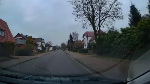
Lunestedt is a village and a former municipality in the district of Cuxhaven, in Lower Saxony, Germany. Since 1 November 2011, it is part of the municipality Beverstedt.
From the Wikipedia article Lunestedt (this version), under CC BY-SA 4.0.
Things to do1

Museums and landmarks4



Astronomischer Beobachtungsplatz (Bremerhavener Sternfreunde E.V.)
Monument and historic site · 1.0 km
Parks, trails and playgrounds2


Restaurants and cafes4

Gaststätte Zur Deutschen Eiche
Restaurant
86 Westerbeverstedter Straße, Beverstedt
closed "Bis auf Weiteres geschlossen."
Hellas Griechische Spezialitäten
Restaurant · Greek · 0.9 km
31 Westerbeverstedter Straße, Beverstedt


History
Lunestedt belonged to the Prince-Archbishopric of Bremen, established in 1180. In 1648 the Prince-Archbishopric was transformed into the Duchy of Bremen, which was first ruled in personal union by the Swedish Crown - interrupted by a Danish occupation (1712–1715) - and from 1715 on by the Hanoverian Crown. In 1807 the ephemeric Kingdom of Westphalia annexed the Duchy, before France annexed it in 1810. In 1813 the Duchy was restored to the Electorate of Hanover, which - after its upgrade to the Kingdom of Hanover in 1814 - incorporated the Duchy in a real union and the Ducal territory, including Lunestedt, became part of the new Stade Region, established in 1823.
From the History section of Lunestedt on Wikipedia, under CC BY-SA 4.0.
Churches and places of worship1
Shopping1
Gas and EV charging1
Schools, colleges and libraries1
Healthcare2
Map of Lunestedt
17 places. The map loads OpenStreetMap tiles when you open it.
Getting there and nearby towns
Fliegerhorst Nordholz (FCN) is the nearest airport with scheduled flights listed in OpenStreetMap, 38 km away.
- Loxstedt 8 km northwest, about 8 min by car
- Schiffdorf 12 km northwest, about 12 min by car
- Bremerhaven 18 km northwest, about 18 min by car
- Nordenham 19 km northwest, about 19 min by car
- Brake (Unterweser) 21 km southwest, about 21 min by car
- Osterholz-Scharmbeck 23 km south, about 23 min by car
- Ovelgönne 24 km southwest, about 24 min by car
- Schwanewede 26 km southwest, about 26 min by car
- Bremervörde 27 km east, about 27 min by car
- Worpswede 27 km southeast, about 27 min by car
Drive times are estimates from straight-line distance, not routes.
Local news
Headlines from INDB.
Reviews, tips and questions
Loading what members have shared...
Sources and licences
- GeoNames (CC BY 4.0): population, coordinates, regions and time zone
- Mapillary (see each image): photos
- OpenStreetMap contributors (ODbL 1.0): places, airports, map data
- Wikidata (CC0 1.0): elevation, founding date, time zone, website
- Wikimedia Commons (see each image): photos
- Wikipedia (CC BY-SA 4.0): overview and history text
Photo credits
- Lunestedt Luftbild, -- Agp, CC BY-SA 3.0
- Blüte der Japanische Kirschen in Lunestedt, Straßenszene, Wikeriki, CC BY-SA 4.0
- Deelbruegmteich060205, Arnold Plesse, CC BY 3.0
- Steinkiste050320b, Arnold Plesse, CC BY-SA 3.0 de
- Flug -Nordholz-Hammelburg 2015 by-RaBoe 0066 - Freschluneberg, © Ra Boe / Wikipedia, CC BY-SA 3.0 de
- Flug -Nordholz-Hammelburg 2015 by-RaBoe 0065 - Freschluneberg, © Ra Boe / Wikipedia, CC BY-SA 3.0 de
- Flug -Nordholz-Hammelburg 2015 by-RaBoe 0067 - Hollen, © Ra Boe / Wikipedia, CC BY-SA 3.0 de
- Street-level photo, StefanS79, CC BY-SA 4.0
- Street-level photo, StefanS79, CC BY-SA 4.0

Page built November 9, 2026. Spotted a mistake? Tell us or suggest a place.