


Why visit Hallstadt
Townapedia lists 87 museums and landmarks, 28 parks and trails, 168 places to eat, 21 places to stay and 14 attractions in and around town.
Highlights include Lichtspiel, Odeon, Gärtner- und Häckermuseum and Konzert- und Kongresshalle Bamberg.
Weather in Hallstadt
Forecast from MET Norway (CC BY 4.0). Full forecast
About Hallstadt
Hallstadt (German pronunciation: [ˈhalʃtat] ) is a town in the Upper Franconian district of Bamberg on the left bank of the Main, 4 km north of Bamberg, Germany.
From the Wikipedia article Hallstadt (this version), under CC BY-SA 4.0.
Things to do14


Odeon
Cinema and theater · 3.7 km
"Das Odeon öffnet täglich 30 Minuten vor der ersten Vorstellung &...

Gärtnerei Sebastian Niedermaier
Farm and orchard · 3.5 km
42 Mittelstraße, Bamberg
Tu,Sa 09:00-13:00; We,Fr 14:00-19:00

E.T.A.-Hoffmann-Theater
Cinema and theater · 4.4 km
Theatre in Bamberg, Germany
Theater am Michelsberg
Cinema and theater · 3.9 km
Theatre in Bamberg, Germany
Gärtnerei Neubauer
Farm and orchard · 3.3 km
32 Heiliggrabstraße, Bamberg
May-Jun Mo-Sa 09:00-18:00; Jul-Apr Tu,We,Fr 09:00-17:00; Jul-Apr...

Gärtnerei Eichfelder
Farm and orchard · 2.4 km
Mo-Fr 08:00-12:30,14:30-18:00; Sa 08:00-12:00
Gärtnerei Emmerling
Farm and orchard · 2.7 km
Mar-Oct We,Sa 08:00-12:30; Mar-Oct Fr 08:00-12:30,14:00-17:00;...

2 more on the map.
Museums and landmarks87


Kunstraum Kesselhaus
Museum · 3.6 km
Ausstellungsort für zeitgenössische Kunst, meist regionaler Künstler
42 Untere Sandstraße, Bamberg
Fr, PH 15:00-18:00; Sa, Su 11:00-18:00
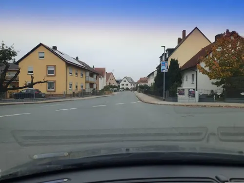
Seebachmarter
Monument and historic site · Roman Catholic · 0.7 km
Sockel; Häuschen mit vergitterter Bildnische; ziegelgedecktes Satteldach; Eisenkreuz; in der Bildnische ein Kruzifix und Bücher

St. Kilian
Monument and historic site
Mit Sandsteinfiguren auf geschwungenen Postamenten zu beiden Seiten der Straße, heiliger Kilian, erstes Drittel 18. Jahrhundert und...

St. Nepomuk
Monument and historic site
Mit Sandsteinfiguren auf geschwungenen Postamenten zu beiden Seiten der Straße, heiliger Kilian, erstes Drittel 18. Jahrhundert und...

Eisenbahnmarter
Monument and historic site · 1.2 km
Zweiteiliger Sockel mit Marmorplatte; Glatte Säule unten und oben mit Ringwulst; Ampel mit vier Reliefs, (Pietà, ein Bauer unter einem...

Gumbertusbrunnen
Monument and historic site · 3.2 km
Auch Jungferlesbrunnen genannt, Marter, Aufsatz mit vier Reliefdarstellungen (Heinrich und Kunigunde, Kreuzigung Christi, Christus als...

Hachomarter
Monument and historic site · 1.6 km
Achteckiger Sockel; Runde Säule; vierseitiger Aufsatz (Kreuzigungsgruppe, Christus am Kreuz mit Leidenswerkzeuge, Erbärmdebild, und...

Löhrmarter
Monument and historic site · 3.0 km
Sogenannte Löhrmarter, Säule mit vierseitigem Aufsatz und vier Bildtafeln, Sandstein, bezeichnet 1668

Reitermarter
Monument and historic site · 0.6 km
Am Sockel ein Relief mit Reiter; Aufsatz mit Muschelnische, darin Pietà; Ein Reiter, der hier in einen Sumpf geraten war, gelobte in...

Ritzmann-Marter
Monument and historic site · 2.2 km
Rechteckig gemauerte Säule; rundbogiger Aufsatz mit drei vergitterten Bildnischen, darin Heiligenfiguren (Johannes der Täufer, Bruder...
75 more on the map.
Parks, trails and playgrounds28

16 more on the map.
Restaurants and cafes168


Wagner-Bräu Kemmern
Bar and pub · 2.7 km
15 Hauptstraße, Kemmern
Mo 15:00+; Tu off; We-Sa 15:00+; Su 10:00-12:00
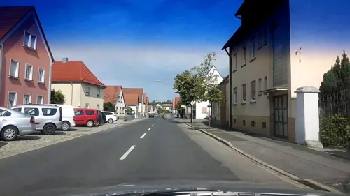
Goldener Adler
Restaurant · Regional
Massiver, zweigeschossiger Traufseitbau mit genuteten Ecklisenen und Brüstungsfeldern, Mansardwalmdach, um 1790/1800; Hofeinfahrt, Mauer...
33 Lichtenfelser Straße, Hallstadt

Goldener Löwe
Restaurant · Regional
Stattlicher, zweigeschossiger Traufseitbau, Fachwerkobergeschoss und Krüppelwalmdach, 17. Jahrhundert, bezeichnet „1502“
1 Marktplatz, Hallstadt

Zum Bären
Restaurant · Regional
Stattlicher, zweigeschossiger Walmdachbau mit Eckpilastern und Gurtgesims, erste Hälfte 19. Jahrhundert
30 Mainstraße, Hallstadt
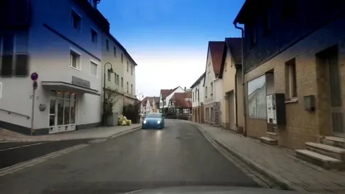
Brauereigasthof und Pension Zur Sonne
Restaurant · Regional · 3.7 km
2 Regnitzstraße, Bischberg
Mo, We-Fr 09:00-23:00; Sa-Su 09:30-23:00
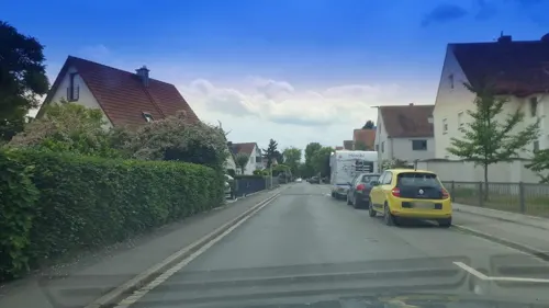

Gourmet Buffet by Cao
Restaurant · Asian, Sushi · 1.3 km
19 Emil-Kemmer-Straße, Hallstadt
Mo off; PH,Tu-Su 11:30-15:00,17:30-22:30
Hanoi
Restaurant · Vietnamese · 3.0 km
92 Gaustadter Hauptstraße, Bamberg
Tu-Su 11:30-15:00, 17:00-22:30


Kalamata
Restaurant · Greek, Fish · 1.4 km
1 Max-Brose-Straße, Hallstadt
Su 11:00-14:00, 17:00-22:00; Mo, We-Sa 17:00-22:00
Mamma Maria
Restaurant · Italian, Ice Cream · 3.3 km
4 Hauptstraße, Gundelsheim
Mo 16:45-20:45; Tu 17:00-20:00; We-Su 16:45-20:45
156 more on the map.
History
Archaeological digs have shown that there were settlers in the area who farmed the land in the New Stone Age, about 5000 BC.
About 670, the later Franconian Saint Kilian was preaching in Hallstadt and almost 50 years later Saint Boniface tried to convert Hallstadt’s Germans. Eventually, sometime between 741 and 747, the town was first named as Halazestat im Radensgove in a document issued by the Frankish Dukes Karlmann and Pepin the Short, and in 793, Charlemagne approved his father Pepin’s donations to the Würzburg Bishop Berwolf, among which was Halazestat. From 794 to 820, the Hallstadt Church of St. Kilian was built as one of Charlemagne’s 14 Slavic churches (Slavenkirchen), and in 805, Hallstadt became Charlemagne’s royal court after years earlier (793) he had spent the night here.
Two hundred years later, in 1007, Emperor Henry II donated the royal court to the Bishopric of Bamberg, which he had founded, and in 1013, by way of exchange, he acquired Hallstadt’s church and parish from the Bishop of Würzburg for the royal court at Gerau on the Upper Rhine.
From the History section of Hallstadt on Wikipedia, under CC BY-SA 4.0.
Where to stay21
Churches and places of worship31
Sankt Maria
Church · Roman Catholic · 3.0 km
86 Siechenstraße, Bamberg
St. Sebastian
Church · Roman Catholic · 3.0 km
29 Gaustadter Hauptstraße, Bamberg
Shopping53
Gas and EV charging26
Aral Tankstelle Alexandra Holl
Gas station · 3.0 km
80 Memmelsdorfer Straße, Bamberg
Schools, colleges and libraries25
Otto-Friedrich-Universität Bamberg
School · 3.2 km
21 Feldkirchenstraße, Bamberg
Healthcare11
AlphaMed Orthopädisch-unfallchirurgische Praxisklinik
Clinic and pharmacy · 3.0 km
2 Kärntenstraße, Bamberg
Apotheke St. Peter und Paul
Clinic and pharmacy · 3.2 km
46 Breitengüßbacher Straße, Kemmern
Arbeitsmedizinisches Zentrum Grüner Markt - Untersuchungsstelle Lichtenhaidestraße
Clinic and pharmacy · 2.7 km
Map of Hallstadt
250 places. The map loads OpenStreetMap tiles when you open it.
Getting there and nearby towns
Verkehrslandeplatz Burg Feuerstein (URD) is the nearest airport with scheduled flights listed in OpenStreetMap, 24 km away.
- Bamberg 4 km southeast, about 4 min by car
- Bischberg 4 km southwest, about 4 min by car
- Breitengüßbach 5 km north, about 5 min by car
- Memmelsdorf 6 km east, about 6 min by car
- Stegaurach 7 km south, about 7 min by car
- Litzendorf 10 km east, about 10 min by car
- Rattelsdorf 10 km north, about 10 min by car
- Walsdorf 10 km southwest, about 10 min by car
- Zapfendorf 11 km north, about 11 min by car
- Strullendorf 12 km southeast, about 12 min by car
Drive times are estimates from straight-line distance, not routes.
Local news
Headlines from INDB.
Reviews, tips and questions
Loading what members have shared...
Sources and licences
- GeoNames (CC BY 4.0): population, coordinates, regions and time zone
- Mapillary (see each image): photos
- OpenStreetMap contributors (ODbL 1.0): places, airports, map data
- Wikidata (CC0 1.0): elevation, founding date, time zone, website, landmarks and historic places
- Wikimedia Commons (see each image): photos
- Wikipedia (CC BY-SA 4.0): overview and history text
Photo credits
- Hallstadt, Marktplatz 11-001, Tilman2007, CC BY-SA 3.0
- Hallstadt St. Kilian Luftaufnahme-20210720-RM-102047, Ermell, CC BY-SA 4.0
- Hallstadt Marktbeckenhaus P4RM1404, Ermell, CC BY-SA 4.0
- Hallstadt Grabstein P4RM1411, Ermell, CC BY-SA 4.0
- Hallstadt Altar Weihnachten-20200112-RM-144744, Ermell, CC BY-SA 4.0
- Hallstadt Osterbrunnen-20120408-RM-085242, Ermell, CC BY-SA 4.0
- Hallstadt Osterbrunnen-20120408-RM-084944, Ermell, CC BY-SA 4.0
- Hallstadt Rathaus P4RM1365, Ermell, CC BY-SA 4.0
- Hallstadt Amtshaus P4RM1363, Ermell, CC BY-SA 4.0
- D-4-71-140-52 Marktbrunnen, Marktplatz (Hallstadt), Stephan van Helden, CC BY-SA 4.0
- Hallstadt Krippe-20200112-RM-145335, Ermell, CC BY-SA 4.0
- Hallstadt Amtshaus P4RM1362, Ermell, CC BY-SA 4.0
- Hallstadt Mittelmühle-20200112-RM-144339, Ermell, CC BY-SA 4.0
- Hallstadt-St.Kilian-P2217895, ermell, CC BY-SA 4.0
- Hallstadt Altar Weihnachten-20200112-RM-144953, Ermell, CC BY-SA 4.0
- Hallstadt Kanzel Kirche P4RM1391 -HDR, Ermell, CC BY-SA 4.0
- Hallstadt Katholische Pfarrkirche P4RM1382, Ermell, CC BY-SA 4.0
- Hallstadt church stairs P4RM1413, Ermell, CC BY-SA 4.0
- Hallstadt Kirchentür P4RM1412, Ermell, CC BY-SA 4.0
- Hallstadt-St.Kilian-P2217890, ermell, CC BY-SA 4.0
- Hallstadt Grabstein P4RM1410, Ermell, CC BY-SA 4.0
- Hallstadt Kriegerdenkmal P4RM1408, Ermell, CC BY-SA 4.0
- Hallstadt-St.Kilian-P2217870, ermell, CC BY-SA 4.0
- Hallstadt-St.Kilian-P2217852HDR1PS, ermell, CC BY-SA 4.0
- Hallstadt St. Kilian Turmuhr-20210720-RM-102318, Ermell, CC BY-SA 4.0
- Hallstadt St. Kilian Wetterhahn-20210720-RM-102230, Ermell, CC BY-SA 4.0
- Hallstadt Gründleinsbach-20200112-RM-144243, Ermell, CC BY-SA 4.0
- Hallstadt Gründleinsbach-20200112-RM-144228, Ermell, CC BY-SA 4.0
- Hallstadt Mühlbach-20200112-RM-144159, Ermell, CC BY-SA 4.0
- D-4-71-140-22 Wohnhaus, Lichtenfelser Straße 5 (Hallstadt), Stephan van Helden, CC BY-SA 4.0
- Hallstadt St. Kilian Luftaufnahme-20210720-RM-102119, Ermell, CC BY-SA 4.0
- D-4-71-140-87 Wohnhaus, Fischergasse 12 (Hallstadt), Stephan van Helden, CC BY-SA 4.0
- Hallstadt St. Kilian Luftaufnahme-20210720-RM-102054, Ermell, CC BY-SA 4.0
- Bamberg Theater Eingang, Photo: Andreas Praefcke, CC BY 3.0
- Hallstadt, Mühlbach, Hl. Nepomuk-001, Tilman2007, CC BY-SA 3.0
- Gnadenbild Gönningerkapelle, BierScout, CC BY-SA 4.0
- Brauerei Fässla, Michael Kranewitter, CC BY-SA 4.0
- DG front, No machine-readable author provided. Tremlin assumed (based on copyright claims)., CC BY 2.5
- Gärtner- und Häckermuseum 201405131004, Atriplex82, CC BY-SA 4.0
- Konzerthalle Bamberg Dämmerung Peter Eberts, Peter Eberts, CC BY-SA 3.0
- Bamberg, Eugen-Pacelli-Platz 1, Kath. Pfarrkirche St. Heinrich-20170102-002, Tilman2007, CC BY-SA 4.0
- Hallstadt-Kapelle-Sankt-Anna-P5284991-PS, ermell, CC BY-SA 4.0
- Hallstadt, Mainstraße 30-001, Tilman2007, CC BY-SA 3.0
- Bamberg, Untere Sandstraße 73-001, Tilman2007, CC BY-SA 3.0
- Bamberg Ottokirche Luftbild-20211031-RM-120034, Ermell, CC BY-SA 4.0
- Bamberg, Siechenstraße, Sebastianskapelle-20170103-002, Tilman2007, CC BY-SA 4.0
- Bamberg, Dr.-Martinet-Straße 13, St. Joseph, 20150927, 001, Tilman2007, CC BY-SA 4.0
- Bamberg, Gaustadter Hauptstraße 29, Kapelle St. Sebastian, 20150927, 001, Tilman2007, CC BY-SA 4.0
- Bamberg, Martin-Ott-Straße 1, Bildstock, 20150927, 003, Tilman2007, CC BY-SA 3.0
- Bamberg, Gumbertsbrunnen, 20151019-001, Tilman2007, CC BY-SA 3.0
- Bamberg Untere Königstraße 34, Photo: Andreas Praefcke, CC BY 3.0
- Bamberg Auferstehungskirche-20211016-RM-162428, Ermell, CC BY-SA 4.0
- Hallstadt, Mühlbach, St. Kilian-001, Tilman2007, CC BY-SA 3.0
- Hallstadt, Marktplatz 1-001, Tilman2007, CC BY-SA 3.0
- Bamberg, Luitpoldstraße 37-20161230-001, Tilman2007, CC BY-SA 4.0
- Hotel Ibis Budget, Bamberg, Gerd Fahrenhorst, CC BY 4.0
- Gundelsheim StMarkus1, Jurapeter, CC0
- Universitaet Bamberg 03, Immanuel Giel, Public domain
- Bierspezial, Z thomas, CC BY-SA 3.0
- Außenansicht Brauerei Wagner, Guidemedia, CC BY-SA 3.0
- D-4-71-140-80 Kreuzwegstation Bamberger Kreuzberg (2), Stephan van Helden, CC BY-SA 4.0
- Kunstraum Kesselhaus in Bamberg, Montrose72, CC BY-SA 4.0
- Hallstadt Eisenbahnmarter-20210328-RM-115026, Ermell, CC BY-SA 4.0
- D-4-71-140-73 Hachomarter nördlich von Dörfleins 2, Stephan van Helden, CC BY-SA 4.0
- D-4-71-140-34 Reitermarter, Lichtenfelser Straße (Hallstadt), Stephan van Helden, CC BY-SA 4.0
- Street-level photo, r66, CC BY-SA 4.0
- Street-level photo, r66, CC BY-SA 4.0
- Street-level photo, r66, CC BY-SA 4.0
- Street-level photo, r66, CC BY-SA 4.0
- Street-level photo, r66, CC BY-SA 4.0
- Street-level photo, r66, CC BY-SA 4.0
- Street-level photo, bernd_niemann, CC BY-SA 4.0
- Street-level photo, r66, CC BY-SA 4.0
- Street-level photo, r66, CC BY-SA 4.0
- Street-level photo, r66, CC BY-SA 4.0
- Street-level photo, r66, CC BY-SA 4.0
- Street-level photo, r66, CC BY-SA 4.0
- Street-level photo, r66, CC BY-SA 4.0
- Street-level photo, r66, CC BY-SA 4.0
- Street-level photo, r66, CC BY-SA 4.0
- Street-level photo, r66, CC BY-SA 4.0
- Street-level photo, r66, CC BY-SA 4.0
- Street-level photo, r66, CC BY-SA 4.0
- Street-level photo, bernd_niemann, CC BY-SA 4.0
- Street-level photo, r66, CC BY-SA 4.0
- Street-level photo, r66, CC BY-SA 4.0


Page built November 9, 2026. Spotted a mistake? Tell us or suggest a place.