


Why visit Rattelsdorf
Townapedia lists 28 museums and landmarks, 6 parks and trails, 59 places to eat, 7 places to stay and 4 attractions in and around town.
Highlights include Kraiberg, Marienstatue, Baunacher Heimatmuseum and Hänge am Kraiberg.
Weather in Rattelsdorf
Forecast from MET Norway (CC BY 4.0). Full forecast
About Rattelsdorf
Rattelsdorf (German pronunciation: [ˈʁatl̩sˌdɔʁf]) is a municipality with market rights in the Upper Franconian district of Bamberg.
From the Wikipedia article Rattelsdorf (this version), under CC BY-SA 4.0.
Things to do4


Museums and landmarks28

Marienstatue
Monument and historic site · Roman Catholic
Marienstatue auf dem Rattelsdorfer Marktplatz (Bildhauer Ferdinand Tietz). Muttergottesstandbild auf dreiseitigem Volutensockel;...


Kämpferstein
Monument and historic site
Hoher, durch Kehlen verj. Vierkantsockel; Hochrecht. Aufsatz mit Relief; Kreuzgr.; Erzb. Eisenkreuz. Der Bildst. befand sich vorm. dort...

Schaumbergstein
Monument and historic site · 2.6 km
Kreuzstein. Schaumberg-Schild erhaben gearb., darüber Kreuz in den Linien vertieft; R.: Lat. Bogensockelkreuz vertieft; Sühnestein für...

Schloß Unterleiterbach
Monument and historic site · 4.7 km
1 Schloßstraße, Zapfendorf



Hl. Johann Nepomuk
Monument and historic site
Balustersockel; Statue des Heiligen Johann Nepomuk

Johannisfigur
Monument and historic site · 4.5 km
Steinsockel; Figur des Heiligen Johannes
Schächer
Monument and historic site · 4.4 km
Sandstein, um 1515, mit spätgotischem Holzkruzifix
16 more on the map.
Parks, trails and playgrounds6



Restaurants and cafes59


Brauerei Gaststätte Schroll
Restaurant · 4.4 km
38 Hauptstraße, Reckendorf
Fr-We 09:30-22:00

Zum goldenen Löwen
Restaurant · Regional
10 Marktplatz, Rattelsdorf
Mo-Su 10:00-22:00; Tu off

Gasthaus Schloßbräu
Restaurant · German · 4.3 km
8 Mühlweg, Reckendorf
Mo 10:00-13:30,16:00+; Tu off; We 16:00+; Th-Sa...
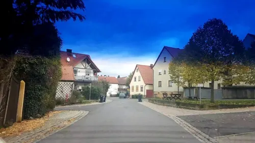

Gaststätte Schützenhaus
Bar and pub · Regional, German · 5.1 km
3 Schützenstraße, Breitengüßbach
Mo,Tu 16:00-24:00; We,Th off; Fr,Sa 15:00-24:00; Su 10:00-24:00
Schwanen-Bräu
Restaurant · Regional · 1.4 km
11 Ebinger Marktplatz, Rattelsdorf
Mo-We 16:00-22:00; Fr 10:00-22:00; Sa-Su 10:00-13:00, 16:00-22:00
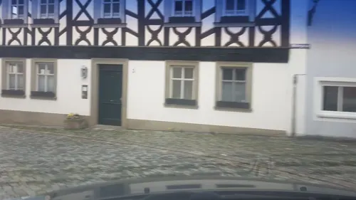
Zum Griechen
Restaurant · Greek · 4.2 km
9 Marktplatz, Baunach
Tu-Sa 17:00-22:00, Su 11:00-14:00,17:00-21:00, Mo off
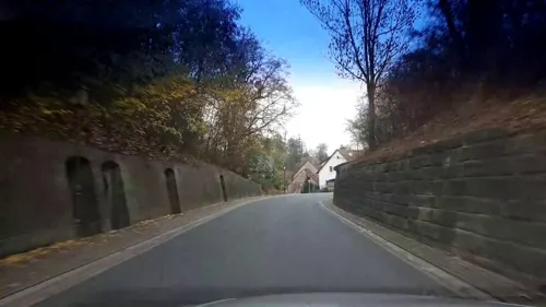


Zur goldenen Krone
Restaurant · Regional
14 Kirchgasse, Rattelsdorf
Th-Fr 11:00-14:00, 17:00-24:00; Sa-Su 11:00-23:59

Little Ohlands
Bakery · 2.8 km
40 Bamberger Straße, Zapfendorf
Mo-Fr 05:30-18:00; Sa 05:30-13:00; PH off
Obere Mühle
Bar and pub
11 An der Itz, Rattelsdorf
May-Aug Fr,Sa 16:00+; May-Aug PH -1 day 16:00+; May-Aug Su,PH...
47 more on the map.
History
Until Secularization in 1803, The Benedictine Monastery at Michelsberg held sway over Rattelsdorf. Michelsberg was one of the monasteries incorporated into the High Monastery at Bamberg. Since the Reichsdeputationshauptschluss of 1803, the municipality has belonged to Bavaria. In the course of administrative reform in Bavaria, today’s municipality came into being under the Gemeindeedikt (“municipality Edict”) of 1818. Until 1972, Rattelsdorf belonged to Staffelstein district. The constituent municipality of Höfen, with Höfenneusig and Freudeneck, as well as Mürsbach, with Zaugendorf and Helfenroth, belonged to Ebern district until 1972, and thereby to Lower Franconia.
From the History section of Rattelsdorf on Wikipedia, under CC BY-SA 4.0.
Where to stay7
Churches and places of worship37
Allerheiligste Dreifaltigkeit
Church · Roman Catholic · 1.7 km
1 Alte Dorfstraße, Baunach
Friedhofskapelle St. Valentin
Church · Roman Catholic · 5.1 km
6 Michael-Küchel-Straße, Zapfendorf
Sankt Nikolaus
Church · Roman Catholic · 4.4 km
40 Hauptstraße, Reckendorf
St. Nikolaus
Church · Roman Catholic · 5.3 km
45 Bamberger Straße, Breitengüßbach
Shopping14
Gas and EV charging10
Schools, colleges and libraries9
Healthcare4
Map of Rattelsdorf
178 places. The map loads OpenStreetMap tiles when you open it.
Getting there and nearby towns
Verkehrslandeplatz Burg Feuerstein (URD) is the nearest airport with scheduled flights listed in OpenStreetMap, 30 km away.
- Zapfendorf 3 km east, about 3 min by car
- Bamberg 13 km south, about 13 min by car
- Bad Staffelstein 13 km northeast, about 13 min by car
- Priesendorf 17 km southwest, about 17 min by car
- Walsdorf 18 km southwest, about 18 min by car
- Lichtenfels 19 km northeast, about 19 min by car
- Pettstadt 21 km south, about 21 min by car
- Hirschaid 23 km south, about 23 min by car
- Stadelhofen 22 km east, about 22 min by car
- Coburg 28 km north, about 28 min by car
Drive times are estimates from straight-line distance, not routes.
Local news
Headlines from INDB.
Reviews, tips and questions
Loading what members have shared...
Sources and licences
- GeoNames (CC BY 4.0): population, coordinates, regions and time zone
- Mapillary (see each image): photos
- OpenStreetMap contributors (ODbL 1.0): places, airports, map data
- Wikidata (CC0 1.0): elevation, founding date, time zone, website
- Wikimedia Commons (see each image): photos
- Wikipedia (CC BY-SA 4.0): overview and history text
Photo credits
- Rattelsdorf-easter-fountain-P4123675, ermell, CC BY-SA 4.0
- Haus in Rattelsdorf, Marktplatz 11, Stephan van Helden, CC BY-SA 4.0
- Rattelsdorf Marienstatue, Radler59, CC BY-SA 3.0
- D-4-71-174-6 Wohnhaus, 1830, Marktplatz 12, Rattelsdorf, Stephan van Helden, CC BY-SA 4.0
- D-4-71-174-21 Wohnhaus mit Zierfachwerk, Marktplatz 5, Rattelsdorf, Stephan van Helden, CC BY-SA 4.0
- D-4-71-174-5 Wohnhaus, Marktplatz 13, Rattelsdorf, Stephan van Helden, CC BY-SA 4.0
- D-4-71-174-4 Wohnhaus, Marktplatz 14, Rattelsdorf, Stephan van Helden, CC BY-SA 4.0
- D-4-71-174-20 Wohnhaus, Marktplatz 4, Rattelsdorf, Stephan van Helden, CC BY-SA 4.0
- D-4-71-174-19 Wohnstallhaus, Marktplatz 2, Rattelsdorf 2, Stephan van Helden, CC BY-SA 4.0
- D-4-71-174-134 Wegkreuz, 1914, Rattelsdorf, Stephan van Helden, CC BY-SA 4.0
- D-4-71-174-19 Wohnstallhaus, Marktplatz 2, Rattelsdorf, Stephan van Helden, CC BY-SA 4.0
- D-4-71-174-22 Gasthaus Grüner Baum, Hauptstraße 4, Rattelsdorf, Stephan van Helden, CC BY-SA 4.0
- D-4-71-174-14 Gasthaus zum Raben, Kirchgasse 1, Rattelsdorf 2, Stephan van Helden, CC BY-SA 4.0
- D-4-71-174-18 Wohnstallhaus, Marktplatz 1, Rattelsdorf, Stephan van Helden, CC BY-SA 4.0
- D-4-71-174-22 Gasthaus Grüner Baum, Nebengebäude, Hauptstraße 4, Rattelsdorf, Stephan van Helden, CC BY-SA 4.0
- D-4-71-174-22 Gasthaus Grüner Baum, Toreinfahrt mit Durchgang, 1849, Hauptstraße 4, Rattelsdorf, Stephan van Helden, CC BY-SA 4.0
- D-4-71-174-15 Dreiseithof, Toranlage und Wohnhaus, Kirchgasse 11, Rattelsdorf, Stephan van Helden, CC BY-SA 4.0
- D-4-71-174-15 Dreiseithof, Nebengebäude und Toranlage, Kirchgasse 11, Rattelsdorf, Stephan van Helden, CC BY-SA 4.0
- D-4-71-174-14 Gasthaus zum Raben, Kirchgasse 1, Rattelsdorf, Stephan van Helden, CC BY-SA 4.0
- D-4-71-174-23 Torturm, Kirchgasse 17, Rattelsdorf, Stephan van Helden, CC BY-SA 4.0
- D-4-71-174-1 Katholische Pfarrkirche St Peter und Paul, Kirchplatz 4, Rattelsdorf, Stephan van Helden, CC BY-SA 4.0
- D-4-71-174-23 Altes Schulhaus, Kirchgasse 17, Rattelsdorf, Stephan van Helden, CC BY-SA 4.0
- D-4-71-174-16 Amtshaus und Tor, Kirchplatz 2, Rattelsdorf, Stephan van Helden, CC BY-SA 4.0
- D-4-71-174-17 Pfarrhaus, Kirchplatz 5, Rattelsdorf, Stephan van Helden, CC BY-SA 4.0
- Kleinhaus neben dem Alten Schulturm in Rattelsdorf, Stephan van Helden, CC BY-SA 4.0
- D-4-71-174-23 Rest eines Torhauses mit gotischer Pforte, Kirchplatz 5, Rattelsdorf (2), Stephan van Helden, CC BY-SA 4.0
- D-4-71-174-23 Altes Schulhaus, Kirchgasse 17, Rattelsdorf 2, Stephan van Helden, CC BY-SA 4.0
- Rattelsdorf-Kriegerdenkmal-P1080142, Ermell, CC BY-SA 4.0
- D-4-71-174-13 Brauereigasthof, 1734, Hauptstraße 14, Rattelsdorf, Stephan van Helden, CC BY-SA 4.0
- D-4-71-174-12 Gemeinde-Torhaus, 1730, 1840, Am Torhaus 1, Rattelsdorf, Stephan van Helden, CC BY-SA 4.0
- D-4-71-174-136 Friedhofskreuz, 1827, Rattelsdorf 2, Stephan van Helden, CC BY-SA 4.0
- Rattelsdorf-Kirche-Altar-P1080103-HDR, Ermell, CC BY-SA 4.0
- Rattelsdorf-Kirche--P1080098-HDR, Ermell, CC BY-SA 4.0
- Rattelsdorf-Kirche-Altar-P1080110-HDR, Ermell, CC BY-SA 4.0
- Rattelsdorf-Kirche-Taufstein-P1080107, Ermell, CC BY-SA 4.0
- Rattelsdorf-Kirche-P1080078-HDR, Ermell, CC BY-SA 4.0
- Rattelsdorf-Kirche-P1080106-PS, Ermell, CC BY-SA 4.0
- Rattelsdorf-Kirche-Krippe-P1080119, Ermell, CC BY-SA 4.0
- Rattelsdorf-Kirche-Orgel-P1080128-HDR, Ermell, CC BY-SA 4.0
- Rattelsdorf-Kirche--P1080113, Ermell, CC BY-SA 4.0
- Kraiberg bei Baunach, Bahrmatt, CC BY-SA 3.0
- D-4-71-115-16 St Nepomuk, Stephan van Helden, CC BY-SA 4.0
- Reckendorf, Lourdes-Kapelle, 001, Tilman2007, CC BY-SA 3.0
- Laimbach, Kapelle Maria Geburt, 001, Tilman2007, CC BY-SA 3.0
- Rattelsdorf, Marktplatz, Marienstatue 20170705 001, Tilman2007, CC BY-SA 4.0
- Baunach Altes Rathaus, Stefan Beck, CC BY-SA 3.0
- Baunach, Marktplatz 12, Friedhofskapelle 20170414 004, Tilman2007, CC BY-SA 4.0
- Am Torhaus, Marter Rattelsdorf 20210221 002, Tilman2007, CC BY-SA 4.0
- Ebing-Kreuzstein, Störfix, CC BY-SA 3.0 de
- Unterleiterbach 216793, ermell, CC BY-SA 3.0
- Am Torhaus 1 Rattelsdorf 20210221 001, Tilman2007, CC BY-SA 4.0
- Bahnstrecke Breitengüßbach-Ebern(-Maroldsweisach) Baunach5, Philipp Jost ( user:mascobado ), CC BY-SA 3.0
- Reckendorf Hauptstraße 38, 002, Tilman2007, CC BY-SA 3.0
- Rattelsdorf, Marktplatz 10 20170705 001, Tilman2007, CC BY-SA 4.0
- Valentini-Kapelle Unterleiterbach, Birgid Röder, CC BY-SA 3.0
- Rattelsdorf in Oberfranken 14, Aarp65, CC BY-SA 3.0
- Ebing-Kirche-8247015, ermell, CC BY-SA 4.0
- Breitengüßbach-St.-Leonhard-02, Störfix, CC BY-SA 3.0 de
- Reckendorf, Katholische Pfarrkirche St. Nikolaus, 001, Tilman2007, CC BY-SA 3.0
- Baunach St Oswald, Benreis, CC BY-SA 3.0
- Breitengüßbach-St.-Nikolaus-01, Störfix, CC BY-SA 3.0 de
- D-4-71-175-32 Johannisfigur, Stephan van Helden, CC BY-SA 4.0
- Street-level photo, r66, CC BY-SA 4.0
- Street-level photo, r66, CC BY-SA 4.0
- Street-level photo, r66, CC BY-SA 4.0
- Street-level photo, r66, CC BY-SA 4.0
- Street-level photo, r66, CC BY-SA 4.0
- Street-level photo, r66, CC BY-SA 4.0
- Street-level photo, bitnapper, CC BY-SA 4.0
- Street-level photo, r66, CC BY-SA 4.0
- Street-level photo, r66, CC BY-SA 4.0
- Street-level photo, r66, CC BY-SA 4.0
- Street-level photo, r66, CC BY-SA 4.0
- Street-level photo, r66, CC BY-SA 4.0
- Street-level photo, r66, CC BY-SA 4.0
- Street-level photo, r66, CC BY-SA 4.0
- Street-level photo, r66, CC BY-SA 4.0
- Street-level photo, r66, CC BY-SA 4.0
- Street-level photo, r66, CC BY-SA 4.0
- Street-level photo, r66, CC BY-SA 4.0
- Street-level photo, r66, CC BY-SA 4.0
- Street-level photo, r66, CC BY-SA 4.0


Page built November 9, 2026. Spotted a mistake? Tell us or suggest a place.