


Why visit Walsdorf
Townapedia lists 6 museums and landmarks, 7 places to eat and 1 attraction in and around town.
Highlights include Schwedenkreuz and Luitpoldsäule.
Weather in Walsdorf
Forecast from MET Norway (CC BY 4.0). Full forecast
About Walsdorf
Walsdorf (German pronunciation: [ˈvalsˌdɔʁf]) is a municipality in the Upper Franconian district of Bamberg. It lies in the valley of the Aurach roughly ten kilometres west of Bamberg.
From the Wikipedia article Walsdorf, Bavaria (this version), under CC BY-SA 4.0.
Things to do1

Museums and landmarks6

Schwedenkreuz
Monument and historic site · 2.6 km
Steinkreuz, ein Schenkel teilweise abgebrochen; vermutlich spätmittelalterlich

Luitpoldsäule
Monument and historic site
Gebauchter, nach oben leicht verjüngter Schaft; bekrönender bayerischer Löwe

Burg Lisberg
Monument and historic site · 4.5 km
Cultural heritage monument in Lisberg, Bavaria

Metzgermarter
Monument and historic site · 3.6 km
Viereckiger Schaft; Aufsatz mit eingezogenem Rundbogenabschluss


Radstein
Monument and historic site · 3.3 km
Gotische Heiligennische; Einritzungen (Lateinisches Kreuz, Wagenrad und Reute => Rodehacke)
Restaurants and cafes7

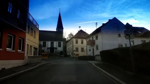
Brauerei-Gasthof Zur alten Mühle
Restaurant · Regional · 2.1 km
Mo, We-Th 16:00-23:00; Fr-Su 11:00-23:00
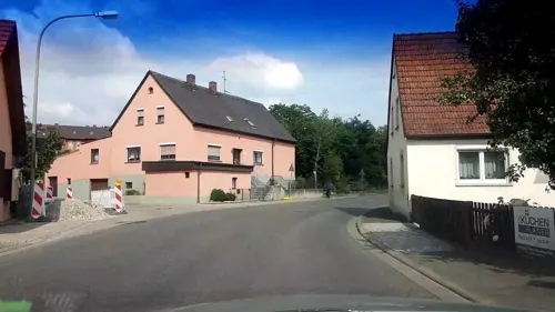

Pizzeria Casa Bona
Restaurant · Italian · 0.6 km
Tu-Su 17:00-22:00
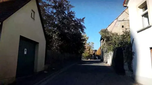
Gasthof Weißes Lamm
Restaurant · Regional
16 Bamberger Straße, Walsdorf
Churches and places of worship10

St. Laurentius
Church · Protestant
Saalbau, Sakristeianbau, Chorturm mit Zwiebelhaube zweite Hälfte 15. Jahrhundert, Langhaus mit Satteldach 1608; mit Ausstattung
19 Bamberger Straße, Walsdorf


St. Wendelin
Church · Catholic · 4.0 km
Saalbau mit Satteldach und Giebelreiter, bezeichnet mit „1788“, Erweiterung durch eingeschobenes Querhaus 1928 von Hans Krug; mit Ausstattung


History
Walsdorf had its first documentoary mention in Würzburg’s oldest book of enfeoffments, for the year 1317. It is entered there along with the whole circle of surrounding places as bambergisches Lehen der Leutersheim von Lisberg (“Bamberg fief of the Leutersheims of Lisberg”). Changing lordly masters in the years that followed determined the community’s fate, whereby its location in the border areas between the Bishopric of Bamberg and the Bishopric of Würzburg allowed it a certain freedom in its own development. As a Bamberg fief under the ownership of the Leutersheims at Lisberg, ownership passed to the Lords of Thüngfeld in 1399 and then in 1524 to Wolf von Krewelsheim (= Crailsheim). Particularly formative effects were wrought beginning in 1525 by the Crailsheims’ overlordship.
The events in those days have had their effect down to today, and even now, the proportion of Walsdorf’s population who follow the Evangelical faith is far greater – almost 40% – than in the overwhelmingly Catholic communities elsewhere in the district.
The autonomous knightly estate of the Barons of Crailsheim passed with the Act of the Confederation of the Rhine in 1806 to Bavaria. These lords, however, remained the local landowners until their overlordship was finally dissolved in 1848, and also remained the patron lords until the patronage, too, was dissolved in 1964.
From the History section of Walsdorf, Bavaria on Wikipedia, under CC BY-SA 4.0.
Shopping1
Schools, colleges and libraries2
Map of Walsdorf
27 places. The map loads OpenStreetMap tiles when you open it.
Getting there and nearby towns
Verkehrslandeplatz Burg Feuerstein (URD) is the nearest airport with scheduled flights listed in OpenStreetMap, 26 km away.
- Bamberg 9 km northeast, about 9 min by car
- Hirschaid 16 km east, about 16 min by car
- Höchstadt an der Aisch 18 km south, about 18 min by car
- Forchheim 26 km southeast, about 26 min by car
- Haßfurt 27 km northwest, about 27 min by car
- Bad Staffelstein 30 km northeast, about 30 min by car
- Herzogenaurach 34 km south, about 34 min by car
- Neustadt an der Aisch 34 km south, about 34 min by car
- Erlangen 35 km southeast, about 35 min by car
- Lichtenfels 37 km northeast, about 37 min by car
Drive times are estimates from straight-line distance, not routes.
Local news
Headlines from INDB.
Reviews, tips and questions
Loading what members have shared...
Sources and licences
- GeoNames (CC BY 4.0): population, coordinates, regions and time zone
- Mapillary (see each image): photos
- OpenStreetMap contributors (ODbL 1.0): places, airports, map data
- Wikidata (CC0 1.0): elevation, founding date, time zone, website, landmarks and historic places
- Wikimedia Commons (see each image): photos
- Wikipedia (CC BY-SA 4.0): overview and history text
Photo credits
- Haus in Walsdorf, The original uploader was Parisek at German Wikipedia .. Uploaded to Commons by Körnerbrötchen ., CC BY-SA 3.0
- Walsdorf Luftbild-20220212-RM-161608, Ermell, CC BY-SA 4.0
- Walsdorf Kirche Luftbild-20220212-RM-160219, Ermell, CC BY-SA 4.0
- Walsdorf Luftbild-20220212-RM-160249, Ermell, CC BY-SA 4.0
- D-4-71-208-6 Bauernhaus um 1820, Bamberger Straße 25, Walsdorf, Stephan van Helden, CC BY-SA 4.0
- D-4-71-208-6 Bauernhaus um 1820, Bamberger Straße 25, Walsdorf 2, Stephan van Helden, CC BY-SA 4.0
- D-4-71-208-6 Scheune um 1820, zu Bamberger Straße 25, Walsdorf, Stephan van Helden, CC BY-SA 4.0
- D-4-71-208-11 Luitpoldsäule (Kriegerdenkmal) vor der Kirche St Laurentius in Walsdorf, Stephan van Helden, CC BY-SA 4.0
- D-4-71-208-11 Luitpoldsäule (Kriegerdenkmal) vor der Kirche St Laurentius in Walsdorf 2, Stephan van Helden, CC BY-SA 4.0
- Walsdorf-Forsthaus-P2147541, ermell, CC BY-SA 4.0
- Walsdorf-Gasthaus-P2147538, ermell, CC BY-SA 4.0
- Walsdorf-war-memorial-P2147540, ermell, CC BY-SA 4.0
- Walsdorf-Kirche-P2147535, ermell, CC BY-SA 4.0
- Walsdorf-Kirche-P2147537, ermell, CC BY-SA 4.0
- Walsdorf-church-P2147544, ermell, CC BY-SA 4.0
- Walsdorf Luftbild Turmuhr-20220212-RM-160616, Ermell, CC BY-SA 4.0
- D-4-71-208-1 Denkmal der kindlichen Liebe bei dem Grabe der besten Eltern in der Mauer der Kirche St Laurentius in Walsdorf, Stephan van Helden, CC BY-SA 4.0
- Walsdorf Kirche Luftbild-20220212-RM-160103, Ermell, CC BY-SA 4.0
- D-4-71-208-4 Gasthaus, Bamberger Straße 13, Walsdorf, Stephan van Helden, CC BY-SA 4.0
- Walsdorf-Epitaph-P2147530PS, ermell, CC BY-SA 4.0
- Walsdorf-church-P2147532PS, Ermell, CC BY-SA 4.0
- D-4-71-208-3 Forst- und Verwaltungsamt Walsdorf, 1714, Bamberger Straße 8, Stephan van Helden, CC BY-SA 4.0
- Walsdorf-Gasthaus-P2147545, ermell, CC BY-SA 4.0
- Walsdorf Kirche Luftbild-20220212-RM-160401, Ermell, CC BY-SA 4.0
- D-4-71-208-10 Bauernhaus, Steinsdorfer Straße 2, Walsdorf, Stephan van Helden, CC BY-SA 4.0
- Fachwerkscheune Steinsdorfer Straße 2, Walsdorf, Stephan van Helden, CC BY-SA 4.0
- Walsdorf Aurachtal Heckrinder 5221856, Ermell, CC BY-SA 4.0
- Walsdorf (Upper Franconia) Luftbild-20240225-RM-153547, Reinhold Möller Ermell, CC BY-SA 4.0
- Walsdorf Aurachtal Heckrind 5221871, Ermell, CC BY-SA 4.0
- Walsdorf Aurachtal Heckrind 5221903, Ermell, CC BY-SA 4.0
- Walsdorf Aurachtal Heckrind 5221913, Ermell, CC BY-SA 4.0
- Walsdorf Aurachtal Heckrind 5221878, Ermell, CC BY-SA 4.0
- Walsdorf Aurachtal 5221927, Ermell, CC BY-SA 4.0
- Walsdorf Aurachtal Hochwasser 1320635, Ermell, CC BY-SA 4.0
- BurgLisberg, Ramessos, Public domain
- Walsdorf, Ev. Kirche, 001, Tilman2007, CC BY-SA 3.0
- Walsdorf, Luitpoldsäule, 001, Tilman2007, CC BY-SA 3.0
- Grasmannsdorf, Hofkapelle Burgebrach 20221229 0034, Tilman2007, CC BY-SA 4.0
- D-4-71-191-10 Kreuzstein, sogenanntes Schwedenkreuz, Lutz Horn, CC BY-SA 4.0
- D-4-71-117-46 Kreuzstein bei der Metzgermarter südwestlich von Rothhof (Bischberg) 7, Stephan van Helden, CC BY-SA 4.0
- D-4-71-208-20 Franzosenstein, um 1800, nördlich von Hetzentännig 4, Stephan van Helden, CC BY-SA 4.0
- Street-level photo, r66, CC BY-SA 4.0
- Street-level photo, r66, CC BY-SA 4.0
- Street-level photo, r66, CC BY-SA 4.0
- Street-level photo, r66, CC BY-SA 4.0
- Street-level photo, r66, CC BY-SA 4.0
- Street-level photo, r66, CC BY-SA 4.0


Page built November 9, 2026. Spotted a mistake? Tell us or suggest a place.