


Why visit Bamberg
Townapedia lists 190 museums and landmarks, 28 parks and trails, 199 places to eat, 25 places to stay and 10 attractions in and around town.
Highlights include Lichtspiel, Odeon, Villa Dessauer and E.T.A.-Hoffmann-Haus.
Weather in Bamberg
Forecast from MET Norway (CC BY 4.0). Full forecast
About Bamberg
Bamberg (, US also , German: [ˈbambɛʁk] ; East Franconian: Bambärch) is a town in Upper Franconia, Bavaria, Germany, on the river Regnitz close to its confluence with the river Main. Bamberg had 79,000 inhabitants in 2022. The town dates back to the 9th century, when its name was derived from the nearby Babenberch castle. Cited as one of Germany's most beautiful towns, with medieval streets and buildings, the old town of Bamberg with around 2,400 timber houses has been a UNESCO World Heritage Site since 1993.
From the Wikipedia article Bamberg (this version), under CC BY-SA 4.0.
Travel tips from other travellers: Bamberg on Wikivoyage (CC BY-SA 4.0).
Photos of Bamberg


Things to do10

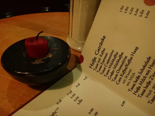

E.T.A.-Hoffmann-Theater
Cinema and theater · 1.1 km
Theatre in Bamberg, Germany

Gärtnerei Sebastian Niedermaier
Farm and orchard · 0.6 km
42 Mittelstraße, Bamberg
Tu,Sa 09:00-13:00; We,Fr 14:00-19:00

Theater am Michelsberg
Cinema and theater · 1.8 km
Theatre in Bamberg, Germany
Gärtnerei Neubauer
Farm and orchard · 0.6 km
32 Heiliggrabstraße, Bamberg
May-Jun Mo-Sa 09:00-18:00; Jul-Apr Tu,We,Fr 09:00-17:00; Jul-Apr...
Gärtnerei Emmerling
Farm and orchard · 1.3 km
Mar-Oct We,Sa 08:00-12:30; Mar-Oct Fr 08:00-12:30,14:00-17:00;...

Museums and landmarks190


E.T.A.-Hoffmann-Haus
Museum · 1.2 km
26 Schillerplatz, Bamberg
Mo-Su,PH off


Isidor Reichmannsdorfer
Monument and historic site · 1.2 km
Isidor Reichmannsdorfer, Jg. 1884, deportiert 1941 Riga, emnordet


Else Pottlitzer, geb. Kahn
Monument and historic site · 1.2 km
Else Pottlitzer (geb. Kahn) Jg. 1905, verzogen 1937 Hamburg, 1941 Berlin, deportiert 1942 Riga, emordet

Esther Kohn
Monument and historic site · 1.2 km
Esther Kohn, Jg. 1900, deportiert 1941 Riga, ermordet

Flora Kahn, geb. Himmelreich
Monument and historic site · 1.2 km
Flora Kahn (geb. Himmelreich) Jg. 1878 Deportiert 1941, Riga, ermordet

Hl. Kunigunde
Monument and historic site · 1.3 km
Mitbegründerin des Bistums Bamberg. Statue 1750 von Jahann Peter Benkert. Kopie 1992, Original in der St. Jakobskirche. Einzig erhalten...

Johanna Dames, geb. Rogozinski
Monument and historic site · 1.2 km
Johanna Dames (geb.Rogozinski), Jg., 1887, Flucht 1939 Italien, interniert Fossoli di Carpi, deportiert 1944, ermordet in Auschwitz

178 more on the map.
Parks, trails and playgrounds28


16 more on the map.
Restaurants and cafes199

Zum Sternla
Restaurant · Franconian · 1.0 km
46 Lange Straße, Bamberg
Tu-Fr,Su 11:00-22:00; Sa 10:00-22:00; Mo 11:00-21:00


Mahrs Bräu
Restaurant · Regional, German · 1.1 km
10 Wunderburg, Bamberg
Mo 15:00-22:30; Tu,We 11:00-22:30; Th-Sa 11:00-23:00; Su 11:00-15:00


Backhäusla
Bakery · 0.9 km
6 Franz-Ludwig-Straße, Bamberg
Mo-Sa 07:00-18:00; Su off
Cafè Leander
Cafe · Breakfast, Soup, Panini, Cake, Salad · 0.9 km
10 Hauptwachstraße, Bamberg
Mo-Su 10:00-21:00

Der Beck
Cafe · German, Coffee Shop, Pastry · 0.9 km
5c Franz-Ludwig-Straße, Bamberg
Mo-Fr 07:00-19:00; Sa 07:00-17:00; Su 07:00-16:00

Aposto
Restaurant · Italian · 1.2 km
5a Geyerswörthstraße, Bamberg
Mo-Fr 11:30-24:00; Sa,Su 09:00-24:00
Casa Zorro – Tapasbar
Restaurant · Tapas · 1.1 km
3 Jesuitenstraße, Bamberg
Mo-Tu 17:00-00:00; We off; Th-Su 17:00-00:00
187 more on the map.
History
During the post-Roman centuries of Germanic migration and settlement, the region later included in the Diocese of Bamberg was inhabited for the most part by Slavs. The town, first mentioned in 902, grew up by the castle Babenberch which gave its name to the Babenberg family. On their extinction, it passed to the Saxon house. The area was Christianized chiefly by the monks of the Benedictine Fulda Abbey, and the land was under the spiritual authority of the Diocese of Würzburg. In 1007, Holy Roman Emperor Henry II made Bamberg a family inheritance, the seat of a separate diocese. The Emperor's purpose in this was to make the Diocese of Würzburg less unwieldy in size and to give Christianity a firmer footing in the districts of Franconia, east of Bamberg.
Read more of the history
In 1008, after long negotiations with the Bishops of Würzburg and Eichstätt, who were to cede portions of their dioceses, the boundaries of the new diocese were defined, and Pope John XVIII granted the papal confirmation in the same year. Henry II ordered the building of a new cathedral, which was consecrated on 6 May 1012. The church was enriched with gifts from the pope, and Henry had it dedicated in honor of him. In 1017, Henry founded Michaelsberg Abbey on the Michaelsberg ("Mount St Michael"), near Bamberg, a Benedictine abbey for the training of the clergy. The emperor and his wife, Kunigunde, gave large temporal possessions to the new diocese, and it received many privileges out of which grew the secular power of the bishop. Pope Benedict VIII visited Bamberg in 1020 to meet Henry II for discussions concerning the Holy Roman Empire. While he was there, he placed the diocese in direct dependence on the Holy See. He also personally consecrated some of Bamberg's churches. For a short time, Bamberg was the centre of the Holy Roman Empire. Henry and Kunigunde were both buried in the cathedral.
From the middle of the 13th century onwards, the bishops were princes of the Empire and ruled Bamberg, overseeing the construction of monumental buildings. In 1248 and 1260, the See obtained large portions of the estates of the Counts of Meran, partly through purchase and partly through the appropriation of extinguished fiefs.
The old Bishopric of Bamberg was composed of an unbroken territory extending from Schlüsselfeld in a northeasterly direction to the Franconian Forest, and possessed in addition estates in the Duchies of Carinthia and Salzburg, in the Nordgau (the present Upper Palatinate), in Thuringia, and on the Danube. By the changes resulting from the Reformation, the territory of this see was reduced by nearly one half in extent. Since 1279 the coat of arms of the city of Bamberg is known in the form of a seal.
The witch trials of the 17th century claimed about one thousand victims in Bamberg, reaching a climax between 1626 and 1631, under the rule of Prince-Bishop Johann Georg II Fuchs von Dornheim. The famous Drudenhaus (witch prison), built in 1627, is no longer standing today; however, detailed accounts of some cases, such as that of Johannes Junius, remain.
In 1647, the University of Bamberg was founded as Academia Bambergensis.
Bambrzy (Posen Bambergers) are German Poles who are descended from settlers from the Bamberg area who settled in villages around Poznań in the years 1719–1753. In 1759, the possessions and jurisdictions of the diocese situated in Austria were sold to that state. When the secularization of church lands took place (1802) the diocese covered 3,305 km2 (1,276 sq mi) and had a population of 207,000. Bamberg thus lost its independence in 1802, becoming part of Bavaria in 1803. The free state of Bavaria and the Federal Republic of Germany gave protections to Bamberg, though the city does handle its own management of properties.
In 1815 chief of staff of French Emperor Napoleon Bonaparte, Louis Alexandre Berthier died in Bamberg, after falling out of the window of his Bamberg home.
Bamberg was first connected to the German rail system in 1844, which has been an important part of its infrastructure ever since. After a communist uprising took control over Bavaria in the years following World War I, the state government fled to Bamberg and stayed there for almost two years before the Bavarian capital of Munich was retaken by Freikorps units (see Bavarian Soviet Republic). The first republican constitution of Bavaria was passed in Bamberg, becoming known as the Bamberger Verfassung (Bamberg Constitution).
In February 1926 Bamberg served as the venue for the Bamberg Conference, convened by Adolf Hitler in his attempt to foster unity and to stifle dissent within the then-young Nazi party. Bamberg was chosen for its location in Upper Franconia, reasonably close to the residences of the members of the dissident northern Nazi faction but still within Bavaria.
From the History section of Bamberg on Wikipedia, under CC BY-SA 4.0.
More about Bamberg
Geography
Bamberg is located in Franconia, 63 km (39 mi) north of Nuremberg by railway and 101 km (63 mi) east of Würzburg, also by rail. It is situated on the Regnitz river, 3 km (1.9 mi) before it flows into the Main river.
Its geography is shaped by the Regnitz and by the foothills of the Steigerwald, part of the German uplands. From northeast to southwest, the town is divided into first the Regnitz plain, then one large and several small islands formed by two arms of the Regnitz (Inselstadt), and finally the part of town on the hills, the "Hill Town" (Bergstadt).
Bamberg extends over seven hills, each crowned by a church. This has led to Bamberg being called the "Franconian Rome"—although a running joke among Bamberg's tour guides is to refer to Rome instead as the "Italian Bamberg". The hills are Cathedral Hill, Michaelsberg, Kaulberg/Obere Pfarre, Stefansberg, Jakobsberg, Altenburger Hill and Abtsberg.
Climate in this area has mild differences between highs and lows, and there is adequate rainfall year-round. The Köppen climate classification subtype for this climate is "Cfb" (Marine West Coast Climate/Oceanic climate), with a certain continental influence as indicated by average winter nighttime temperatures well below zero.
Economy
Bamberg is considered an important economic center and is one of the 15 strongest economic regions in Bavaria compared to the other 95 districts and independent cities. Central locations for industry, manufacturing and trade can be found in the north and east of the city. In the north, around the Bamberg harbor, there is a large industrial area that partly extends into the Hallstadt urban area. Bosch operates one if its largest plant in Germany in the east and is also the city's most important employer.
Relevant economic sectors in Bamberg are the automotive supply industry, electrical engineering and the food industry. The traditional industry of market gardening with large inner-city cultivation areas, which has characterized the city since its beginnings, is still present. Due to its UNESCO World Heritage status and the more than 800,000 overnight guests a year in the city alone, tourism, hotels and gastronomy also play a central role in the city's economy.
In the 2010s, Bamberg's gross domestic product increased by a total of 17.7%. The city of Bamberg generated €5.1 billion in 2021 (€66,543 per capita).
In the 2016 Future Atlas, Bamberg was ranked 32nd out of 402 districts, municipal associations and independent cities in Germany, making it one of the places with "very high future prospects".
Arts and culture
The Town of Bamberg was inscribed on the UNESCO World Heritage List in 1993 due to its medieval layout and its well-preserved historic buildings. Since the Middle Ages, urban gardening has been practiced in Bamberg. The Market Gardeners’ District together with the City on the Hills and the Island District is an integral part of the World Heritage site. In 2005, the Municipality established a unit to coordinate the implementation of the World Heritage Convention in Bamberg. In 2019, a visitor and interpretation centre opened for the World Heritage site.
Bamberg Cathedral (1237), with the tombs of Emperor Henry II and Pope Clement II
Alte Hofhaltung, residence of the bishops in the 16th and 17th centuries
Neue Residenz, residence of the bishops after the 17th century
Old town hall (1386), built in the middle of the Regnitz river, accessible by two bridges
Klein-Venedig ("Little Venice"), a colony of fishermen's houses from the 19th century along one bank of the river Regnitz
Michaelsberg Abbey, built in the 12th century on one of Bamberg's "Seven Hills." The former Benedictine abbey, which once housed a brewery, is now home to the Franconian Brewery Museum.
Education
The University of Bamberg, named Otto-Friedrich University, offers higher education in the areas of social science, business studies and the humanities, and is attended by more than 12,000 students. The University of Applied Sciences Bamberg offers higher education in the areas of public health. Bamberg is also home to eight secondary schools (gymnasiums):
There are also numerous other institutes for primary, secondary, technical, vocational and adult education.
From the Wikipedia article Bamberg, under CC BY-SA 4.0.
Notable people from Bamberg
 Conrad III of GermanyHohenstaufen dynasty king (r. 1138–1152)Photo: Unknown author Unknown author, Public domain
 Christopher ClaviusGerman astronomer and mathematician (1538–1612)Photo: Rijksmuseum, CC0
 Karlheinz DeschnerGerman writer and activist (1924-2014)Photo: User:Mathias Schindler, CC BY-SA 4.0
 August von WassermannGerman bacteriologist (1866-1925)Photo: anonymous/unknown, Public domain
 Ignaz von DöllingerGerman Catholic priest, theologian and historian (1799–1890)Photo: Franz Hanfstaengl, Public domain
 Thomas GottschalkGerman television host and entertainerPhoto: Raimond Spekking, CC BY-SA 4.0
 Theodor BoveriGerman geneticist (1862-1915)Photo: Unknown author Unknown author, Public domain
 Joachim CamerariusGerman humanist, polymath and poet (1500-1574)Photo: Print made by: Philips Galle..., Public domain
 BertholdRoman Catholic archbishop (1180-1251)Photo: Hermann Junghans, CC BY-SA 3.0 de
- Johann Lukas SchönleinGerman naturalist and professor of medicine (1793–1864)
- Princess Antoinette of Saxe-AltenburgGerman duchess (1838-1908)
- Otto DeßlochLuftwaffe general (1889–1977)
Born in Bamberg, according to Wikidata (CC0). Each name links to its Wikipedia article.
Where to stay25
Churches and places of worship18
Sankt Maria
Church · Roman Catholic · 1.0 km
86 Siechenstraße, Bamberg
Shopping55
Gas and EV charging5
Aral Tankstelle Alexandra Holl
Gas station · 0.8 km
80 Memmelsdorfer Straße, Bamberg
Schools, colleges and libraries41
Healthcare14
AlphaMed Orthopädisch-unfallchirurgische Praxisklinik
Clinic and pharmacy · 1.2 km
2 Kärntenstraße, Bamberg
Map of Bamberg
250 places. The map loads OpenStreetMap tiles when you open it.
Getting there and nearby towns
Verkehrslandeplatz Burg Feuerstein (URD) is the nearest airport with scheduled flights listed in OpenStreetMap, 20 km away.
- Hallstadt 4 km northwest, about 4 min by car
- Bischberg 5 km west, about 5 min by car
- Memmelsdorf 5 km northeast, about 5 min by car
- Stegaurach 6 km southwest, about 6 min by car
- Strullendorf 8 km southeast, about 8 min by car
- Litzendorf 8 km east, about 8 min by car
- Breitengüßbach 8 km north, about 8 min by car
- Pettstadt 8 km south, about 8 min by car
- Frensdorf 9 km south, about 9 min by car
- Walsdorf 9 km southwest, about 9 min by car
Drive times are estimates from straight-line distance, not routes.
Towns near Bamberg


Keep exploring
Local news
Headlines from INDB.
Reviews, tips and questions
Loading what members have shared...
Sources and licences
- GeoNames (CC BY 4.0): population, coordinates, regions and time zone
- Mapillary (see each image): photos
- OpenStreetMap contributors (ODbL 1.0): places, airports, map data
- Openverse (see each image): photos
- Wikidata (CC0 1.0): elevation, founding date, time zone, website, landmarks and historic places
- Wikimedia Commons (see each image): photos
- Wikipedia (CC BY-SA 4.0): overview and history text
Photo credits
- Wasserschloss-Villa-Concordia-P3100010, Ermell, CC BY-SA 4.0
- Bamberg Apotheke Atrium Innen-20180417-RM-171812, Ermell, CC BY-SA 4.0
- Bamberg Atrium Innen-20180417-RM-171831, Ermell, CC BY-SA 4.0
- Bamberg Atrium Innen-20180417-RM-171900, Ermell, CC BY-SA 4.0
- Bamberg Atrium-20180417-RM-171705, Ermell, CC BY-SA 4.0
- Bamberg Atrium-20180417-RM-171657, Ermell, CC BY-SA 4.0
- Bamberg Atrium-20180417-RM-171633, Ermell, CC BY-SA 4.0
- Bamberg Atrium Rolltreppen-20180417-RM-171311, Ermell, CC BY-SA 4.0
- Bamberg Atrium-20180417-RM-171617, Ermell, CC BY-SA 4.0
- Bamberg Atrium Kassenautomat -20180417-RM-171327, Ermell, CC BY-SA 4.0
- Bamberg Atrium-20180417-RM-163228, Ermell, CC BY-SA 4.0
- Bamberg Atrium Kassenautomat -20180417-RM-171331, Ermell, CC BY-SA 4.0
- Bamberg Atrium Halle-20180417-RM-162859, Ermell, CC BY-SA 4.0
- Bamberg Atrium-20180417-RM-171401, Ermell, CC BY-SA 4.0
- Bamberg Atrium Parkdeck-20180417-RM-170225, Ermell, CC BY-SA 4.0
- Bamberg Atrium Halle-20180417-RM-162947, Ermell, CC BY-SA 4.0
- Bamberg Atrium Glasdach-20180417-RM-162821, Ermell, CC BY-SA 4.0
- Bamberg Atrium Halle-20180417-RM-163004, Ermell, CC BY-SA 4.0
- Bamberg Atrium-20180417-RM-162800, Ermell, CC BY-SA 4.0
- Bamberg Bahnhof Gleise-20180417-RM-164005, Ermell, CC BY-SA 4.0
- Bamberg Bahnhof Gleise-20180417-RM-164013, Ermell, CC BY-SA 4.0
- Bamberg Bahnhof Luftbild-20230625-RM-165541, Ermell, CC BY-SA 4.0
- Bamberg Atrium Abbruch-20230625-RM-165515, Ermell, CC BY-SA 4.0
- Bamberg Atrium Abbruch-20230625-RM-165525, Ermell, CC BY-SA 4.0
- Bamberg Bahnhof Vorplatz-20180417-RM-165447, Ermell, CC BY-SA 4.0
- Bamberg Bahnhof, Allie_Caulfield from Germany, CC BY 2.0
- Bamberg Theater Eingang, Photo: Andreas Praefcke, CC BY 3.0
- 00 3376 Bamberg - Dom (Adamspforte), W. Bulach, CC BY-SA 4.0
- Gnadenbild Gönningerkapelle, BierScout, CC BY-SA 4.0
- Bamberg Sankt Gangolf BW 2, Berthold Werner, CC BY-SA 3.0
- Brauerei Fässla, Michael Kranewitter, CC BY-SA 4.0
- Martinskirche in Bamberg, Unknown author, Public domain
- Clavius-Gymnasium Bamberg 5, Stefan Dassler, CC BY-SA 3.0
- DG front, No machine-readable author provided. Tremlin assumed (based on copyright claims)., CC BY 2.5
- Eichendorff-Gymnasium Bamberg 4, Stefan Dassler, CC BY-SA 3.0
- Bamberg, Kunigundendamm 14, Evang.-Luth. Erlöserkirche-20170103-002, Tilman2007, CC BY-SA 4.0
- FLG, Neubau Naturwissenschaften, Unknown author, Public domain
- Gärtner- und Häckermuseum 201405131004, Atriplex82, CC BY-SA 4.0
- Bamberg Naturkundemuseum, FerdiBf, Public domain
- Bamberg, Eugen-Pacelli-Platz 1, Kath. Pfarrkirche St. Heinrich-20170102-002, Tilman2007, CC BY-SA 4.0
- Villa Dessauer, D.j.mueller ( talk ) 10:48, 5 December 2008 (UTC), Public domain
- Bamberg, Schillerplatz 26, 20150925, 001, Tilman2007, CC BY-SA 3.0
- Bamberg, Schönleinsplatz 4-20170103-001, Tilman2007, CC BY-SA 4.0
- Bamberg, Franz-Ludwig-Straße 6, 20150918, 001, Tilman2007, CC BY-SA 3.0
- Bamberg, Grüner Markt 23, 25, 27-20170102-001, Tilman2007, CC BY-SA 4.0
- Bamberg, Habergasse 11, 20151019-001, Tilman2007, CC BY-SA 3.0
- Bamberg, Lange Straße 46-20170102-001, Tilman2007, CC BY-SA 4.0
- Bamberg, Zinkenwörth, Harmoniegarten-20170103-001, Tilman2007, CC BY-SA 4.0
- Bamberg, Egelseestraße, Bildstock D-4-61-000-116-20170102-001, Tilman2007, CC BY-SA 4.0
- Bamberg Kirche Wunderburg Luftbild-20211031-RM-112127, Ermell, CC BY-SA 4.0
- Bamberg Ottokirche Luftbild-20211031-RM-120034, Ermell, CC BY-SA 4.0
- Bamberg, Siechenstraße, Sebastianskapelle-20170103-002, Tilman2007, CC BY-SA 4.0
- Bamberg Untere Königstraße 34, Photo: Andreas Praefcke, CC BY 3.0
- Institutskirche Bamberg 1, Bärwinkel,Klaus, CC BY-SA 4.0
- Bamberg, Heiliggrabstraße 26, Heiligrabbkirche-20161230-006, Tilman2007, CC BY-SA 4.0
- Stolperstein CC Flora Kahn 1878-1941, Ludwig Hagelstein, CC BY-SA 4.0
- Elsa Pottlitzer Stolperstein Austraße 23, Arappathor, CC BY-SA 4.0
- Stolperstein CC Johanna Dames 1887-1944, Ludwig Hagelstein, CC BY-SA 4.0
- Stolperstein CC Isidor Reichmannsdorfer 1884-1941, Ludwig Hagelstein, CC BY-SA 4.0
- Stolperstein CC Esther Kohn 1900-1941, Ludwig Hagelstein, CC BY-SA 4.0
- Bamberg Kunigunde, Schubbay, CC BY-SA 3.0
- Bamberg, Luitpoldstraße 37-20161230-001, Tilman2007, CC BY-SA 4.0
- Hotel Ibis Budget, Bamberg, Gerd Fahrenhorst, CC BY 4.0
- Bierspezial, Z thomas, CC BY-SA 3.0
- Wunderburg10 ba, Z thomas, CC BY-SA 3.0
- Odeon (2), Rauchbier, CC BY-SA 2.0
- Street-level photo, r66, CC BY-SA 4.0
- Street-level photo, changchun1, CC BY-SA 4.0
- Street-level photo, r66, CC BY-SA 4.0
- Street-level photo, r66, CC BY-SA 4.0
- Street-level photo, bernd_niemann, CC BY-SA 4.0
- Street-level photo, r66, CC BY-SA 4.0
- Street-level photo, msdess, CC BY-SA 4.0
- Street-level photo, master, CC BY-SA 4.0
- Street-level photo, r66, CC BY-SA 4.0
- Street-level photo, r66, CC BY-SA 4.0
- Street-level photo, r66, CC BY-SA 4.0
- Street-level photo, r66, CC BY-SA 4.0
- Street-level photo, r66, CC BY-SA 4.0
- Street-level photo, r66, CC BY-SA 4.0
- Street-level photo, r66, CC BY-SA 4.0
- Street-level photo, r66, CC BY-SA 4.0
- Street-level photo, r66, CC BY-SA 4.0
- Street-level photo, bernd_niemann, CC BY-SA 4.0
- Street-level photo, r66, CC BY-SA 4.0


Page built November 9, 2026. Spotted a mistake? Tell us or suggest a place.