


Why visit Litzendorf
Townapedia lists 13 museums and landmarks, 5 parks and trails, 36 places to eat, 8 places to stay and 12 attractions in and around town.
Highlights include Geisberg, Hofladen zur Krämara (Brotzeithüttla), Schloss Seehof and Kunigundenstein.
Weather in Litzendorf
Forecast from MET Norway (CC BY 4.0). Full forecast
About Litzendorf
Litzendorf is a municipality in the Upper Franconian district of Bamberg. Following an administrative reform it has been a unified community since 1 May 1978.
From the Wikipedia article Litzendorf (this version), under CC BY-SA 4.0.
Things to do12

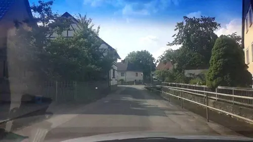
Hofladen zur Krämara (Brotzeithüttla)
Farm and orchard
Lohndorfer Weg
Mo-Su 07:00-21:00

Museums and landmarks13

Schloss Seehof
Monument and historic site · 4.7 km
Cultural heritage monument D-4-71-159-52 (0) in Memmelsdorf, Bavaria
1 Schloß Seehof, Memmelsdorf
Apr-Oct Tu-Su 09:00-18:00

Drei-Bäcker-Stein
Monument and historic site · 4.2 km
Kleiner Stein mit eingeritztem Kreuz; Vermutlich mittelalterlich. Der ursprüngliche Standort war etwa 350m nordöstlich. Sage: Hier...
Dreifaltigkeitsmarter
Monument and historic site · 4.2 km
Rechteckiger Sockel; toskanische Säule; Aufsatz mit Relief der Heiligen Dreifaltigkeit

Magdalenenkapelle
Monument and historic site · 2.6 km
Gemauerter Sockel; Bildhäuschen mit vergitterter Bildnische und Ziegeldach; Bild der hl. Magdalena; Err. 1888 von Johann Sauer aus...

Oberjägermarter
Monument and historic site · 4.2 km
Recht. Sockel; runde Säule, o.+u. Ringwulst; Aufsatz (v: das Kaiserpaar vor der hl. Dreifaltigkeit, h: die Legende des hl. Hubertus);...
Hochwasserschutz Drosendorf (BA 02) Gemeinde Memmelsdorf
Monument and historic site · 4.1 km
Naturstein mit Schrifttafel

Kriegsopferkapelle
Monument and historic site
Kleine offene Kapelle (ehemaliges Beinhaus); Kruzifix und Steintafeln mit den Namen der Gefallenen und Vermissten

Sängerehrenmal
Monument and historic site · 1.9 km
Zwölf 4m hohe Kalksandstein-Säulen um einen Altar gruppiert. Die Säulen symbolisieren die damaligen Sängerkreise des Fränkischen...

von-Poellnitz-Gedenkstein
Monument and historic site · 4.6 km
Stein mit Gedenkinschrift sowie Wappen derer von Poellnitz
1 more on the map.
Parks, trails and playgrounds5

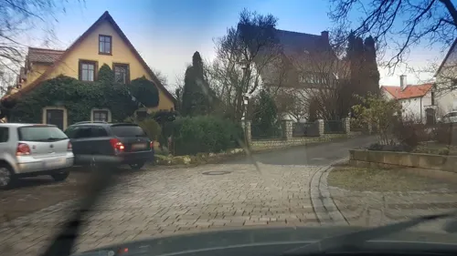


Restaurants and cafes36


Brauerei-Gasthof Griess
Restaurant · Regional · 3.8 km
6 Magdalenenstraße, Strullendorf
Mo,Tu,Th,Fr 15:00-22:00, Sa,Su 10:00-22:00
Brauereigasthof Göller
Restaurant · Regional · 4.0 km
7 Scheßlitzer Straße, Memmelsdorf
Mo, We-Su 09:30-23:00
HAY26
Restaurant · Sushi, Vietnamese
26 Hauptstraße, Litzendorf
Tu-Sa 11:30-14:30, 17:30-22:00; Su 11:30-14:30, 17:30-21:15
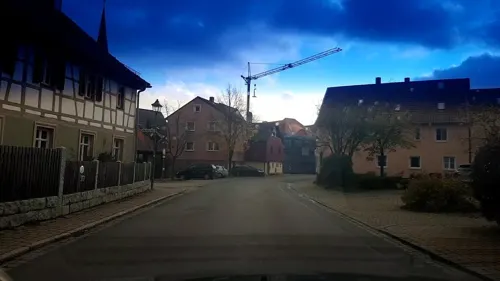
Hotel Landgasthof Büttel
Restaurant · Regional · 3.6 km
3 Litzendorfer Straße, Strullendorf
Tu 17:00-20:30, We-Su 11:30-20:30
Restaurant-Café Schloss Seehof
Restaurant · German · 4.6 km
14 Schloß Seehof, Memmelsdorf
Tu-Su 09:00-18:00; Mo off

Brauerei Reh
Brewery and winery · 2.9 km
36 Ellertalstraße, Litzendorf
Mo-Fr 07:30-18:00; Sa 08:30-13:00
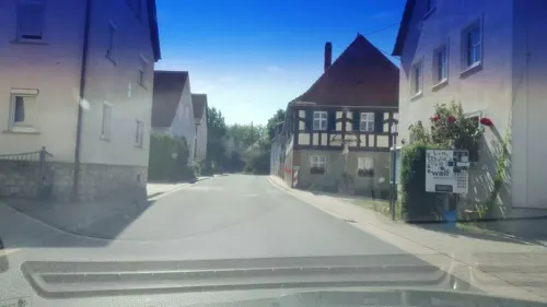
Brauerei Knoblach
Bar and pub · Fränkisch · 1.3 km
1 Kremmeldorfer Straße, Litzendorf
Tu-Fr 15:00-23:00; Sa 09:00-23:00


24 more on the map.
History
The derivation of the name Litzendorf is unclear. It could have come from the Slavic word lyko ("bast") or from the Germanic word litzel ("little").
In Merovingian and Carolingian times, when the villages, which were likely of Frankish and Slavic origin, arose, the Ellern Valley was still heavily wooded.
The name Litzendorf first cropped up in 1129 in a document from Bishop of Bamberg Otto, which mentions an Otgoz von Licindorf. Otgoz belonged to the lower subservient nobility and was a court and administrative official to Saint Otto.
Litzendorf later belonged to the High Monastery at Bamberg, but since the Reichsdeputationshauptschluss of 1803, the community has belonged to Bavaria.
From the History section of Litzendorf on Wikipedia, under CC BY-SA 4.0.
Where to stay8
Wohnmobilstellplatz Memmelsdorf - Hotel Brauerei Gasthof Höhn
Campground · 4.7 km
Churches and places of worship15
Mariä Geburt
Church · Roman Catholic · 2.7 km
3 Kirchberg, Litzendorf
Mariä Himmelfahrt
Church · Roman Catholic · 4.5 km
23 Hauptstraße, Memmelsdorf
Sankt Maria Magdalena
Church · Roman Catholic · 3.8 km
18 Magdalenenstraße, Strullendorf
Maria von der Immerwährenden Hilfe
Church · Roman Catholic · 1.3 km
2 Litzendorfer Straße, Litzendorf
Shopping5
Gas and EV charging2
Schools, colleges and libraries5
Healthcare4
Map of Litzendorf
105 places. The map loads OpenStreetMap tiles when you open it.
Getting there and nearby towns
Verkehrslandeplatz Burg Feuerstein (URD) is the nearest airport with scheduled flights listed in OpenStreetMap, 16 km away.
- Bamberg 8 km west, about 8 min by car
- Hirschaid 11 km south, about 11 min by car
- Pettstadt 11 km southwest, about 11 min by car
- Zapfendorf 13 km northwest, about 13 min by car
- Rattelsdorf 14 km northwest, about 14 min by car
- Stadelhofen 17 km northeast, about 17 min by car
- Walsdorf 17 km west, about 17 min by car
- Bad Staffelstein 21 km north, about 21 min by car
- Pommersfelden 22 km southwest, about 22 min by car
- Forchheim 22 km south, about 22 min by car
Drive times are estimates from straight-line distance, not routes.
Local news
Headlines from INDB.
Reviews, tips and questions
Loading what members have shared...
Sources and licences
- GeoNames (CC BY 4.0): population, coordinates, regions and time zone
- Mapillary (see each image): photos
- OpenStreetMap contributors (ODbL 1.0): places, airports, map data
- Wikidata (CC0 1.0): elevation, founding date, time zone, website
- Wikimedia Commons (see each image): photos
- Wikipedia (CC BY-SA 4.0): overview and history text
Photo credits
- Kirche Litzendorf-6, ermell, CC BY-SA 3.0
- Kirche Litzendorf-8-2, ermell, CC BY-SA 3.0
- Kirche Litzendorf-83, ermell, CC BY-SA 3.0
- Litzendorf BW 2013-02-06 16-31-52, Berthold Werner, CC BY-SA 3.0
- Litzendorf BW 2013-02-06 16-30-42, Berthold Werner, CC BY-SA 3.0
- Litzendorf BW 2013-02-06 16-29-26, Berthold Werner, CC BY-SA 3.0
- Litzendorf BW 2013-02-06 16-25-06, Berthold Werner, CC BY-SA 3.0
- Kirche Litzendorf-20-2, ermell, CC BY-SA 3.0
- Litzendorf Osterbrunnen-20070409-RM-112319, Ermell, CC BY-SA 4.0
- Litzendorf Kirche Luftbild-20231022-RM-105845, Ermell, CC BY-SA 4.0
- Litzendorf Luftbild-20231022-RM-105734, Ermell, CC BY-SA 4.0
- Litzendorf Kirche Luftbild-20231022-RM-105403, Ermell, CC BY-SA 4.0
- Litzendorf Friedhof Luftbild-20231022-RM-110011, Ermell, CC BY-SA 4.0
- Litzendorf Kirche Luftbild-20231022-RM-105511, Ermell, CC BY-SA 4.0
- Litzendorf Kirche Luftbild-20231022-RM-105835, Ermell, CC BY-SA 4.0
- Litzendorf Kirche Luftbild-20231022-RM-105751, Ermell, CC BY-SA 4.0
- Litzendorf-overview-6116998-pano, ermell, CC BY-SA 4.0
- Litzendorf-Cruzifix-6116997, ermell, CC BY-SA 4.0
- Litzendorf-Cruzifix-6116995, ermell, CC BY-SA 4.0
- Litzendorf-Marter-6116987, ermell, CC BY-SA 4.0
- Litzendorf-Marter-6116991, ermell, CC BY-SA 4.0
- Litzendorf-Marter-6116993, ermell, CC BY-SA 4.0
- Litzendorf-Marter-6116988, ermell, CC BY-SA 4.0
- Aerial image of Schloss Seehof (view from the southeast), Carsten Steger, CC BY-SA 4.0
- LitzendorfKirche, Immanuel Giel, CC BY-SA 3.0
- Strullendorf, Geisfeld, Magdalenenstraße 18-002, Tilman2007, CC BY-SA 3.0
- Peulendorf-Kirche-40, ermell, CC BY-SA 4.0
- Schammelsdorf-6117016, ermell, CC BY-SA 4.0
- Kirche Tiefenellern 01, Immanuel Giel, Public domain
- Memmelsdorf BW 2011-05-11 18-05-51, Berthold Werner, CC BY-SA 3.0
- Podeldorf HeiligGeist KircheAussen, Jurapeter, CC0
- Kremmeldorf Herz-Jesu-Kapelle-20250216-RM-155258, Reinhold Möller Ermell, CC BY-SA 4.0
- Schammelsdorf-church-6117013, ermell, CC BY-SA 4.0
- Magdalenenkapelle Geisfeld P2RM0137, Ermell, CC BY-SA 4.0
- Litzendorf - Schimmelsgraben 3 (Beinhaus), Berny23BE, CC BY-SA 4.0
- Lohndorf Naturwald Reservat 17RM1656-PSD, Ermell, CC BY-SA 4.0
- Kirche Lohndorf 02, Immanuel Giel, Public domain
- Kapelle Lohndorf 06, Immanuel Giel, Public domain
- Senderanlage Bamberg, Cybertorte, CC BY-SA 3.0
- Saengerehrenmal Melkendorf 01, Immanuel Giel, Public domain
- Informationstafel Oberjägermarter im Hauptsmoor, Stephan van Helden, CC BY-SA 4.0
- Street-level photo, r66, CC BY-SA 4.0
- Street-level photo, r66, CC BY-SA 4.0
- Street-level photo, r66, CC BY-SA 4.0
- Street-level photo, r66, CC BY-SA 4.0
- Street-level photo, r66, CC BY-SA 4.0
- Street-level photo, r66, CC BY-SA 4.0
- Street-level photo, r66, CC BY-SA 4.0
- Street-level photo, r66, CC BY-SA 4.0
- Street-level photo, r66, CC BY-SA 4.0
- Street-level photo, r66, CC BY-SA 4.0
- Street-level photo, r66, CC BY-SA 4.0
- Street-level photo, r66, CC BY-SA 4.0
- Street-level photo, r66, CC BY-SA 4.0


Page built November 9, 2026. Spotted a mistake? Tell us or suggest a place.