


Haltern am See, Germany
Haltern am See is a town of 38,142 people in North Rhine-Westphalia, Germany.
Why visit Haltern am See
Townapedia lists 151 museums and landmarks, 99 parks and trails, 135 places to eat, 22 places to stay and 44 attractions in and around town.
Highlights include Naturwildpark Granat, Feuerwachturm Rennberg, LWL-Römermuseum and Haltern.
Weather in Haltern am See
Forecast from MET Norway (CC BY 4.0). Full forecast
About Haltern am See
Haltern am See (German pronunciation: [ˈhaltɐn ʔam ˈzeː], lit. 'Haltern on the lake'; before December 2001 only Haltern) is a medium-sized town in the northern part of the district of Recklinghausen in the Regierungsbezirk Münster in North Rhine-Westphalia. The town is located in the northern Ruhr area, directly bordering the Münsterland region. In terms of natural geography, it belongs to the Westmünsterland. The town is about 80 kilometres (50 mi) north of Düsseldorf.
From the Wikipedia article Haltern am See (this version), under CC BY-SA 4.0.
Travel tips from other travellers: Haltern am See on Wikivoyage (CC BY-SA 4.0).
Photos of Haltern am See


Things to do44

Naturwildpark Granat
Zoo and aquarium · 7.4 km
626 Granatstraße, Haltern am See
Feb: Mo-Su,PH 10:00-17:30; Mar-Oct: Mo-Su,PH 10:00-18:00


Hof Hagedorn
Farm and orchard · 4.5 km
117 Rekener Straße, Haltern am See
Fr-We 08:00-18:00; Th closed
Hofkäserei Andres
Farm and orchard · 2.9 km
125 Lünzumer Weg, Haltern am See
Th-Fr 16:00-19:00, Sa 10:00-13:00
Kemper‘s Deelenladen
Farm and orchard · 6.8 km
290 Westruper Straße, Haltern am See
Tu-Fr 09:00-12:00,14:00-18:00, Sa 09:00-14:00

Rennbeck fire tower
Monument and historic site · 5.4 km
Observation tower
Hofladen Belustedde
Farm and orchard · 8.3 km
767 Dorstener Straße, Haltern am See
Mo-Fr 10:00-13:00,15:00-18:00, Sa 10:00-12:00

32 more on the map.
Museums and landmarks151

LWL-Römermuseum
Museum · 0.9 km
100 Weseler Straße, Haltern am See
Tu-Fr 09:00-17:00; Sa,Su,PH 10:00-18:00; Dec 24,25,31,Jan 01: off

Haltern
Monument and historic site · 0.9 km
Roman military camps in Haltern am See

Haus Sythen
Monument and historic site · 4.4 km
25 Stockwieser Damm, Haltern am See

Heimathaus Lippramsdorf
Monument and historic site · 7.1 km
38 Antoniusweg, Haltern am See


Christophoruskapelle
Monument and historic site · Roman Catholic · 4.8 km
Inschrift Bronzeplakette: Diese Kapelle wurde von den Eheleuten Erika und Heinrich Rohlf erbaut und am Patronasfest dem 24. Juli 2005 eingeweiht.
Annakapelle
Monument and historic site · Roman Catholic · 1.7 km
Als Baudenkmal in Haltern unter Nr. 62 eingetragen
Dorstener Straße, Haltern am See
Krüssteen
Monument and historic site · 7.5 km
Kleines Steinkreuz, als Baudenkmal unter Nr. 39 in Haltern am See eingetragen. Dort als "sehr alt" bezeichnet, genauere Datierung nicht möglich.
139 more on the map.
Parks, trails and playgrounds99

Ketteler Hof
Sports field and stadium · 5.4 km
234 Rekener Straße, Haltern am See
Mo-Su,PH 09:00-18:00



87 more on the map.
Restaurants and cafes135
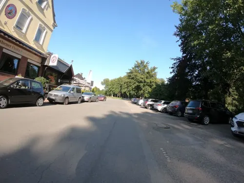
Pfeiffer's Sythener Flora
Restaurant · Regional · 4.3 km
71 Am Wehr, Haltern am See
Mo,Tu 17:00-21:00; We,Fr-Su 12:00-21:00; Th off
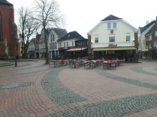
Cafe Extrablatt
Cafe · Coffee Shop
1-3 Merschstraße, Haltern am See
Mo-Sa 08:00-24:00; Su,PH 09:30-24:00
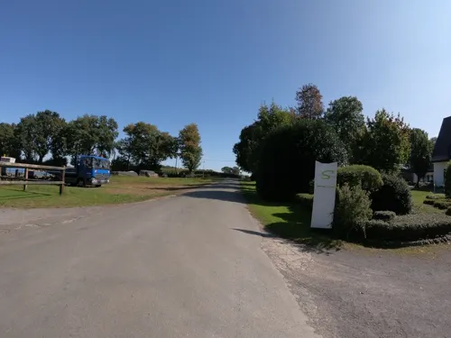
Das Tannenhäuschen
Restaurant · German · 3.9 km
389 Hennewiger Weg, Haltern am See
We-Sa 17:00-22:00; Su, PH 11:00-22:00
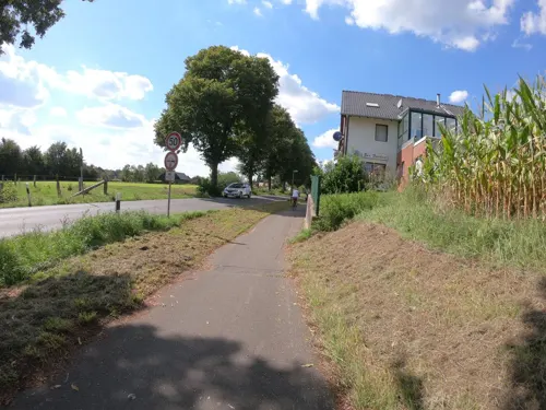
Landgasthaus Zur Freiheit
Restaurant · Regional · 5.1 km
456 Dorstener Straße, Haltern am See
Mo-Tu 17:00+; Th-Sa 17:00+; Su 11:30-14:30,17:00+
Pizzeria Avanti
Restaurant · Pizza
15 Lippstraße, Haltern am See
Mo-Th 11:00-23:00; Fr-Sa 11:00-23:30; Su 11:00-23:00
Punjab Garden
Restaurant · Indian · 4.6 km
377 Flaesheimer Straße, Haltern am See
Tu-Su, PH 11:30-14:30, 17:00-23:00; Mo off


Arentz Bauernhofcafé
Cafe · Breakfast, Cake, German · 7.7 km
117 Birkenallee, Haltern am See
Mo-Sa 09:00-17:00
Haus Himmelmann
Restaurant · German · 6.8 km
650 Dorstener Straße, Haltern am See
We-Sa 17:00-21:30; Su,PH 11:00-14:00,17:00-21:00
Lakeside Inn
Restaurant · Burger, Breakfast, Barbecue, German · 4.2 km
291 Stockwieser Damm, Haltern am See
Fr,Sa 09:00+; Su-Th 09:00-22:30
Landhaus Föcker
Restaurant · German · 6.7 km
12 Lembecker Straße, Haltern am See
We-Su 09:00-22:00; Fr 17:00-22:00
123 more on the map.
History
About one hundred flint artifacts from the late Neanderthal period were found in a dry sand pit in Haltern-Lavesum between 2009 and 2012. Cores provided evidence of the typical use of Levallois technique, a technique used to obtain flakes and blades. The site is associated with wedge knife groups (cf. Micoquia).
Artifacts from the Neolithic also come from Lavesum. These include two blades made of Rijckholt flint, i.e., from the Netherlands or the Rhine region, and a chalcedony scraper from a deposit near Bonn-Muffendorf. Not only were they transported over 100 km, but they also represent some of the earliest artifacts from the period of repopulation of the Westphalian Bay after the last Last Glacial Period.
254 flint artifacts from Bergbossendorf can be dated to the Late Glacial Interstadial. This constitutes a complete inventory that likely originates from a short stay by a hunting party.
In Haltern-Uphusen, small remains of a solitary farmstead with a granary (probably without livestock) from the Early Iron Age were excavated starting in 2015.
Read more of the history
Along the Lippe River, the Romans repeatedly moved from the west into the Westphalian hinterland and established military camps. The plan to make Germania a Roman province failed in 9 AD with the Battle of the Teutoburg Forest and finally in 16 AD with Tiberius's renunciation of the Germania east of the Rhine after the failed campaigns of Germanicus. All Lippe camps, including the one in Haltern, were abandoned. In the present-day urban area of Haltern, there were several partially fortified camps and forts, as well as a harbor on the Lippe River. The former Roman Aliso camp is believed to have been located in the Haltern Roman camp. Many finds from this period are on display in the LWL-Römermuseum in Haltern.
On February 3, 1289, what was then Halteren received lower city rights (minor city) from its sovereign, the Prince-Bishop of Münster Everhard von Diest, “quale in aliis opides nostris Coesvelt et Borken” (Latin: as in our other cities Coesfeld and Borken), and thus the right to build a city wall, of which the Seven Devils Tower (Siebenteufelsturm) is still preserved.
Like many other towns in Westphalia, Haltern was a member of the Hanseatic League from the 14th century until 1611. The activities of Haltern citizens in the Hanseatic League's trading alliance can be traced back even further. Today, Haltern is a member of the International Hanseatic League of the Modern Age and the Westphalian Hanseatic League, which sought to revive the Hanseatic League with their re-foundation in the 1980s.
During Kristallnacht (1938), the town's synagogue, Jewish cemetery and the houses and shops belonging to the town's Jews were vandalised. Jews were deported to concentration camps, the last five of whom were deported in January 1942. Only one of the town's Jews survived the Holocaust: Alexander Lebenstein, after whom a school is named.
In March 2015, the town received international attention when 16 students and two teachers from the Joseph-König-Gymnasium in Haltern, were killed in the Germanwings Flight 9525 crash in the French Alps. They were on their way home from a student exchange with the Giola Institute in Llinars del Vallès, Catalonia, Spain. Haltern's then mayor, Bodo Klimpel, described it as "the darkest day in the history of our city."
From the History section of Haltern am See on Wikipedia, under CC BY-SA 4.0.
More about Haltern am See
Geography
Haltern am See is situated on the shores of the Halterner Stausee, which is a popular destination for swimming, boating, and hiking.
The area around the lake is characterized by green forests, rolling hills, and sprawling meadows. The town is surrounded by several nature reserves, including the Hohe Mark Nature Park, which is known for its flora and fauna. Here, visitors can hike through dense forests and spot rare birds and other wildlife.
During winter, tourists can experience traditional German Christmas markets. These markets are held in the city's historic old town.
In the summer months, Haltern am See offers visitors the opportunity to explore the rural areas of Germany. The city is surrounded by fields and rolling countryside.
The city is divided into the districts, with the associated hamlets:
Haltern-Mitte (19,771 inhabitants); with Berghaltern (formerly the Holtwick farmstead), which has grown close to the core city, in the extreme southwest.
Sythen (6,305 inhabitants); with Lehmbraken, Uphusen, and Stockwiese; the Sythener End in the extreme northeast has belonged to Hausdülmen since 1975.
From the Wikipedia article Haltern am See, under CC BY-SA 4.0.
Notable people from Haltern am See
 Benedikt HöwedesGerman association football playerPhoto: Анна Нэсси, CC BY-SA 3.0
 Christoph MetzelderGerman footballer (born 1980)Photo: 9EkieraM1, CC BY-SA 3.0
 Luba GoyCanadian actress and comedianPhoto: Tabercil, CC BY-SA 2.0
 Helmut Müller-EnbergsGerman historianPhoto: Helmut Müller-Enbergs, CC BY-SA 2.0
 Josef HovenjürgenGerman politicianPhoto: Frank Schürmann, CC BY-SA 3.0 de
 Christine FiggenerGerman marine biologistPhoto: Christine Figgener, CC BY-SA 4.0
- Gaby BußmannGerman athlete
- Joseph KönigGerman chemist (1843–1930)
- Malte MetzelderGerman footballer
- Leni FischerGerman politician (1935–2022)
- Alexander LebensteinGerman-American Holocaust survivor (1927-2010)
Born in Haltern am See, according to Wikidata (CC0). Each name links to its Wikipedia article.
Where to stay22
Churches and places of worship36
Heilig-Kreuz
Church · Roman Catholic · 2.5 km
14 Kirchweg, Haltern am See
St. Joseph
Church · Roman Catholic · 4.5 km
3 Hellweg, Haltern am See
Shopping34
Gas and EV charging14
Schools, colleges and libraries27
Healthcare11
Lambertus-Apotheke
Clinic and pharmacy · 6.7 km
3 Lembecker Straße, Haltern am See
Map of Haltern am See
250 places. The map loads OpenStreetMap tiles when you open it.
Getting there and nearby towns
Dortmund Airport (DTM) is the nearest airport with scheduled flights listed in OpenStreetMap, 39 km away.
- Marl 11 km southwest, about 11 min by car
- Dülmen 12 km northeast, about 12 min by car
- Bahnhof Reken 12 km northwest, about 12 min by car
- Oer-Erkenschwick 13 km southeast, about 13 min by car
- Reken 14 km northwest, about 14 min by car
- Recklinghausen 14 km south, about 14 min by car
- Datteln 15 km southeast, about 15 min by car
- Olfen 14 km east, about 14 min by car
- Herten 17 km south, about 17 min by car
- Dorsten 17 km southwest, about 17 min by car
Drive times are estimates from straight-line distance, not routes.
Towns near Haltern am See


Keep exploring
Local news
Headlines from INDB.
Reviews, tips and questions
Loading what members have shared...
Sources and licences
- GeoNames (CC BY 4.0): population, coordinates, regions and time zone
- Mapillary (see each image): photos
- OpenStreetMap contributors (ODbL 1.0): places, airports, map data
- Wikidata (CC0 1.0): elevation, founding date, time zone, website, landmarks and historic places
- Wikimedia Commons (see each image): photos
- Wikipedia (CC BY-SA 4.0): overview and history text
Photo credits
- Haltern am See, Gänsemarkt -- 2013 -- 0202, Dietmar Rabich, CC BY-SA 4.0
- Haltern am See, Innenstadt -- 2014 -- 8937, Dietmar Rabich, CC BY-SA 4.0
- Haltern am See-Figurengruppe Musikanten, Dat doris, CC BY-SA 4.0
- Haltern am See sculpture Gahlen, Arnoldius, CC BY-SA 3.0
- Haltern am See Siebenteufelsturm, Arnoldius, CC BY-SA 3.0
- Haltern am See, Skulptur "Kardinal von Galen" -- 2026 -- 0770, Dietmar Rabich, CC BY-SA 4.0
- Haltern am See-Sonnenuhr 02, Dat doris, CC BY-SA 4.0
- Haltern am See, Skulptur -- 2014 -- 5952, Dietmar Rabich, CC BY-SA 4.0
- Haltern am See-Sonnenuhr 01, Dat doris, CC BY-SA 4.0
- Haltern am See, Skulptur -- 2014 -- 5953, Dietmar Rabich, CC BY-SA 4.0
- Haltern am See-Gaudette, Dat doris, CC BY-SA 4.0
- Haltern am See-Gescheiterter Varus, Dat doris, CC BY-SA 4.0
- Haltern am See, Skulptur -Der gescheiterte Varus- -- 2016 -- 1405, Dietmar Rabich, CC BY-SA 4.0
- Haltern am See, Skulptur -Der gescheiterte Varus- -- 2016 -- 1409, Dietmar Rabich, CC BY-SA 4.0
- Haltern am See, Skulptur -Der gescheiterte Varus- (Wilfried Koch) -- 2013 -- 5001, Dietmar Rabich, CC BY-SA 4.0
- Haltern am See-Landschaft, Dat doris, CC BY-SA 4.0
- Haltern am See, Skulptur -Der gescheiterte Varus- -- 2014 -- 4289-93, Dietmar Rabich, CC BY-SA 4.0
- Haltern am See, Rathaus -- 2014 -- 5951, Dietmar Rabich, CC BY-SA 4.0
- Haltern am See, Skulptur "Kardinal von Galen" -- 2026 -- 0778, Dietmar Rabich, CC BY-SA 4.0
- Haltern am See, Rathaus -- 2014 -- 5946, Dietmar Rabich, CC BY-SA 4.0
- Haltern am See, Siebenteufelsturm -- 2014 -- 4224-8, Dietmar Rabich, CC BY-SA 4.0
- Haltern am See-Kardinal von Galen, Dat doris, CC BY-SA 4.0
- Haltern am See-Kardinal von Galen Wappen, Dat doris, CC BY-SA 4.0
- Haltern am See, Rathaus -- 2016 -- 0600-6, 0614-20, 0621-7, Dietmar Rabich, CC BY-SA 4.0
- Haltern am See, Rathaus -- 2016 -- 0600-6, Dietmar Rabich, CC BY-SA 4.0
- Haltern am See, Rathaus -- 2016 -- 0600-6, 0614-20, 0621-7 - bw, Dietmar Rabich, CC BY-SA 4.0
- Haltern am See, Rathaus -- 2014 -- 4234-8, Dietmar Rabich, CC BY-SA 4.0
- Haltern am See-Tor, Dat doris, CC BY-SA 4.0
- Haltern am See 2010-04-05 - Siebenteufelsturm - panoramio, Edgar El, CC BY 3.0
- Haltern am See, Skulptur -Kardinal von Galen- -- 2014 -- 5948, Dietmar Rabich, CC BY-SA 4.0
- Haltern am See, Einheits-Eiche, Schild, 01, Haltern am See, CC BY-SA 4.0
- Haltern am See, Skulptur "Kardinal von Galen" -- 2026 -- 0773, Dietmar Rabich, CC BY-SA 4.0
- Haltern am See, Siebenteufelsturm -- 2013 -- 3178-80, Dietmar Rabich, CC BY-SA 4.0
- Legionslager Haltern Principia, Mediatus, CC BY-SA 3.0
- HeimathausLippramsdorf1, JosefLehmkuhl, Public domain
- Haltern am See, St.-Sixtus-Kirche -- 2014 -- 8931 -- Ausschnitt, Dietmar Rabich, CC BY-SA 4.0
- Haus Ostendorf, Daniel Ullrich, Threedots, CC BY-SA 3.0
- Haltern am See, Wesel-Datteln-Kanal -- 2014 -- 8902, Dietmar Rabich, CC BY-SA 4.0
- Haltern am See Ketteler Hof Eingangsbereich, Unknown author, CC BY-SA 3.0
- Luftaufnahme 2016 der LWL-Klinik Marl-Sinsen, MiRi-LWL, CC BY-SA 4.0
- LWL-Römermuseum-Haltern, JosefLehmkuhl, Public domain
- Haltern Prickings Hof, Unknown author, CC BY-SA 3.0
- Sythen, Haus Sythen -- 2014 -- 00607, Dietmar Rabich, CC BY-SA 4.0
- Haltern am See, Strandbad am Stausee -- 2014 -- 8935 -- Ausschnitt, Dietmar Rabich, CC BY-SA 4.0
- Haltern am See, Hullern, St.-Andreas-Kirche -- 2014 -- 3232, Dietmar Rabich, CC BY-SA 4.0
- Katharinenkapelle Haltern, JosefLehmkuhl, Public domain
- Haltern am See, Sythen, Wassermühle -- 2020 -- 0405-9, Dietmar Rabich, CC BY-SA 4.0
- Idylle am Haardsee, Gunu48, CC BY-SA 4.0
- Am schwarzen Berg, Gunu48, CC BY-SA 4.0
- Haltern am See, Sythen, Naturschutzgebiet "Bäche im Linnert und Rietwiesen", Mühlenbach -- 2020 -- 6973, Dietmar Rabich, CC BY-SA 4.0
- Haltern am See, NSG "Borkenberge" -- 2021 -- 0542, Dietmar Rabich, CC BY-SA 4.0
- Haltern am See, kerk2 foto5 2010-08-07 14.24, Michielverbeek, CC BY-SA 3.0
- Haltern Denkmal 04 Antoniuskapelle Lavesum-0513, W.Strickling, CC BY-SA 4.0
- Kirche Heilig Kreuz (Haltern am See-Hamm) (2), Chris06, CC BY-SA 4.0
- Haltern am See, Sythen, St.-Joseph-Kirche -- 2014 -- 9022 -- Ausschnitt, Dietmar Rabich, CC BY-SA 4.0
- Liebfrauenkirche Marl-Sinsen 135024, Creosoph, CC BY-SA 4.0
- Haltern - Naturwildpark Granat - Dama dama dama+Ovis orientalis musimon 01 ies, Frank Vincentz, CC BY-SA 3.0
- Stolperstein Haltern Disselhof 36 Alexander Lebenstein, Tomtom10, CC BY-SA 4.0
- Stolperstein Haltern Rekumer Straße 18 Caecillia Chava Meyer, Tomtom10, CC BY-SA 4.0
- Stolperstein Haltern Disselhof 36 Charlotte Lebenstein, Tomtom10, CC BY-SA 4.0
- Naturschutzgebiet Braucksenke, Werner Buzan, CC BY-SA 4.0
- Feuerwachturm Rennberg in der Haard Naturpark Hohe Mark Westmuensterland, DerMische, CC BY-SA 4.0
- Heiligenhäuschen Christophoruskapelle Merfelder Str.-Schützenstr. 51 Lavesum 2020-06-10 Haltern-5912, Dr. W. Strickling, CC BY-SA 4.0
- Street-level photo, geogladbecker, CC BY-SA 4.0
- Street-level photo, changchun1, CC BY-SA 4.0
- Street-level photo, changchun1, CC BY-SA 4.0
- Street-level photo, changchun1, CC BY-SA 4.0
- Street-level photo, changchun1, CC BY-SA 4.0
- Street-level photo, geogladbecker, CC BY-SA 4.0
- Street-level photo, lednerb, CC BY-SA 4.0
- Street-level photo, geogladbecker, CC BY-SA 4.0
- Street-level photo, poxonline, CC BY-SA 4.0
- Street-level photo, poxonline, CC BY-SA 4.0
- Street-level photo, changchun1, CC BY-SA 4.0
- Street-level photo, poxonline, CC BY-SA 4.0
- Street-level photo, changchun1, CC BY-SA 4.0
- Street-level photo, changchun1, CC BY-SA 4.0
- Street-level photo, poxonline, CC BY-SA 4.0
- Street-level photo, heetENkoel, CC BY-SA 4.0
- Street-level photo, diecookieente, CC BY-SA 4.0
- Street-level photo, geogladbecker, CC BY-SA 4.0
- Street-level photo, poxonline, CC BY-SA 4.0
- Street-level photo, TechniPorter, CC BY-SA 4.0


Page built November 9, 2026. Spotted a mistake? Tell us or suggest a place.