


Why visit Dülmen
Townapedia lists 124 museums and landmarks, 74 parks and trails, 165 places to eat, 36 places to stay and 23 attractions in and around town.
Highlights include Hof Hagedorn, Ulrikes Lädchen, Alter Bahnhof Lette and Haus Osthoff.
Weather in Dülmen
Forecast from MET Norway (CC BY 4.0). Full forecast
About Dülmen
Dülmen (German pronunciation: [ˈdʏlmən] ) is a town in the district of Coesfeld, North Rhine-Westphalia, Germany.
From the Wikipedia article Dülmen (this version), under CC BY-SA 4.0.
Travel tips from other travellers: Dülmen on Wikivoyage (CC BY-SA 4.0).
Photos of Dülmen


Things to do23

Hof Hagedorn
Farm and orchard · 10.8 km
117 Rekener Straße, Haltern am See
Fr-We 08:00-18:00; Th closed
Ulrikes Lädchen
Farm and orchard · 3.5 km
20 Börnste, Dülmen
Mo-Th 11:00-18:00; Sa-Su 11:00-18:00; Fr off

Cinema Dülmen
Cinema and theater
20 Lohwall, Dülmen
Mo-Fr 16:15-18:00+; Sa,Su 13:30-18:00+

11 more on the map.
Museums and landmarks124


Haus Osthoff
Monument and historic site · 1.6 km
Das Haus Osthoff ist das älteste Haus in Dülmen. Es ist das einzige Gebäude des ehemaligen Rittergutes Osthoff.
30 Von-dem-Busche-Straße, Dülmen


Haus Merfeld
Monument and historic site · 5.3 km
5 Bauerschaft, Dülmen


Lüdinghauser Tor
Monument and historic site
Das bauliche Wahrzeichen der Stadt Dülmen


Haltern
Monument and historic site · 12.7 km
Roman military camps in Haltern am See


112 more on the map.
Parks, trails and playgrounds74



62 more on the map.
Restaurants and cafes165
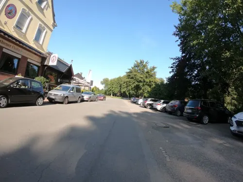
Pfeiffer's Sythener Flora
Restaurant · Regional · 7.8 km
71 Am Wehr, Haltern am See
Mo,Tu 17:00-21:00; We,Fr-Su 12:00-21:00; Th off
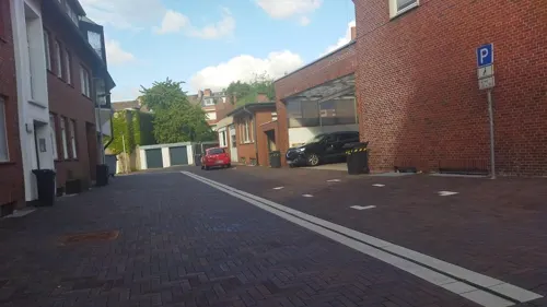
Café Dülmen
Cafe · Coffee Shop, Cake, Salad, Ice Cream, Pasta · 1.1 km
50 Bahnhofstraße, Dülmen
Mo-Th 06:00-19:00; Fr 06:00-21:00; Sa 08:00-21:00; Su 10:00-18:30
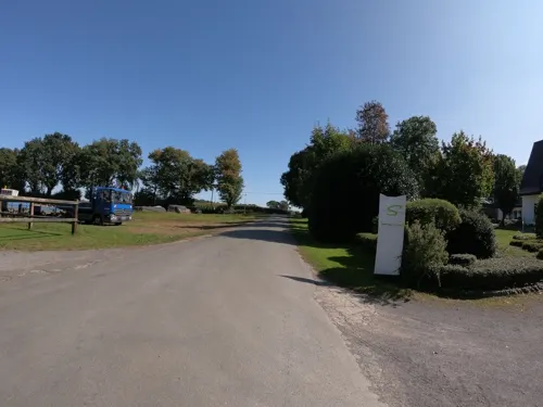
Das Tannenhäuschen
Restaurant · German · 10.4 km
389 Hennewiger Weg, Haltern am See
We-Sa 17:00-22:00; Su, PH 11:00-22:00
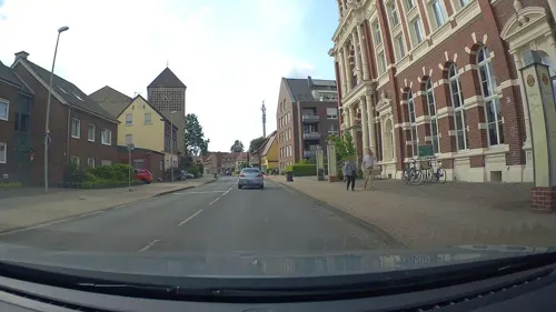


Bäckerei Böckmann
Bakery · 1.1 km
Bäckerei Böckmann
18 Am Luchtkamp, Dülmen
Mo-Fr 05:30-18:00, Sa 05:30-12:30, Su,PH 07:00-12:00
Gourmet Tempel Dülmen
Restaurant · Asian · 0.8 km
131 Münsterstraße, Dülmen
Mo-Sa 11:30-15:00,17:30-23:00; Su 11:30-23:00
Lakeside Inn
Restaurant · Burger, Breakfast, Barbecue, German · 9.9 km
291 Stockwieser Damm, Haltern am See
Fr,Sa 09:00+; Su-Th 09:00-22:30
Landgasthaus Darup
Restaurant · Regional · 11.0 km
60 Coesfelder Straße, Nottuln
We-Sa 17:00-24:00; Su,PH 11:30-24:00
153 more on the map.
History
The place was first mentioned as Dulmenni in 889, as a property of Werden Abbey. Dülmen received town privileges in 1311. It joined the Hanseatic League in 1470. It was part of the Prince-Bishopric of Münster until it was mediatised in 1803. After a short period in the hands of the House of Croÿ, and later part of the Duchy of Arenberg, it was taken by the French in 1811. After the defeat of Napoleon, it became part of the Prussian Province of Westphalia. The Dülmen oil plant was a target of the Oil Campaign of World War II: 90% of the city was destroyed and the city was rebuilt after the war. In 1973, the population reached 20,000. In 1975, Rorup, Merfeld, Hiddingsel, Buldern, Hausdülmen and Kirchspiel Dülmen became part of Dülmen.
From the History section of Dülmen on Wikipedia, under CC BY-SA 4.0.
More about Dülmen
Geography
Dülmen is situated in the south part of the Münsterland area, between the Lippe river to the south, the Baumberge hills to the north and the Ems river to the east. South of Dülmen the Ruhr area is located.
After the local government reforms of 1975 Dülmen consists of the 7 subdivisions Dülmen, Kirchspiel, Buldern, Hausdülmen, Hiddingsel, Merfeld and Rorup.
Merfeld was first mentioned in 890. It became a part of Dülmen in 1975. It is known for its herd of Dülmen Ponies.
Rorup was first mentioned in 1050 and became a district of Dülmen in 1975.
From the Wikipedia article Dülmen, under CC BY-SA 4.0.
Notable people from Dülmen
 André StinkaGerman politicianPhoto: Foto-AG Melle, CC BY-SA 3.0 de
 Thekla WalkerGerman politicianPhoto: Bündnis 90/Die Grünen..., CC BY-SA 2.0
- Marianne WernerWest German shot putter (1924–2023)
- Princess Isabella of CroÿArchduchess of Austria
- Manuel SandersGerman sprinter
- Hartmut SurmannGerman computer scientist
- Wilhelm BromenGerman officer and Knight's Cross recipient
Born in Dülmen, according to Wikidata (CC0). Each name links to its Wikipedia article.
Where to stay36
Churches and places of worship27
Pfarrkirche St. Georg
Church · Catholic · 8.3 km
34 Neustraße, Dülmen
St. Joseph
Church · Roman Catholic · 7.5 km
3 Hellweg, Haltern am See
Shopping43
Gas and EV charging25
Schools, colleges and libraries34
Healthcare14
Map of Dülmen
250 places. The map loads OpenStreetMap tiles when you open it.
Getting there and nearby towns
Dortmund Airport (DTM) is the nearest airport with scheduled flights listed in OpenStreetMap, 42 km away.
- Haltern am See 12 km southwest, about 12 min by car
- Nottuln 12 km northeast, about 12 min by car
- Lüdinghausen 13 km southeast, about 13 min by car
- Coesfeld 15 km northwest, about 15 min by car
- Olfen 15 km southeast, about 15 min by car
- Billerbeck 16 km north, about 16 min by car
- Reken 16 km west, about 16 min by car
- Bahnhof Reken 17 km west, about 17 min by car
- Datteln 20 km south, about 20 min by car
- Selm 20 km southeast, about 20 min by car
Drive times are estimates from straight-line distance, not routes.
Towns near Dülmen


Keep exploring
Local news
Headlines from INDB.
Reviews, tips and questions
Loading what members have shared...
Sources and licences
- GeoNames (CC BY 4.0): population, coordinates, regions and time zone
- Mapillary (see each image): photos
- OpenStreetMap contributors (ODbL 1.0): places, airports, map data
- Wikidata (CC0 1.0): elevation, founding date, time zone, website, landmarks and historic places
- Wikimedia Commons (see each image): photos
- Wikipedia (CC BY-SA 4.0): overview and history text
Photo credits
- Dülmen, St.-Viktor-Kirche -- 2014 -- 8033, Dietmar Rabich, CC BY-SA 4.0
- Dülmen, Hermann-Leeser-Schule -- 2014 -- 3198, Dietmar Rabich, CC BY-SA 4.0
- Dülmen, Hermann-Leeser-Schule -- 2015 -- 4954, Dietmar Rabich, CC BY-SA 4.0
- Dülmen, Charleville-Mézières-Platz, Berliner Mauer -- 2019 -- 7463, Dietmar Rabich, CC BY-SA 4.0
- Dülmen - Charleville-Mézières-Platz - panoramio, giggel, CC BY 3.0
- Dülmen, Charleville-Mézières-Platz, Berliner Mauer -- 2020 -- 3994, Dietmar Rabich, CC BY-SA 4.0
- Dülmen, Charleville-Mézières-Platz, Berliner Mauer -- 2021 -- 4750, Dietmar Rabich, CC BY-SA 4.0
- Dülmen, Charleville-Mézières-Platz, Berliner Mauer -- 2019 -- 7461, Dietmar Rabich, CC BY-SA 4.0
- Dülmen, Charleville-Mézières-Platz, Berliner Mauer -- 2026 -- 4674, Dietmar Rabich, CC BY-SA 4.0
- Dülmen, Charleville-Mézières-Platz, Berliner Mauer -- 2026 -- 4672, Dietmar Rabich, CC BY-SA 4.0
- Dülmen, Charleville-Mézières-Platz, Berliner Mauer -- 2026 -- 4664, Dietmar Rabich, CC BY-SA 4.0
- Dülmen, Charleville-Mézières-Platz, Berliner Mauer -- 2026 -- 4679, Dietmar Rabich, CC BY-SA 4.0
- Dülmen, Charleville-Mézières-Platz, Berliner Mauer -- 2026 -- 4667, Dietmar Rabich, CC BY-SA 4.0
- Dülmen, Hermann-Leeser-Schule -- 2021 -- 4747, Dietmar Rabich, CC BY-SA 4.0
- Dülmen, Hermann-Leeser-Schule -- 2021 -- 4749, Dietmar Rabich, CC BY-SA 4.0
- Dülmen – evangelische Christuskirche - panoramio, Edgar El, CC BY 3.0
- Dülmen, Hermann-Leeser-Schule -- 2021 -- 4751, Dietmar Rabich, CC BY-SA 4.0
- Dülmen, Skulptur "Partnerschaft" (Charleville-Mézières-Platz) -- 2011 -- 1870, Dietmar Rabich, CC BY-SA 4.0
- Dülmen, Skulptur "Partnerschaft" (Charleville-Mézières-Platz) -- 2012 -- 3905, Dietmar Rabich, CC BY-SA 4.0
- Dülmen, Skulptur "Partnerschaft" (Charleville-Mézières-Platz) -- 2012 -- 8756, Dietmar Rabich, CC BY-SA 4.0
- Dülmen, Charleville-Mézières-Platz, Mitfahrbank -- 2021 -- 4753, Dietmar Rabich, CC BY-SA 4.0
- Dülmen, Charleville-Mézières-Platz, Bank -- 2021 -- 4752, Dietmar Rabich, CC BY-SA 4.0
- Dülmen, Charleville-Mézières-Platz, BMW i3 -- 2019 -- 7450, Dietmar Rabich, CC BY-SA 4.0
- Dülmen, Christuskirche -- 2021 -- 4744, Dietmar Rabich, CC BY-SA 4.0
- Dülmen, Christuskirche -- 2015 -- 4957, Dietmar Rabich, CC BY-SA 4.0
- Dülmen, Hermann-Leeser-Schule -- 2012 -- 3906, Dietmar Rabich, CC BY-SA 4.0
- Dülmen, Hermann-Leeser-Schule -- 2012 -- 3907, Dietmar Rabich, CC BY-SA 4.0
- Dülmen, Hermann-Leeser-Schule -- 2012 -- 3085, Dietmar Rabich, CC BY-SA 4.0
- Dülmen, Hermann-Leeser-Schule -- 2012 -- 3900, Dietmar Rabich, CC BY-SA 4.0
- Dülmen, Hermann-Leeser-Schule -- 2011 -- 1876, Dietmar Rabich, CC BY-SA 4.0
- Dülmen, Hermann-Leeser-Schule -- 2010 -- 2893, Dietmar Rabich, CC BY-SA 4.0
- Dülmen, Hermann-Leeser-Schule -- 2010 -- 2896, Dietmar Rabich, CC BY-SA 4.0
- Dülmen, Hermann-Leeser-Schule -- 2010 -- 2895, Dietmar Rabich, CC BY-SA 4.0
- Dülmen, Hermann-Leeser-Schule -- 2014 -- 3197, Dietmar Rabich, CC BY-SA 4.0
- Dülmen, Hermann-Leeser-Schule -- 2014 -- 3201, Dietmar Rabich, CC BY-SA 4.0
- Dülmen, Hermann-Leeser-Schule -- 2014 -- 3205, Dietmar Rabich, CC BY-SA 4.0
- Dülmen, Hermann-Leeser-Schule -- 2014 -- 3203, Dietmar Rabich, CC BY-SA 4.0
- Dülmen, Hermann-Leeser-Schule -- 2014 -- 3204, Dietmar Rabich, CC BY-SA 4.0
- Dülmen, Hermann-Leeser-Schule -- 2014 -- 3202, Dietmar Rabich, CC BY-SA 4.0
- Dülmen, Hermann-Leeser-Schule -- 2014 -- 3206, Dietmar Rabich, CC BY-SA 4.0
- Legionslager Haltern Principia, Mediatus, CC BY-SA 3.0
- Bahnhof Lette, Stefan Flöper, CC BY-SA 4.0
- Dülmen, Clemens-Brentano-Gymnasium -- 2014 -- 8093, Dietmar Rabich, CC BY-SA 4.0
- Dülmen Haus Merfeld, Stahlkocher, CC BY-SA 3.0
- Dülmen, Nonnenturm -- 2012 -- 4152, Dietmar Rabich, CC BY-SA 4.0
- Dülmen, Haus Osthoff -- 2012 -- 7754, Dietmar Rabich, CC BY-SA 4.0
- Dülmen, Heilig-Kreuz-Kirche -- 2014 -- 3368, Dietmar Rabich, CC BY-SA 4.0
- Rorup, St.-Agatha-Kirche -- 2014 -- 9181 -- Ausschnitt, Dietmar Rabich, CC BY-SA 4.0
- Haltern Prickings Hof, Unknown author, CC BY-SA 3.0
- Buldern, Schloss Buldern -- 2, Dietmar Rabich, CC BY-SA 4.0
- Haltern am See, Strandbad am Stausee -- 2014 -- 8935 -- Ausschnitt, Dietmar Rabich, CC BY-SA 4.0
- Hiddingsel, St.-Georg-Kirche -- 2013 -- 2769, Dietmar Rabich, CC BY-SA 4.0
- Dülmen, Buldern, Kloster Hamicolt -- 2013 -- 00429, Dietmar Rabich, CC BY-SA 4.0
- Kirchspiel (Dülmen), Haus Empte -- 2014 -- 5420, Dietmar Rabich, CC BY-SA 4.0
- Dülmen, Stadtbücherei -- 2021 -- 5306, Dietmar Rabich, CC BY-SA 4.0
- Dülmen, Kirchspiel, NSG Franzosenbach -- 2016 -- 1819-25, Dietmar Rabich, CC BY-SA 4.0
- Haltern am See, Sythen, Naturschutzgebiet "Bäche im Linnert und Rietwiesen", Mühlenbach -- 2020 -- 6973, Dietmar Rabich, CC BY-SA 4.0
- Haltern am See, NSG "Borkenberge" -- 2021 -- 0542, Dietmar Rabich, CC BY-SA 4.0
- Dülmen, Christuskirche -- 2019 -- 7556, Dietmar Rabich, CC BY-SA 4.0
- Dülmen, Kreuzkapelle -- 2012 -- 3063, Dietmar Rabich, CC BY-SA 4.0
- Buldern, Alte Kirche -- 2012 -- 7112, Dietmar Rabich, CC BY-SA 4.0
- Dülmen, Buldern, Kirche des Klosters Hamicolt -- 2015 -- 7509, Dietmar Rabich, CC BY-SA 4.0
- Haltern Denkmal 04 Antoniuskapelle Lavesum-0513, W.Strickling, CC BY-SA 4.0
- Haltern am See, Sythen, St.-Joseph-Kirche -- 2014 -- 9022 -- Ausschnitt, Dietmar Rabich, CC BY-SA 4.0
- Lüdinghauser Tor (Markus Schweiß), Markus Schweiß, CC BY-SA 3.0
- Dülmen, Hausdülmen, Große Teichsmühle -- 2016 -- 3684, Dietmar Rabich, CC BY-SA 4.0
- Dülmen, Weddern, St.-Jakobus-Kirche -- 2018 -- 2034, Dietmar Rabich, CC BY-SA 4.0
- Coesfeld, Lette, St.-Johannes-Kirche -- 2015 -- 5741, Dietmar Rabich, CC BY-SA 4.0
- Coesfeld - Lette - Glasmuseum, Horst J. Meuter, CC BY-SA 4.0
- NSG Alter Kanalarm Lüdinghausen, Dirkfried, CC BY-SA 4.0
- Street-level photo, geogladbecker, CC BY-SA 4.0
- Street-level photo, geogladbecker, CC BY-SA 4.0
- Street-level photo, changchun1, CC BY-SA 4.0
- Street-level photo, poxonline, CC BY-SA 4.0
- Street-level photo, changchun1, CC BY-SA 4.0
- Street-level photo, poxonline, CC BY-SA 4.0
- Street-level photo, changchun1, CC BY-SA 4.0
- Street-level photo, poxonline, CC BY-SA 4.0
- Street-level photo, descilla, CC BY-SA 4.0
- Street-level photo, poxonline, CC BY-SA 4.0
- Street-level photo, zuse, CC BY-SA 4.0
- Street-level photo, poxonline, CC BY-SA 4.0
- Street-level photo, Eglisius, CC BY-SA 4.0
- Street-level photo, descilla, CC BY-SA 4.0
- Street-level photo, poxonline, CC BY-SA 4.0
- Street-level photo, descilla, CC BY-SA 4.0
- Street-level photo, diecookieente, CC BY-SA 4.0
- Street-level photo, heetENkoel, CC BY-SA 4.0
- Street-level photo, poxonline, CC BY-SA 4.0
- Street-level photo, descilla, CC BY-SA 4.0
- Street-level photo, TechniPorter, CC BY-SA 4.0


Page built November 9, 2026. Spotted a mistake? Tell us or suggest a place.