


Why visit Marl
Townapedia lists 73 museums and landmarks, 50 parks and trails, 208 places to eat, 12 places to stay and 30 attractions in and around town.
Highlights include Theater Marl, Movie Park Germany, Heimatkabinett im Café Oelmann and Skulpturenmuseum Glaskasten.
Weather in Marl
Forecast from MET Norway (CC BY 4.0). Full forecast
About Marl
Marl (German pronunciation: [maʁl] ) is a town and a municipality in the district of Recklinghausen, in North Rhine-Westphalia, Germany. It is situated near the Wesel-Datteln Canal and is about 10 km north-west of Recklinghausen. It has about 90,000 people.
From the Wikipedia article Marl, North Rhine-Westphalia (this version), under CC BY-SA 4.0.
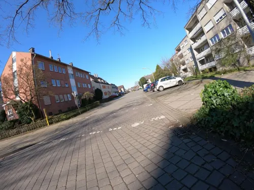
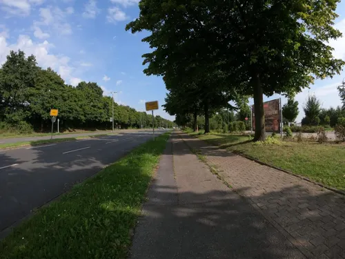
Photos of Marl


Things to do30


Movie Park Germany
Monument and historic site · 9.1 km
Theme park in Bottrop, Germany


Spargelhof Schulte-Scherlebeck
Farm and orchard · 4.5 km
435 Scherlebecker Straße, Herten
Apr-Jun: 07:00-19:00; Jul-Oct: 09:00-18:00

Rennbeck fire tower
Monument and historic site · 10.2 km
Observation tower
Hof Koch
Farm and orchard · 3.8 km
31 Kardenstraße, Marl
Mo-Fr 08:00-18:00; Sa 08:00-13:00
Hof Vortmann
Farm and orchard · 3.6 km
17 Altendorfer Straße, Dorsten
Sep-Mar: We-Fr 09:00-18:00; Sa 09:00-14:00; Apr-Aug: Mo-Su 09:00-18:00
Hofladen Belustedde
Farm and orchard · 5.2 km
767 Dorstener Straße, Haltern am See
Mo-Fr 10:00-13:00,15:00-18:00, Sa 10:00-12:00


18 more on the map.
Museums and landmarks73

Heimatkabinett im Café Oelmann
Museum · 6.3 km
34 Schloßstraße, Herten
Th 09:30-11:00; Sa,Su 15:00-17:30


Fußboden Service Rohlof
Monument and historic site · 5.7 km
204 Hellweg, Dorsten
Mo-Fr 08:00-13:00, 15:00-18:00; Sa 09:00-13:00


Schloss Westerholt
Monument and historic site · 6.6 km
1 Schloßstraße, Herten

Haltern
Monument and historic site · 10.7 km
Roman military camps in Haltern am See



Krüssteen
Monument and historic site · 5.9 km
Kleines Steinkreuz, als Baudenkmal unter Nr. 39 in Haltern am See eingetragen. Dort als "sehr alt" bezeichnet, genauere Datierung nicht möglich.
61 more on the map.
Parks, trails and playgrounds50



Copa Ca Backum
Sports field and stadium · 6.8 km
18 Teichstraße, Herten
Mo 10:00-22:00; Tu-Sa 08:00-22:00; Su 08:00-21:00
Guido-Heiland-Bad
Sports field and stadium · 1.5 km
1 Am Volkspark, Marl
Mo-Su 10:30-20:00 "an Tagen mit Badewetter"

Hasseler Mühlenbach, Rappenhofsmühlenbach, Picksmühlenbach
Hiking and trails · 5.2 km
38 more on the map.
Restaurants and cafes208

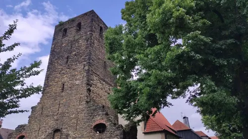
Restaurant Haus Alt Westerholt
Restaurant · German · 6.5 km
3 Schloßstraße, Herten
We-Su 11:30-15:00,17:00-22:00
Road Camp
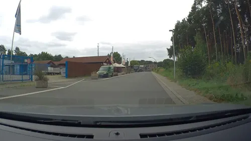
Restaurant · American, Burger · 3.1 km
3 Neckarstraße, Marl
Mo-Fr 07:00-10:00,16:00-22:00; Sa-Su 08:00-23:00
Schneider in der Ried
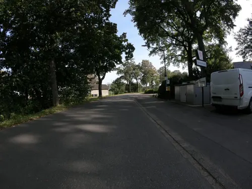
Restaurant · German · 4.1 km
459 Backumer Straße, Herten
We-Sa 11:30-24:00+; Su 11:00-24:00+

Knebels Arkade
Cafe · Bistro, Café, Feinkost, Wein · 6.3 km
25 Schloßstraße, Herten
We-Sa 09:00-18:30; Su, PH 10:30-18:30
L'Osteria
Restaurant · Italian · 1.6 km
125 Herzlia-Allee, Marl
Mo-Th 11:00-23:00; Fr,Sa 11:00-24:00; Su,PH 12:00-23:00

Arentz Bauernhofcafé
Cafe · Breakfast, Cake, German · 6.4 km
117 Birkenallee, Haltern am See
Mo-Sa 09:00-17:00

Bones BBQ & Burger
Diner · American · 1.1 km
12 Loestraße, Marl
Mo, We, Th 12:00-21:30; Fr, Sa 12:00-22:30; Su 17:00-22:30; PH off

Haus Himmelmann
Restaurant · German · 6.4 km
650 Dorstener Straße, Haltern am See
We-Sa 17:00-21:30; Su,PH 11:00-14:00,17:00-21:00
Landhaus Föcker
Restaurant · German · 6.6 km
12 Lembecker Straße, Haltern am See
We-Su 09:00-22:00; Fr 17:00-22:00
196 more on the map.
History
The town area was already populated in the old and middle Stone Age, as many archeological finds in the district of Sinsen confirm. Remains of the first settlements are dated to 600 BC.
At 300 BC Celtic tribes settled in the area but were expelled by invading Germanic tribes. The Brukterer controlled thereupon the area north of the river Lippe and the Marser lived south of the Lippe.
The Germanic invasion was stopped by the advance of the Romans, who built a huge fort in Haltern. Remains of a smaller Roman fort were found at the city limit between Polsum and Herten.
After the Battle of the teutoburg forest in 9AC the Romans lost most of their influence and retreated behind the Rhine river. The area was again in Germanic possession.
In 80 AC the Brukterer were expelled by rival tribes and moved to the today's area of Recklinghausen.
The next migration movement took place in the Marl area between the 5th and 7th century, when the Saxons invaded from the northeast across the Lippe into the former Brukterer area.
In the 1920th archeological excavations proofed, that the Brukterer built a circular hillfort in the district of Sinsen to defend against the Saxon attacks.
Today the hillfort is only recognisable for the expert and lies in the nature reserve "Die Burg" (which means "the castle") which is named after the hillfort.
Read more of the history
Archeologists consider the hillfort as an outstanding historical monument which is worth of protection.
The hillfort was used by the rural population as a protective barrier until the Late Middle Ages.
Assured written regional facts about the Early Middle Ages in the 9th and 10th century were however not documented till the end of the 19th and the beginning of the 20th century.
Marl was first documented in 890 in the urbarium of the benedictine abbey of Werden, which was founded in 799 during the Saxon wars. There is written, that a Dagubraht donated his possession and revenues to the abbey for his salvation.
The name of Marl derives from the medieval place name "meronhlare".
Linguists interpreted this name as "marshy range" or "range at a pond". The name changed over the centuries from "Marlar", "Maerl" to "Marler" and finally Marl
In the urbarium are furthermore found the names of nearby settlements which later became part of the town. They were called "Threviri (Drewer)", "Vrilinctorpe(Frentrop) und "Haranni (Hamm). In addition to the Werden Abbey there were other great land owners as the Cologne and Xanten chapter, the Essen abbey and some nobles.
This scattered property caused massive feuds and fighting in the Middle Ages.
In the urban district of "Alt-Marl" (Old Marl) stands St George's Church, which in the 11th century belonged to the local Count Balderich of the Lower Rhine. Later he gave the church to Archbishop Heribert of Cologne. A manuscript dating from 1160 states that Archbishop Heribert donated the church to Deutz Abbey. In the 13th century it became a parish church, the appointment of its first priest being recorded in 1228. From 1419 the church was under the patronage of the local noble family of Loe. This lasted until 1830, when the patronage devolved to Baron Twickel of Lüttinghoff. Between 1856 and 1859 the church was completely restored, to plans drawn up by Emil von Manger, a builder employed by the Roman Catholic Diocese of Münster. The church's Romanesque foundation walls dating from the 12th century were retained in the restoration.
In the year 1111 the noble family of Loe built a castle with a moat named "Strevelsloe". In 1359 it was renamed to "Haus Loe". In official manuscripts of 1373 it was named as "castrum".
In 1378 the castle was signed over as an "Offenhaus" by the owner Wessel van Loe to the Archbishop of Cologne, Frederick III. of Saarwerden. "Offenhaus" means, that in the case of war, the owner can use the castle as a stronghold.
The family had very many properties in the region, several farms and mills, like the "Loemill", the "Sickingmill" and the Wermeling manor at the Lippe river.
Although the Loe-family had no male successor, the name lived on as in 1585 the daughter of Wolter van Loe married her cousin Baron Dietrich of Dorneburg-Loe from Eickel.
From 1705 to 1832 the castle and all properties were passed over to the noble Family of Wiedenbrück. They sold it to the baron of Twickel, who sold it on his part to Theodor Waldhausen from Essen. 30 years later it was sold to the Duke of Arenberg, who demolished the castle.
Today on the former site of the castle there is a grammar school and several sports grounds.
The noble Loe-family is borne in remembrance through several names like "Loe Street", "Grammar school at the Loefield" or "Loemill-Airport".
Throughout the Middle Ages Marl was involved in several wars.
Between 1243 and 1384 there were many military operations between the Archbishop of Cologne and the Count of Mark among other things about the possession of the neighbor town of Recklinghausen.
1388 and 1389 Marl was involved in the "Great Dortmund feud" and in the fratricidal war between Adolf IV. of Kleve-Mark and Gerhard of the Mark from Hamm.
From 1442 to 1449 Marl suffered from the Soest feud in which the town of Soest defended her freedom against the Archbishop of Cologne.
At the end of the 16th century Marl had 800 inhabitants. Most of them lived in the farming community of Drewer.
In the "War of the Jülich-Cleves succession", the farming communities around Marl were plundered by the Dutch and Spanish troops who joined the war.
Directly following this war, the Thirty Years' War began, where the plunderings continued.
After the war, there was peace for many centuries. During the French campaign of Charles, Prince of Soubise, in the Seven Years' War in 1758 the plundering of Marl started again. After the French troops, the Prussians came but without improvement for the situation of the inhabitants.
From the History section of Marl, North Rhine-Westphalia on Wikipedia, under CC BY-SA 4.0.
More about Marl
Geography
The town adjoins in the north to the woodlands of the Haard and the natural park Hohe Mark. The town forms the smooth transition between the industrial Ruhrgebiet and the rural Münsterland. The northern town border coincides nearly completely with the course of the river Lippe.
Approximately 60% of the total town area are fields, woods, watercourses, parks and other green areas.
In the north Marl adjoins to Haltern am See, in the east to Oer-Erkenschwick, in the southeast to Recklinghausen, in the south to Herten, in the southwest to Gelsenkirchen and in the west to Dorsten.
Economy
The "Chemical Park Marl", the mine "Auguste Victoria", the "Medienhaus Bauer", are the largest employers in Marl. The coal mine at Marl-Hüls, Zeche Auguste Victoria, was founded in 1899, and is still operating. The mass production of the Loremo was planned for 2010 in a yet-to-be-constructed car factory in the industrial complex of Dorsten/Marl, but looks now into uncertain future.
From the Wikipedia article Marl, North Rhine-Westphalia, under CC BY-SA 4.0.
Notable people from Marl
 Tim HooglandGerman footballerPhoto: DerHans04, CC BY-SA 3.0
 Sönke WortmannGerman film director (born 1959)Photo: Martin Kraft, CC BY-SA 4.0
 Franz-Josef OverbeckGerman bishopPhoto: ACBahn, CC BY-SA 3.0
 Christian AhlmannGerman equestrianPhoto: Kontrola, CC BY-SA 4.0
 Christian WetkloGerman footballerPhoto: Daniel Kraski, CC BY 2.0
 Peter NeururerGerman association football managerPhoto: Thomas Rodenbücher, CC BY 2.0
 MoguaiGerman DJ and music producerPhoto: Mixtribe from japan ( mixtribe.net/ ), CC BY 2.0
 Serap GülerGerman politicianPhoto: Raimond Spekking, CC BY-SA 4.0
 Polat KeserTurkish association football player (born 1985)Photo: AntalyasporFC, CC BY-SA 3.0
- Karsten BraaschGerman tennis player
- Matthias PintscherGerman composer
- Niklas NienaßGerman politician
Born in Marl, according to Wikidata (CC0). Each name links to its Wikipedia article.
Where to stay12
Churches and places of worship49
St. Martinus
Church · Roman Catholic · 6.4 km
24 Schloßstraße, Herten
Schloßkapelle St. Martinus
Church · Catholic · 6.5 km
1a Schloßstraße, Herten
Shopping56
Gas and EV charging22
Schools, colleges and libraries45
Healthcare28
Map of Marl
250 places. The map loads OpenStreetMap tiles when you open it.
Getting there and nearby towns
Flughafen Essen-Mülheim (ESS) is the nearest airport with scheduled flights listed in OpenStreetMap, 30 km away.
- Herten 8 km southeast, about 8 min by car
- Recklinghausen 9 km southeast, about 9 min by car
- Dorsten 9 km west, about 9 min by car
- Haltern am See 11 km northeast, about 11 min by car
- Gladbeck 12 km southwest, about 12 min by car
- Oer-Erkenschwick 12 km east, about 12 min by car
- Rhade 15 km northwest, about 15 min by car
- Herne 16 km southeast, about 16 min by car
- Gelsenkirchen 17 km south, about 17 min by car
- Schermbeck 16 km west, about 16 min by car
Drive times are estimates from straight-line distance, not routes.
Towns near Marl


Keep exploring
Local news
Headlines from INDB.
Reviews, tips and questions
Loading what members have shared...
Sources and licences
- GeoNames (CC BY 4.0): population, coordinates, regions and time zone
- Mapillary (see each image): photos
- OpenStreetMap contributors (ODbL 1.0): places, airports, map data
- Wikidata (CC0 1.0): elevation, founding date, time zone, website, landmarks and historic places
- Wikimedia Commons (see each image): photos
- Wikipedia (CC BY-SA 4.0): overview and history text
Photo credits
- Rathaus Marl, Daniel Ullrich ( Threedots ), CC BY-SA 3.0
- Eingangspforte moviepark, Schue~commonswiki, Public domain
- Schloss beck, Stefan Scheer, CC BY-SA 2.5
- Legionslager Haltern Principia, Mediatus, CC BY-SA 3.0
- Herten Westerholt St. Martinus 3, Unknown author, CC BY-SA 3.0
- Hans-Böckler-Berufskolleg Haltern-6353, User:Creosoph, CC BY-SA 4.0
- Haus Ostendorf, Daniel Ullrich, Threedots, CC BY-SA 3.0
- MarlerStern 1, Nordenfan, CC BY-SA 4.0
- Herten Westerholt - Schloßstraße - Schloss 05 ies, Frank Vincentz, CC BY-SA 3.0
- Herten Westerholt Schlosskapelle, Unknown author, CC BY-SA 3.0
- Heimatmuseum Marl, Nordenfan, CC BY-SA 4.0
- Glaskasten, Gerardus, Public domain
- Herten Westerholt - Schlossstraße - Heimatkabinett ies, Frank Vincentz, CC BY-SA 3.0
- Theater Marl 2021, Nordenfan, CC BY-SA 4.0
- Marl Monument 35 Erloeserkirche Brassert 2018-11-01 Marl-9952, W.Strickling, CC BY-SA 4.0
- Herz-Jesu-Kirche, Marl-Hüls 9938, Dr. W. Strickling, CC BY-SA 4.0
- St. Bartholomäus Marl-Polsum 0628, Dr. W. Strickling, CC BY-SA 4.0
- St. Maria Heimsuchung Herten-1259, Dr. W. Strickling, CC BY-SA 4.0
- Auferstehungskirche Zeltkirche Marl 7836, Dr. W. Strickling, CC BY-SA 4.0
- Pauluskirche Marl-Hüls 2018-11-01 Marl-9928, Dr. W. Strickling, CC BY-SA 4.0
- St Pius Marl-Brassert 9949, Dr. W. Strickling, CC BY-SA 4.0
- Ehemalige Postpferdewechselstation 1, Ziltoidium, CC BY-SA 4.0
- Naturschutzgebiet Bertlich von Süden aus gesehen, Thomas Krakow, CC BY-SA 4.0
- Naturschutzgebiet Braucksenke, Werner Buzan, CC BY-SA 4.0
- Lebensraum "Die Burg" - "Silvertbach"-"Totholz"-"Laubwald"-"Nieringbach"-"Feuchtwiese" 55, OnkelMama85, CC BY-SA 3.0
- Jägerhof Einhaus 3, Ziltoidium, CC BY-SA 4.0
- Herten Westerholt - Schloßstraße 17 ies, Frank Vincentz, CC BY-SA 3.0
- Dorsten St Josefs Datteln Eingang Seite, User:Stahlkocher, CC BY-SA 3.0
- St. Paulus, Ziltoidium, CC BY-SA 4.0
- SchlossWesterholt01, NatiSythen, CC BY-SA 3.0
- Lebensraum - "Silvertbach", "Totholz", "Laubwald", "Nieringbach", "Feuchtwiese" 14, OnkelMama85, CC BY-SA 3.0
- Street-level photo, geogladbecker, CC BY-SA 4.0
- Street-level photo, poxonline, CC BY-SA 4.0
- Street-level photo, geogladbecker, CC BY-SA 4.0
- Street-level photo, ziltoidium, CC BY-SA 4.0
- Street-level photo, geogladbecker, CC BY-SA 4.0
- Street-level photo, ziltoidium, CC BY-SA 4.0
- Street-level photo, geogladbecker, CC BY-SA 4.0
- Street-level photo, geogladbecker, CC BY-SA 4.0
- Street-level photo, geogladbecker, CC BY-SA 4.0
- Street-level photo, poxonline, CC BY-SA 4.0
- Street-level photo, ziltoidium, CC BY-SA 4.0
- Street-level photo, geogladbecker, CC BY-SA 4.0
- Street-level photo, geogladbecker, CC BY-SA 4.0
- Street-level photo, geogladbecker, CC BY-SA 4.0
- Street-level photo, geogladbecker, CC BY-SA 4.0
- Street-level photo, geogladbecker, CC BY-SA 4.0
- Street-level photo, geogladbecker, CC BY-SA 4.0
- Street-level photo, poxonline, CC BY-SA 4.0
- Street-level photo, geogladbecker, CC BY-SA 4.0
- Street-level photo, geogladbecker, CC BY-SA 4.0
- Street-level photo, geogladbecker, CC BY-SA 4.0
- Street-level photo, geogladbecker, CC BY-SA 4.0
- Street-level photo, geogladbecker, CC BY-SA 4.0
- Street-level photo, geogladbecker, CC BY-SA 4.0
- Street-level photo, jackien, CC BY-SA 4.0


Page built November 9, 2026. Spotted a mistake? Tell us or suggest a place.