


Why visit Herten
Townapedia lists 58 museums and landmarks, 36 parks and trails, 247 places to eat, 10 places to stay and 30 attractions in and around town.
Highlights include Tierpark im Stadtgarten, Halde Hoheward, Heimatkabinett im Café Oelmann and Ikonen-Museum.
Weather in Herten
Forecast from MET Norway (CC BY 4.0). Full forecast
About Herten
Herten (German pronunciation: [ˈhɛʁtn̩] ; Westphalian: Hiätten) is a town and a municipality in the district of Recklinghausen, in North Rhine-Westphalia, Germany. It is situated in the industrial Ruhr Area, some five kilometres (three miles) west of Recklinghausen.
From the Wikipedia article Herten (this version), under CC BY-SA 4.0.
Photos of Herten


Things to do30
Tierpark im Stadtgarten
Zoo and aquarium · 3.9 km
2 Stadtgarten, Recklinghausen
Oct-Mar: 09:00-16:30; Apr-Sep: 09:00-18:00



Cineworld
Cinema and theater · 3.9 km
3 Kemnastraße, Recklinghausen
Mo-We 11:00-23:00, Th-Sa 11:00-02:00, Su 10:30-23:00

Spargelhof Schulte-Scherlebeck
Farm and orchard · 3.7 km
435 Scherlebecker Straße, Herten
Apr-Jun: 07:00-19:00; Jul-Oct: 09:00-18:00
Bauer Feldhaus
Farm and orchard · 1.9 km
56 Ebbelicher Weg, Herten
Mo-Sa 08:00-18:30; Su 15:00-18:30
Hofladen am Brunnenhof
Farm and orchard · 3.8 km
169 Riedstraße, Herten
Tu-Fr 07:00-18:00; Sa 06:00-18:00; Su 09:00-18:00

18 more on the map.
Museums and landmarks58

Heimatkabinett im Café Oelmann
Museum · 3.6 km
34 Schloßstraße, Herten
Th 09:30-11:00; Sa,Su 15:00-17:30


Schloss Westerholt
Monument and historic site · 3.7 km
1 Schloßstraße, Herten

Schloss Herten
Monument and historic site · 1.1 km
15 Im Schloßpark, Herten

Atelier Münsterstraße
Museum · 4.3 km
6 Münsterstraße, Recklinghausen
Th, Fr 13:00-18:00; Sa 10:00-15:00
1000 Marken Bude Bowski
Museum · 4.3 km
17 Münsterstraße, Recklinghausen
Mo-Fr 10:00-18:00; Sa 10:00-16:00
46 more on the map.
Parks, trails and playgrounds36



Copa Ca Backum
Sports field and stadium · 0.8 km
18 Teichstraße, Herten
Mo 10:00-22:00; Tu-Sa 08:00-22:00; Su 08:00-21:00

24 more on the map.
Restaurants and cafes247
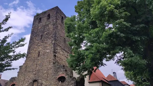
Restaurant Haus Alt Westerholt
Restaurant · German · 3.7 km
3 Schloßstraße, Herten
We-Su 11:30-15:00,17:00-22:00
Schneider in der Ried
Restaurant · German · 3.6 km
459 Backumer Straße, Herten
We-Sa 11:30-24:00+; Su 11:00-24:00+
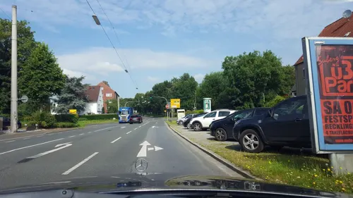
Baan Sukhothai
Restaurant · Thai · 3.1 km
141 Westerholter Weg, Recklinghausen
Mo off; Tu-Sa 17:00-22:30; Su 16:00-22:00
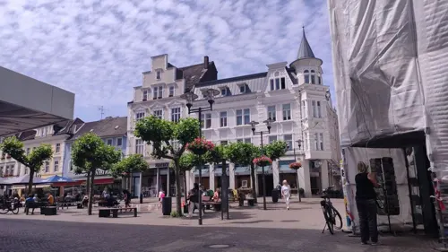
Biermanns-No.1
Cafe · Coffee Shop, German, Brunch, Cake, Breakfast, Soup · 4.2 km
1 Holzmarkt, Recklinghausen
Tu-Sa 09:00-18:00
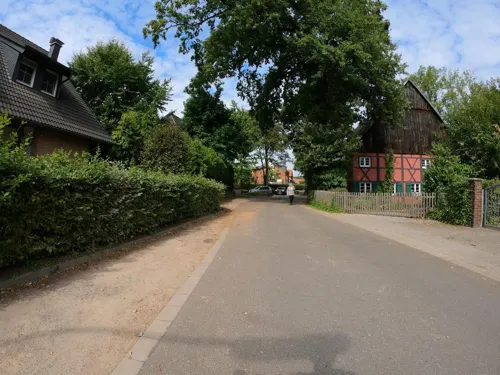

Becky's
Restaurant · German · 4.0 km
38 Herzogswall, Recklinghausen
Tu-Th 16:00-23:00; Fr-Sa 16:00-24:00; Su,PH 12:00-22:00

Café Extrablatt
Cafe · International · 4.2 km
16-17 Markt, Recklinghausen
Mo-Sa 08:30-23:00+; Su,PH 09:00-23:00+
Casa Rubio - Café Blond
Restaurant · Spanish · 4.1 km
5 Heilige-Geist-Straße, Recklinghausen
Mo-Su 18:00-23:00
235 more on the map.
History
Herten was the seat of the governors of the County of Vest Recklinghausen, an autonomous state within the Archbishopric of Cologne. The first time Herten was mentioned in official documents was in 1050 as Herthene. In 1867 Herten was a village with 891 inhabitants. The first coal mines in Herten were founded in 1872 and Herten developed from a village to a mining town. Depending on additional workers, the coal mines attracted many people. Therefore, Herten rapidly grew by immigration from surrounding Westphalia, from the eastern provinces of Prussia and from eastern Europe. The number of inhabitants rose from 3,616 in 1890 to 6,698 in 1895 and to 12,186 in 1900. At the beginning of the 1920s, 18,519 people lived in Herten. When Herten obtained municipal status in 1936 it had 33,000 inhabitants.
During World War II, Herten was spared serious destruction, although it was hit by bombs 53 times. 62 civilians were killed and 143 injured, 18 industrial plants and commercial enterprises and 145 houses were destroyed or seriously damaged. Herten as a whole was destroyed by 16%. After the war 11,600 cubic metres of demolition rubble had to be removed from the streets.
Read more of the history
After the villages Westerholt and Bertlich had been incorporated into Herten in 1975 the number of inhabitants rose to 70,676. Due to the crisis of the mining industry in the 1980s the number of inhabitants started declining. The last coal mine in Herten was closed in 2008.
From the History section of Herten on Wikipedia, under CC BY-SA 4.0.
More about Herten
Geography
Herten covers an area of 37.31 km2, with a maximum north–south extent of 9.5 km, and a maximum east–west extent of 6.5 km. The municipality's highest natural point is in Scherlebeck, close to the border with Recklinghausen, with an altitude of 110 m.
Herten borders Marl in the north, Recklinghausen in the east, Herne in the south, and Gelsenkirchen in the west.
From the Wikipedia article Herten, under CC BY-SA 4.0.
Notable people from Herten
 Kerem DemirbayTurkish-German association football player (born 1993)Photo: Pyaet, CC BY-SA 4.0
 Barbara Mensingarcher from GermanyPhoto: Mozamaniac, CC BY-SA 4.0
 Timo BeckerGerman footballer, born 1997Photo: Lanthan2003, CC BY-SA 4.0
 Stephan BrandnerGerman politician (born 1966)Photo: Arianakk, CC BY-SA 4.0
- Christian TimmGerman footballer
- Peter KentGerman singer and music producer
- Gerhard KentschkeGerman football player and manager
- Leroy KwadwoGerman footballer
- Erwin MarschewskiGerman politician
- Oliver BobergGerman artist (born 1965)
- Karl Ludwig SchweisfurthGerman businessman
Born in Herten, according to Wikidata (CC0). Each name links to its Wikipedia article.
Where to stay10
Churches and places of worship47
Gastkirche
Church · Roman Catholic · 4.1 km
7a Heilige-Geist-Straße, Recklinghausen
Gymnasialkirche
Church · Roman Catholic · 4.0 km
18 Heilige-Geist-Straße, Recklinghausen
St. Paulus
Church · Roman Catholic · 3.8 km
29 Paulusstraße, Recklinghausen
St. Peter
Church · Roman Catholic · 4.3 km
Kirchplatz, Recklinghausen
St. Martinus
Church · Roman Catholic · 3.6 km
24 Schloßstraße, Herten
Schloßkapelle St. Martinus
Church · Catholic · 3.7 km
1a Schloßstraße, Herten
St. Markus
Church · Roman Catholic · 3.3 km
1-2 Sankt-Markus-Platz, Recklinghausen
Shopping54
Gas and EV charging18
Schools, colleges and libraries35
Abendgymnasium Weiterbildungskolleg Emscher-Lippe
School · 2.6 km
316 Middelicher Straße, Gelsenkirchen
Healthcare36
Map of Herten
250 places. The map loads OpenStreetMap tiles when you open it.
Getting there and nearby towns
Flughafen Essen-Mülheim (ESS) is the nearest airport with scheduled flights listed in OpenStreetMap, 26 km away.
- Recklinghausen 4 km northeast, about 4 min by car
- Marl 8 km northwest, about 8 min by car
- Herne 9 km southeast, about 9 min by car
- Oer-Erkenschwick 10 km northeast, about 10 min by car
- Gelsenkirchen 11 km south, about 11 min by car
- Gladbeck 11 km west, about 11 min by car
- Castrop-Rauxel 12 km east, about 12 min by car
- Wattenscheid 13 km south, about 13 min by car
- Bochum 14 km south, about 14 min by car
- Dorsten 14 km northwest, about 14 min by car
Drive times are estimates from straight-line distance, not routes.
Towns near Herten


Keep exploring
Local news
Headlines from INDB.
Reviews, tips and questions
Loading what members have shared...
Sources and licences
- GeoNames (CC BY 4.0): population, coordinates, regions and time zone
- Mapillary (see each image): photos
- OpenStreetMap contributors (ODbL 1.0): places, airports, map data
- Wikidata (CC0 1.0): elevation, founding date, time zone, website, landmarks and historic places
- Wikimedia Commons (see each image): photos
- Wikipedia (CC BY-SA 4.0): overview and history text
Photo credits
- Kaiserstraße 82, 1, Herten, Kreis Recklinghausen, GeorgDerReisende, CC BY-SA 4.0
- Bushaltestelle Herten Mitte, 1, Herten, Kreis Recklinghausen, GeorgDerReisende, CC BY-SA 4.0
- Linie 43, 1, Herten, Kreis Recklinghausen, GeorgDerReisende, CC BY-SA 4.0
- Linie SB27, 1, Herten, Kreis Recklinghausen, GeorgDerReisende, CC BY-SA 4.0
- Hermannstraße 24, 1, Herten, Kreis Recklinghausen, GeorgDerReisende, CC BY-SA 4.0
- Konrad-Adenauer-Straße 12, 1, Herten, Kreis Recklinghausen, GeorgDerReisende, CC BY-SA 4.0
- Bushaltestelle Herten Mitte, 2, Herten, Kreis Recklinghausen, GeorgDerReisende, CC BY-SA 4.0
- HertenNeuerHaltepunkt, Torbenbrinker, CC BY-SA 4.0
- Erinnerungstafel, 3, Gartenstraße 40, Herten, Kreis Recklinghausen, GeorgDerReisende, CC BY-SA 4.0
- Bushaltestelle Herten Mitte, 3, Herten, Kreis Recklinghausen, GeorgDerReisende, CC BY-SA 4.0
- Kaiserstraße, 3, Herten, Kreis Recklinghausen, GeorgDerReisende, CC BY-SA 4.0
- Erinnerungstafel, 1, Gartenstraße 40, Herten, Kreis Recklinghausen, GeorgDerReisende, CC BY-SA 4.0
- Erinnerungstafel, 2, Gartenstraße 40, Herten, Kreis Recklinghausen, GeorgDerReisende, CC BY-SA 4.0
- Herten-Mitte-Kreisverkehr, Dat doris, CC BY-SA 4.0
- Hoffnungskirche Hochstr. Herten 0100, Dr. W. Strickling, CC BY-SA 4.0
- Kaiserstraße 62, 1, Herten, Kreis Recklinghausen, GeorgDerReisende, CC BY-SA 4.0
- Herten-Musikschule-Kontrabass 02, Dat doris, CC BY-SA 4.0
- Herten-Musikschule, Dat doris, CC BY-SA 4.0
- Herten-Musikschule-Kontrabass 01, Dat doris, CC BY-SA 4.0
- Herten Baudenkmal 24 Antoniusdenkmal 7924, Dr. W. Strickling, CC BY-SA 4.0
- Herten Monument 82 Am Wittkamp 3 2018-11-07, W.Strickling, CC BY-SA 4.0
- Herten-Schweinefamilie-Ekkhard Arens, Dat doris, CC BY-SA 4.0
- Herten-Schwein mit Herz im Ohr-Ekkhard Arens, Dat doris, CC BY-SA 4.0
- Herten-Sankt Antonius (Swinetiöns), Dat doris, CC BY-SA 4.0
- Konrad-Adenauer-Straße, 1, Herten, Kreis Recklinghausen, GeorgDerReisende, CC BY-SA 4.0
- Herten - Antoniusstraße - Antoniusdenkmal 03 ies, Frank Vincentz, Public domain
- Herten - Antoniusstraße - Antoniusdenkmal 02 ies, Frank Vincentz, CC BY-SA 3.0
- Herten - Antoniusstraße - Antoniusdenkmal 04 ies, Frank Vincentz, Public domain
- Herten - Antoniusstraße - Antoniusdenkmal 01 ies, Frank Vincentz, Public domain
- Hp Herten (Westf), Gleis 2, Mai 2024, AlanyaSeeburg, CC0
- Herten-Brunnensäule-Waldemar Wien, Dat doris, CC BY-SA 4.0
- Großer Summstein (Hugo Kükelhaus) Herten-0154, Creosoph, CC0
- Hp Herten (Westf), Zugang Staakener Straße, Mai 2024, AlanyaSeeburg, CC0
- Großer Summstein (Hugo Kükelhaus) Herten-0155, Creosoph, CC0
- Herten-Kommunikation-Heinrich Brockmeier 02, Dat doris, CC BY-SA 4.0
- Herten-Kommunikation-Heinrich Brockmeier 01, Dat doris, CC BY-SA 4.0
- Herten-Wandorgel-Brinkertgasse, Dat doris, CC BY-SA 4.0
- Wilhelmstraße 13, 4, Herten, Kreis Recklinghausen, GeorgDerReisende, CC BY-SA 4.0
- Herne Mondpalast Autostitch, The original uploader was Stahlkocher at German Wikipedia ., CC BY-SA 3.0
- Germany Herten Castle (1), Arnold Paul, CC BY-SA 3.0
- Engelsburg Recklinghausen NOR, Nordenfan, CC BY-SA 4.0
- Gymnasium Petrinum Recklinghausen, Unknown author, CC BY-SA 3.0
- Herten - Halde Hoheward (Halde Hoppenbruch) 01 ies, Frank Vincentz, CC BY-SA 3.0
- Herten - Halde Hoppenbruch (Halde Hoheward) 04 ies, Frank Vincentz, CC BY-SA 3.0
- Herten Westerholt St. Martinus 3, Unknown author, CC BY-SA 3.0
- Recklinghausen Monument 133 Hittorf-Gymnasium 7108, W.Strickling, CC BY-SA 4.0
- Ikonenmuseum 2, Nordenfan, CC BY-SA 4.0
- Ruhrfestspielhaus Recklinghausen, Daniel Ullrich, Threedots, CC BY-SA 3.0
- Herten Westerholt - Schloßstraße - Schloss 05 ies, Frank Vincentz, CC BY-SA 3.0
- Herten Westerholt Schlosskapelle, Unknown author, CC BY-SA 3.0
- StGHLuftbild, Mxxii, CC BY-SA 4.0
- Herten Westerholt - Schlossstraße - Heimatkabinett ies, Frank Vincentz, CC BY-SA 3.0
- Sankt Peter Recklinghausen, Nordenfan, CC BY-SA 4.0
- GaKiRe, Netzhering, CC BY-SA 3.0
- St. Paulus Recklinghausen 02, H.Helmlechner, CC BY-SA 4.0
- Recklinghausen Monument 120 Gustav-Adolf-Kirche 8759, W.Strickling, CC BY-SA 4.0
- RE-Mon 055 Christuskirche Recklinghausen-6817, W.Strickling, CC BY-SA 4.0
- Recklinghausen, Gymnasialkirche -- 2015 -- 7351 2, Original: Dietmar Rabich ( Derivative work: Rabanus Flavus ), CC BY-SA 4.0
- St. Markus, Westerholter Weg 2020-07-18 Recklinghausen-6933, Dr. W. Strickling, CC BY-SA 4.0
- St. Maria Heimsuchung Herten-1259, Dr. W. Strickling, CC BY-SA 4.0
- Ev. Matthäushaus, Hochlar 2020-07-18 Recklinghausen-6957, Dr. W. Strickling, CC BY-SA 4.0
- St. Josef-Kirche, 1, Herten, Kreis Recklinghausen, GeorgDerReisende, CC BY-SA 4.0
- Ewaldsee, Gelsenkirchen Herten, nahe Zeche Ewald - panoramio, HansPeter, CC BY 3.0
- Resse, Gelsenkirchen, Germany - panoramio, HansPeter, CC BY 3.0
- Hoheward Horizont Observatorium 2, Ulomek-foto de, CC BY-SA 3.0
- Recklinghausen Knappschaftskrankenhaus, Arnoldius, CC BY-SA 4.0
- Herten Weg im Schlosspark, Arnoldius, CC BY-SA 4.0
- Gelsenkirchen Ewaldsee (3), Arnoldius, CC BY-SA 4.0
- Street-level photo, geogladbecker, CC BY-SA 4.0
- Street-level photo, geogladbecker, CC BY-SA 4.0
- Street-level photo, geogladbecker, CC BY-SA 4.0
- Street-level photo, geogladbecker, CC BY-SA 4.0
- Street-level photo, geogladbecker, CC BY-SA 4.0
- Street-level photo, Vogelmensch, CC BY-SA 4.0
- Street-level photo, geogladbecker, CC BY-SA 4.0
- Street-level photo, geogladbecker, CC BY-SA 4.0
- Street-level photo, mapnrw, CC BY-SA 4.0
- Street-level photo, geogladbecker, CC BY-SA 4.0
- Street-level photo, poxonline, CC BY-SA 4.0
- Street-level photo, mapnrw, CC BY-SA 4.0
- Street-level photo, geogladbecker, CC BY-SA 4.0
- Street-level photo, Vogelmensch, CC BY-SA 4.0
- Street-level photo, wladimir, CC BY-SA 4.0
- Street-level photo, LouCipher, CC BY-SA 4.0
- Street-level photo, Vogelmensch, CC BY-SA 4.0
- Street-level photo, Vogelmensch, CC BY-SA 4.0
- Street-level photo, geogladbecker, CC BY-SA 4.0
- Street-level photo, geogladbecker, CC BY-SA 4.0
- Street-level photo, geogladbecker, CC BY-SA 4.0
- Street-level photo, mapnrw, CC BY-SA 4.0


Page built November 9, 2026. Spotted a mistake? Tell us or suggest a place.