


Why visit Harsum
Townapedia lists 21 museums and landmarks, 30 parks and trails, 116 places to eat, 19 places to stay and 8 attractions in and around town.
Highlights include Theaterhaus Hildesheim e.V., Heidelberg, Heimatmuseum and Heimatmuseum.
Weather in Harsum
Forecast from MET Norway (CC BY 4.0). Full forecast
About Harsum
Harsum is a village and a municipality in the district of Hildesheim, in Lower Saxony, Germany. It is situated approximately 6 km north of Hildesheim, and 25 km southeast of Hanover.
From the Wikipedia article Harsum (this version), under CC BY-SA 4.0.
Things to do8



Museums and landmarks21


Roemer- und Pelizaeus-Museum
Museum · 6.9 km
Museum in Hildesheim, Germany, among others with collection of ancient Egypt

Burg Steuerwald
Monument and historic site · 5.2 km
Gebäudeteil "Palas"

9 more on the map.
Parks, trails and playgrounds30

Wasserparadies
Sports field and stadium · 6.0 km
1 Marie-Wagenknecht-Straße, Hildesheim
Mo-Su,PH 09:00-22:00




18 more on the map.
Restaurants and cafes116

Café Bistro Piccolo
Restaurant · German, Italian · 5.2 km
6 Richthofenstraße
Mo-Th 09:00-19:00; Fr 09:00-20:00; Su 12:00-17:00
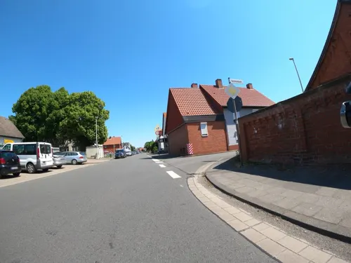
Dorfkrug
Restaurant · 4.3 km
6 Bavenstedter Hauptstraße
Tu-Fr 11:30-14:00, 17:30-20:30; Sa, Su 11:30-14:00
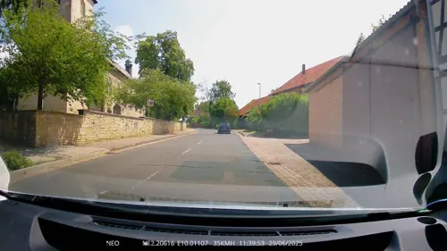
Landgasthaus Willke
Restaurant · German · 3.1 km
1 Am Hohen Turm, Harsum
Mo-Sa 17:00-24:00; Tu off; Su 11:00-14:00,17:00-24:00
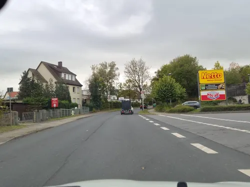
Villa dell’ Angelo
Restaurant · Italian · 5.8 km
15 Carl-Zeiss-Straße, Hildesheim
Mo-Fr 12:00-14:00; Su 10:00-14:00 || "unregelmäßige Themenabende...


Öz Baba Clubhaus
Restaurant · 5.3 km
1 Am Waldstadion, Giesen
Mo off; Tu-Fr 16:30-22:00; Sa-Su 13:00-22:00
Adelle Restaurant
Restaurant · Turkish · 6.0 km
13/14 Bahnhofsallee, Hildesheim
Mo-Th 11:00-22:30; Fr,Sa 11:00-23:00; Su 11:30-22:30

Café Übersee
Cafe · Breakfast, Lunch, Coffee Shop · 6.2 km
Wallstraße
Mo-Th 08:00-01:00, Fr,Sa 08:00-02:00, Su 08:00-21:00 || Mo-Fr...
104 more on the map.
Where to stay19
Churches and places of worship56
Sankt Matthias
Church · Roman Catholic · 5.2 km
29 Matthiasstraße, Harsum
Shopping47
Gas and EV charging27
EWE Go Glockensteinfeld
EV charging · 6.0 km
2 Albert-Einstein-Straße, Hildesheim
Schools, colleges and libraries21
Healthcare10
Map of Harsum
250 places. The map loads OpenStreetMap tiles when you open it.
Getting there and nearby towns
Hannover Airport (HAJ) is the nearest airport with scheduled flights listed in OpenStreetMap, 34 km away.
- Hildesheim 7 km south, about 7 min by car
- Sarstedt 8 km west, about 8 min by car
- Sehnde 12 km north, about 12 min by car
- Nordstemmen 13 km southwest, about 13 min by car
- Pattensen 15 km northwest, about 15 min by car
- Laatzen 16 km northwest, about 16 min by car
- Lehrte 18 km north, about 18 min by car
- Hemmingen 20 km northwest, about 20 min by car
- Peine 22 km northeast, about 22 min by car
- Hannover 24 km northwest, about 24 min by car
Drive times are estimates from straight-line distance, not routes.
Local news
Headlines from INDB.
Reviews, tips and questions
Loading what members have shared...
Sources and licences
- GeoNames (CC BY 4.0): population, coordinates, regions and time zone
- Mapillary (see each image): photos
- OpenStreetMap contributors (ODbL 1.0): places, airports, map data
- Wikidata (CC0 1.0): elevation, founding date, time zone, website, landmarks and historic places
- Wikimedia Commons (see each image): photos
- Wikipedia (CC BY-SA 4.0): overview and history text
Photo credits
- Harsum Altenheim, Kirchenfan, CC0
- St Cäcilia Kirche Harsum, Ralfclaus, CC BY-SA 3.0
- Bushaltestelle Grundschule, 1, Harsum, Landkreis Hildesheim, GeorgDerReisende, CC BY-SA 4.0
- Bushaltestelle Konrad-Adenauer-Straße, 1, Harsum, Landkreis Hildesheim, GeorgDerReisende, CC BY-SA 4.0
- Bushaltestelle Schulzentrum, 1, Harsum, Landkreis Hildesheim, GeorgDerReisende, CC BY-SA 4.0
- Bushaltestelle Schulzentrum, 2, Harsum, Landkreis Hildesheim, GeorgDerReisende, CC BY-SA 4.0
- Linie RVHI 24, 1, Asel, Harsum, Landkreis Hildesheim, GeorgDerReisende, CC BY-SA 4.0
- LSG HI 00011,Harsumer Holz,Harsum,Landkreis Hildesheim, GeorgDerReisende, CC BY-SA 4.0
- Bushaltestelle Göriacher Straße, 1, Asel, Harsum, Landkreis Hildesheim, GeorgDerReisende, CC BY-SA 4.0
- Hildesheim Roemer.Pelizaeus.Museum, Longbow4u, Public domain
- Hildesheimer Dom 2015, Roland Struwe, CC BY-SA 4.0
- Hildesheim Himmelthür Orthodox church-2, Hildesheim_Himmelthür_Orthodox_church.JPG : Qasinka derivative work: Rabanus Flavus, Public domain
- HildesheimMagdalenenkirche, Ramessos, Public domain
- 1000 Kulturwissenschaftler aus der gesamten Bundesrepublik studieren auf dem Kulturcampus Domaene Marienburg der Stiftung Universität Hildesheim. Foto Isa Lange, Universität Hildesheim, Isa Lange, CC BY-SA 3.0
- NSG Ahrberger Holz Groß Förster Holz 1, Lotte76, CC BY-SA 3.0
- BurgSteuerwald, Torbenbrinker, CC BY-SA 3.0
- NSG Giesener Teiche 1, Lotte76, CC BY-SA 3.0
- Landkreis Hildesheim Haseder Busch, 1ew0p, CC BY-SA 3.0
- HA 134 Mastberg und Innersteaue Hildesheim DSC00218, Wedmann, CC BY-SA 3.0
- St Cäcilia Harsum Südost, Kassandro (changes by Rabanus Flavus ), CC BY-SA 4.0
- NSG Lange Dreisch und Osterberg 1, Lotte76, CC BY-SA 3.0
- Marienfriedhof Hildesheim (1), Ragnar1904, CC BY-SA 4.0
- Robert-Bosch-School-Hildesheim-Germany, Rjh, Public domain
- St.-Martinus-Kirche (Borsum)2, Rabanus Flavus, Public domain
- Hüddessum Kirche SO, Kirchenfan, CC0
- Algermissen St Matthaeus West, Rabanus Flavus, Public domain
- Sülte (Hildesheim), Jedesto, CC BY-SA 3.0
- Waetzumer-tonkuhle9196-Pano, Herbert Weber, Hildesheim, CC BY-SA 4.0
- Gross Giesen Kirche, Kirchenfan, CC0
- Giesen StMartin, Rabanus Flavus, Public domain
- Cosmas und Damian-Kirche in Rautenberg (Harsum) IMG 5089, Losch, CC BY-SA 3.0
- Burg Steuerwald1, Torbenbrinker, CC BY-SA 4.0
- St. Vitus label QS:Len,"St. Vitus" label QS:Lde,"Martyrium des Heiligen Vitus.", Johann Jakob Zeiller, CC BY-SA 3.0
- Borsum Kirche 2010, Kirchenfan, CC0
- Hüddessum Kirche SW, Kirchenfan, CC0
- NSG Giesener Teiche 3, Lotte76, CC BY-SA 3.0
- Hartholzauwald im Haseder Busch bei Hildesheim, O.Drachenfels, CC BY-SA 4.0
- NSG Ahrberger Holz Groß Förster Holz 2, Lotte76, CC BY-SA 3.0
- Fire-fighting-facility node-3706811599, Harsum Feuerwehr Harsum, CC BY 2.0
- Aseler 1000jährige Grafeneiche - panoramio, T-Pal, CC BY 3.0
- Street-level photo, mfa, CC BY-SA 4.0
- Street-level photo, ramap, CC BY-SA 4.0
- Street-level photo, cageythree, CC BY-SA 4.0
- Street-level photo, aceini, CC BY-SA 4.0
- Street-level photo, Langfahrer, CC BY-SA 4.0
- Street-level photo, maturion, CC BY-SA 4.0
- Street-level photo, maturion, CC BY-SA 4.0
- Street-level photo, TechniPorter, CC BY-SA 4.0
- Street-level photo, Langfahrer, CC BY-SA 4.0
- Street-level photo, hotteliene, CC BY-SA 4.0
- Street-level photo, aceini, CC BY-SA 4.0
- Street-level photo, Langfahrer, CC BY-SA 4.0
- Street-level photo, cageythree, CC BY-SA 4.0
- Street-level photo, hotteliene, CC BY-SA 4.0
- Street-level photo, agranizo, CC BY-SA 4.0
- Street-level photo, Langfahrer, CC BY-SA 4.0
- Street-level photo, hotteliene, CC BY-SA 4.0
- Street-level photo, Hightower-, CC BY-SA 4.0
- Street-level photo, hotteliene, CC BY-SA 4.0
- Street-level photo, aceini, CC BY-SA 4.0
- Street-level photo, ramap, CC BY-SA 4.0
- Street-level photo, Langfahrer, CC BY-SA 4.0
- Street-level photo, ramap, CC BY-SA 4.0
- Street-level photo, aceini, CC BY-SA 4.0
- Street-level photo, aceini, CC BY-SA 4.0


Page built November 8, 2026. Spotted a mistake? Tell us or suggest a place.