


Why visit Herborn
Townapedia lists 128 museums and landmarks, 40 parks and trails, 151 places to eat, 15 places to stay and 52 attractions in and around town.
Highlights include Wildpark Donsbach, Aussichtsturm Dillblick, Villa Grün and Herbstlabyrinth-Adventhöhle-System.
Weather in Herborn
Forecast from MET Norway (CC BY 4.0). Full forecast
About Herborn
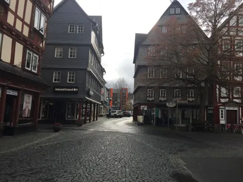
Herborn (German pronunciation: [ˈhɛʁbɔʁn] ) is a historic town on the Dill in the Lahn-Dill district of Hesse in Germany. Before World War I, it was granted its own title as Nassauisches Rothenburg. The symbol or mascot of this town is a bear. Scenic attractions include its half-timbered houses; Herborn is located on the German Timber-Frame Road.
From the Wikipedia article Herborn, Hesse (this version), under CC BY-SA 4.0.
Travel tips from other travellers: Herborn on Wikivoyage (CC BY-SA 4.0).
Things to do52



Wendel
Farm and orchard · 1.7 km
16 Burger Hauptstraße, Herborn
Apr-Jun: Mo-Fr 08:30-12:30,13:30-17:30,Sa 08:30-17:00




40 more on the map.
Museums and landmarks128

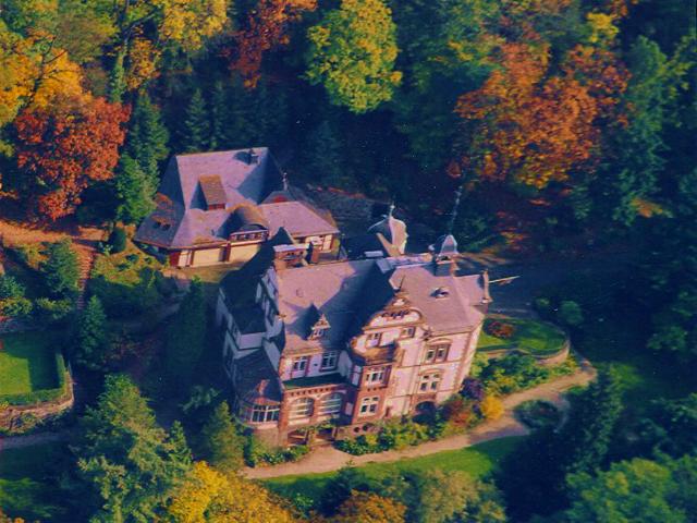
Villa Grün
Museum · 6.4 km
Wirtschaftsgeschichtliches Museum
3 Schloßberg, Dillenburg
Apr 01-Nov 01 Tu-Su,PH 10:00-12:00,13:00-17:00




Alte Schule
Monument and historic site · 3.7 km
Alte Schule Sinn, Historismus, heute Haus der Vereine mit Seminar - und Kulturräumen, Freiwilligenbüro, Neugotisches Bruchsteinmauerwerk...
1 Ballersbacher Weg, Sinn


Altes Bürgermeisteramt
Monument and historic site · 3.3 km
22 Alte Hauptstraße, Herborn


Museum für Heimat- und Industriegeschichte
Museum · 1.8 km
39 Burger Hauptstraße, Herborn
"nach Vereinbarung"
116 more on the map.
Parks, trails and playgrounds40



Weißehöll bei Niederscheld
Hiking and trails · 4.0 km
Relikt der historischen Nutzung unproduktiven Grünlandes als Weiden (Huten) für Schafe, Ziegen und Rinder.







28 more on the map.
Restaurants and cafes151

Algati
Restaurant · Italian · 6.6 km
4 Marktstraße, Dillenburg
Mo off; Tu-Fr 11:30-15:00; Sa-Su 11:30-21:30
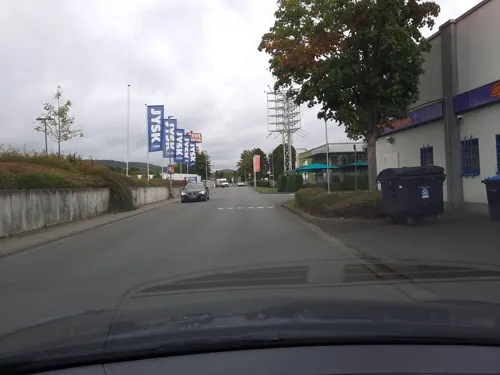
Backhaus Moos
Cafe · Coffee Shop, Cake, Bistro · 1.3 km
10, Herborn
Mo-Fr 07:00-19:00; Sa 07:00-18:00; Su 08:00-17:00
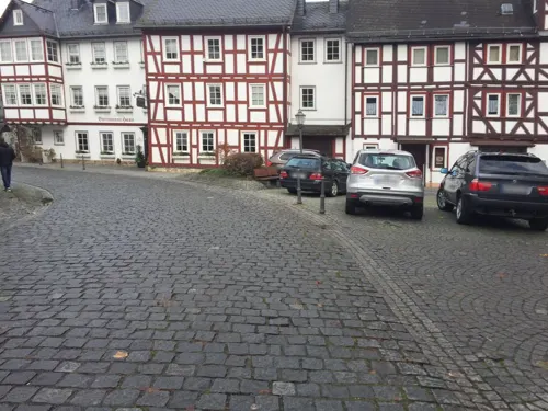
Bartmanns Haus
Restaurant · 6.4 km
3 Untertor, Dillenburg
Mo-Fr 11:30-14:30,17:30-22:00; Sa 17:30-22:00
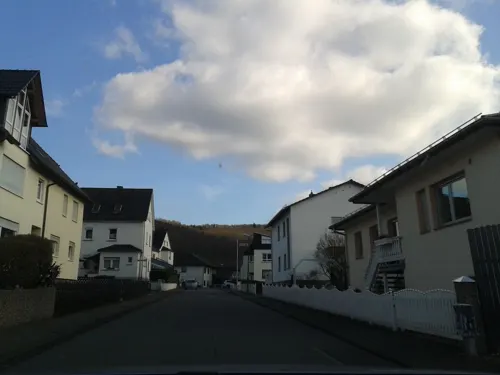
BeZett
Restaurant · Regional · 4.0 km
5 Hofstraße, Sinn
Tu-Th 12:00-18:00; Fr-Sa 09:30-22:00; Su-Mo off
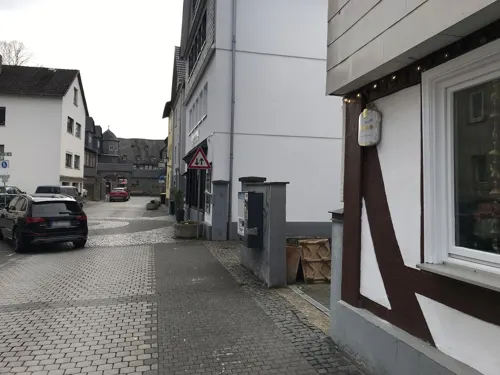
Bistro Franz Ferdinand
Bar and pub · Pizza, Tapas, Pasta
21-23 Hauptstraße, Herborn
Su,Mo off; Tu-Th 17:00-23:00; Fr 12:00-14:30,17:00-24:00; Sa 18:00-24:00
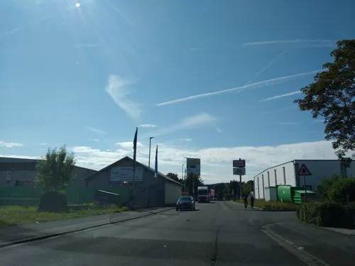
Das Esszimmer
Restaurant · German, Regional · 1.0 km
33 Konrad-Adenauer-Straße, Herborn
Mo,Tu off; We-Sa 17:00+, PH,Su 11:30+
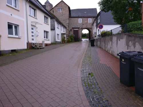
Gittis Bergggasthof
Restaurant · German, Austrian · 6.6 km
3 Talstraße, Greifenstein
Tu,Fr 12:00-14:00, Tu,We,Fr 17:00-22:00; Sa,Su 12:00-22:00
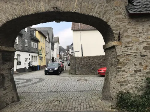
Gusto e Fantasia
Restaurant · Italian
4 Kornmarkt, Herborn
Mo-Th 11:00-18:00; Fr 11:00-20:00; Sa,Su,PH off
Indian Tandoori Kitchen
Restaurant · Indian
24 Mühlgasse, Herborn
Mo-Fr 11:00-14:30, 17:00-21:30,Sa 16:00-21:30,Su,PH 12:00-21:30
Kaisergarten
Restaurant · Chinese, Mongolian · 1.4 km
13 Rehbergring, Herborn
Tu off; Mo,We-Sa 12:00-14:30,18:00-22:00, Sa,Su,PH 12:00-22:00,...
Karawanserei
Restaurant · Turkish
17 Augustastraße, Herborn
Mo,Tu,Th-Sa 17:00-23:00; Su,PH 12:00-15:00,17:00-22:00


139 more on the map.
History
Herborn had its first documentary mention in 1048, and was granted the privilege of a city in 1251 by the Counts of Nassau.
In 1584 the Herborn Academy, a Reformed (Calvinistic) institution, was founded by John VI of Nassau-Dillenburg, younger brother of William the Silent and namesake of today's Gymnasium Johanneum.
Herborn was where Johannes Piscator published the Reformed Church translation of the Bible into German, in 1602. This work has had a decisive effect in shaping church life among followers of the Reformed movement in Germany, the Netherlands, Switzerland and the United States. It was printed in Herborn in the akademische Druckerei von Corvinus, known today as the Corvinsche Druckerei or Paul's Hof, after the Paul family who own it.
In 1626, the town lost 214 houses in a fire started by accident in soldiers' quarters. Soon after, Herborn and the surrounding area were the scene of a number of witch trials.
Towards the end of the Thirty Years' War, the townsfolk were looking after 50 Swedish soldiers, which brought them protection by the Swedish Army, and thereby also a reputation as a "field hospital town" ("Lazarettstadt") that lasted until the end of the Second World War.
From the History section of Herborn, Hesse on Wikipedia, under CC BY-SA 4.0.
Where to stay15
Churches and places of worship36
Evangelische Kirche
Church · Protestant · 6.5 km
15 Rother Straße, Driedorf
Evangelische Stadtkirche Herborn
Church · Protestant
4a Kirchberg, Herborn
Evangelische Stadtkirche Dillenburg
Church · Protestant · 6.5 km
18 Kirchberg, Dillenburg
Shopping36
Gas and EV charging14
Schools, colleges and libraries31
Healthcare18
Map of Herborn
250 places. The map loads OpenStreetMap tiles when you open it.
Getting there and nearby towns
Siegerlandflughafen (SGE) is the nearest airport with scheduled flights listed in OpenStreetMap, 16 km away.
- Aßlar 15 km southeast, about 15 min by car
- Solms 18 km southeast, about 18 min by car
- Wetzlar 20 km southeast, about 20 min by car
- Braunfels 19 km south, about 19 min by car
- Gladenbach 22 km northeast, about 22 min by car
- Weilburg 22 km south, about 22 min by car
- Siegen 29 km northwest, about 29 min by car
- Lollar 29 km east, about 29 min by car
- Biedenkopf 30 km northeast, about 30 min by car
- Hadamar 32 km southwest, about 32 min by car
Drive times are estimates from straight-line distance, not routes.
Local news
Headlines from INDB.
Reviews, tips and questions
Loading what members have shared...
Sources and licences
- GeoNames (CC BY 4.0): population, coordinates, regions and time zone
- Mapillary (see each image): photos
- OpenStreetMap contributors (ODbL 1.0): places, airports, map data
- Wikidata (CC0 1.0): elevation, founding date, time zone, website, landmarks and historic places
- Wikimedia Commons (see each image): photos
- Wikipedia (CC BY-SA 4.0): overview and history text
Photo credits
- Herborn Blick auf die Stadt, Unknown author, CC BY-SA 3.0
- Herborn - Amtsapothekte Hauptstraße 87 (KD.HE 190496 1 07.2015), Oliver Abels, CC BY-SA 4.0
- Herborn - Erinnerungstafel Untertor (1 07.2015), Oliver Abels, CC BY-SA 4.0
- Herborn - Fachwerkhaus Hauptstraße 74a (KD.HE 132993 1 07.2015), Oliver Abels, CC BY-SA 4.0
- Herborn - Hexenturm, Oliver Abels ( SBT ), CC BY 2.5
- Herborn - Speckturm Schmaler Weg (KD.HE 133055 1 07.2015), Oliver Abels, CC BY-SA 4.0
- Herborn - Fachwerkhaus Holzmarkt 6 (KD.HE 133002 1 07.2015), Oliver Abels, CC BY-SA 4.0
- Herborn - Fachwerkhaus Holzmarkt 2 (KD.HE 133000 1 07.2015), Oliver Abels, CC BY-SA 4.0
- Herborn - Fachwerkhaus Kornmarkt 27 (KD.HE 133026 1 07.2015), Oliver Abels, CC BY-SA 4.0
- Herborn - Fachwerkhaus Kornmarkt 34 (KD.HE 133028 1 07.2015), Oliver Abels, CC BY-SA 4.0
- Herborn - Fachwerkhaus Schmaler Weg 7-9 (KD.HE 133054 2 07.2015), Oliver Abels, CC BY-SA 4.0
- Herborn - Fachwerkhaus Schmaler Weg 7-9 (KD.HE 133054 1 07.2015), Oliver Abels, CC BY-SA 4.0
- Herborn - Fachwerkhaus Kornmarkt 28 (KD.HE 133027 1 07.2015), Oliver Abels, CC BY-SA 4.0
- Herborn - Fachwerkhaus Hauptstraße 83 (KD.HE 132995 2 07.2015), Oliver Abels, CC BY-SA 4.0
- Herborn - Scharfrichter-Haus Schmaler Weg 17 (KD.HE 133056 2 07.2015), Oliver Abels, CC BY-SA 4.0
- Herborn - Fachwerkhaus Hauptstraße 83 (KD.HE 132995 5 07.2015), Oliver Abels, CC BY-SA 4.0
- Herborn - Fachwerkhaus Kornmarkt 22 (KD.HE 133025 2 07.2015), Oliver Abels, CC BY-SA 4.0
- Herborn - Villa Hainstraße 14 (KD.HE 132964 2 07.2015), Oliver Abels, CC BY-SA 4.0
- Herborn - Hainpforte Chaldäergasse (KD.HE 132965 1 07.2015), Oliver Abels, CC BY-SA 4.0
- Herborn - Villa Hainstraße 14 (KD.HE 132964 1 07.2015), Oliver Abels, CC BY-SA 4.0
- Herborn - Schloss Kirchberg 11 (KD.HE 132957 1 07.2015), Oliver Abels, CC BY-SA 4.0
- Herborn - Hainpforte Chaldäergasse (KD.HE 132965 2 07.2015), Oliver Abels, CC BY-SA 4.0
- Herborn - Fachwerkhaus Mühlbach 5-7 (KD.HE 133037 1 07.2015), Oliver Abels, CC BY-SA 4.0
- Herborn - Scharfrichter-Haus Schmaler Weg 17 (KD.HE 133056 1 07.2015), Oliver Abels, CC BY-SA 4.0
- Herborn - Hohe Schule Schulhofstraße 3-5 (KD.HE 133065 1 07.2015), Oliver Abels, CC BY-SA 4.0
- Herborn - Fachwerkhaus Kornmarkt 12 (KD.HE 133023 1 07.2015), Oliver Abels, CC BY-SA 4.0
- Herborn - Fachwerkhaus Kornmarkt 12 (KD.HE 133023 2 07.2015), Oliver Abels, CC BY-SA 4.0
- Herborn - Fachwerkhaus Kornmarkt 15-17 (KD.HE 133024 2 07.2015), Oliver Abels, CC BY-SA 4.0
- Herborn - Fachwerkhaus Kornmarkt 11-13 (KD.HE 133022 1 07.2015), Oliver Abels, CC BY-SA 4.0
- Herborn - Fachwerkhaus Kornmarkt 7-9 (KD.HE 133020 1 07.2015), Oliver Abels, CC BY-SA 4.0
- Herborn - Fachwerkhaus Kornmarkt 8-10 (KD.HE 133021 1 07.2015), Oliver Abels, CC BY-SA 4.0
- Herborn - Fachwerkhaus Kornmarkt 15-17 (KD.HE 133024 1 07.2015), Oliver Abels, CC BY-SA 4.0
- Herborn - Fachwerkhaus Kornmarkt 3 (KD.HE 133016) und 5 (KD.HE 133018 1 07.2015), Oliver Abels, CC BY-SA 4.0
- Herborn - Wohnhaus Hauptstraße 108 (KD.HE 132999 1 07.2015), Oliver Abels, CC BY-SA 4.0
- Herborn - Fachwerkhaus Marktplatz 6-7 (KD.HE 133033 1 07.2015), Oliver Abels, CC BY-SA 4.0
- Herborn - Fachwerkhaus Marktplatz 6-7 (KD.HE 133033 2 07.2015), Oliver Abels, CC BY-SA 4.0
- Herborn - Fachwerkhaus Kornmarkt 1 (KD.HE 133014 1 07.2015), Oliver Abels, CC BY-SA 4.0
- Herborn - Fachwerkhaus Marktplatz 5 (KD.HE 133032 1 07.2015), Oliver Abels, CC BY-SA 4.0
- Herborn - Fachwerkhaus Hauptstraße 83 (KD.HE 132995 4 07.2015), Oliver Abels, CC BY-SA 4.0
- Herborn - Fachwerkhaus Kornmarkt 2 (KD.HE 133015 1 07.2015), Oliver Abels, CC BY-SA 4.0
- Villa Haas Luftbild, www.villahaas.com, CC BY 3.0
- Dillenburg - Evangelische Pfarrkirche Kirchberg 18 (KD.HE 132582 3 08.2015), Oliver Abels, CC BY-SA 4.0
- Herborn - Stadtkirche, Oliver Abels ( SBT ), CC BY 2.5
- Herbstlabyrinth04 2013-04-29, KlausFoehl, CC BY-SA 3.0
- Herborn - Schloss Vorderseite 3, Kurt + Else Dietrich, CC BY-SA 3.0
- Alteburg Hörre, Santasantaxxx, CC BY-SA 4.0
- Dillenburg, Schloßberg 3, Grünsche Villa Eingang Museum, Stefan Didam - Schmallenberg, CC BY-SA 4.0
- Herborn - Gesamtanlage Jüdischer Friedhof (KD.HE 132942 1 07.2015), Oliver Abels, CC BY-SA 4.0
- Aussichtsturm Dillblick-01, Muck, CC BY-SA 4.0
- Hof Feldbach, Useibert, CC BY-SA 4.0
- Kirchenruine Feldbach, USeibert, CC BY-SA 3.0 de
- Roth-Kirche, Otto Domes, CC BY-SA 4.0
- Burg Greifenstein Ev. Kirche (03), Wikiwal, CC BY-SA 4.0
- Betsaal Amdorf, Useibert, CC BY-SA 4.0
- Burg Eisenbahnbrücke, Otto Domes, CC BY-SA 4.0
- Herborn - Dillturm (KD.HE 132946 2 07.2015), Oliver Abels, CC BY-SA 4.0
- Kirche HBS, Marcel Georg, CC BY-SA 3.0
- Sinn, Evangelische Kirche, Otto Domes, CC BY-SA 4.0
- Amdorfer Viehweide - 2, Otto Domes, CC BY-SA 4.0
- Führungsweg im Herbstlabyrinth 05, Zeitsprünge, CC BY-SA 3.0
- Hörbacher Viehweide 1, Otto Domes, CC BY-SA 4.0
- Alteberg und Sauernberg 2, Otto Domes, CC BY-SA 4.0
- Am Hindstein bei Greifenstein 2, Otto Domes, CC BY-SA 4.0
- Weißehöll bei Niederscheld 14, Otto Domes, CC BY-SA 4.0
- Mühlberg und Kramberg bei Erdbach 4, Otto Domes, CC BY-SA 4.0
- Wilhelm-von-Oranien-Schule, WIlhelm-von-Oranien-Schule, CC BY-SA 4.0
- Herborn St. Petrus, Wikiwal, CC BY-SA 4.0
- Dillbrücke, Useibert, CC BY-SA 4.0
- Gleichenhäuschen, Clisch, CC BY-SA 4.0
- Sinn, Ballersbacher Weg 1, Otto Domes, CC BY-SA 4.0
- Altes Bürgermeisteramt Uckersdorf, Useibert, CC BY-SA 4.0
- Dillenburg Kastanien bei Hof Feldbach, Otto Domes, CC BY-SA 4.0
- Evangelische Kirche Uckersdorf, Useibert, CC BY-SA 4.0
- Papageienfütterung 02.04.2016, Britta L, CC BY-SA 4.0
- Wildpark Donsbach 2017 Damwild, Otto Domes, CC BY-SA 4.0
- Street-level photo, cfbolz, CC BY-SA 4.0
- Street-level photo, troher15, CC BY-SA 4.0
- Street-level photo, troher15, CC BY-SA 4.0
- Street-level photo, troher15, CC BY-SA 4.0
- Street-level photo, troher15, CC BY-SA 4.0
- Street-level photo, grinninghamster, CC BY-SA 4.0
- Street-level photo, troher15, CC BY-SA 4.0
- Street-level photo, troher15, CC BY-SA 4.0
- Street-level photo, troher15, CC BY-SA 4.0
- Street-level photo, troher15, CC BY-SA 4.0
- Street-level photo, troher15, CC BY-SA 4.0
- Street-level photo, troher15, CC BY-SA 4.0
- Street-level photo, thetornado76, CC BY-SA 4.0
- Street-level photo, Lowiekse, CC BY-SA 4.0
- Street-level photo, lllooommm, CC BY-SA 4.0
- Street-level photo, bitnapper, CC BY-SA 4.0
- Street-level photo, lllooommm, CC BY-SA 4.0
- Street-level photo, thetornado76, CC BY-SA 4.0
- Street-level photo, bct, CC BY-SA 4.0


Page built November 8, 2026. Spotted a mistake? Tell us or suggest a place.