


Why visit Wetzlar
Townapedia lists 95 museums and landmarks, 38 parks and trails, 229 places to eat, 24 places to stay and 9 attractions in and around town.
Highlights include Bismarckturm Wetzlar, Freilichtbühne Rosengärtchen, Lottehaus and Reichskammergericht.
Weather in Wetzlar
Forecast from MET Norway (CC BY 4.0). Full forecast
About Wetzlar
Wetzlar (German pronunciation: [ˈvɛtslaːɐ̯] ) is a city in the state of Hesse, Germany. It is the twelfth largest city in Hesse with currently 55,371 inhabitants at the beginning of 2019 (including second homes). As an important cultural, industrial and commercial centre, the university town is one of the ten regional centres in the state of Hesse.
From the Wikipedia article Wetzlar (this version), under CC BY-SA 4.0.
Travel tips from other travellers: Wetzlar on Wikivoyage (CC BY-SA 4.0).
Photos of Wetzlar


Things to do9



Neues Kellertheater Wetzlar
Cinema and theater · 0.8 km
2 Brühlsbachstraße, Wetzlar
"Nur bei Veranstaltungen geöffnet"


Museums and landmarks95


Reichskammergericht
Monument and historic site · 0.7 km
14. Jh. bis 1693 Rathaus. 1693 bis 1806 Sitz und ab 1756 auch Kanzlei des Reichskammergerichts.
1 Schwarzadlergasse, Wetzlar
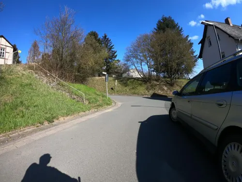

Palais Papius
Museum · 0.9 km
1 Kornblumengasse, Wetzlar
Apr-Oct Tu-Su,PH 11:00-17:00; Nov-Mar Tu-Su,PH 11:00-16:00


Hofgut Magdalenenhausen
Monument and historic site · 3.7 km
100 Magdalenenhäuser Weg, Wetzlar


83 more on the map.
Parks, trails and playgrounds38



e-werk - Der Segway-Park in Hessen
Sports field and stadium
15 - 17 Garbenheimer Straße, Wetzlar
We 11:00-18:30; Th 11:00-19:00; Fr 11:00-19:30; Sa,Su 13:00-19:00

Spielplatz am Rasselberg
Playground · 1.4 km
Spielpaltz mit Rutsche, Korbschaukel, Seilbahn, Klettergerüst, Trampolin und Sitzmöglichkeiten

26 more on the map.
Restaurants and cafes229
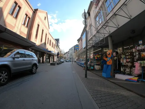
Aji Sushi
Restaurant · Sushi · 0.7 km
55 Langgasse, Wetzlar
Tu-Fr 11:30-15:00, 17:00-21:30; Sa,Su,PH 17:00-21:30
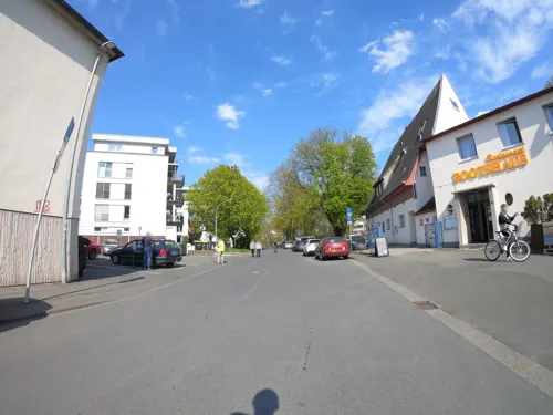
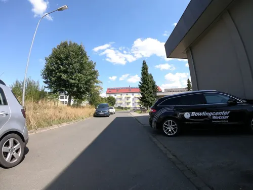
Charly‘s Bar
Bar and pub · Italian · 1.9 km
3 Franz-Schubert-Straße, Wetzlar
Mo-Sa 11:00-01:00, PH 16:00-01:00; Su off
Culinarik im Wöllbacher Tor
Restaurant · German, Seafood
14 Goethestraße, Wetzlar
Mo,Th-Sa 17:30+; Su 11:30+ || "nach Vereinbarung"

Bei Seibel
Restaurant · German, International · 3.2 km
25b Solmserweg, Wetzlar
Tu,Th-Su 17:00-23:00; Su,PH 10:00-15:00; We "nur auf Vorbestellung"
Bolero
Restaurant · Steak House · 0.7 km
7-9 Kornmarkt, Wetzlar
Mo-We,Fr 12:00-14:30,17:00-23:30; Sa-Su 12:00-23:30

Café Dolce
Cafe · Coffee Shop, Breakfast, Regional, Cake, Tea, Snack, Wine, Italian, German · 0.7 km
13 Fischmarkt, Wetzlar
Tu-Su 09:00-18:00
Edelweiss Gastronomie - Laguna Asslar
Restaurant · German · 3.8 km
1 Europastraße, Aßlar
Mo-Th 13:00-21:00; Fr 13:00-21:00; Sa 11:30-21:00; Su 11:00-19:00
217 more on the map.
History
The town's founding date is not known. There were "Bandkeramiker" settlements right on the western town limits, partly from 5,000 years BC.
Iron ore extraction and smelting in and around Wetzlar has been documented as early as the Celtic La Tène period. Iron processing has a tradition of around 2500 years there. There were also pit fields for copper, silver and gold in and around Wetzlar, albeit much later.
In the proximity of Wetzlar there are also a few Roman remains, which were constructed during the reign of the emperor Augustus (reigned 27 BC – 14 AD). There was a military camp at Dorlar and some Roman roadwork. The most important finding however is an uncompleted city (Waldgirmes Forum), which has been excavated since 1993. After their defeat in the battle of the Teutoburg Forest the Romans abandoned the area and withdrew to the Rhine border.
The name "Wetzlar" had come into being most likely by the 3rd century to the 8th century. The last syllable "―lar" suggests that the town was in existence by the 3rd century. The ending may be Celtic or Frankish (in the latter case, most likely referring to wooden defences around the town). The Conradine Gebhard, Count in the Wetterau, and as of 904 Duke of Lorraine, had a Church of the Saviour consecrated in 897, which replaced earlier structures. In the early 10th century came the founding of the Marienstift (monastery).
Read more of the history
At some unknown time, Wetzlar was granted market rights, and thereby, the right to levy market dues. Within a year, a market community came into being. The monastery's forerunners were surely part of the crystallization point at which believers, traders and craftsmen met, above all on holidays.
The Hohenstaufen Emperor Frederick I Barbarossa (r. 1152–1190) created a Reichsvogtei (roughly "Imperial Bailiwick"), and in 1180 put Wetzlar's citizens on the same level as Frankfurt's. Wetzlar became a Free Imperial City and kept this distinction until 1803. For the town's protection, and to secure the Wetterau as an Imperial Province, he expanded high above Wetzlar the Imperial Castle (Reichsburg), which had most likely already stood in one form or another before then. The origin of the name "Reichsburg Kalsmunt" is not quite clear. The following explanation cannot be ruled out: Kals- = Karls and munt ≈ vassal, that is, a liege of the Frankish court. Thus it would seem to be a case of a building work from Charlemagne's time ("Charlemagne" is "Karl der Große" – "Charles the Great" (740s–814) – in German). Imperial coinage was struck at Kalsmunt. The commercial road, which crossed the Lahn at Wetzlar, the town's iron production, to which the Iron Market (forum ferri) still bears witness, the wool weaving mill and tanning seemed a good basis on which to develop the town further.
In 1285 the "false emperor" Dietrich Holzschuh, called Tile Kolup, who claimed to be Frederick II, Holy Roman Emperor (who actually had already died in Italy in 1250) came to Wetzlar. When the rightful king, Rudolph I (r. 1273–1291), heard of this and came to Wetzlar, the city leaders seized Tile Kolup and handed him over. He was sentenced as a warlock, a heretic and a blasphemer to a fiery death, which he suffered the next day in Wetzlar at the stake.
Until 1250, most of the town fortifications, whose remains can still be seen today, were complete. By the middle of the 14th century, it is reckoned, the town's population was 6,000, making it by the standards of the time a "city". About 1350, the high point of the town's development in the Middle Ages was reached.
Decades-long feuds with the Counts of Solms, who were trying to make Wetzlar into a Solms-domain city, threatened the vital commercial road. The Emperor supported the town, albeit vainly. The city plunged into debt and in 1387 it fell under forced administration; however, it was incorporated into the Swabian League of Towns. The town's decline led by the end of the Thirty Years' War to a drop in population, to 1,500.
In 1689, the Holy Roman Empire's highest court, the Reichskammergericht (Imperial Chamber Court), was moved from Speyer to Wetzlar after Speyer had been devastated by the French in the War of the Palatinate Succession. Besides Vienna (residence of the Emperor) and Regensburg (seat of the Imperial Diet) Wetzlar thus gained a central function within the Holy Roman Empire and although it remained a tiny town it was regarded as one of its capitals. The court became the town's main employer; at the Empire's dissolution in 1806, it had a staff of about 150 including 20 judges, while a further 750 derived their income from it.
In the summer of 1772, Johann Wolfgang von Goethe was at the Reichskammergericht as a trainee. His novel The Sorrows of Young Werther is inspired by real events which Goethe experienced in Wetzlar. In 1803 Wetzlar came under the rule of Karl Theodor Anton Maria von Dalberg, the Archchancellor of the Holy Roman Empire and a close ally of Napoleon Bonaparte and thus lost its status as a free town. With the Empire's dissolution in 1806, the great court also met its end. It was replaced by a school of law founded by Karl von Dalberg in 1808, which not only continued the Reichskammergericht's function of training constitutional lawyers, but also employed many of the former staff as teachers. A former legal trainee, Franz Stickel (1786–1848), was selected to translate the Code Napoleon that Dalberg introduced in his territories in 1810–11.
After the Congress of Vienna, the area passed to Prussia in 1815, and in 1822 it became the seat of the newly formed district of Wetzlar, which later became an exclave of the Rhine Province.
From the History section of Wetzlar on Wikipedia, under CC BY-SA 4.0.
More about Wetzlar
Geography
Wetzlar lies in the Lahn-Dill area in Middle Hesse on the river Lahn, not far downstream from where it changes direction from south to west in the heights near the mouth of the Dill. The town lies at a point that divides the low Hessian mountain ranges: south of the Lahn lies the Taunus; north of the Lahn and west of the Dill the Westerwald begins; north of the Lahn and east of the Dill the Rothaargebirge begin. The highest point within town limits is the Stoppelberg at 401 m above sea level.
Wetzlar's neighbouring towns and cities are Gießen (up the Lahn from centre to centre about 12 km), Koblenz 80 km (50 mi) down the Lahn, Limburg an der Lahn 40 km (25 mi) to the west, Siegen 50 km (31 mi) to the northwest, Dillenburg 30 km (19 mi) to the north, Marburg 30 km (19 mi) to the northeast and Frankfurt am Main 60 km (37 mi) to the south.
Wetzlar and Gießen are the two cores of this small (about 200,000 inhabitants) urban agglomeration in Middle Hesse. Along the valleys of the Lahn (east and west) and Dill (north) are heavily built-up neighbouring communities, whose built-up areas in some places merge with Wetzlar's. The low mountain ranges around Wetzlar to the northwest, northeast and south, on the other hand, are heavily wooded and very thinly populated.
Economy
According to the figures of the Society for Consumer Research Wetzlar is one of the most attractive commercial locations in Germany. The city has a high centrality coefficient and a retail turnover of around EUR 10,000 per inhabitant. In Germany it takes third place among all cities with over 50,000 inhabitants.
Wetzlar has two large shopping centres, of those the FORUM Wetzlar is the largest in central Hesse (Mittelhessen). It has around 110 shops and accommodates a large multi-storey car park of 1700 places. Retail trade is located mainly in the areas Bahnhofsstraße, Karl-Kellner-Ring and the historic old town. In the Bahnhofstraße, the Karl-Kellner-Ring and in the two shopping centres where almost all goods are available.
Arts and culture
The Phantastische Bibliothek Wetzlar (Fantastic Library of Wetzlar) is one of the largest public libraries specialising in fantastic literature worldwide, it is the largest in Europe. It is generally a reference library, open for the public and scientists.
Arena Wetzlar is a multi-functional arena and is primarily used for pop concerts, shows and team handball and is the home arena of HSG Wetzlar (Handball Bundesliga).
Every summer, operas, music and drama are performed in the open air at the Freilichtbühne during the month-long Wetzlar Festival ("Wetzlarer Festspiele").
Education
Wetzlar offers a wide variety of educational paths students can choose from. [1]
Traditionally a child's education starts in one of Wetzlar's 18 nurseries. There are public and private nurseries and religiously influenced ones. Children will spend between one and four years in one of these day cares, until they move on to an elementary school.
Wetzlar has around 12 elementary schools. This includes private schools and schools, who are dedicated to special needs children. Most elementary schools offer an afterschool day care program for students, whose parents are at work longer than the school day. In addition to these programs, the city has public day care facilities that provide afterschool care. The afterschool program consists of warm meals, tutors who help with homework and playtime. Kita Marienheim Archived 21 September 2021 at the Wayback Machine is an example. After spending four years in elementary school, students are off to middle school.
From the Wikipedia article Wetzlar, under CC BY-SA 4.0.
Notable people from Wetzlar
 Gisela MayGerman actress and singer (1924-2016)Photo: Hans van Dijk for Anefo, CC BY-SA 3.0
 Friedrich Sixt von ArminGerman general (1851–1936)Photo: Unknown author Unknown author, CC BY-SA 3.0
 Jürgen StockGerman law enforcement officer (born 1959)Photo: Diyarenoon, CC BY-SA 4.0
 Stefan Lorenz SorgnerGerman philosopherPhoto: Ferenbar, CC BY-SA 4.0
 Hieronymus Karl Graf von Colloredo-Mansfeld(1775-1822) Austrian generalPhoto: Josef Kriehuber, Public domain
- Cenk TosunTurkish association football player (born 1991)
- Lukas MüllerGerman rower
- Charlotte Buffacquaintance of Goethe
- Nahum SonenbergCanadian microbiologist
- Karl von AbelBavarian statesman (1788-1859)
- Ludwig Julius BudgeGerman physiologist (1811-1888)
- Ludwig ErkGerman musician and musicologist (1807–1883)
Born in Wetzlar, according to Wikidata (CC0). Each name links to its Wikipedia article.
Where to stay24
Churches and places of worship39
Shopping63
Gas and EV charging16
Schools, colleges and libraries35
Healthcare31
Map of Wetzlar
250 places. The map loads OpenStreetMap tiles when you open it.
Getting there and nearby towns
Siegerlandflughafen (SGE) is the nearest airport with scheduled flights listed in OpenStreetMap, 34 km away.
- Aßlar 5 km northwest, about 5 min by car
- Solms 7 km west, about 7 min by car
- Schöffengrund 8 km south, about 8 min by car
- Braunfels 10 km southwest, about 10 min by car
- Ehringshausen 10 km northwest, about 10 min by car
- Leun 10 km west, about 10 min by car
- Langgöns 13 km southeast, about 13 min by car
- Greifenstein 16 km northwest, about 16 min by car
- Sinn 16 km northwest, about 16 min by car
- Selters 16 km west, about 16 min by car
Drive times are estimates from straight-line distance, not routes.
Towns near Wetzlar


Keep exploring
Local news
Headlines from INDB.
Reviews, tips and questions
Loading what members have shared...
Sources and licences
- GeoNames (CC BY 4.0): population, coordinates, regions and time zone
- Mapillary (see each image): photos
- OpenStreetMap contributors (ODbL 1.0): places, airports, map data
- Wikidata (CC0 1.0): elevation, founding date, time zone, website, landmarks and historic places
- Wikimedia Commons (see each image): photos
- Wikipedia (CC BY-SA 4.0): overview and history text
Photo credits
- Wetzlarskyline, Krusto, CC BY 2.0 de
- Der junge Goethe (Leonie Woeller) Wetzlar 3, Gerd Fahrenhorst, CC BY 4.0
- Der junge Goethe (Leonie Woeller) Wetzlar 2, Gerd Fahrenhorst, CC BY 4.0
- Der junge Goethe (Leonie Woeller) Wetzlar 1, Gerd Fahrenhorst, CC BY 4.0
- Wetzlar, Hausertorstrasse - geo.hlipp.de - 21058, Hans Carlos Hofmann on geo.hlipp.de, CC BY-SA 2.0
- Wetzlar, Zentrale Kreuzung an der B277, Blick auf Zeiss - geo.hlipp.de - 21824, Hans Carlos Hofmann on geo.hlipp.de, CC BY-SA 2.0
- Wetzlar, Hausertorstrasse - geo.hlipp.de - 21060, Hans Carlos Hofmann on geo.hlipp.de, CC BY-SA 2.0
- Infotafel Rüstungsproduktion Wetzlar, Gerd Fahrenhorst, CC BY 4.0
- Wetzlar, Hausertorstrasse - geo.hlipp.de - 21059, Hans Carlos Hofmann on geo.hlipp.de, CC BY-SA 2.0
- Haarbachstraße 5 in Wetzlar, Fernando Ferkelkraut, CC BY-SA 4.0
- Forum Wetzlar - panoramio, Christoph Schäfer, CC BY 3.0
- Haarbachstraße 15 in Wetzlar, Fernando Ferkelkraut, CC BY-SA 4.0
- Haarbachstraße 20 in Wetzlar, Fernando Ferkelkraut, CC BY-SA 4.0
- Stolperstein Wetzlar Karl-Kellner-Ring 41 Emmy Wetzstein, Gmbo 2013, CC0
- Stolperstein Wetzlar Karl-Kellner-Ring 41 Clothilde Salomon, Gmbo 2013, CC0
- Stolperstein Wetzlar Karl-Kellner-Ring 41 Liesa Wetzstein, Gmbo 2013, CC0
- Wetzlar Siena Promenade 38, Burkhard Mücke, CC BY-SA 4.0
- Stolpersteine Wetzlar Karl-Kellner-Ring 41, Gmbo 2013, CC0
- Stolperstein Wetzlar Karl-Kellner-Ring 41 Moritz Salomon, Gmbo 2013, CC0
- Stolperstein Wetzlar Karl-Kellner-Ring 41 Friedrich Wetzstein, Gmbo 2013, CC0
- Wetzlar Siena Promenade 39, Burkhard Mücke, CC BY-SA 4.0
- Stolpersteinlage Wetzlar Karl-Kellner-Ring 41, Gmbo 2013, CC0
- Wetzlar Siena Promenade 41, Burkhard Mücke, CC BY-SA 4.0
- Wetzlar Siena Promenade 40, Burkhard Mücke, CC BY-SA 4.0
- Wetzlar Lahn und Uferbereiche 04, Burkhard Mücke, CC BY-SA 4.0
- Wetzlar Lahn und Uferbereiche 06, Burkhard Mücke, CC BY-SA 4.0
- Philosophenweg 2 in Wetzlar, Fernando Ferkelkraut, CC BY-SA 4.0
- Wetzlar Lahn und Uferbereiche 05, Burkhard Mücke, CC BY-SA 4.0
- Wetzlar Lahn und Uferbereiche 03, Burkhard Mücke, CC BY-SA 4.0
- Wetzlar Lahn und Uferbereiche 02, Burkhard Mücke, CC BY-SA 4.0
- Wetzlar Siena Promenade 35, Burkhard Mücke, CC BY-SA 4.0
- Wetzlar Forum, Karl Udo Gerth, CC BY 3.0
- Stadion Wetzlar, The original uploader was Thomy3k at German Wikipedia ., GFDL
- Südwestansicht Wetzlarer Dom-MJ, Philipp Trümper, CC BY 3.0
- Anskar-Kirche Wetzlar, Manuel Heinemann, CC BY-SA 3.0 de
- Bismarckturm Wetzlar - Garbenheimer Warte, Longbow4u, CC BY-SA 3.0
- Lottehaus-2011-wetzlar-063, Dontworry, CC BY-SA 3.0
- Hospitalkirche Wetzlar, Oliver Deisenroth, CC BY-SA 3.0
- Wetzlar Palais Papius 1, presse03 ( talk ), CC BY-SA 3.0
- Hermannstein, Burgstraße 5, Kirche 2, Manuel Funk, CC BY-SA 3.0
- Phantastische Bibliothek Wetzlar, Stefan Flöper, CC BY-SA 4.0
- Evangelische Kirche Dorlar (026), GR Second Life ( talk ) 17:55, 29 May 2016 (UTC), CC BY-SA 3.0
- Evangelische Kirche Wetzlar-Naunheim, Philipp Trümper, CC BY 3.0
- Wetzlar, Hauser Gasse 17-20160801-002, Tilman2007, CC BY-SA 4.0
- Haus Hauser Gasse 20 in Wetzlar, von Osten, Jörg Wiegels, CC BY-SA 3.0
- Freiherr vom Stein Schule Stoppelberger Hohl 89, Fernando Ferkelkraut, CC BY-SA 4.0
- Naunheim Oberwasen, Fernando Ferkelkraut, CC BY-SA 4.0
- Garbenheim Würzberg, Fernando Ferkelkraut, CC BY-SA 4.0
- Kellerberg bei Nauborn, Fernando Ferkelkraut, CC BY-SA 4.0
- Wetzlar rosengaertchen 0551, Elektroll, CC0
- Wetzlar WLMMH 24769 by Stepro IMG 1521, Steffen Prößdorf, CC BY-SA 3.0 de
- Grube Malapertus, Wetzlar IV, GerritR, CC BY-SA 4.0
- Werner von Siemens Schule Wetzlar - panoramio, Christoph Schäfer, CC BY 3.0
- Dalheim Wetzlar Ev. Kirche (01), Wikiwal, CC BY-SA 4.0
- Aßlar-Wiki-Backhaus, Otto Domes, CC BY-SA 4.0
- Magdalenenhausen, Krokogitarre, CC BY-SA 3.0
- Stoppelberg wetzlar, The original uploader was Gemgem at German Wikipedia ., CC BY-SA 3.0
- Goetheschulewetzlar-juli2021, Designdifferent, CC BY-SA 4.0
- Bruehlsbacher Warte (Wetzlar, Anfang 2007), Michael J. Zirbes, CC BY-SA 3.0
- Wetzlar Reichskammergericht 2003, Photo: Andreas Praefcke, CC BY 3.0
- Wetzlar, die Colchester- Anlage, Dguendel, CC BY 4.0
- Street-level photo, grinninghamster, CC BY-SA 4.0
- Street-level photo, grinninghamster, CC BY-SA 4.0
- Street-level photo, grinninghamster, CC BY-SA 4.0
- Street-level photo, grinninghamster, CC BY-SA 4.0
- Street-level photo, grinninghamster, CC BY-SA 4.0
- Street-level photo, grinninghamster, CC BY-SA 4.0
- Street-level photo, grinninghamster, CC BY-SA 4.0
- Street-level photo, grinninghamster, CC BY-SA 4.0
- Street-level photo, grinninghamster, CC BY-SA 4.0
- Street-level photo, grinninghamster, CC BY-SA 4.0
- Street-level photo, grinninghamster, CC BY-SA 4.0
- Street-level photo, grinninghamster, CC BY-SA 4.0
- Street-level photo, grinninghamster, CC BY-SA 4.0
- Street-level photo, grinninghamster, CC BY-SA 4.0
- Street-level photo, grinninghamster, CC BY-SA 4.0
- Street-level photo, Jeykey90, CC BY-SA 4.0
- Street-level photo, grinninghamster, CC BY-SA 4.0
- Street-level photo, grinninghamster, CC BY-SA 4.0
- Street-level photo, grinninghamster, CC BY-SA 4.0
- Street-level photo, grinninghamster, CC BY-SA 4.0
- Street-level photo, grinninghamster, CC BY-SA 4.0
- Street-level photo, grinninghamster, CC BY-SA 4.0


Page built November 9, 2026. Spotted a mistake? Tell us or suggest a place.