


Why visit Braunfels
Townapedia lists 95 museums and landmarks, 18 parks and trails, 90 places to eat, 18 places to stay and 11 attractions in and around town.
Highlights include Wildpark Tiergarten Weilburg, Freilichtbühne Bonbaden, Schloß Braunfels and Jüdischer Friedhof.
Weather in Braunfels
Forecast from MET Norway (CC BY 4.0). Full forecast
About Braunfels
Braunfels (German pronunciation: [ˈbʁaʊnfɛls] ) is a town in the Lahn-Dill-Kreis in Hesse, Germany. It is located on the German Timber-Frame Road.
From the Wikipedia article Braunfels (this version), under CC BY-SA 4.0.
Things to do11

Wildpark Tiergarten Weilburg
Zoo and aquarium · 5.1 km
Mar-Oct Mo-Su,PH 09:00-18:00; Nov-Feb Mo-Su,PH 09:00-16:30


Fürstlicher Tiergarten Braunfels
Zoo and aquarium · 1.3 km
26 Tiergartenstraße, Braunfels
Mo-Su 10:00-18:00


Waldlädchen - Norbert Paal
Farm and orchard · 2.9 km
29 Clara-Schumann-Straße, Solms
Museums and landmarks95


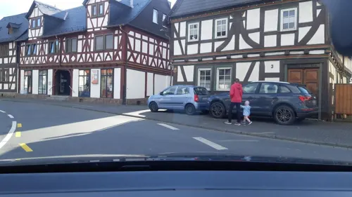
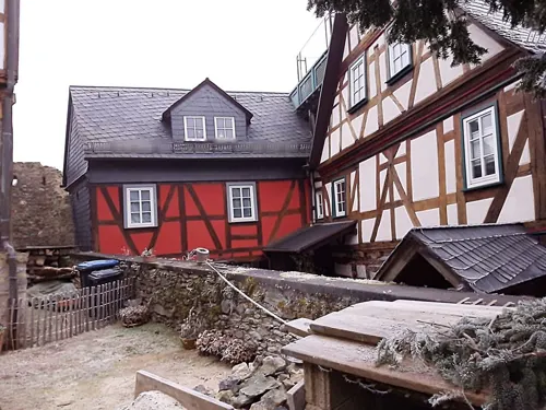

Stollen Würgengel
Monument and historic site · 2.5 km
Mundloch erhalten, Stollen verschüttet, ehemals Wasserlösung

83 more on the map.
Parks, trails and playgrounds18



Golf Club Schloss Braunfels
Golf course · 1.7 km
Homburger Hof, Braunfels
sunrise-sunset


Bauernhof und mehr
Sports field and stadium · 1.2 km
4 Sportanlage, Braunfels
6 more on the map.
Restaurants and cafes90
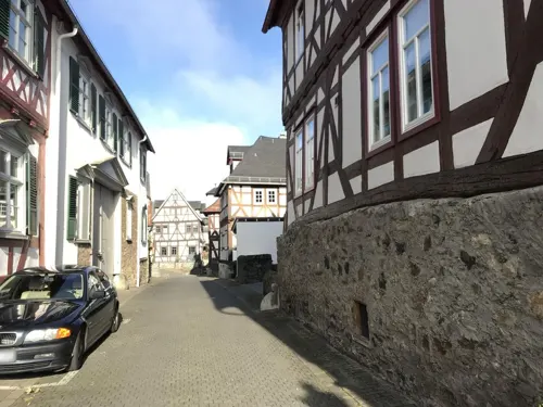
Zum Solmser Hof
Restaurant · Greek
1 Marktplatz, Braunfels
Tu-Fr 18:00-21:00; Sa,Su 12:00-15:00,18:00-21:00
GEORGIE’S RESTAURANT im Bistro am Schloss
Restaurant · International
4 Schloßstraße, Braunfels
Tu-Su 16:00-22:00

La Stella Solms
Restaurant · Italian, German · 4.6 km
55 Bahnhofstraße, Solms
Mo-Sa 10:30-14:15, 16:30-23:30, Su 10:30-23:00
Memoria
Restaurant · Mediterranean · 2.4 km
20 Oberndorfer Straße, Solms
Tu-Su,PH 11:30-14:00, 17:00-22:30; Mo off


Pizzeria Germania
Restaurant · Italian · 3.2 km
1 Solmsbachstraße, Braunfels
Mo-Sa 11:30-14:30,17:30-23:00; Su 11:00-14:30,17:00-23:00
Pizzeria Pizza Pie
Restaurant · Italian · 1.2 km
3 Alte Leuner Straße, Braunfels
Tu-Su 11:30-14:30,17:30-23:00
Restaurant Zum Turm
Restaurant · German
11 Marktplatz, Braunfels
Mo,Th-Fr 12:00-14:00,18:00-22:00; Sa-Su 12:00-22:00; Tu,We off
78 more on the map.
History
The town and district seat of Braunfels were first mentioned in 1246. Braunfels has had town rights since 1607. In 1950 Braunfels had a population of 3,337. In the course of municipal reforms, the aforesaid constituent communities, formerly all independent villages, were amalgamated with Braunfels in 1972.
Bonbaden had its first documented mention in 772, and so celebrated 1200 years of existence in 1972. Bonbaden is therefore one of Lahn-Dill's oldest inhabited places.
Braunfels Castle, a stately home that had been built from a castle built in the 13th century by the Counts of Nassau, served as of about 1260 as the Solms-Braunfels noble family's residential castle. After Solms Castle had been destroyed by the Rhenish League of Towns in 1384, Braunfels Castle became the seat of the Counts of Solms. Over the castle's more than 750-year-long history, building work was done many times. Particularly worthy of mention is the town and castle fire of 1679, which destroyed much of both; the castle was rebuilt into a Baroque residence, while the town was given a regular marketplace, which is still preserved today and lies before the town wall.
From the History section of Braunfels on Wikipedia, under CC BY-SA 4.0.
Where to stay18
Churches and places of worship24
Evangelische Kirche Albshausen
Church · Protestant · 4.4 km
4 Laubacher Weg, Solms
Evangelische Kirche Burgsolms
Church · Protestant · 3.1 km
1 Bergstraße, Solms
Evangelische Kirche Bonbaden
Church · Protestant · 2.9 km
1 Am Kirchberg, Braunfels
Shopping23
Gas and EV charging7
Schools, colleges and libraries11
Ev. Öffentliche Bibliothek der Kirchengemeinde Burgsolms
Library · 3.1 km
7a Georgshüttenstraße, Solms
Healthcare11
Map of Braunfels
250 places. The map loads OpenStreetMap tiles when you open it.
Getting there and nearby towns
Siegerlandflughafen (SGE) is the nearest airport with scheduled flights listed in OpenStreetMap, 30 km away.
- Weilburg 10 km west, about 10 min by car
- Langgöns 20 km east, about 20 min by car
- Usingen 23 km southeast, about 23 min by car
- Neu-Anspach 23 km south, about 23 min by car
- Bad Camberg 26 km south, about 26 min by car
- Hadamar 26 km west, about 26 min by car
- Lollar 27 km northeast, about 27 min by car
- Lich 30 km east, about 30 min by car
- Gladenbach 31 km northeast, about 31 min by car
- Rosbach vor der Höhe 32 km southeast, about 32 min by car
Drive times are estimates from straight-line distance, not routes.
Local news
Headlines from INDB.
Reviews, tips and questions
Loading what members have shared...
Sources and licences
- GeoNames (CC BY 4.0): population, coordinates, regions and time zone
- Mapillary (see each image): photos
- OpenStreetMap contributors (ODbL 1.0): places, airports, map data
- Wikidata (CC0 1.0): elevation, founding date, time zone, website, landmarks and historic places
- Wikimedia Commons (see each image): photos
- Wikipedia (CC BY-SA 4.0): overview and history text
Photo credits
- Braunfels - Marktplatz mit Brunnen und Fachwerkhäusern, Franzfoto, CC BY-SA 3.0
- Braunfels Belzgasse 5, Fernando Ferkelkraut, CC BY-SA 4.0
- Braunfels Belzgasse 13, Fernando Ferkelkraut, CC BY-SA 4.0
- Braunfels Belzgasse 11, Fernando Ferkelkraut, CC BY-SA 4.0
- Braunfels Marktplatz, Gabriele Delhey, CC BY-SA 3.0
- Braunfels - Schloß, Santiago2000, CC BY-SA 3.0
- Braunfels - Schloß-1, Santiago2000, CC BY-SA 3.0
- Braunfels Solmser Hof, Ulrich Mayring, CC BY-SA 3.0
- Braunfels Belzgasse 2, Fernando Ferkelkraut, CC BY-SA 4.0
- Braunfels, Teil der Burg, Varus111, CC BY-SA 4.0
- Hülse Braunfels, Fernando Ferkelkraut, CC BY 4.0
- Braunfels - Schloßhof mit Kanonen, Franzfoto, CC BY-SA 3.0
- Braunfels Belzgasse Leierbrunnen, Fernando Ferkelkraut, CC BY-SA 4.0
- Schloss Braunfels Blick in den Innenhof, IRiS-Photographie, CC BY-SA 4.0
- Braunfels - Fachwerkhaus mit Torturm, Franzfoto, CC BY-SA 3.0
- Braunfels - Schloß der Grafen von Solms-Braunfelsm Haupthof, Franzfoto, CC BY-SA 3.0
- Schloss Braunfels, Rainer Lippert, CC BY-SA 3.0
- Kirche Solms-Niederbiel, Philipp Trümper ( PTWZ ( talk )), CC BY 3.0
- Weilburg-Drommershausen WLMMH 52479 by Stepro IMG 1101, Steffen Prößdorf, CC BY-SA 3.0 de
- Hirschhausen - Evang. Kirche, Santiago2000, CC BY-SA 3.0
- Albshausen Ev. Kirche (12), Wikiwal, CC BY 4.0
- Burgsolms Ev. Kirche, Wikiwal, CC BY-SA 4.0
- Evangelische Kirche Bonbaden, Philipp Trümper ( PTWZ ), CC BY 3.0
- Leun Kath Kirche, Meikel1965, CC BY-SA 3.0
- Laufdorf Ev. Kirche (09), Wikiwal, CC BY 4.0
- Braunfels Urwaldzelle, Fernando Ferkelkraut, CC BY-SA 4.0
- Oberndorf Borngrund, Fernando Ferkelkraut, CC BY-SA 4.0
- Kirche Solms-Oberbiel, Philipp Trümper ( PTWZ ( talk )), CC BY 3.0
- Jüdischer Friedhof Solms, Barnack, Public domain
- Schloss Braunfels 2, Ulrich Mayring, CC BY-SA 3.0
- Weilburg - Tiergarten - Dillhäuser Bauernhaus, Oliver Abels ( SBT ), CC BY-SA 3.0
- Weilburg-Drommershausen, Kirche, Karsten Ratzke, CC0
- Weilburger Straße 18, Fernando Ferkelkraut, CC BY-SA 4.0
- Pumpe am Hintertaler Tor, Fernando Ferkelkraut, CC BY-SA 4.0
- Schnitzereien gegenüber Pumpe, Fernando Ferkelkraut, CC BY-SA 4.0
- Weilburger Straße 14, Fernando Ferkelkraut, CC BY-SA 4.0
- Weilburger Straße 10, Fernando Ferkelkraut, CC BY-SA 4.0
- Weilburger Straße 8, Fernando Ferkelkraut, CC BY-SA 4.0
- Schütt Gesamtanlage, Fernando Ferkelkraut, CC BY-SA 4.0
- Schütt 2, Fernando Ferkelkraut, CC BY-SA 4.0
- Street-level photo, troher15, CC BY-SA 4.0
- Street-level photo, troher15, CC BY-SA 4.0
- Street-level photo, troher15, CC BY-SA 4.0
- Street-level photo, troher15, CC BY-SA 4.0
- Street-level photo, troher15, CC BY-SA 4.0
- Street-level photo, troher15, CC BY-SA 4.0
- Street-level photo, snowden, CC BY-SA 4.0
- Street-level photo, troher15, CC BY-SA 4.0
- Street-level photo, lllooommm, CC BY-SA 4.0
- Street-level photo, troher15, CC BY-SA 4.0
- Street-level photo, lllooommm, CC BY-SA 4.0
- Street-level photo, lllooommm, CC BY-SA 4.0
- Street-level photo, bitnapper, CC BY-SA 4.0
- Street-level photo, grinninghamster, CC BY-SA 4.0
- Street-level photo, sdos77, CC BY-SA 4.0
- Street-level photo, jurgenweighardt, CC BY-SA 4.0
- Street-level photo, troher15, CC BY-SA 4.0
- Street-level photo, Jeykey90, CC BY-SA 4.0
- Street-level photo, troher15, CC BY-SA 4.0
- Street-level photo, sdos77, CC BY-SA 4.0
- Street-level photo, lllooommm, CC BY-SA 4.0
- Street-level photo, lllooommm, CC BY-SA 4.0
- Street-level photo, grinninghamster, CC BY-SA 4.0
- Street-level photo, grinninghamster, CC BY-SA 4.0


Page built November 8, 2026. Spotted a mistake? Tell us or suggest a place.