


Why visit Schwelm
Townapedia lists 42 museums and landmarks, 31 parks and trails, 133 places to eat, 12 places to stay and 10 attractions in and around town.
Highlights include Ehrenberg, Ehrenberger Bauernkäserei, Haus Martfeld and Elbschetalbahn.
Weather in Schwelm
Forecast from MET Norway (CC BY 4.0). Full forecast
About Schwelm
Schwelm (German pronunciation: [ʃvɛlm] ) is a town in the district of Ennepe-Ruhr-Kreis in the administrative region of Arnsberg within the state of North Rhine-Westphalia in western Germany.
From the Wikipedia article Schwelm (this version), under CC BY-SA 4.0.
Photos of Schwelm


Things to do10





Museums and landmarks42

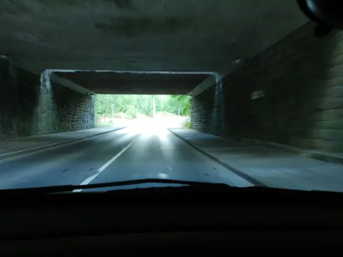


Villa Altenloh
Monument and historic site · 4.1 km
34 Bahnhofstraße, Ennepetal

Villa Brackelsberg
Monument and historic site · 3.3 km
103 Heilenbecker Straße, Ennepetal

Villa Stockey
Monument and historic site · 3.8 km
20a Heinrichstraße, Ennepetal
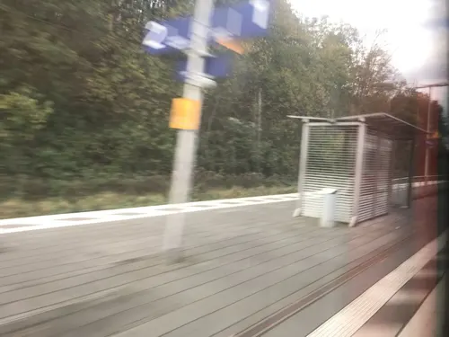
Förderverein Denkmal Bahnhof Ennepetal e.V.
Monument and historic site · 4.0 km
19 Bahnhofstraße, Ennepetal



ehemalige Brennerei Saure
Monument and historic site · 4.0 km
39 Elberfelder Straße, Gevelsberg
Haus Heilenbecke
Monument and historic site · 3.5 km
42 Heilenbecker Straße, Ennepetal
30 more on the map.
Parks, trails and playgrounds31
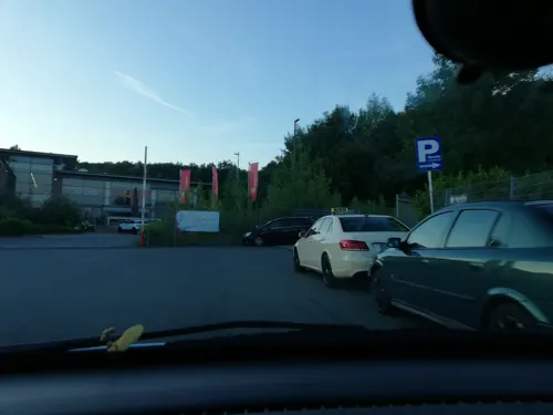
Upsalla Kinderpark
Playground · 3.3 km
22 Porschestraße, Wuppertal
Mo-Fr 14:00-19:00; Sa,Su,PH 10:00-19:00;SH 10:00-19:00



Erlebnispark Gevelsberg
Sports field and stadium · 4.1 km
Tu-Fr 14:30-19:00; SH Tu-Fr 11:00-19:00; Sa, Su, PH 10:00-19:00

Urban-Gardening-Projekt "PflanzBar"
Park · 4.1 km
Für jeden, insbesondere Anwohner/-innen aus Oberbarmen und dem Quartier Hilgershöhe, frei zugänglicher Mitmach-Garten. Zur Nutzung bitte...
19 more on the map.
Restaurants and cafes133

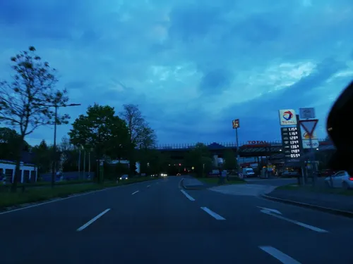
China City Restaurant
Restaurant · Chinese · 2.7 km
82 Clausewitzstraße, Wuppertal
Mo-Fr 11:30-15:00,17:00-23:00; Sa,Su,PH 11:30-23:00
Restaurant Habbel's
Restaurant · German, Mediterranean · 3.9 km
127 Gevelsberger Straße, Sprockhövel
Mo,Tu closed; We-Sa 18:00-22:30; Su 12:00-14:30, 17:00-22:00

Ristorante Da Pino
Restaurant · Pizza, Italian
3 Altmarkt, Schwelm
Tu-Su 12:00-14:30,17:30-23:00; Mo off

Bäckerei Steinbrink
Bakery · 4.2 km
75 Voerder Straße, Ennepetal
Mo-Fr 06:00-18:00; Sa 06:00-13:00; Su 08:00-11:00

121 more on the map.
History
The history of Schwelm can be traced back to the ninth century, where it is first mentioned as "Suelmiu". The town of Schwelm was officially established in 1496 and became seat of the Ennepe-Ruhr district in 1929.
During World War II, forced laborers of the 3rd SS construction brigade were dispatched in the town by the Nazis in 1943.
From the History section of Schwelm on Wikipedia, under CC BY-SA 4.0.
More about Schwelm
Geography
Schwelm is situated in the southeast of the "Ruhrgebiet", the Ruhr district of Germany, between Westphalia and the "Bergisches Land". Schwelm is commonly known as the "Pforte Westfalens" ("Gate to Westphalia").
According to its area, Schwelm is the smallest town in North Rhine-Westphalia.
Surrounding towns include Ennepetal, Gevelsberg, Sprockhövel and Wuppertal.
Schwelm is called the "town of neighbourhoods". It is made up of the following 13 neighbourhoods:
From the Wikipedia article Schwelm, under CC BY-SA 4.0.
Notable people from Schwelm
 Andreas SanderGerman alpine skierPhoto: Martin Rulsch , Wikimedia Commons, CC BY-SA 4.0
 Marcel AppiahGerman footballerPhoto: Northside, CC BY-SA 3.0
 Martin GrötschelGerman mathematicianPhoto: Martin Groetschel, Public domain
 Hugo ErfurtGerman entrepreneur and inventor of wood-chip wallpaperPhoto: Erfurt & Sohn KG, CC BY 3.0
 Thomas SchirrmacherChristian university lecturer in systematic theology and moral philosophy, rector of the Martin Bucer SeminaryPhoto: Religionssoziologe, CC BY-SA 4.0
 Erich BitterGerman bicycle racerPhoto: Torana, CC BY-SA 3.0
- Gustav HeinemannGerman politician; President of Germany from 1969–1974 (1899–1976)
- Rolf RüssmannGerman footballer (1950-2009)
- Johannes Joachim DegenhardtArchbishop of Paderborn, Germany (1926–2002)
- Franz Josef DegenhardtGerman songwriter, writer and lawyer (1931–2011)
- Wilhelm GöckeGerman Nazi concentration camp commandant (1898–1944)
- Ludwig WeberGerman theologian (1846–1922)
Born in Schwelm, according to Wikidata (CC0). Each name links to its Wikipedia article.
Where to stay12
Familien-Sport-Gemeinschaft Lichtbund Wuppertal e.V.
Campground · 3.7 km
25 Eichenhofer Weg, Sprockhövel
Churches and places of worship31
Klosterkirche St. Maria Magdalena
Church · Roman Catholic · 4.1 km
49 Beyenburger Freiheit, Wuppertal
St. Raphael
Church · Roman Catholic · 3.6 km
21 Henkelsstraße, Wuppertal
St. Paul
Church · Roman Catholic · 3.8 km
30 Bornscheuerstraße, Wuppertal
Shopping44
Gas and EV charging28
Schools, colleges and libraries24
Healthcare13
Map of Schwelm
250 places. The map loads OpenStreetMap tiles when you open it.
Getting there and nearby towns
Flughafen Essen-Mülheim (ESS) is the nearest airport with scheduled flights listed in OpenStreetMap, 28 km away.
- Gevelsberg 5 km northeast, about 5 min by car
- Ennepetal 5 km east, about 5 min by car
- Sprockhövel 8 km northwest, about 8 min by car
- Radevormwald 10 km southeast, about 10 min by car
- Wuppertal 11 km west, about 11 min by car
- Wetter 13 km northeast, about 13 min by car
- Breckerfeld 12 km east, about 12 min by car
- Remscheid 14 km southwest, about 14 min by car
- Hagen 15 km northeast, about 15 min by car
- Hattingen 15 km northwest, about 15 min by car
Drive times are estimates from straight-line distance, not routes.
Towns near Schwelm


.jpg)


Keep exploring
Local news
Headlines from INDB.
Reviews, tips and questions
Loading what members have shared...
Sources and licences
- GeoNames (CC BY 4.0): population, coordinates, regions and time zone
- Mapillary (see each image): photos
- OpenStreetMap contributors (ODbL 1.0): places, airports, map data
- Wikidata (CC0 1.0): elevation, founding date, time zone, website
- Wikimedia Commons (see each image): photos
- Wikipedia (CC BY-SA 4.0): overview and history text
Photo credits
- Schwelm Stadtansicht, F.Broer, CC BY-SA 3.0
- Neumarkt 11, 13, 15, 17, 1, Schwelm, Ennepe-Ruhr-Kreis, GeorgDerReisende, CC BY-SA 4.0
- Neumarkt, 2, Schwelm, Ennepe-Ruhr-Kreis, GeorgDerReisende, CC BY-SA 4.0
- Neumarkt 17, 2, Schwelm, Ennepe-Ruhr-Kreis, GeorgDerReisende, CC BY-SA 4.0
- Neumarkt 15, 3, Schwelm, Ennepe-Ruhr-Kreis, GeorgDerReisende, CC BY-SA 4.0
- Neumarkt, 4, Schwelm, Ennepe-Ruhr-Kreis, GeorgDerReisende, CC BY-SA 4.0
- Neumarkt 13, 2, Schwelm, Ennepe-Ruhr-Kreis, GeorgDerReisende, CC BY-SA 4.0
- Neumarkt 11, 2, Schwelm, Ennepe-Ruhr-Kreis, GeorgDerReisende, CC BY-SA 4.0
- Neumarkt 17, 3, Schwelm, Ennepe-Ruhr-Kreis, GeorgDerReisende, CC BY-SA 4.0
- Neumarkt, 3, Schwelm, Ennepe-Ruhr-Kreis, GeorgDerReisende, CC BY-SA 4.0
- Neumarkt, 1, Schwelm, Ennepe-Ruhr-Kreis, GeorgDerReisende, CC BY-SA 4.0
- Neumarkt 9, 1, Schwelm, Ennepe-Ruhr-Kreis, GeorgDerReisende, CC BY-SA 4.0
- Neumarkt 32, 2, Schwelm, Ennepe-Ruhr-Kreis, GeorgDerReisende, CC BY-SA 4.0
- Neumarkt, 6, Schwelm, Ennepe-Ruhr-Kreis, GeorgDerReisende, CC BY-SA 4.0
- Moltkestraße, 4, Schwelm, Ennepe-Ruhr-Kreis, GeorgDerReisende, CC BY-SA 4.0
- Neumarkt 7, 1, Schwelm, Ennepe-Ruhr-Kreis, GeorgDerReisende, CC BY-SA 4.0
- Neumarkt, 5, Schwelm, Ennepe-Ruhr-Kreis, GeorgDerReisende, CC BY-SA 4.0
- Neumarkt 32, 1, Schwelm, Ennepe-Ruhr-Kreis, GeorgDerReisende, CC BY-SA 4.0
- Neumarkt 5, 1, Schwelm, Ennepe-Ruhr-Kreis, GeorgDerReisende, CC BY-SA 4.0
- Mittelstraße, 1, Schwelm, Ennepe-Ruhr-Kreis, GeorgDerReisende, CC BY-SA 4.0
- Neumarkt 3, 1, Schwelm, Ennepe-Ruhr-Kreis, GeorgDerReisende, CC BY-SA 4.0
- Moltkestraße 5, 1, Schwelm, Ennepe-Ruhr-Kreis, GeorgDerReisende, CC BY-SA 4.0
- Moltkestraße 11, 2, Schwelm, Ennepe-Ruhr-Kreis, GeorgDerReisende, CC BY-SA 4.0
- Schulstraße 9, 1, Schwelm, Ennepe-Ruhr-Kreis, GeorgDerReisende, CC BY-SA 4.0
- Neumarkt 15, 4, Schwelm, Ennepe-Ruhr-Kreis, GeorgDerReisende, CC BY-SA 4.0
- Mittelstraße 6, 1, Schwelm, Ennepe-Ruhr-Kreis, GeorgDerReisende, CC BY-SA 4.0
- Schulstraße, 5, Schwelm, Ennepe-Ruhr-Kreis, GeorgDerReisende, CC BY-SA 4.0
- Schulstraße 7, 1, Schwelm, Ennepe-Ruhr-Kreis, GeorgDerReisende, CC BY-SA 4.0
- Schulstraße 11, 1, Schwelm, Ennepe-Ruhr-Kreis, GeorgDerReisende, CC BY-SA 4.0
- Moltkestraße 8, 3, Schwelm, Ennepe-Ruhr-Kreis, GeorgDerReisende, CC BY-SA 4.0
- Mittelstraße 5, 3, Schwelm, Ennepe-Ruhr-Kreis, GeorgDerReisende, CC BY-SA 4.0
- Schulstraße 13, 1, Schwelm, Ennepe-Ruhr-Kreis, GeorgDerReisende, CC BY-SA 4.0
- Schulstraße 5, 1, Schwelm, Ennepe-Ruhr-Kreis, GeorgDerReisende, CC BY-SA 4.0
- Moltkestraße 13, 2, Schwelm, Ennepe-Ruhr-Kreis, GeorgDerReisende, CC BY-SA 4.0
- Moltkestraße 11, 1, Schwelm, Ennepe-Ruhr-Kreis, GeorgDerReisende, CC BY-SA 4.0
- Mittelstraße 8, 1, Schwelm, Ennepe-Ruhr-Kreis, GeorgDerReisende, CC BY-SA 4.0
- Untermauerstraße 29, 3, Schwelm, Ennepe-Ruhr-Kreis, GeorgDerReisende, CC BY-SA 4.0
- Schulstraße, 3, Schwelm, Ennepe-Ruhr-Kreis, GeorgDerReisende, CC BY-SA 4.0
- Mittelstraße 7, 1, Schwelm, Ennepe-Ruhr-Kreis, GeorgDerReisende, CC BY-SA 4.0
- Schulstraße, 4, Schwelm, Ennepe-Ruhr-Kreis, GeorgDerReisende, CC BY-SA 4.0
- Evangelische Kirche Langerfeld, Wuppertal, Morty, CC BY-SA 3.0
- Schwelm Altmarkt Christuskirche, Schwelmer, CC BY 3.0
- Beyenburg Klosterkirche v O, Beckstet, CC BY-SA 3.0
- Ehrenberg (Wuppertal), The original uploader was Morty at German Wikipedia ., CC BY-SA 2.0 de
- Evangelische Kirche Milspe2, giggel, CC BY 3.0
- Villa Altenloh, Grenzestein, CC BY-SA 3.0
- Gevelsberg - Elberfelder Straße - Erlöserkirche 11, Frank Vincentz, CC BY-SA 3.0
- Tor Haus Martfeld, DooFi, CC BY 3.0
- Wuppertal - Zu den Dolinen - Dolinengelände 14 ies, Frank Vincentz, CC BY-SA 3.0
- Wuppertal Langerfeld - Bandfabrik Carl Kettler 05 ies, Frank Vincentz, CC BY-SA 3.0
- Villa Brackelsberg 1, Grenzestein, CC BY-SA 3.0
- Wuppertal, Gesamtschule Langerfeld, Haus 2 (Heinrich-Böll-Str. 250), Eingang, Im Fokus, CC BY-SA 4.0
- NSG Tal der Wolfsbecke (15), DiAuras, CC BY-SA 4.0
- NSG Tal der Fastenbecke - Unterlauf (11), DiAuras, CC BY-SA 4.0
- Schwelm Beyenburger Straße 2017 035, Atamari, CC BY-SA 4.0
- Naturschutzgebiet Heilenbecker Tal (EN-026) (13), DiAuras, CC BY-SA 4.0
- Märkisches Gymnasium Schwelm kk, KJ136, CC BY-SA 3.0 de
- Sankt Paul Langerfeld 06, Opernkomponist, CC BY-SA 4.0
- Schwelm - Martfeld - Helios Klinikum 07 ies, Frank Vincentz, CC BY-SA 3.0
- Wupper b), B. Eindorf, CC BY-SA 4.0
- Steilhang der Wupper, DiAuras, CC BY-SA 4.0
- Wiesen Junkersbeck, Juli 2021 - 2, AlanyaSeeburg, CC0
- Kriegerdenkmal-Junkersbeck, Morty, CC BY-SA 3.0 de
- Gevelsberg - Rosendahler Straße - St Engelbert 06, Frank Vincentz, CC BY-SA 3.0
- Wuppertal - Windhukstraße - Christus Gemeinde 04 ies, Frank Vincentz, CC BY-SA 3.0
- Untere herbringhauser talsperre01, The original uploader was Gammlaa at German Wikipedia . ( Original text: Christian Roschow ), CC BY-SA 3.0
- Wuppertal Wittener Str 0004, Atamari, CC BY-SA 3.0
- Evangelische Kirche Wuppertal-Beyenburg, Am Kriegermal 24, Bergermotte, CC BY-SA 3.0
- Wuppertal Inselstr 0011, Atamari, CC BY-SA 3.0
- Wuppertal Wittener Str 0020, Atamari, CC BY-SA 3.0
- Ennepetal, Auf der Hardt, Gedenkstätte, von S, Bild 2, Im Fokus, CC BY-SA 4.0
- Ennepetal, Heinrichstr. 20a, Im Fokus, CC BY-SA 4.0
- Ennepetal, Bremenplatz 33, Bremenstadion, von NW, Bild 2, Im Fokus, CC BY-SA 4.0
- Steig zum Bilsteiner Kopf (2), DiAuras, CC BY-SA 4.0
- Street-level photo, thoschi, CC BY-SA 4.0
- Street-level photo, thoschi, CC BY-SA 4.0
- Street-level photo, thoschi, CC BY-SA 4.0
- Street-level photo, thoschi, CC BY-SA 4.0
- Street-level photo, LouCipher, CC BY-SA 4.0
- Street-level photo, teddy73, CC BY-SA 4.0
- Street-level photo, thoschi, CC BY-SA 4.0
- Street-level photo, ASRvw, CC BY-SA 4.0
- Street-level photo, thoschi, CC BY-SA 4.0
- Street-level photo, phitec, CC BY-SA 4.0
- Street-level photo, phitec, CC BY-SA 4.0
- Street-level photo, kgvx, CC BY-SA 4.0
- Street-level photo, do8pgg, CC BY-SA 4.0
- Street-level photo, ASRvw, CC BY-SA 4.0
- Street-level photo, ASRvw, CC BY-SA 4.0
- Street-level photo, baldur80, CC BY-SA 4.0
- Street-level photo, miguel_andrade, CC BY-SA 4.0
- Street-level photo, maxd, CC BY-SA 4.0
- Street-level photo, ASRvw, CC BY-SA 4.0
- Street-level photo, miguel_andrade, CC BY-SA 4.0
- Street-level photo, do8pgg, CC BY-SA 4.0


Page built November 9, 2026. Spotted a mistake? Tell us or suggest a place.