


Sprockhövel, Germany
Sprockhövel is a town of 26,400 people in North Rhine-Westphalia, Germany.
Why visit Sprockhövel
Townapedia lists 67 museums and landmarks, 27 parks and trails, 109 places to eat, 19 places to stay and 40 attractions in and around town.
Highlights include Hofladen Bergerhof, Limas Lädle, Stock und Scherenberger Erbstollen and Sprockhöveler Heimatstube.
Weather in Sprockhövel
Forecast from MET Norway (CC BY 4.0). Full forecast
About Sprockhövel
Sprockhövel (German pronunciation: [ˈʃpʁɔkˌhøːfl̩] ) is a town in the district of Ennepe-Ruhr-Kreis, North Rhine-Westphalia, Germany.
From the Wikipedia article Sprockhövel (this version), under CC BY-SA 4.0.
Things to do40

Limas Lädle
Farm and orchard · 2.9 km
Https://archive.is/hOseh
19a Bochumer Straße, Sprockhövel
24/7
Hofladen Sticht
Farm and orchard · 5.0 km
120 Bredenscheider Straße, Hattingen
Tu-Sa 10:00-18:00; Mo,Su,PH off
Milchbauernhof Hegenberg
Farm and orchard · 3.4 km
44 Uhlenbruchstraße, Sprockhövel
Tu 09:00-13:00, 15:00-18:30; Th 15:00-18:30; Sa 09:00-13:00; Mo,...
Schröers Hofladen
Farm and orchard · 5.7 km
1 Ochsenkamp, Wuppertal
Tu-Fr 17:00-19:00, Sa 10:00-13:00


Hofladen Krevert
Farm and orchard · 4.3 km
292 Wittener Straße, Sprockhövel
Hofladen Lohmann
Farm and orchard · 5.0 km
Mo,We,Fr 09:00-18:00; Tu 09:00-13:00; PH closed; Sa 09:00-14:00
28 more on the map.
Museums and landmarks67

Stock und Scherenberger Erbstollen
Museum · 2.8 km
25 Helsbergstraße, Sprockhövel
"Nur nach Anmeldung"
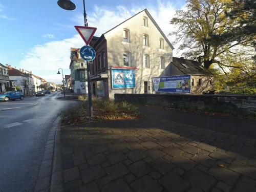


Haus Heine
Monument and historic site · 2.6 km
4 Hauptstraße, Sprockhövel


Maschinenhaus Zeche Blankenburg
Monument and historic site · 5.6 km
85 Im Hammertal, Witten

Wetterschornstein Buchholz
Monument and historic site · 5.6 km
Gehörte zur ehemaligen Zeche „Vereinigte Geschwind“, wurde als als Abluft-Schornstein des Bergwerkes benutzt, mit dem Kesselhaus der...



55 more on the map.
Parks, trails and playgrounds27
Dampf Bahn-Club Sprockhövel e. V.
Sports field and stadium · 3.2 km
Am Beermannshaus, Sprockhövel
Apr-Sep: Su[3] 11:00-17:00
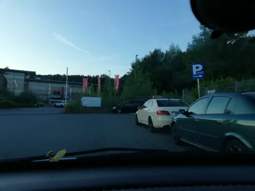
Upsalla Kinderpark
Playground · 4.6 km
22 Porschestraße, Wuppertal
Mo-Fr 14:00-19:00; Sa,Su,PH 10:00-19:00;SH 10:00-19:00



Freibad Sprockhövel
Sports field and stadium · 2.3 km
9 Bleichwiese, Sprockhövel
May-Aug Mo-Su 09:00-19:00


15 more on the map.
Restaurants and cafes109

Alter Bahnhof
Restaurant · German · 5.4 km
42 Am Overbeck, Wetter (Ruhr)
We-Fr 17:00-21:00; Sa-Su 12:00-21:00

Café Wünnerhof
Cafe · Regional · 5.3 km
Hofcafé für Wanderer, regionale Bio-Küche, Demeter-Biobauernhof
34 Felderbachstraße, Hattingen
Th-Fr 12:00-18:00; Apr-Oct: We 12:00-18:00; Sa 11:00-18:00;...

Felderbacher Alm
Restaurant · Alpin, Regional · 5.0 km
Seit August 2024 am Wochenende bei jedem Wetter geöffnet. Wir sind nur fußläufig oder mit dem Rad erreichbar.
26 Höhenweg, Hattingen
Sa-Su 12:00-20:00
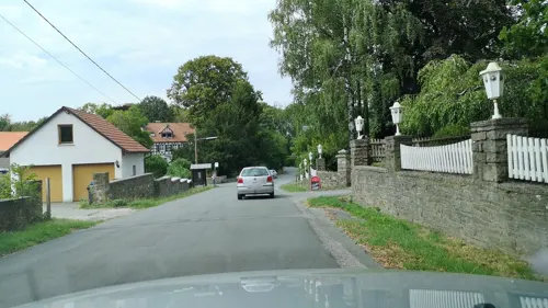
Kastanie am Hax
Restaurant · 4.8 km
Https://web.archive.org/web/20250724094402/https://www1.wdr.de/lokalzeit/heimatliebe/jobwechsel-wetter-ruhr-biergarten-kastanie-am-hax-100.html
Th-Sa,Fr 18:00-24:00; Su 15:00-22:00; PH,Mo-We off
Restaurant Habbel's
Restaurant · German, Mediterranean · 4.4 km
127 Gevelsberger Straße, Sprockhövel
Mo,Tu closed; We-Sa 18:00-22:30; Su 12:00-14:30, 17:00-22:00
Zwölf Apostel Schulenburg
Restaurant · German, Italian · 6.1 km
1 Schützenplatz, Hattingen
Mo-Sa 17:00-23:00; Su,PH 11:00-23:00


sukhothai
Restaurant · Thai · 2.8 km
15 Bochumer Straße, Sprockhövel
Mo 17:30-23:00; We-Su 17:30-23:00; Su 12:00-14:30
97 more on the map.
History
The town was first mentioned in documents around 1000 AD. It was part of the County of Mark, but close to the Duchy of Berg, whose cultural influence is still visible today in the historical part of town. The current administration of Sprockhövel is a result of the local government reform on 1 January 1975.
From the History section of Sprockhövel on Wikipedia, under CC BY-SA 4.0.
Where to stay19
Familien-Sport-Gemeinschaft Lichtbund Wuppertal e.V.
Campground · 3.8 km
25 Eichenhofer Weg, Sprockhövel
Naturfreundehaus Hagelsiepen
Motel and hotel · 2.5 km
36 Kaninchenweg, Sprockhövel
Churches and places of worship18
Shopping23
Gas and EV charging12
Schools, colleges and libraries19
Wilhelm-Kraft-Gesamtschule des Ennepe-Ruhr-Kreises
School · 3.2 km
10 Geschwister-Scholl-Straße, Sprockhövel
Healthcare8
Friedrich-Apotheke
Clinic and pharmacy · 2.8 km
20-22 Hattinger Straße, Sprockhövel
Map of Sprockhövel
250 places. The map loads OpenStreetMap tiles when you open it.
Getting there and nearby towns
Flughafen Essen-Mülheim (ESS) is the nearest airport with scheduled flights listed in OpenStreetMap, 22 km away.
- Wuppertal 12 km southwest, about 12 min by car
- Wetter 11 km northeast, about 11 min by car
- Witten 13 km northeast, about 13 min by car
- Velbert 14 km west, about 14 min by car
- Bochum 15 km north, about 15 min by car
- Hagen 16 km east, about 16 min by car
- Wattenscheid 16 km northwest, about 16 min by car
- Wülfrath 16 km southwest, about 16 min by car
- Remscheid 19 km south, about 19 min by car
- Essen 20 km northwest, about 20 min by car
Drive times are estimates from straight-line distance, not routes.
Local news
Headlines from INDB.
Reviews, tips and questions
Loading what members have shared...
Sources and licences
- GeoNames (CC BY 4.0): population, coordinates, regions and time zone
- Mapillary (see each image): photos
- OpenStreetMap contributors (ODbL 1.0): places, airports, map data
- Wikidata (CC0 1.0): elevation, founding date, time zone, website, landmarks and historic places
- Wikimedia Commons (see each image): photos
- Wikipedia (CC BY-SA 4.0): overview and history text
Photo credits
- NSG EN-017 Oberes Sprockhöveler Bachtal (16), DiAuras, CC BY-SA 4.0
- NSG EN-017 Oberes Sprockhöveler Bachtal (25), DiAuras, CC BY-SA 4.0
- NSG EN-017 Oberes Sprockhöveler Bachtal (22), DiAuras, CC BY-SA 4.0
- NSG EN-017 Oberes Sprockhöveler Bachtal (13), DiAuras, CC BY-SA 4.0
- NSG EN-017 Oberes Sprockhöveler Bachtal (15), DiAuras, CC BY-SA 4.0
- NSG EN-017 Oberes Sprockhöveler Bachtal (12), DiAuras, CC BY-SA 4.0
- IG Metall Bildungszentrum (Sprockhövel), DiAuras, CC BY-SA 4.0
- NSG EN-017 Oberes Sprockhöveler Bachtal (11), DiAuras, CC BY-SA 4.0
- NSG EN-017 Oberes Sprockhöveler Bachtal (9), DiAuras, CC BY-SA 4.0
- NSG EN-017 Oberes Sprockhöveler Bachtal (7), DiAuras, CC BY-SA 4.0
- NSG EN-017 Oberes Sprockhöveler Bachtal (8), DiAuras, CC BY-SA 4.0
- NSG EN-017 Oberes Sprockhöveler Bachtal (4), DiAuras, CC BY-SA 4.0
- NSG EN-017 Oberes Sprockhöveler Bachtal (6), DiAuras, CC BY-SA 4.0
- NSG EN-017 Oberes Sprockhöveler Bachtal (34), DiAuras, CC BY-SA 4.0
- NSG EN-017 Oberes Sprockhöveler Bachtal (23), DiAuras, CC BY-SA 4.0
- NSG EN-017 Oberes Sprockhöveler Bachtal (32), DiAuras, CC BY-SA 4.0
- NSG EN-017 Oberes Sprockhöveler Bachtal (29), DiAuras, CC BY-SA 4.0
- NSG EN-017 Oberes Sprockhöveler Bachtal (30), DiAuras, CC BY-SA 4.0
- NSG EN-017 Oberes Sprockhöveler Bachtal (27), DiAuras, CC BY-SA 4.0
- NSG EN-017 Oberes Sprockhöveler Bachtal (24), DiAuras, CC BY-SA 4.0
- NSG EN-017 Oberes Sprockhöveler Bachtal (31), DiAuras, CC BY-SA 4.0
- NSG EN-017 Oberes Sprockhöveler Bachtal (17), DiAuras, CC BY-SA 4.0
- Evangelische Kirche Langerfeld, Wuppertal, Morty, CC BY-SA 3.0
- Witten - Zeche Blankenburg 09 ies, Frank Vincentz, CC BY-SA 3.0
- Niedersprockhövel, die evangelische Kirche Dm6 foto2 2015-04-19 11.55, Michielverbeek, CC BY-SA 4.0
- Wuppertal Wittener Str 0013, Atamari, CC BY-SA 3.0
- Gennebreck, evangelische Kirche Herzkamp Dm9 foto4 2015-04-19 11.10, Michielverbeek, CC BY-SA 4.0
- Hattingen Burg Blankenstein, Marku1988, CC BY 3.0
- Davidis Sprockhoevel01, Markus Schweiss, CC BY-SA 3.0
- Stock & Scherenberger Erbstollen - Mauerung, Ralf Hüls, CC BY-SA 4.0
- Bandwebereimuseum Elfringhausen, Bärwinkel,Klaus, CC BY 3.0
- NSG EN-009 Wald am oberen Paasbach (57), DiAuras, CC BY-SA 4.0
- NSG EN-011 Unteres Sprockhöveler Bachtal (43), DiAuras, CC BY-SA 4.0
- Sprockhövel NSG-Oberes Felderbachtal 2, Bärwinkel,Klaus, CC BY 3.0
- Sprockhövel NSG-Am Nockenberg, Bärwinkel,Klaus, CC BY-SA 4.0
- NSG EN-018 Südliches Sprockhöveler Bachtal (23), DiAuras, CC BY-SA 4.0
- NSG Südholz (14), DiAuras, CC BY-SA 4.0
- Stadtbücherei Sprockhövel, Conny, CC BY-SA 3.0
- St.Januarius Sprockhoevel, 35mm, CC BY-SA 4.0
- Wiesen Junkersbeck, Juli 2021 - 2, AlanyaSeeburg, CC0
- NSG Felderbachtal (ME-008) (1), DiAuras, CC BY-SA 4.0
- Sprockhoevel-HasslinghausenKirche1-Asio, Asio otus, CC BY-SA 3.0
- Wichern-Kirche, Qwertz1234567, CC BY-SA 3.0
- Kapelle Elfringhausen 1, Bärri, CC BY-SA 3.0 de
- Gut Oberleveringhausen, Morty, CC BY-SA 3.0
- Maschinenhaus Zeche Blankenburg, Markus Schweiss, CC BY-SA 3.0
- Witten - Wetterschornstein Buchholz 02 ies, Frank Vincentz, CC BY-SA 3.0
- Sirrenbergtunnel, Markus Schweiß, CC BY-SA 3.0
- Elbschebahn2, Morty at de.wikipedia, CC BY-SA 3.0
- Wuppertal Wittener Str 0004, Atamari, CC BY-SA 3.0
- Wuppertal Wittener Str 0020, Atamari, CC BY-SA 3.0
- Witten - Zeche Blankenburg 08 ies, Frank Vincentz, CC BY-SA 3.0
- Schacht Julie01, Markus Schweiss, CC BY-SA 3.0
- Street-level photo, cuspis, CC BY-SA 4.0
- Street-level photo, VIA_DT, CC BY-SA 4.0
- Street-level photo, cuspis, CC BY-SA 4.0
- Street-level photo, VIA_DT, CC BY-SA 4.0
- Street-level photo, VIA_DT, CC BY-SA 4.0
- Street-level photo, LouCipher, CC BY-SA 4.0
- Street-level photo, thoschi, CC BY-SA 4.0
- Street-level photo, thoschi, CC BY-SA 4.0
- Street-level photo, VIA_DT, CC BY-SA 4.0
- Street-level photo, thoschi, CC BY-SA 4.0
- Street-level photo, VIA_DT, CC BY-SA 4.0
- Street-level photo, cuspis, CC BY-SA 4.0
- Street-level photo, thoschi, CC BY-SA 4.0
- Street-level photo, thoschi, CC BY-SA 4.0
- Street-level photo, changchun1, CC BY-SA 4.0
- Street-level photo, kgvx, CC BY-SA 4.0
- Street-level photo, thoschi, CC BY-SA 4.0
- Street-level photo, cuspis, CC BY-SA 4.0
- Street-level photo, cuspis, CC BY-SA 4.0
- Street-level photo, phitec, CC BY-SA 4.0
- Street-level photo, thoschi, CC BY-SA 4.0
- Street-level photo, thoschi, CC BY-SA 4.0
- Street-level photo, phitec, CC BY-SA 4.0
- Street-level photo, cuspis, CC BY-SA 4.0
- Street-level photo, do8pgg, CC BY-SA 4.0


Page built November 8, 2026. Spotted a mistake? Tell us or suggest a place.