


Why visit Hirschaid
Townapedia lists 32 museums and landmarks, 9 parks and trails, 92 places to eat, 14 places to stay and 12 attractions in and around town.
Highlights include Friesener Warte, Hoflädla, Levi Strauss Museum and Schleusenwärterhaus 96.
Weather in Hirschaid
Forecast from MET Norway (CC BY 4.0). Full forecast
About Hirschaid
Hirschaid is a German market town in the Upper Franconian district of Bamberg and lies roughly twelve kilometres south of Bamberg on the Regnitz and the Main-Danube Canal.
From the Wikipedia article Hirschaid (this version), under CC BY-SA 4.0.
Things to do12


Hoflädla
Farm and orchard · 1.5 km
39 Pfarrer-Hopfenmüller-Straße, Hirschaid
06:00-20:00

Museums and landmarks32

Schleusenwärterhaus 96
Monument and historic site · 1.3 km
Schleusenwärterhaus, Ludwig-Donau-Main-Kanal


Schleusenwärterhaus 95
Monument and historic site · 5.4 km
Schleusenwärterhaus, Ludwig-Donau-Main-Kanal

Schloss Buttenheim
Monument and historic site · 3.5 km
11 Schloßstraße, Buttenheim

Schloss Wernsdorf
Monument and historic site · 4.9 km
4 Zur Schleifmühle, Strullendorf


Franzosenmarter
Monument and historic site · 4.8 km
Fundament; Säule mit gebrochenen Kanten; Aufsatz mit dreiseitigem Relief (Kreuzigungsgruppe, der hl. Petrus und der hl. Matthäus); auf...

Lieb Herrchäla
Monument and historic site · 4.2 km
Gebauchter Sockel mit Altartisch; barocker Bildstock; Bildnische mit Kreuzschlepper-Relief; Satteldach mit Ziegeleindeckung. Den...

St. Nepomuk
Monument and historic site · 3.7 km
Sockel mit Schriftkartusche; Statue des heiligen Nepomuk mit Birett und Kreuz
Weiße Marter
Monument and historic site · 5.6 km
Rechteckiger Sockel und Schaft; vierseitiger Aufsatz; Der alter Standort war 300 Meter weiter in der Flur. Nach einer Beschädigung wurde...
Altes Märterla
Monument and historic site · 2.9 km
Holzmarter mit Bildnische; hinter einer Glasplatte das Bild der Muttergottes mit Kind; Kupferblechbedachung; Bis 2000 am Waldweg zw....
20 more on the map.
Parks, trails and playgrounds9


FrankenLagune Badespaß-das Erlebnisbad in Hirschaid
Sports field and stadium · 0.6 km
Mo-Fr 13:00-21:00; Sa 15:00-21:00; PH,Su 10:00-21:00


Restaurants and cafes92

Georg Schwarzmann
Restaurant · Regional · 5.1 km
13 Hallerndorfer Straße, Hallerndorf
We-Sa 10:00-14:30, 16:30-21:30; Su 10:00-21:30; Mo,Tu off
Lily Asia Spezialitäten
Restaurant · Chinese · 1.0 km
13 Industriestraße, Hirschaid
PH,Mo-Su 11:00-15:00,17:00-22:00
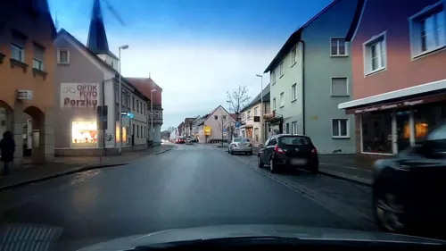
OLYMPIA BEI COSTA
Restaurant · Greek
19 Nürnberger Straße, Hirschaid
Mo-Sa 17:00-22:00; Su 11:30-13:30,17:00-22:00; We off
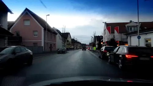
Pizzeria Capriccio Mondello
Restaurant · Italian · 0.6 km
62 Nürnberger Straße, Hirschaid
Mo-Su 17:00-23:30; Tu off
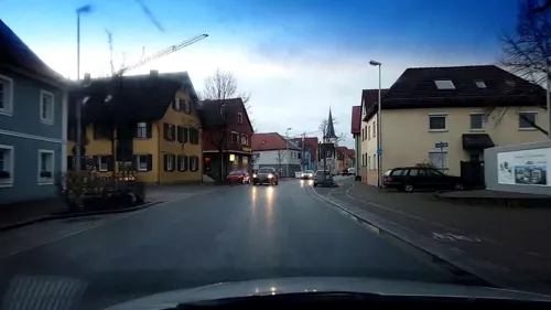
Schwarzer Bär
Restaurant · Regional
31 Nürnberger Straße, Hirschaid
Tu,We,Fr-Su 11:00-14:00,16:30-21:30; Mo,Th off

St.Georgenbräu-Keller
Restaurant · Regional · 4.0 km
Bei schönem Wetter von Anfang April bis Ende September
Mo-Fr 14:00-22:00, Sa-Su 11:00-22:00
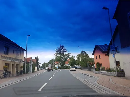


Backerie Café Göller
Cafe · Coffee Shop
30 Bamberger Straße, Hirschaid
Tu-Fr 05:45-17:30; Sa 05:45-13:00; Su, PH, Mo off
80 more on the map.
History
The community's name goes back to the von Hirzheide noble family whose coat of arms were charged with a hart, still seen in the community's arms today.
Hirschaid lies not far from the former via regia, an ancient road that since antiquity joined the north in the area around Lüneburg with the south all the way to Lower Austria. The name Hirschaid refers to the former landscape and wildlife (Hirsch is “hart” in German).
Finds dug up on the Regnitz Valley terraces bear witness to an early settlement beginning no later than the New Stone Age. Bearing witness to the later La Tène culture (Celtic) are above all the finds and wall remains on the nearby Friesener Warte
In 1079, Hirschaid became historical for the first time through a document issued by King Heinrich IV. In 1979, this date was duly celebrated in the community's 900th anniversary celebration. From 1300, it was the seat of the Lords, ministeriales and Vögte (sing. Vogt – reeve) of Hirzheide. Their Frankish line died out in 1590, although a Swedish-Livonian line still lives today. The coat of arms that they bore then, showing a golden hart in silver climbing out of a blue three-knolled hill (a charge called a Dreiberg in German heraldry), foreshadowed the one now borne by the community.
From the History section of Hirschaid on Wikipedia, under CC BY-SA 4.0.
Where to stay14
Pfadfinderheim Christliche Pfadfinderschaft Bamberg e.V.
Motel and hotel · 4.6 km
Churches and places of worship26
St. Mauritius-Kirche
Church · Roman Catholic · 1.5 km
20 St.-Mauritius-Straße, Hirschaid
Mauritiuskapelle
Church · Roman Catholic · 1.4 km
16 St.-Mauritius-Straße, Hirschaid
Shopping17
Gas and EV charging15
Schools, colleges and libraries10
Healthcare5
Map of Hirschaid
232 places. The map loads OpenStreetMap tiles when you open it.
Getting there and nearby towns
Verkehrslandeplatz Burg Feuerstein (URD) is the nearest airport with scheduled flights listed in OpenStreetMap, 11 km away.
- Höchstadt an der Aisch 18 km southwest, about 18 min by car
- Erlangen 25 km south, about 25 min by car
- Bad Staffelstein 32 km north, about 32 min by car
- Lichtenfels 37 km north, about 37 min by car
- Fürth 38 km south, about 38 min by car
- Neustadt an der Aisch 38 km southwest, about 38 min by car
- Langenzenn 39 km south, about 39 min by car
- Nuremberg 41 km south, about 41 min by car
- Lauf an der Pegnitz 40 km southeast, about 40 min by car
- Pegnitz 40 km east, about 40 min by car
Drive times are estimates from straight-line distance, not routes.
Local news
Headlines from INDB.
Reviews, tips and questions
Loading what members have shared...
Sources and licences
- GeoNames (CC BY 4.0): population, coordinates, regions and time zone
- Mapillary (see each image): photos
- OpenStreetMap contributors (ODbL 1.0): places, airports, map data
- Wikidata (CC0 1.0): elevation, founding date, time zone, website
- Wikimedia Commons (see each image): photos
- Wikipedia (CC BY-SA 4.0): overview and history text
Photo credits
- Hirschaid Kirche Luftbild-20211002-RM-152006, Ermell, CC BY-SA 4.0
- Strassenunterführung-Hirschaid-P5022882, ermell, CC BY-SA 4.0
- Hirschaid Bahnhof Baustelle Luftbild-20250112-RM-121112, Reinhold Möller Ermell, CC BY-SA 4.0
- Hirschaid Kirche Tür 20191003-RM-033946, Ermell, CC BY-SA 4.0
- Hirschaid Kruzifix 20191003-RM-033945, Ermell, CC BY-SA 4.0
- Hirschaid Kruzifix 20191003-RM-033944, Ermell, CC BY-SA 4.0
- Hirschaid Orgel 20191003-RM-033955, Ermell, CC BY-SA 4.0
- Hirschaid Pumpe 20191003-RM-033943, Ermell, CC BY-SA 4.0
- Hirschaid Kirche St.Vitus Innenraum 20191003-RM-PA033950, Ermell, CC BY-SA 4.0
- Hirschaid Kirche St.Veit 20191003-RM-033940, Ermell, CC BY-SA 4.0
- Hirschaid Kirche St.Vitus Altar 20191003-RM-PA033957, Ermell, CC BY-SA 4.0
- Hirschaid Kirche St.Vitus Orgel 20191003-RM-PA033970-2, Ermell, CC BY-SA 4.0
- Hirschaid Kirche St.Vitus Orgel 20191003-RM-PA033957-2, Ermell, CC BY-SA 4.0
- Hirschaid Kirche St.Vitus Kanzel 20191003-RM-PA033952, Ermell, CC BY-SA 4.0
- Hirschaid Kirche St.Vitus Decke 20191003-RM-PA033970, Ermell, CC BY-SA 4.0
- Hirschaid Kirche St.Vitus Altar 20191003-RM-033961, Ermell, CC BY-SA 4.0
- Hirschaid-SkulpturP5022886, ermell, CC BY-SA 4.0
- Hirschaid 20191003-RM-033979, Ermell, CC BY-SA 4.0
- D-4-71-145-10 Wohnhaus, Rathausstraße 8, Hirschaid, Stephan van Helden, CC BY-SA 4.0
- Fachwerkscheune neben Luitpoldstraße 2, Hirschaid, Stephan van Helden, CC BY-SA 4.0
- Hirschaid Rathaus Brunnen 20191003-RM-033942, Ermell, CC BY-SA 4.0
- Hirschaid 20191003-RM-033981, Ermell, CC BY-SA 4.0
- Hirschaid Bahnhof-20260308-RM-162856, Reinhold Möller Ermell, CC BY-SA 4.0
- Hirschaid-Bahnhof- P5023058PS, ermell, CC BY-SA 4.0
- Hirschaid-Bahnhof- P5023056, ermell, CC BY-SA 4.0
- Hirschaid-Bahnhof- P5023057, ermell, CC BY-SA 4.0
- Hirschaid Bahnhof Baustelle Luftbild-20250112-RM-121401, Reinhold Möller Ermell, CC BY-SA 4.0
- Hirschaid Bahnhof Baustelle Luftbild-20250112-RM-121127, Reinhold Möller Ermell, CC BY-SA 4.0
- Hirschaid Bahnhof Baustelle Luftbild-20250112-RM-121411, Reinhold Möller Ermell, CC BY-SA 4.0
- Hirschaid Franken-Thüringen-Express-20260308-RM-161330, Reinhold Möller Ermell, CC BY-SA 4.0
- Hirschaid Bahnhof-20260308-RM-161526, Reinhold Möller Ermell, CC BY-SA 4.0
- Hirschaid Bahnhof Baustelle Luftbild-20250112-RM-121135, Reinhold Möller Ermell, CC BY-SA 4.0
- Hirschaid Bahnhof Gleise-20260308-RM-162040, Reinhold Möller Ermell, CC BY-SA 4.0
- Hirschaid Bahnhof Gleise-20260308-RM-161943, Reinhold Möller Ermell, CC BY-SA 4.0
- Hirschaid Bahnhof-20260308-RM-162011, Reinhold Möller Ermell, CC BY-SA 4.0
- Friesener Warte 002, Janericloebe, CC BY 3.0
- AltendorfKapelle, Global Fish, CC BY-SA 4.0
- Schloss Buttenheim, Hubertus von Seefried, CC BY-SA 2.5
- Kirche-Pettstadt-Altäre-Interieur-1000802, Ermell, CC BY-SA 4.0
- Strullendorf, Amlingstadt, St. Ägidius-008, Tilman2007, CC BY-SA 3.0
- Strullendorf, Wernsfeld, Amlingstadter Straße, Kapelle-001, Tilman2007, CC BY-SA 3.0
- Schloss Wernsdorf Strullendorf (02), Presse03, CC BY-SA 3.0
- Hirschaid Kirchplatz 01 Kath. Pfarrkirche St. Veit 002, Demidow, CC BY-SA 3.0
- Hirschaid Ludwig-Donau-Main-Kanal Schleuse 96 002, Janericloebe, CC BY 3.0
- Röbersdorf Kirche Luftbild-20240428-RM-154316, Reinhold Möller, CC BY-SA 4.0
- Sassanfahrt Kirche Luftbild-20211002-RM-164753, Ermell, CC BY-SA 4.0
- Ludwig-Donau-Main-Kanal Neuses an der Regnitz 018, Janericloebe, CC BY 3.0
- Sandgrasheide Pettstadt 1, barbaraglessinger, CC BY-SA 3.0
- Ludwig-Donau-Main-Kanal Neuses an der Regnitz 013, Janericloebe, CC BY 3.0
- Pettstadt Bildstock P3280008, Ermell, CC BY-SA 4.0
- Pettstadt Bildstock 3280015, Ermell, CC BY-SA 4.0
- Strullendorf-Laurenzi-Kirche-PB090004, Ermell, CC BY-SA 4.0
- Kath Kapelle St Maria Friesen D-4-71-145-24 (5), Harro, CC BY-SA 3.0
- Buttenheim, St. Bartholomäus-015, Tilman2007, CC BY-SA 3.0
- Hirschaid alte Schule 20191003-RM-033982, Ermell, CC BY-SA 4.0
- Street-level photo, r66, CC BY-SA 4.0
- Street-level photo, r66, CC BY-SA 4.0
- Street-level photo, r66, CC BY-SA 4.0
- Street-level photo, r66, CC BY-SA 4.0
- Street-level photo, r66, CC BY-SA 4.0
- Street-level photo, r66, CC BY-SA 4.0
- Street-level photo, r66, CC BY-SA 4.0
- Street-level photo, r66, CC BY-SA 4.0
- Street-level photo, r66, CC BY-SA 4.0
- Street-level photo, wegavision, CC BY-SA 4.0
- Street-level photo, r66, CC BY-SA 4.0
- Street-level photo, qgeb, CC BY-SA 4.0
- Street-level photo, r66, CC BY-SA 4.0
- Street-level photo, r66, CC BY-SA 4.0
- Street-level photo, r66, CC BY-SA 4.0
- Street-level photo, r66, CC BY-SA 4.0
- Street-level photo, r66, CC BY-SA 4.0
- Street-level photo, wbr210, CC BY-SA 4.0
- Street-level photo, r66, CC BY-SA 4.0
- Street-level photo, r66, CC BY-SA 4.0
- Street-level photo, r66, CC BY-SA 4.0


Page built November 8, 2026. Spotted a mistake? Tell us or suggest a place.